
The landslide of the right dike of Cau will develop quickly and dangerously due to the convergence of four unfavorable factors including morphology, geology, flow and human factors, according to the Vietnam Institute of Water Resources.
The Right Bridge dike section through Van An ward, Bac Ninh city has been experiencing landslides in recent days, causing many houses to collapse and tilt, threatening the lives and property of people as well as the safety of this dike. VnExpress interviewed Prof. Dr. Tran Dinh Hoa, Director of the Vietnam Institute of Water Resources - the unit that is advising Bac Ninh province on a solution to the problem.
- How do you evaluate the erosion of the Cau River dike?
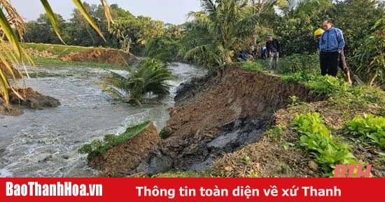
- Immediately after the incident on April 7, at the request of Bac Ninh province, officers from the Vietnam Institute of Water Resources went to the scene to conduct a survey. Preliminary assessment showed that the riverbank area had a landslide of about 50 m long, 20-25 m deep into the riverbank. Considering the terrain, this location is on a very short sharp curve of the river, the deep channel is close to the bank and the curved peak of the flow. Therefore, the flow tends to push straight into the bank.

Professor, Dr. Tran Dinh Hoa answers VnExpress. Photo: Ha An
According to the cross-section of the riverbank, houses are densely packed on the steep riverbank. The landslide is of the deep type, with a height difference between the riverbed and the bank of 15-20 m. In addition, the geology of the riverbank here is quite weak, very sensitive, and prone to landslides when there are fluctuations in flow and load changes.
I think the landslide location is very unfavorable in terms of river morphology, geology, flow and load due to houses built up to the edge of the river. The adjacent area, near the landslide point also has similar characteristics, posing a high risk of landslides.
- What causes this situation?
- For the problem of river and sea bank erosion in general, there are four main causes: River morphology (topography, flow state); hydrodynamics, flow; geology, foundation; other factors (loads that change the structure of the channel and bank). The landslide area is very unfortunate to have all four unfavorable factors.
The first group of objective causes is the river morphology. It is easy to see that the landslide occurred in a curved section of the river, with the flow direction directed straight to the bank, causing disadvantages and a very high erosion rate. The flow velocity at the river bottom of the landslide section is greater than the erosion resistance of the riverbed soil material.
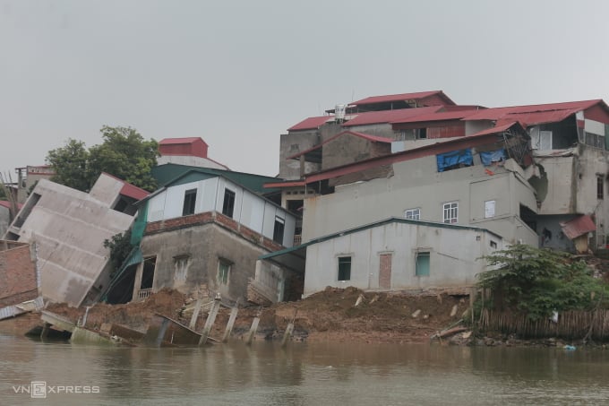
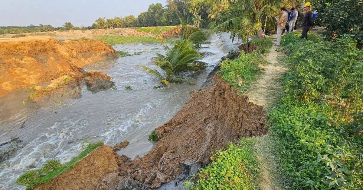
6 solid houses tilted and collapsed into the river in Bac Ninh. Photo: Gia Chinh
Next is the hydrodynamic conditions. According to the Institute's research, considering the entire downstream system of the Red River - Thai Binh River, the riverbeds have fluctuated very strongly in recent years. The bed has been lowered, especially the branches of the Duong River downstream. This makes the tide affect the flow more and more strongly, affecting the upstream very deeply. Therefore, at times when the tide is at the ebb phase, encountering a lot of upstream water, it is very easy to cause riverbank erosion.
Geologically, the riverbank foundation is weak, especially when the water level recedes rapidly, water pressure will create voids combined with a large difference in elevation between the bank and the riverbed. The impact of the flow with the complex hydraulic regime will form erosion holes in the riverbed, causing the current landslide phenomenon.
The subjective cause is that houses are built with high density and heavy load right next to the river bank, so it is difficult to avoid landslides. Of the four causes above, each is important, the problem is only the timing, which factor reaches the limit first.
- What is your forecast for the future landslides on both sides of the Cau River?
- We assess that the risk of landslides on both sides of the river will develop rapidly and dangerously. This risk exists in all river systems of Thai Binh, Kinh Thay, and Duong. Therefore, when studying hydrology, hydraulics of the riverbed and assessing the current status of rivers in Bac Ninh, it is necessary to consider the unfavorable combinations and developments on the Red - Thai Binh river system.
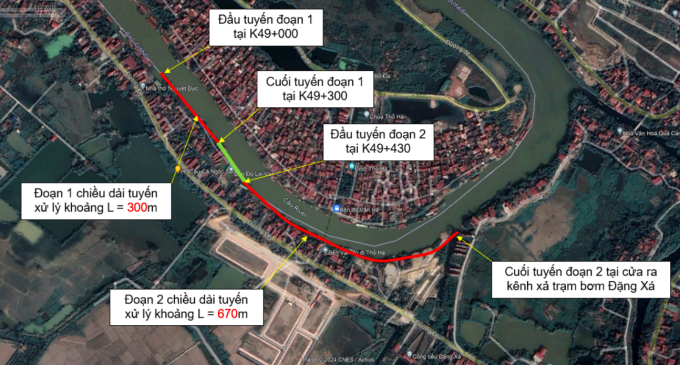
Locations that need to be measured and processed. Photo: VAWR
Along with that, the province needs to consider the unfavorable factors arising from practice, the need for people's development and other economic sectors. The landslide must be urgently handled, but the Cau River should be assessed as a whole within the province, thereby predicting the risk points to prioritize solutions. The province should also develop a research project to plan for long-term protection of the main rivers in the area.
- What is the most important solution to overcome landslides on Cau River?
- In a discussion with the leaders of Bac Ninh province, I think that first of all, we must evacuate people from the next landslide-prone area, then remove structures and objects from the landslide-affected area. I emphasize that we must not only remove structures on the banks and landslide sites, but also on the river. During this process, we must limit the loading so as not to aggravate the landslide area. If landslides continue, the next handling will be complicated and very costly.
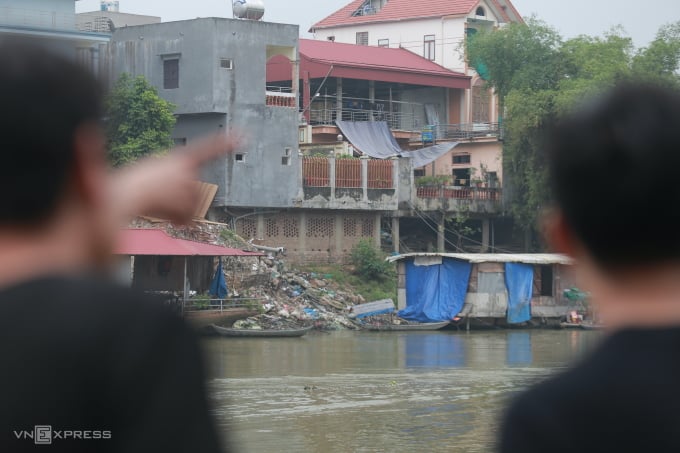
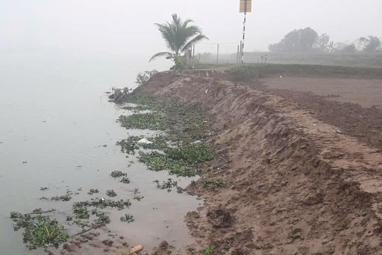
Encroachment and dumping of waste in the Cau River protection corridor occurs on both banks. Photo: Gia Chinh
Next, we will deal with landslides and high-risk locations on the river. To have accurate scope and data, the authorities need to survey and assess the entire province where the river passes or at least the entire landslide area. I think this work needs to be done immediately to assess the actual and objective landslide developments, as a basis for proposing appropriate solutions.
In terms of treatment, the design of embankment works should aim at multiple objectives, combining bank protection, increasing flood drainage capacity and ensuring the environment, landscape and ecology on and on both sides of the river. The proposed solution must take into account the general trend of the whole region and the mutual impact of the treated area at different investment stages.
Source link


Comment (0)