
Hanoi Capital is the center of politics, economy, culture, education and international transactions, playing a particularly important role and position in the development of the country, and is one of the main driving forces to promote economic development. Therefore, the planning of the development of the Capital has a special strategic significance, and when completed, it will be a particularly important legal tool for the authorities of Hanoi City to lead, direct, unify and formulate policies, and create development momentum.
Currently, the draft Hanoi Capital Planning for the period 2021-2030, with a vision to 2050, has been completed and is in the process of consultation to enter the final stage of completion. One of the notable contents of this Planning is the vision and orientation for the development of the capital's transport infrastructure network.
Public passenger transport market share reaches 35% - 40%
Accordingly, the draft Plan identifies the development of a synchronous, sustainable, modern, accessible, convenient transport infrastructure network that meets people's travel needs and is environmentally friendly. It ensures scientific, reasonable and feasible nature, meeting immediate requirements and long-term orientation.
In particular, prioritize the development of public transport, especially the completion of the urban railway system, contributing to solving traffic congestion and traffic accidents in Hanoi.
Hanoi aims to develop a complete network by 2030, with a vision to 2050, with convenient traffic organization and harmonious coordination between modes of transport.
Specifically, in terms of infrastructure, ensure that the ratio of traffic land area to urban construction land area reaches 20 - 26% for central urban areas; 18 - 23% for non-central urban areas and 16 - 20% for towns. Of which, the land area for static traffic needs to reach 3 - 4%.
The density of the public passenger transport network is from 2 - 3.0 km/km2 for central urban areas and 2 - 2.5 km/km2 for non-central urban areas.
Regarding the transport market share, strive for public passengers to reach 35% - 40%; in which strive for the central urban area to reach about 50 - 55% by 2030, after 2030 to reach 65 - 70%; in non-central urban areas to reach about 40% by 2030, after 2030 to reach about 50%.
With the market share of inter-provincial passenger transport, road is about 75 - 80%; railway is about 10 - 15%; aviation is about 7 - 10%. The market share of inter-provincial freight transport, road is about 65 - 70%; railway is about 3 - 5%; waterway is about 25 - 30%.
Based on the above viewpoints, goals and development targets, Hanoi aims to develop a diverse network of transportation methods.
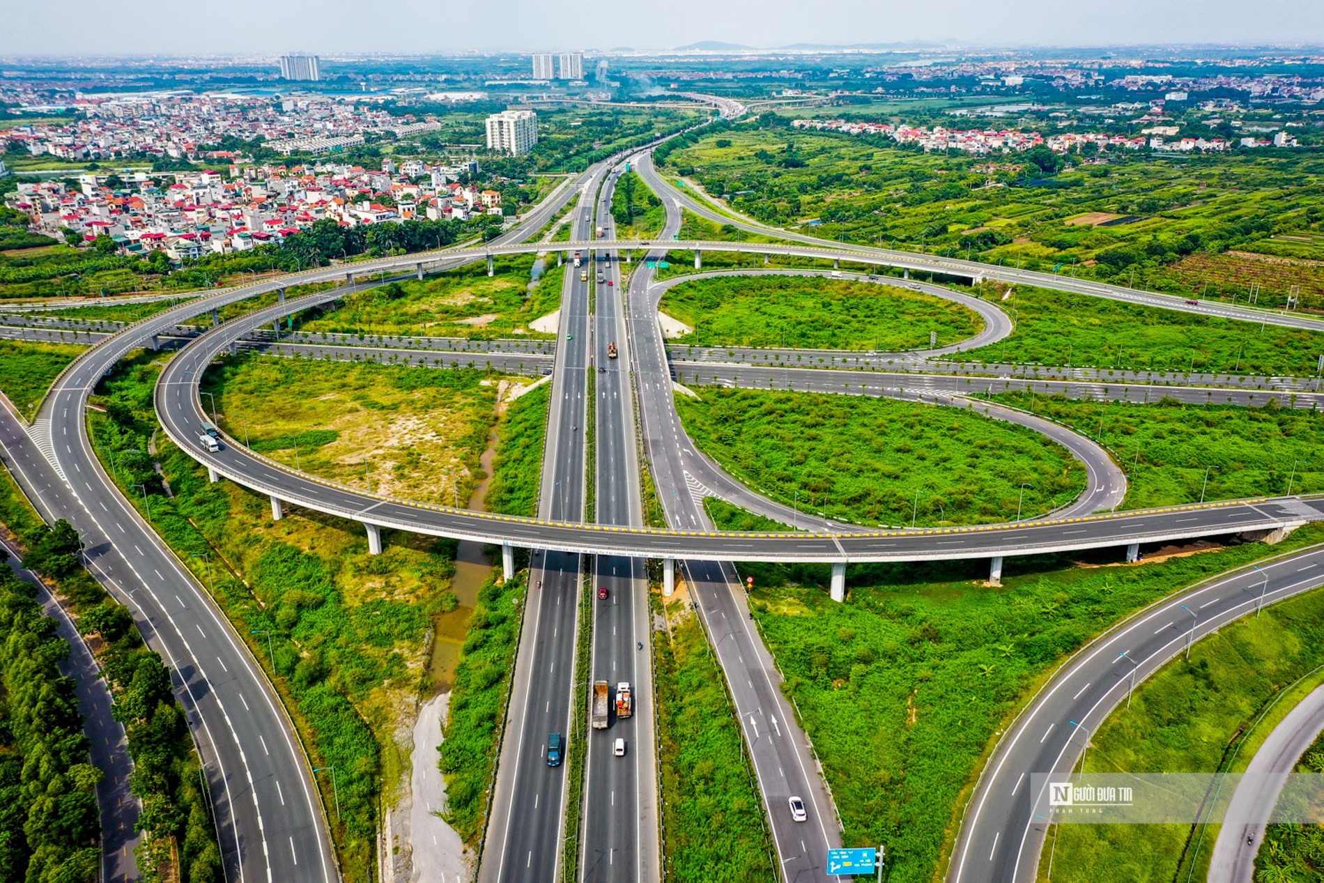
Surrounding and connecting Hanoi with other localities are 13 expressways (Photo: Trong Tung).
By road, Hanoi will be connected by 13 expressways, including the North-South Eastern Expressway, the North-South Western Expressway, the Hanoi - Hoa Binh - Son La - Dien Bien Expressway, the Hanoi - Hai Phong Expressway, the Hanoi - Lao Cai Expressway, the Hanoi - Thai Nguyen - Bac Kan - Cao Bang Expressway, the Noi Bai - Bac Ninh - Ha Long Expressway, the Cho Ben - Yen My Expressway, Ring Road 3, Ring Road 4, Ring Road 5, the Nhat Tan - Noi Bai Expressway and the Southern Expressway (starting point from Ring Road 4, ending point is the 2nd Airport of the Capital Region).
In addition, Hanoi will also build and complete the national highway network in the city, upgrade the sections passing through urban areas according to the scale of urban roads, specifically: National Highway 1, National Highway 2, National Highway 2C, National Highway 3, National Highway 5, National Highway 6, National Highway 21, National Highway 21B, National Highway 23, National Highway 32. At the same time, renovate and upgrade the existing provincial road system, invest in building new provincial roads to act as the driving force for development. The provincial road system is planned to have a minimum scale of level III in the plains, and the sections passing through urban areas meet urban road standards according to the approved urban planning.
Stable development of urban railway network
Regarding the railway network development plan, Hanoi will plan a high-speed railway line on the North-South axis passing through Hanoi city starting from Ngoc Hoi station, parallel to the current unified railway. Study the exploitation plan to connect high-speed railway trains to Hanoi station via urban railway line No. 1.
With the belt railway, the Eastern belt of Hanoi City will be developed, the Ngoc Hoi - Lac Dao - Bac Hong - Thach Loi section is 59km long, with a dual gauge. After completion and operation, the Ngoc Hoi - Yen Vien, Gia Lam - Lac Dao and Ngoc Hoi - Nam Hong sections will be converted into urban railways. The Western belt of Hanoi City with the Ngoc Hoi - Thach Loi section is 54km long, dual gauge, following the direction of Ring Road 4.
The radial railway includes 6 routes: Hanoi - Ho Chi Minh City route, Hanoi - Lao Cai route, Hanoi - Hai Phong route, Yen Vien - Ha Long - Cai Lan route, Hanoi - Thai Nguyen route, Hanoi - Lang Son route.
Notably, Hanoi will continue to orient the stable development of the planned urban railway network, with 14 specific routes: Route 01 Ngoc Hoi - Yen Vien - Lac Dao, route 02 Soc Son - Noi Bai - Thuong Dinh - Buoi, route 02A Cat Linh - Ha Dong - Xuan Mai, route 03 Son Tay - Troi - Nhon - Yen So - Cau Dien, route 04 Me Linh - Sai Dong - Lien Ha, route 05 Van Cao - Hoa Lac, route 06 Noi Bai - Mai Dich, route 07 Me Linh - Ha Dong - Ngoc Hoi, route 08 Son Dong - Mai Dich - Duong Xa, route 09 Ngoc Hoi - Thuong Tin - CHK 2 Capital Region - Phu Xuyen, route 10 Me Linh - Co Loa - Yen Vien - Duong Xa, route 11 Cat Linh - Le Van Luong - Ring Road 4, route 12 Son Tay - Hoa Lac - Xuan Mai, route 09 Me Linh - Ha Dong - Ngoc Hoi, route 09 Me Linh ... Ha Dong - Ngoc Hoi, route 09 Me Linh - Thuong Tin - CHK 2 Capital Region - Phu Xuyen, route 09 Me Linh - Co Loa - Yen Vien - Duong Xa, route 09 Me Linh - Le Van Luong - Ring Road 4, route 09 Son Tay - Hoa Lac - Xuan Mai, route 09 Me Linh - Ha Dong - Ngoc Hoi, route 09 Me Linh - Ha Dong - Ngoc Hoi, route 09 Me 14 Vinh Tuy – Minh Khai – Truong Chinh – Lang – Nhat Tan.
In addition, Hanoi will also research an elevated monorail system running along both banks of the Red River, combining tourism, landscape and a route running in the Old Quarter area.
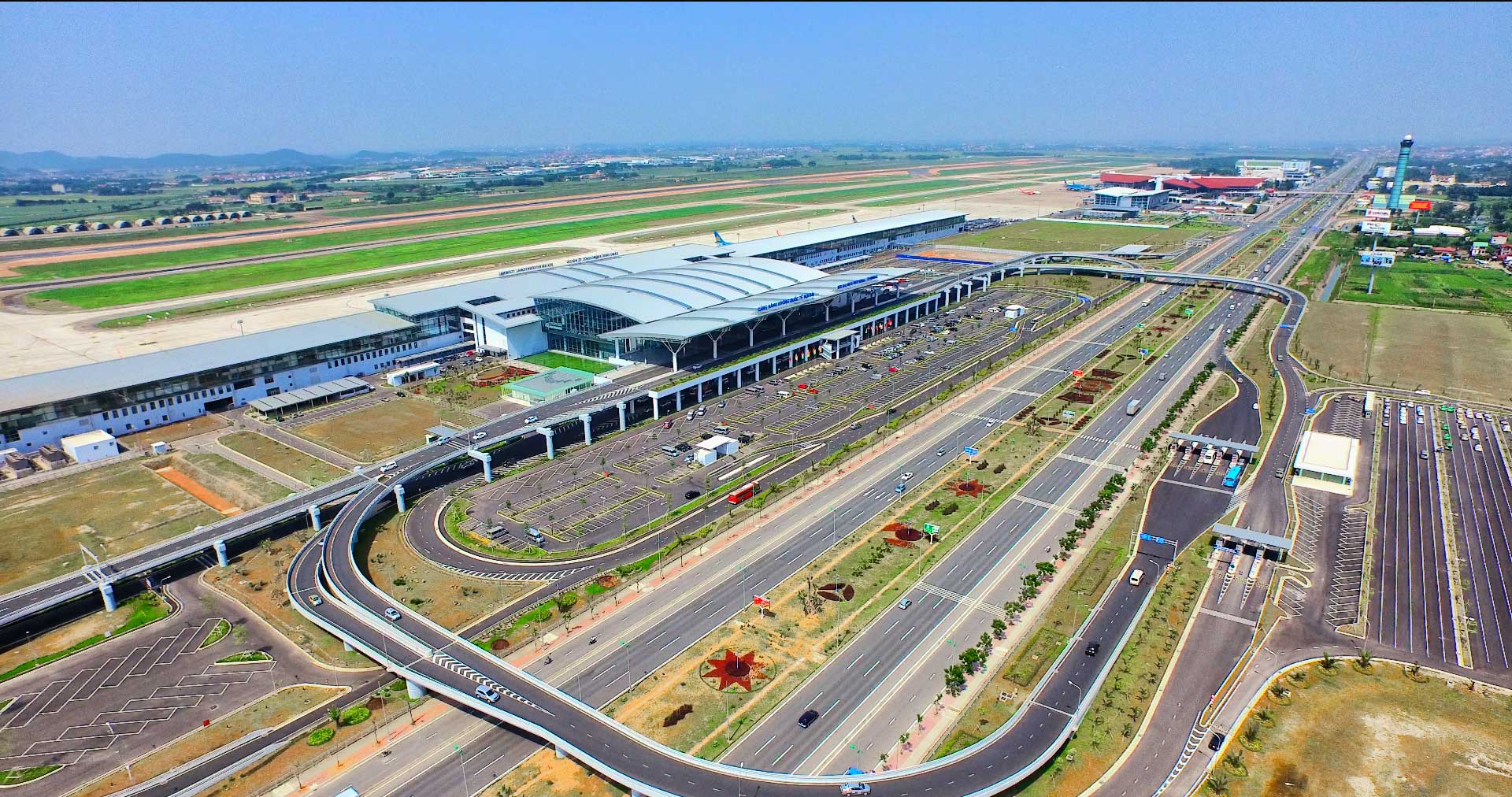
Noi Bai International Airport aims to welcome 60 million passengers per year by 2030.
Regarding inland waterways, the draft planning identifies the focus on developing 3 inland waterway transport corridors (Quang Ninh - Hai Phong - Hanoi; Hanoi - Nam Dinh - Ninh Binh; Hanoi - Viet Tri - Lao Cai); 3 main waterway transport routes (Quang Ninh - Hai Phong - Viet Tri, Hanoi - Lach Giang, Hanoi - Viet Tri - Lao Cai) and 7 inland waterway routes through rivers in the area.
On that basis, the planning for the development of passenger ports is synchronous along transport routes and consistent with the urban planning of Hanoi city, not developing cargo ports on the right bank of the Red River in the Ring Road 3 area, and developing cargo port clusters.
Regarding aviation, the draft plan emphasizes the renovation and upgrading of Noi Bai International Airport into a major international airport in the North. It aims to reach 60 million passengers per year by 2030, with a vision to reach 100 million passengers per year by 2050, playing a role in meeting the air transport needs of Hanoi and the entire capital region.
With the second international airport in the Capital Region, the planning period after 2030 is to reach 30 million passengers/year, supporting Noi Bai International Airport and serving the needs of the southern region of the Capital Region, the expected location is in the southern area of Ung Hoa district, Hanoi.
Gia Lam and Hoa Lac airports will be used for both military and civilian purposes.
For urban traffic, the draft planning emphasizes the role of the urban beltway network: Beltway 1, Beltway 2, Beltway 2.5, Beltway 3: Coinciding with the beltway 3, Beltway 3.5 and the renovation and expansion combined with the construction of new urban main axes.
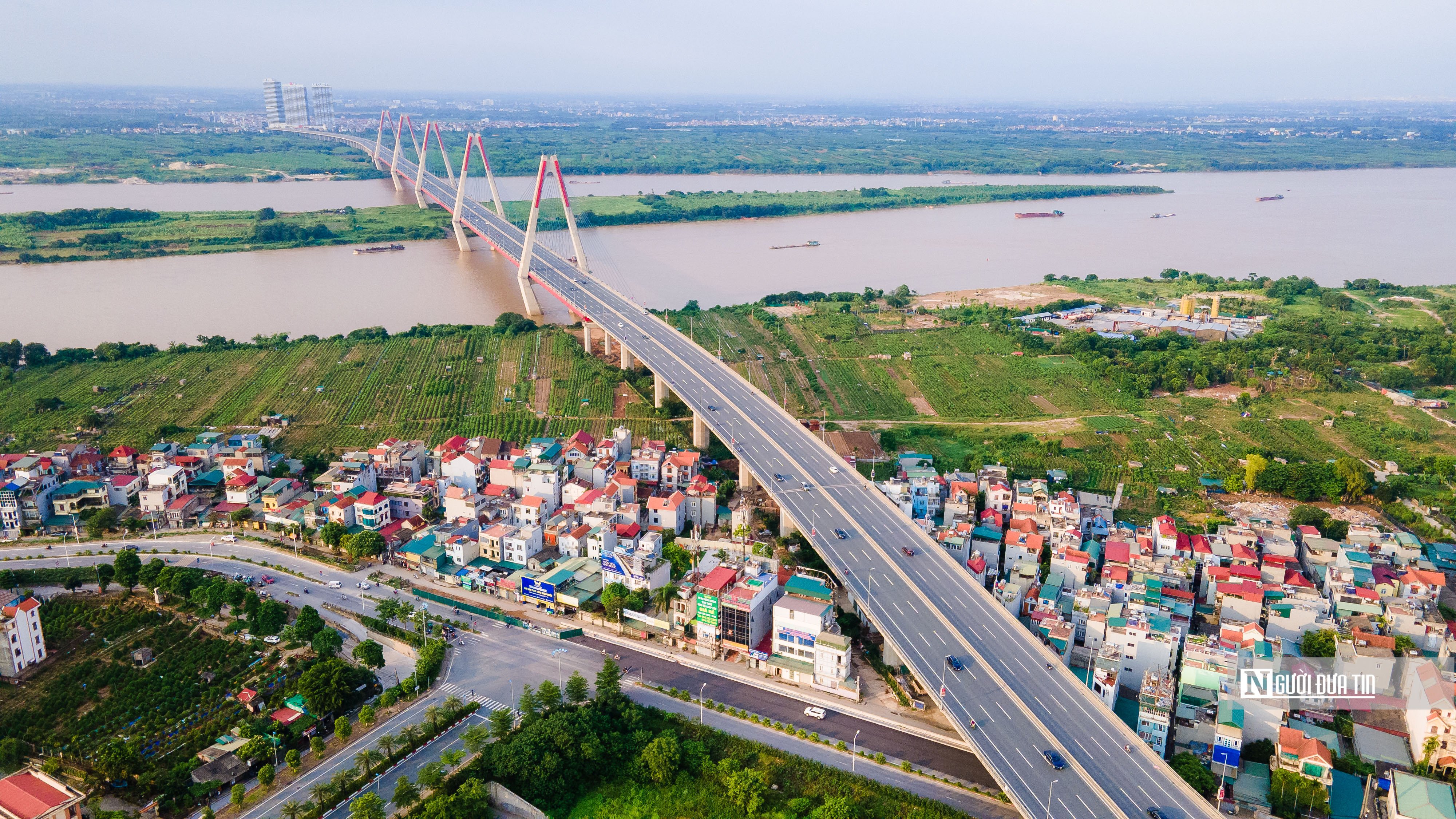
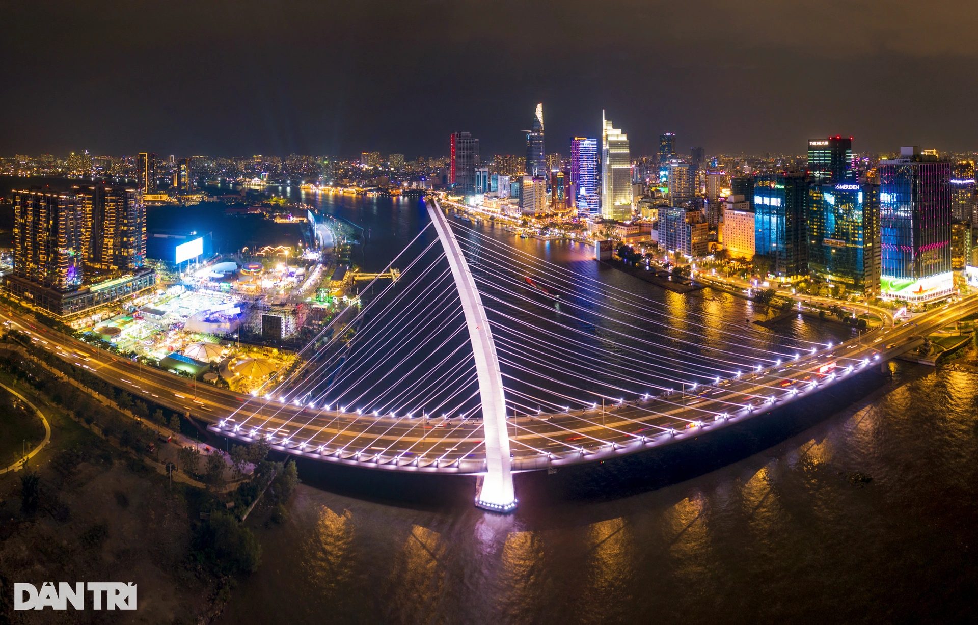
Nhat Tan Bridge is the largest cable-stayed bridge in Vietnam spanning the Red River connecting Tay Ho district and Dong Anh district (Photo: Huu Thang).
Also in the direction of developing the transport infrastructure network, the draft Planning identifies the construction of road works across the Red River in the Hanoi area, including upgrading Long Bien Bridge into a bridge for separate roads; building new bridges and tunnels including: Tran Hung Dao Bridge, Tu Lien Bridge, Tam Xa Bridge and Bat Trang Bridge; new Thang Long Bridge, Thuong Cat Bridge and Ngoc Hoi Bridge, Hong Ha Bridge and Me So Bridge, Van Phuc Bridge, Tien Dung Bridge, Tin Chau - Dong Ninh Bridge, Phu Xuyen - Chi Tan Bridge.
Construct 8 bridges across the Duong River, of which 4 are in use (existing Duong Bridge, Phu Dong 1 and 2 Bridges, Dong Tru Bridge), 1 bridge is under investment (new Duong Bridge) and 3 new bridges are under construction including: Giang Bien Bridge, Mai Lam Bridge, Ngoc Thuy Bridge.
Construct 4 bridges across the Da River, of which 2 are in use (Trung Ha Bridge, Dong Quang Bridge) and 2 newly constructed bridges including: new Trung Ha Bridge (on the North-South Expressway in the West), Tu Vu Bridge.
Construct new bridges across the Day River including: Thanh Da Bridge (Western Thang Long Axis), Dong Hoang Bridge (Ha Dong - Xuan Mai Axis), Hoang Thanh Bridge (Thanh Oai District Axis), Hoa Vien Bridge, Song Day Bridge (Do Xa - Quan Son Road), bridges on the Cho Ben - Yen My Expressway , etc.
Source


Comment (0)