
Nghe An Lam River section through Lang Son commune, Anh Son district suffered a landslide, dragging more than 1,000 square meters of garden land into the river, threatening to collapse dozens of houses.
In the afternoon of mid-November, Mrs. Nguyen Thi Tin, 53 years old, and many people in Hamlet 1, Lang Son Commune, went out to stretch nylon ropes in their 200-400 m2 gardens located next to the Lam River. They were afraid that the upcoming rains would cause the riverbank to erode further, causing danger.
While working, Mrs. Tin was sometimes startled by many rocks and soil suddenly rolling down the river, creating loud noises. More than 50 meters away, on the opposite side, many barges were sucking sand from the river.
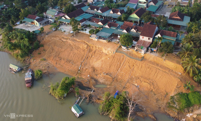
Lam River bank in hamlet 1, Lang Son commune, landslide near residential area. Photo: Duc Hung
Ms. Tin said that the landslide on the Lam River bank through Hamlet 1 has been happening for nearly 10 years, but 2023 was the most serious. Her family used to have more than 300 square meters of garden and residential land located by the river, near the water's edge protected by bamboo. But 5 years ago, the bamboo was washed away, the riverbed ate into the garden 20 meters deep. The livestock and poultry pens were also pulled into the water.
In early October, after prolonged heavy rains, water from upstream poured down, causing the Lam River to rise. When the water receded, landslides followed, and Ms. Tin's house continued to lose dozens of square meters of land. "The landslide is now only about 10 meters from my house. At this rate, it will soon encroach on the yard, and the whole family is worried," Ms. Tin said.
According to statistics from Lang Son commune, the landslide section of Lam river bank through hamlet 1 is 120 m long, 20 m wide, 12 m deep, sweeping away more than 15,000 m3 of soil. Currently, more than 10 families have solid houses only 10-50 m from the landslide site. Since the beginning of October, the government has mobilized machinery to level, lower the landslide site, and treat cracks to limit spreading.
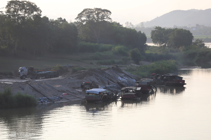
Sand mining barge on Lam River, about 50m from landslide point in Hamlet 1. Photo: Duc Hung
In addition, whenever it rains heavily, people in Hamlet 1 add bamboo stakes and cover landslides with tarps to prevent water from washing away the soil. Many families plant trees in their gardens near the Lam River and stretch ropes to create protective barriers to prevent children from approaching and to prevent danger.
Nearly 40 km from Lang Son commune, agricultural land growing vegetables and crops along the Lam River through Dinh Thang village, Dinh Son commune also suffered landslides stretching over 700 m. The landslides occurred in sections along the river, each point was 30-50 m long, with many cracks, the landslide edges were 8-10 m high above the water surface.
This situation has been going on for more than 5 years now, after each flood, the agricultural land area has shrunk. Statistics show that so far about 1.5 hectares of land along the river in Dinh Thang village have been washed away, said Mr. Phan Van Hoi, Chairman of Dinh Son commune.
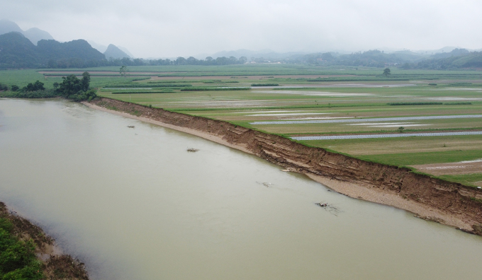
The Lam River bank through Dinh Thang village, Dinh Son commune has eroded, eating deep into agricultural land. Photo: Duc Hung
According to Anh Son district authorities, heavy rains and floods over the past years have caused landslides. People living around the Lam River believe that sand mining along the river has weakened the geology in some places. The flow has changed, and water has been pushed straight to both banks.
To overcome the above situation, Mr. Hoang Quyen, Chairman of Anh Son district, said that the specialized agency has established a project to build concrete embankments to prevent landslides in villages of Lang Son and Dinh Son communes, with an estimated cost of more than 10 billion VND. The province assigned relevant departments and branches to consult on the plan.
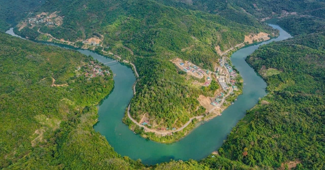
The Lam River originates from the Xiangkhoang Plateau of Laos, the main part flows through Nghe An, the last part merges with the La River from Ha Tinh and flows into the Gulf of Tonkin at Cua Hoi. The total length of the Lam River is about 520 km, the part flowing through inland Vietnam is about 360 km.
Source link


Comment (0)