
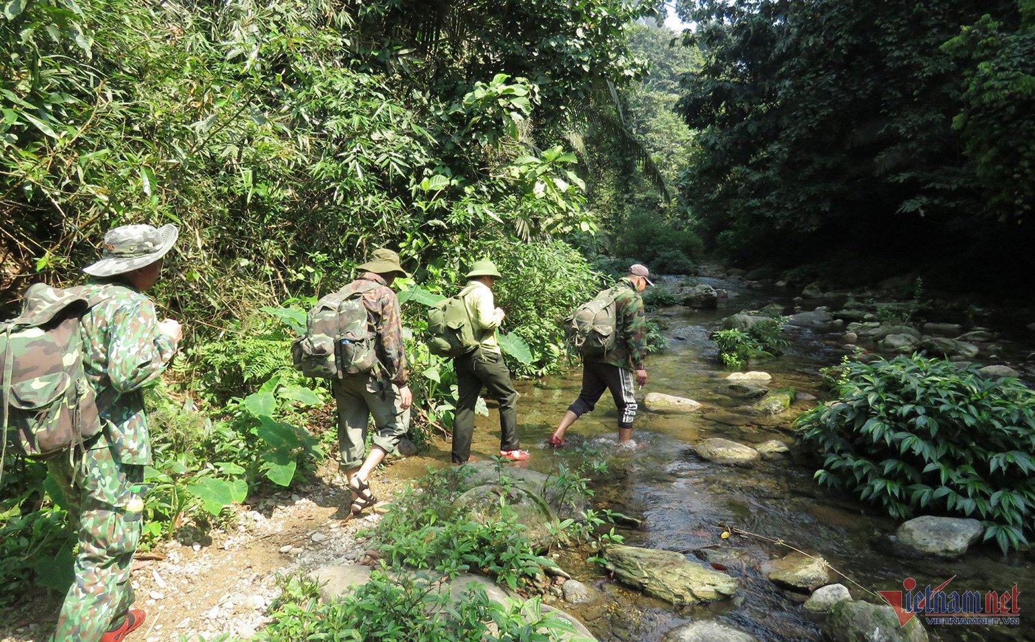
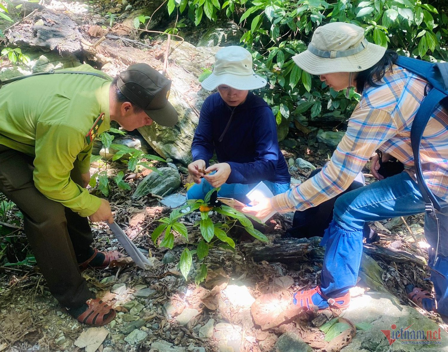
Speaking to reporters, Mr. Vo Minh Son - Director, Head of Pu Huong Nature Reserve (Nghe An) said that the total forest area in the reserve is more than 46 thousand hectares, while there are only 55 staff members working in the 5 districts of Con Cuong; Quy Chau; Quy Hop; Tuong Duong and Que Phong with rugged terrain.
“The area is spread out, distributed in many districts where local people live in protected forest areas. Therefore, the risk of people impacting and encroaching on forest areas is very high. To detect, prevent and handle promptly, the unit has applied technology to detect, prevent and handle promptly when people impact the forest” – Mr. Son informed.
The unit has applied smart software as a tool for data management, patrol reporting, and biodiversity monitoring in national parks as well as in nature reserves.
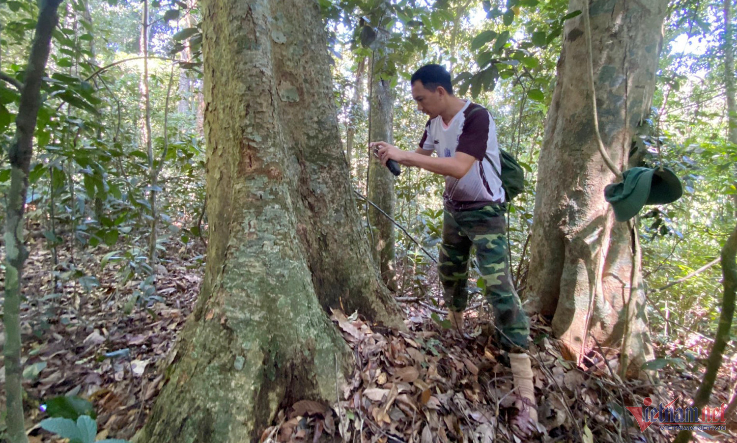
Applying smart during patrol, the guard can see the staff moving to the forest area under their management. On the way, integrate and send information from the scene to the management agency such as: Forest resources are encroached, detecting footprints, traces of animals... taking photos, evaluating and sending to the server.
"Using this technology helps officers reduce reporting after returning from the forest. The server automatically exports the information that officers send back via the software. In addition, the software also helps forest rangers avoid mistaking routes and travel schedules during patrols," Mr. Son shared.
Previously, before applying smart software, patrol data collection was done through tools such as handheld GPS locators, recorders, and cameras. Data was manually entered into the computer, patrol results, and field monitoring took a lot of time and was prone to errors during recording and data entry.
Since using smart mobile, collecting information and field data has become easier, faster and more accurate from field data on the current status of the forest.
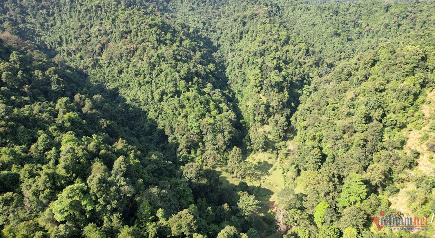
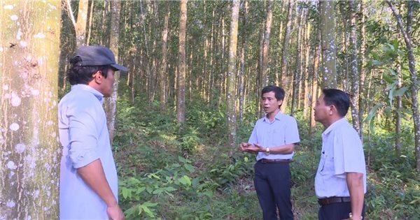
In addition, the Reserve also purchased the copyright of vetools software, updating satellite images within the protected area twice a month. From satellite images, forest protection officers can compare the current status of the forest from above this month with the previous month.
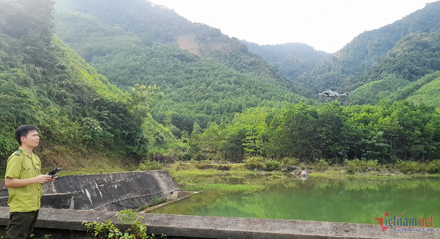
In recent years, Pu Huong Nature Reserve has also used flycams to control within a small area to monitor and check the current status of the forest. This helps staff reduce a lot of effort and time in the field.
Mr. Son added that through satellite images, it was discovered that people were exploiting protective forests to plant acacia. Specifically, in the Chau Hong commune, the protective forest was cut down in an area of 1-2000m2. Immediately after that, forces were mobilized to the scene to handle the situation promptly.
Source
![[Photo] Head of the Central Propaganda and Mass Mobilization Commission Nguyen Trong Nghia received the delegation of Nhan Dan Daily](https://vstatic.vietnam.vn/vietnam/resource/IMAGE/2025/3/25/cdb71275aa7542b082ec36b3819cfb5c)

![[Photo] Nhan Dan Newspaper Youth Union visits Vietnam Military History Museum](https://vstatic.vietnam.vn/vietnam/resource/IMAGE/2025/3/25/374e4f70a35146928ecd4a5293b25af0)
![[Photo] Prime Minister Pham Minh Chinh meets with the Ministry of Education and Training; Ministry of Health on the draft project to be submitted to the Politburo](https://vstatic.vietnam.vn/vietnam/resource/IMAGE/2025/3/25/c0e5c7348ced423db06166df08ffbe54)


![[Photo] General Secretary To Lam chairs the Standing Meeting of the Central Steering Committee on preventing and combating corruption, waste and negativity](https://vstatic.vietnam.vn/vietnam/resource/IMAGE/2025/3/25/839ea9ed0cd8400a8ba1c1ce0728b2be)


Comment (0)