
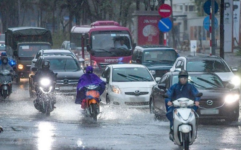
Today (August 6), the Northern region is forecast to have moderate to heavy rain, with some places experiencing very heavy rain with rainfall of more than 180mm. There is a risk of flash floods and landslides in mountainous areas and flooding in low-lying areas.
According to the National Center for Hydro-Meteorological Forecasting, from August 6 to 8, in the Northern region, there will be moderate rain, heavy rain, some places will have very heavy rain and scattered thunderstorms with common rainfall of 60-120mm, some places will have more than 180mm; in the North Central region, there will be rain, moderate rain and thunderstorms, locally heavy rain with rainfall of 20-40mm/24 hours, some places will have more than 70mm/24 hours.
Warning, on the day and night of August 8, in the mountainous and midland areas of the North, there will be moderate rain, heavy rain, and in some places very heavy rain with common rainfall of 20-50mm, in some places more than 100mm.
Risk of flash floods, landslides in mountainous areas and flooding in low-lying areas. Beware of heavy rain in a short period of time causing flooding in urban areas. During thunderstorms, there is a possibility of tornadoes, lightning, and strong gusts of wind.
Ships and marine activities should beware of tornadoes and strong winds.
Due to the influence of the low pressure trough passing through the northern East Sea connecting with the low pressure area north of the Gulf of Tonkin, on the day and night of August 6, in the northern and central East Sea (including the waters of the Hoang Sa archipelago), the Gulf of Tonkin, and the waters from Khanh Hoa to Binh Thuan, there will be strong southwest winds of level 5, sometimes level 6, gusting to level 7-8. The sea will be rough, with waves 2-3m high, and in the Gulf of Tonkin from 1.5-2.5m.
In addition, during the day and night of August 6, there will be scattered showers and thunderstorms in the northern part of the Gulf of Tonkin. There is a possibility of tornadoes and strong gusts of wind during thunderstorms.
During the day and night of August 7, in the Gulf of Tonkin, the sea area from Khanh Hoa to Binh Thuan, the northern and central areas of the East Sea (including the waters of the Hoang Sa archipelago), there will be strong southwest winds of level 5, sometimes level 6, gusting to level 7-8, rough seas. Waves will be 2-3m high; in the Gulf of Tonkin, waves will be 1.5-2.5m high.
Warning, all vessels and other activities in the above sea areas are at high risk of being affected by strong winds and large waves.
According to nhandan.vn
Source link


Comment (0)