
The National Center for Hydro-Meteorological Forecasting predicts that in the next few days, a tropical convergence zone will form in the central East Sea and tropical cyclones may form on this tropical convergence zone.
Speaking to Dan Tri reporters on the morning of October 19, Mr. Nguyen Van Huong, Head of the Weather Forecast Department (under the National Center for Hydro-Meteorological Forecasting), said that the unit is closely monitoring the weather situation in the East Sea to make the most accurate forecasts.
According to Mr. Huong, it is not possible to make an exact forecast, but in the next few days, a tropical depression or storm may appear in the East Sea.

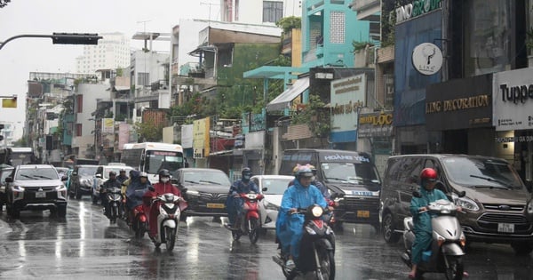
Image of devastated streets in Quang Ninh after recent storm No. 3 (Photo: Nam Anh).
The meteorological agency said that from now until October 25, the sea weather will be very bad, wave height in the East Sea tends to increase in most sea areas.
According to forecasts, in the North and Central East Sea (including Hoang Sa archipelago), the wave height will range from 3-5m. In the South East Sea (including Truong Sa archipelago), the central and South Central Coast, the wave height will generally range from 2-4m, while in other areas it will be less than 2m.
The meteorological agency also forecasts that from now until the end of the year, the possibility of storms and tropical depressions appearing in the East Sea may be close to or higher than the average of many years (the average of many years is 4.5 storms).
Of which, the number of storms making landfall may be higher than the average of many years (the average of many years is 1.9 storms) and concentrated in the Central region and the Southern provinces.
Experts also recommend being on guard against the possibility of storms and tropical depressions forming in the East Sea and do not rule out the possibility of strong storms.
Source: https://dantri.com.vn/xa-hoi/vai-ngay-toi-co-the-xuat-hien-bao-hoac-ap-thap-nhiet-doi-tren-bien-dong-20241019115923983.htm


Comment (0)