
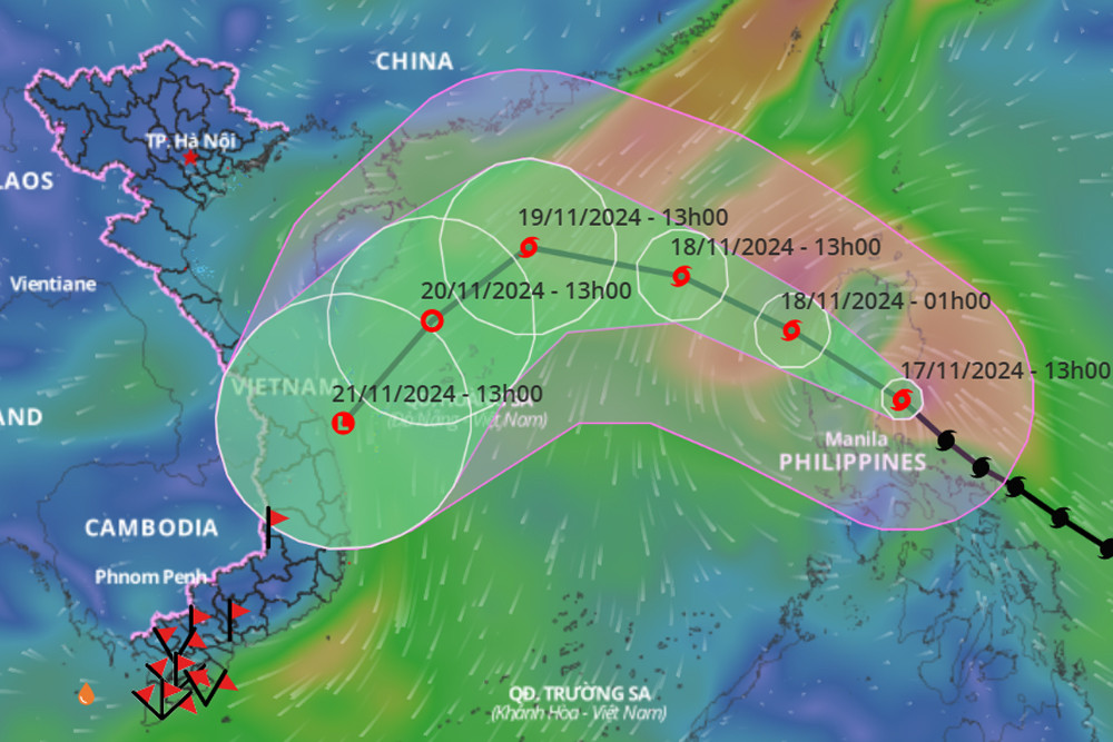
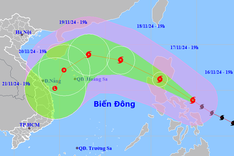
Super Typhoon Man-yi is currently active in the waters east of the central Philippines. It is forecasted that on November 18, the storm will move into the East Sea, interact with cold air, and its intensity may decrease by 3-4 levels.
According to the National Center for Hydro-Meteorological Forecasting, at 1:00 p.m. this afternoon (November 17), the center of super typhoon Man-yi was located on the southeast coastal area of Luzon Island (Philippines). The strongest wind near the center of the super typhoon was level 16 (184-201 km/h), gusting to level 17. Moving northwest at a speed of 20 km/h.
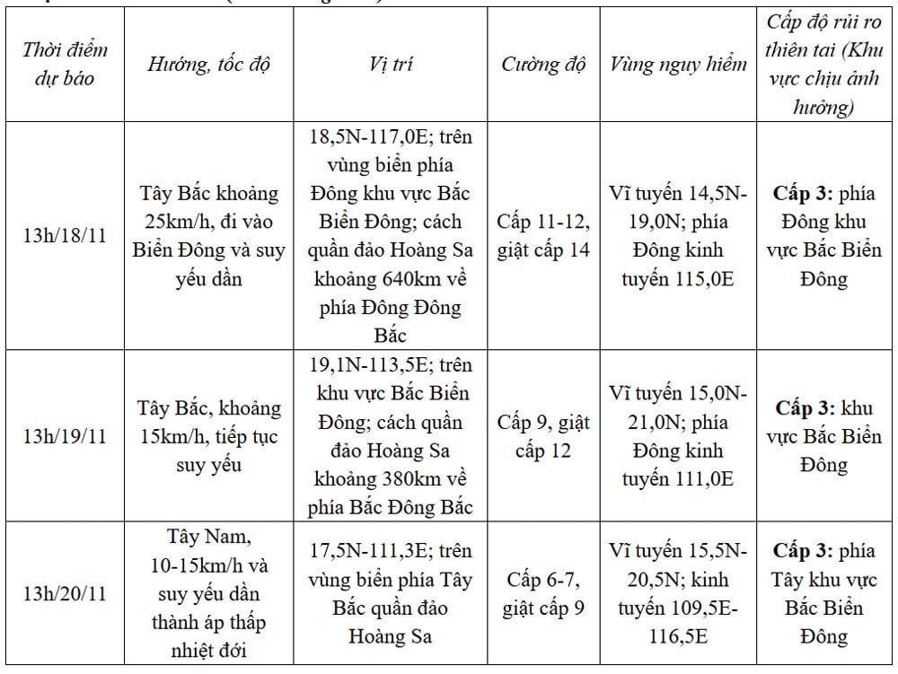
Forecast of storm Man-yi (next 24 to 72 hours) :
From the next 72 to 96 hours, the tropical depression will move in the South Southwest direction, traveling 10km per hour, and its intensity will continue to weaken.
According to experts, it is forecasted that around dawn tomorrow (November 18), super typhoon Man-yi will pass Lu Dong island (Philippines) to enter the East Sea, becoming storm number 9. However, when moving into the East Sea, the storm is likely to encounter the "nemesis" of cold air that is strengthening towards our country, so the development and intensity will change.
On the same day, the Minister of Agriculture and Rural Development issued a telegram to the People's Committees of coastal provinces and cities from Quang Ninh to Binh Thuan on responding to storm Man-yi near the East Sea.
Specifically, according to the National Center for Hydro-Meteorological Forecasting, super typhoon Man-yi is active in the sea east of the central Philippines; on November 18, the storm is forecast to enter the East Sea with a level 12 intensity, gusting to level 15.
The Minister of Agriculture and Rural Development requested departments, branches and localities to closely monitor the storm's developments; manage means of transport going out to sea; organize the counting of ships and boats; notify owners of means of transport, captains of ships and boats operating at sea of the location, direction of movement and developments of the storm so that they can proactively avoid, escape or not move into dangerous areas...
Due to the influence of storm Man-yi, the eastern sea area of the North East Sea has strong winds of level 6-7, then increasing to level 8-9, near the storm's eye level 10-13, gusting to level 15, waves 2-4m high, near the storm's eye 5-7m; the sea is very rough.
Warning: Vessels operating in the above mentioned dangerous areas are likely to be affected by storms, whirlwinds, strong winds and large waves.
New cold air mass affects HCMC weather the most since the beginning of the season
Super typhoon Man-yi heads towards the East Sea, likely to encounter a 'wall' of cold air
Source: https://vietnamnet.vn/sieu-bao-man-yi-co-the-vao-bien-dong-ngay-18-11-giam-lien-4-cap-2342837.html


Comment (0)