
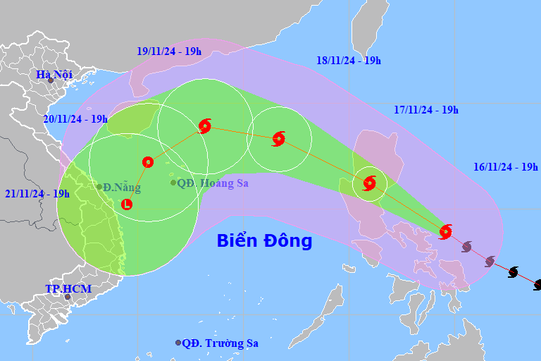
Typhoon Man-yi has made landfall in the eastern part of Luzon Island (Philippines) with the intensity of a super typhoon decreasing by 2 levels. Around tonight to early tomorrow morning (November 18), the storm will enter the East Sea and become typhoon number 9.
The National Center for Hydro-Meteorological Forecasting said that as of 7:00 p.m. tonight (November 17), the center of storm Man-yi was located on the mainland of Lu Dong Island (Philippines). The strongest wind near the center of the storm is level 14 (150-166 km/h), gusting to level 17. Moving northwest at a speed of about 25 km/h.
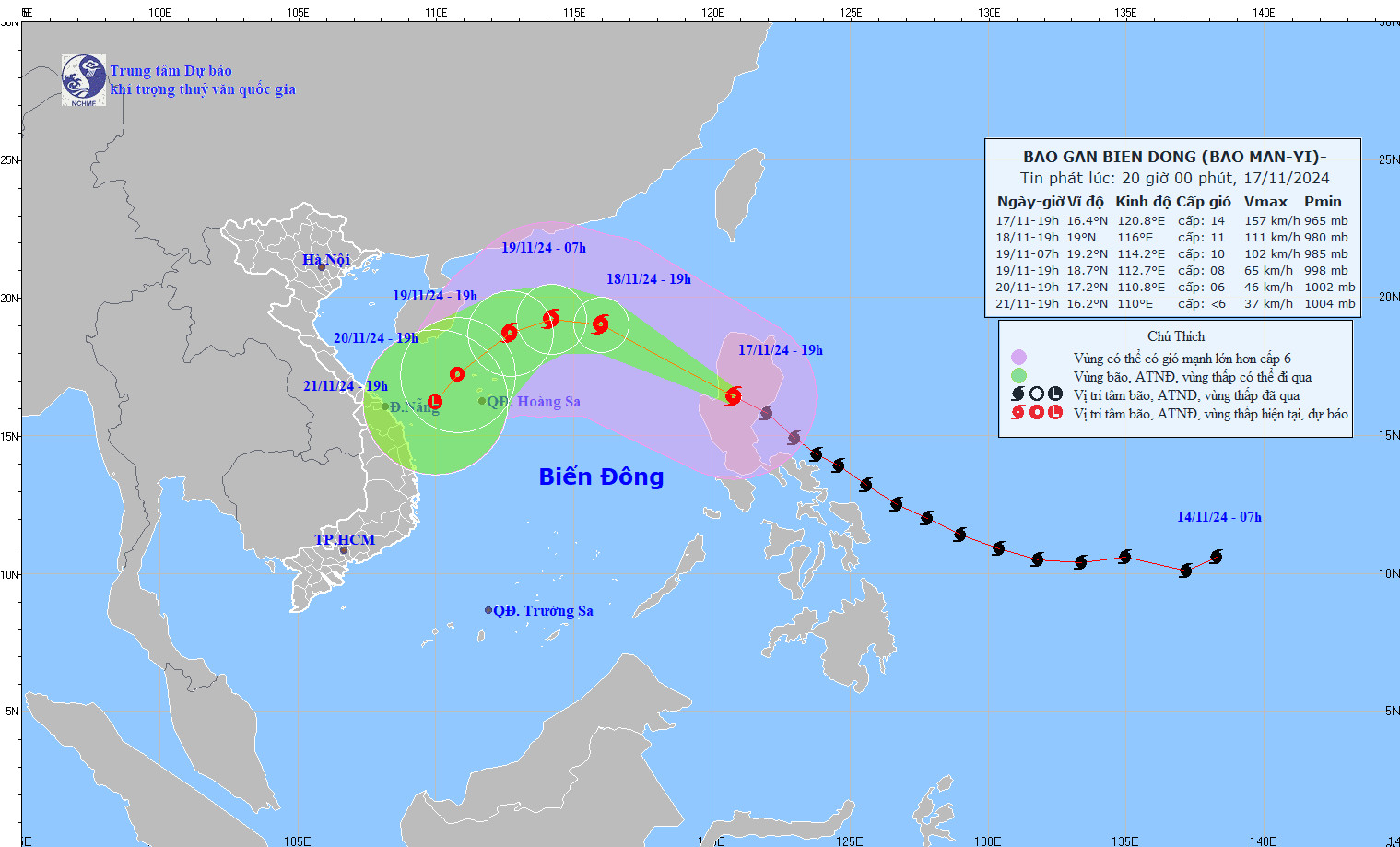
It is forecasted that in the next 24 hours, storm Man-yi will continue to move northwest at a speed of 20-25km/h and enter the East Sea, becoming storm number 9 in the 2024 storm season.
By 7pm tomorrow night (November 18), the eye of the storm will be located in the North East Sea, approximately 470km northeast of the Hoang Sa archipelago. The storm’s intensity will continue to decrease, to level 11, with gusts of level 14.
Storm forecast (next 24 to 72 hours) :
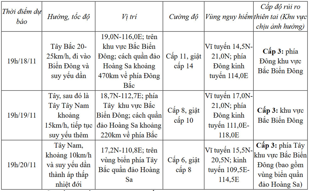
From the next 72 to 96 hours, the tropical depression moves in the South-Southwest direction, traveling 5-10km per hour, gradually weakening into a low pressure area.
Experts say that when entering the East Sea, storm Man-yi is likely to interact with cold air flowing toward our country, so it will quickly weaken.
However, due to the impact of the storm, the eastern sea area of the North East Sea has strong winds of level 8-10, near the eye of the storm level 11-13, gusts of level 15, waves 3-5m high, near the eye of the storm 5-7m; the sea is very rough. Ships operating in the above-mentioned dangerous areas are likely to be affected by storms, whirlwinds, strong winds, and large waves.
Super typhoon Man-yi heads towards the East Sea, likely to encounter a 'wall' of cold air

New cold air mass affects HCMC weather the most since the beginning of the season
Source: https://vietnamnet.vn/bao-man-yi-giam-2-cap-sap-di-chuyen-vao-bien-dong-thanh-bao-so-9-2342909.html


Comment (0)