
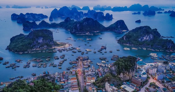
Quang Ninh approves planning for eco-tourism and resort area in Van Don
Tra Ban Island area, Van Don economic zone, Quang Ninh province has the function of an eco-tourism area, high-class resort, residential area, public services; high-tech agricultural production area, and diverse ecosystem conservation area.
Concretizing the orientation of Adjusting the Master Plan for the construction of Van Don Economic Zone to 2040 approved by the Prime Minister in Decision No. 266/QD-TTg dated February 17, 2020. The People's Committee of Quang Ninh province has decided to approve the 1/2000 scale zoning planning task of Tra Ban island area in Van Don economic zone, Quang Ninh province.
The construction of planning space is based on the organization and harmonious exploitation of residential areas, functional production areas and natural ecological landscapes in the area, effectively using land resources, protecting and promoting natural ecological landscapes in the area. Forming a system of urban residential areas, services, harmoniously connecting with natural terrain features, water surface and ecosystems, becoming a functional area of Van Don Economic Zone.
According to the plan, the boundary of the planning area includes Tra Ban island, Chau Dap island, Cong Nua island, Van Tau island, Cap Diem Chu island, Buong Tro island, Cai Suoi island and some other neighboring rocky islands of Van Hai archipelago, located within the defined administrative boundaries of the communes: Ban Sen, Minh Chau, Quan Lan, Van Don district, Quang Ninh province.
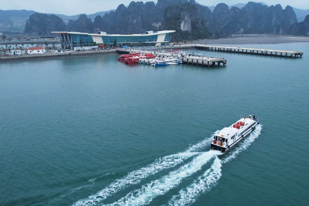 |
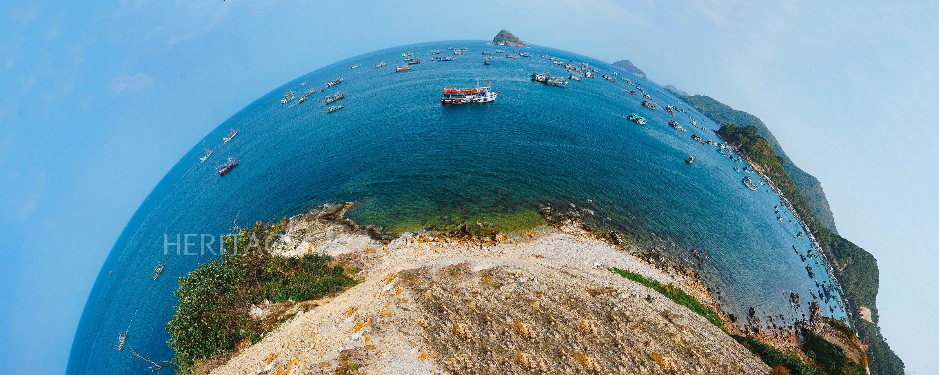
| The operation of Ao Tien International Passenger Port has helped Van Don district increase its connecting traffic infrastructure, improve the quality of tourism services; contributing to building Van Don into a multi-sector, multi-field economic zone, high-class sea and island tourism. |
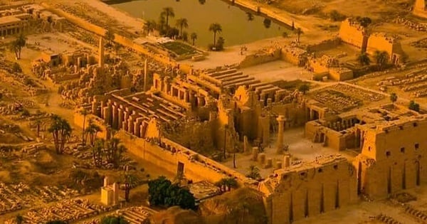
Tra Ban island area is planned to be about 11,110ha wide. Of which, the area belonging to Ban Sen commune is about 6,820ha, Minh Chau commune is about 1,640ha, Quan Lan commune is about 2,650ha.
The planning area borders the Mang River to the East, the Dong Chen River to the West, the Vong Vang River to the South, and the Cai Quyt River to the North (expected to be limited by points M1, M2, M3, ..., M33, M1 on the research boundary map, the scope of the planning area).
According to the orientation of Quang Ninh province, the planned area will be developed into a high-class eco-tourism and resort area, residential and public services, high-tech agricultural production area, and ecological diversity conservation area. In line with the development orientation of the approved adjustment of the General Planning for the construction of Van Don Economic Zone to 2040 and the potential advantages of the planning area; the sub-zones are divided into functional areas, each area is associated with its own development orientation.
Preliminarily, the planned area is expected to have 6 functional areas. Of which, the high-end marine eco-tourism area in the North will exploit the advantages of terrain, vision and landscape, develop tourism service models, sports, entertainment centers, resort tourism... and renovated residential areas associated with high-tech agricultural production activities.
For the high-end marine eco-tourism area in the East, priority will be given to developing high-end resort tourism services, forming public beaches; developing a system of inland ports and tourist ports on the Mang River, preserving and restoring relics associated with the history of Van Don commercial port.
The Ban Sen service, tourism and residential center will be the area where residents and public service facilities of Ban Sen commune are concentrated. This place has favorable terrain, research and development of new residential areas with low-rise ecological housing and public services, community tourism services; agricultural development.
 |
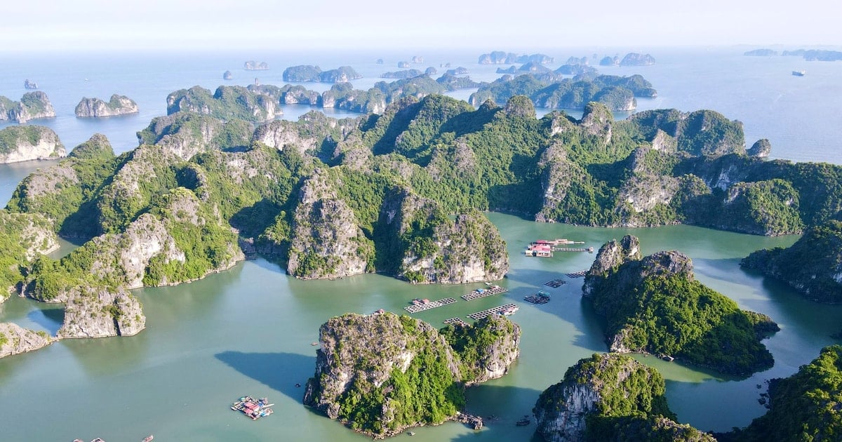
| The focus on infrastructure investment has been and is the driving force for investment activities in tourism, services and the development of Van Don. Photo: Do Phuong |
To the Southeast, the current residential area is located in the Southeast of the island and is the closest point to connect to Quan Lan Island. We will study the development of a residential area combined with tourism services, associated with promoting the value of Van Don Commercial Port and forming a road traffic route connecting to Quan Lan Island.
To the south, this is the area belonging to and bordering Chau Dap island, with relatively diverse terrain and large water surface areas. With these natural conditions, we will study and plan high-end eco-resorts and boat dock services, entertainment associated with the water surface...
In the area on the west coast of the island, where the terrain is rugged and the natural forest area needs to be protected, research will be conducted to develop forms of experiential tourism and adventure tourism to contribute to diversifying local tourism products.
According to the plan, other functional areas will be specified and supplemented during the planning research process. The orientation of functional areas is specified during the zoning planning process to ensure consistency with the approved Adjustment of the General Construction Planning of Van Don Economic Zone to 2040 and the actual conditions of the area.


Comment (0)