
Updated date: 05/17/2023 16:38:59
On May 17, Associate Professor, Dr. Mai Van Khiem - Director of the National Center for Hydro-Meteorological Forecasting had an interview with the press about increasingly severe weather, the coming El Nino phenomenon and response plans.
Associate Professor, Dr. Mai Van Khiem (Photo: HOANG LINH)

- Reporter: Sir, what is El Nino and when is it forecasted to appear?
Mr. Mai Van Khiem : El Nino is the term used to refer to the phenomenon of abnormal warming of the surface sea water in the central and eastern equatorial Pacific, lasting 8-12 months or longer, usually appearing every 3-4 years, but sometimes thicker or thinner.
After 3 years of La Nina causing heavy rain and floods, ENSO is now in a neutral state. El Nino is forecast to appear in the second half of summer 2023 and last until 2024 with a probability of about 70-80%.
- How does El Nino usually affect Vietnam?
Under El Nino conditions, in most regions across the country, average monthly temperatures tend to be higher than normal, heat waves may be more frequent and more intense, and there is a possibility of many records for absolute highest temperatures.
Storm and tropical depression activity may not be as high, but it is concentrated in the middle of the season, and is more unusual in both intensity and trajectory. It is worth noting that El Nino often causes rainfall deficits in many places across the country, with a common level of 25 - 50%.
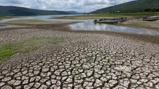
Therefore, there is a high risk of local or widespread drought in areas with high water demand for production and daily life during the dry months of 2023. It is necessary to guard against low rainfall leading to drought, saltwater intrusion, and water shortages in the first months of 2024 nationwide.
Previously, El Nino caused record droughts in 2015-2016 and 2019-2020.
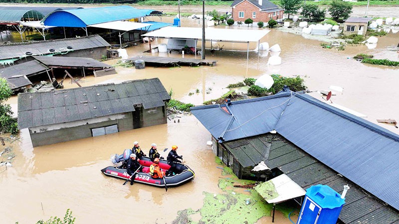
Illustration
- Does this mean that when El Nino appears, there will no longer be flooding like in previous years when La Nina was active?
Not so, although under El Nino conditions, rainfall tends to decrease but there can be records for the heaviest rainfall in 24 hours. For example, in 2015 there was El Nino but in Quang Ninh there was historic heavy rain at the end of July.
In the year of El Nino 2002, heavy rains still occurred and caused major floods in many areas. Specifically, major floods above alert level 3 occurred in July and early August on the Red River and Thai Binh River systems. In the Central region, historic floods occurred in the upper reaches of the Ca River (Ha Tinh) at the end of September. In the South, major floods occurred for a long time in the Mekong Delta.
Or like in 2009, the appearance of storm No. 9 (Ketsana) entering the provinces of Quang Nam - Quang Ngai also caused a large flood, a historic flood in late September 2009. The flood peak in 2009, on the main rivers from Quang Binh to Phu Yen all exceeded alert level 3. Severe flooding from Quang Binh to Khanh Hoa and Kon Tum.
- So what should be done to cope with the effects of El Nino?
The General Department of Hydrometeorology has sent a dispatch to the National Steering Committee for Natural Disaster Prevention and Control, warning of the impact of El Nino, and informing ministries, branches and localities to have response plans. The immediate and long-term tasks have been directed by the Prime Minister in a recently issued dispatch.
With the high possibility of El Nino, we need to review and assess the water demand for production and daily life to adjust plans accordingly, especially for the summer-autumn crop in the North Central, Central Central, or major tourist areas in the dry months of 2023. Reservoirs also need to review and adjust their operation and production plans to cope with the risk of rainfall deficit under El Nino conditions.
Besides coping with water shortages and droughts in El Nino conditions, we must not lose vigilance against the possibility of unusual rains and floods as happened in previous El Nino years.
According to VAN PHUC (SGGP)
Source link


![[Photo] Prime Minister Pham Minh Chinh chairs Government Conference with localities on economic growth](https://vstatic.vietnam.vn/vietnam/resource/IMAGE/2025/2/21/f34583484f2643a2a2b72168a0d64baa)


Comment (0)