
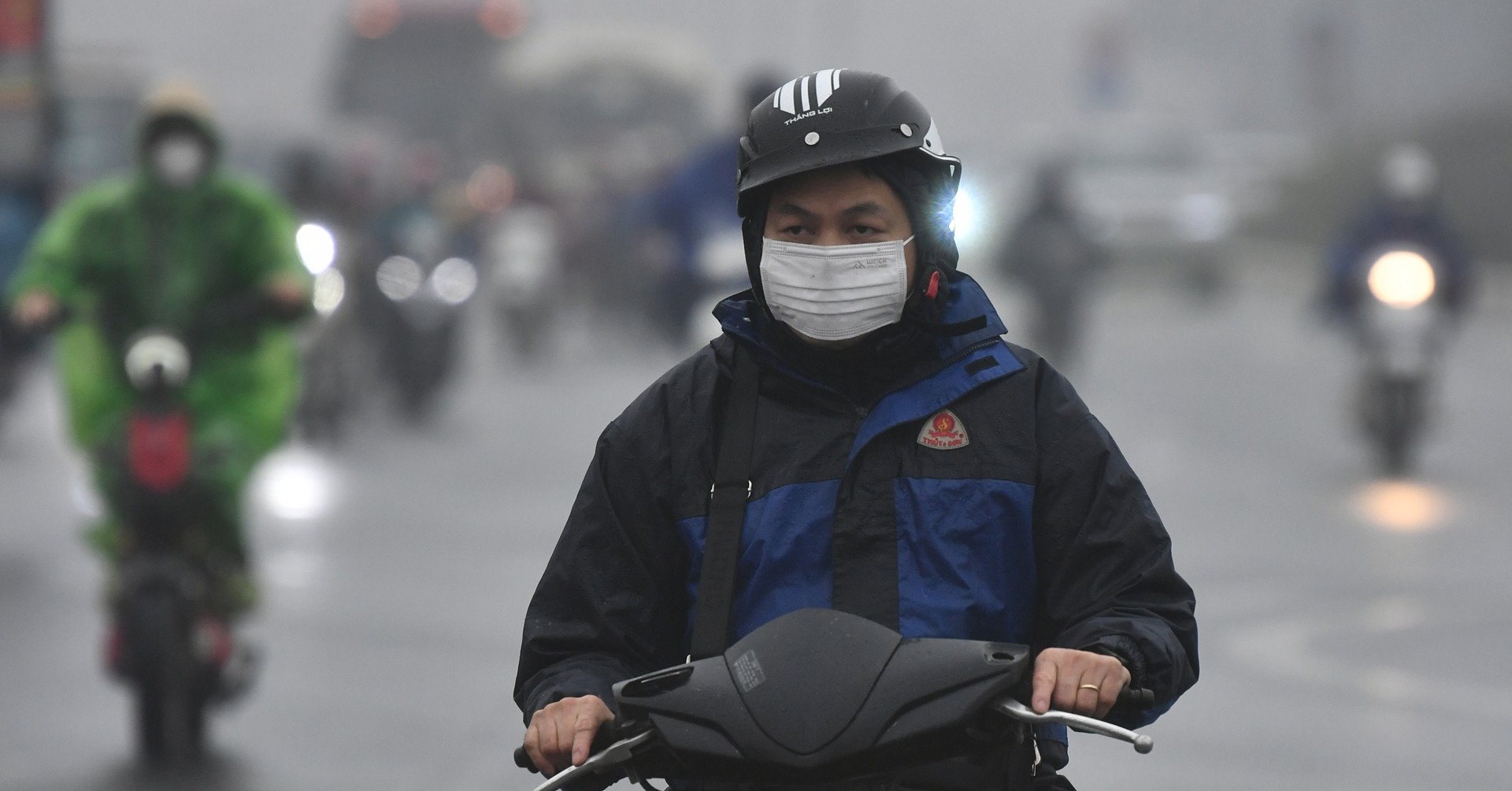
Around the afternoon and night of November 17, cold air will affect the Northeast, then the North Central region and some places in the Northwest and North Central regions, causing temperatures to drop sharply.
According to the National Center for Hydro-Meteorological Forecasting, currently (November 16), in the North, a cold air mass is moving south.
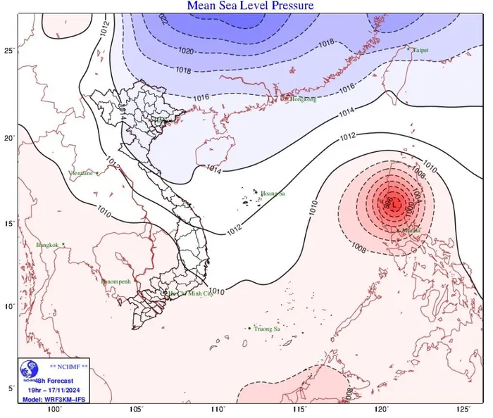
Cold air is moving south. Photo: NCHMF
It is forecasted that in the afternoon and night of November 17, this cold air mass will affect the Northeast; then affect the North Central region, some places in the Northwest and the Central Central region.
From November 18, in the Northeast and Thanh Hoa, the weather will turn cold at night and early morning. From November 20, in the North and North Central regions, the weather will be cold at night and early morning. The lowest temperature during this cold air mass in the North and North Central regions will generally be from 18-20 degrees Celsius, in mountainous areas, some places will be below 15 degrees Celsius.
Due to the influence of disturbances in the upper easterly wind zone combined with cold air, from November 18-19, in the North and Central Central regions, there will be scattered showers and thunderstorms, with some places having heavy rain. During thunderstorms, there is a possibility of tornadoes, lightning and strong gusts of wind.
Interacting with cold air, typhoon Man-yi may change direction
This morning, super typhoon Man-yi has strengthened to level 16, gusting over level 17, and is moving over the sea east of the central Philippines.
It is forecasted that in the next 24 hours, super typhoon Man-yi will move mainly in the northwest direction, maintaining the intensity of level 16. By tomorrow afternoon (November 17), super typhoon Man-yi will make landfall in the Luzon island area (Philippines) and gradually weaken. Around the morning of November 18, typhoon Man-yi will move into the East Sea, becoming the 9th typhoon affecting our country during this year's storm and flood season.
It is worth noting that the time when Typhoon Man-yi moves into the East Sea is also the time when the East Sea is affected by a strong cold air wave. The interaction of cold air and Typhoon Man-yi will cause many changes in the intensity and direction of the storm.
The interaction of cold air and storm Man-yi will make the weather in the East Sea very bad in the coming days, with strong winds, high waves and fluctuations. The development of this storm Man-yi is still changing, so we need to monitor it closely.
In addition to Typhoon Man-yi, there is also Typhoon Usagi active in the eastern part of the northeastern sea of the East Sea. It is forecasted that today, Typhoon Usagi will make landfall in Taiwan (China), then weaken into a tropical depression and dissipate.
Source vietnamnet
Source: https://baophutho.vn/khong-khi-lanh-sap-tran-ve-bac-bo-va-bac-trung-bo-chuyen-ret-222812.htm


Comment (0)