
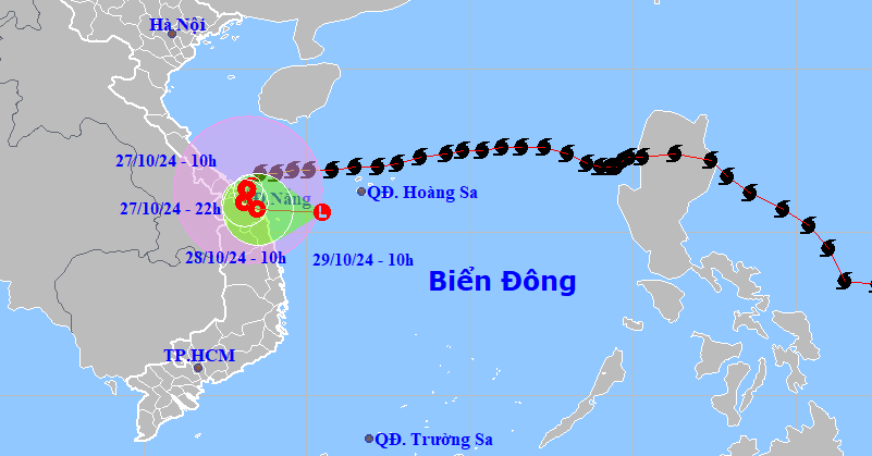
To proactively respond to storm Tra Mi when it enters the East Sea, the Ministry of Agriculture and Rural Development (MARD) has just sent a telegram to ministries, branches and provinces and cities from Quang Ninh to Binh Thuan.
On the afternoon of October 22, the Ministry of Agriculture and Rural Development sent a telegram to ministries, departments, branches and People's Committees of provinces and cities from Quang Ninh to Binh Thuan to proactively respond to storm Tra Mi when it enters the East Sea.
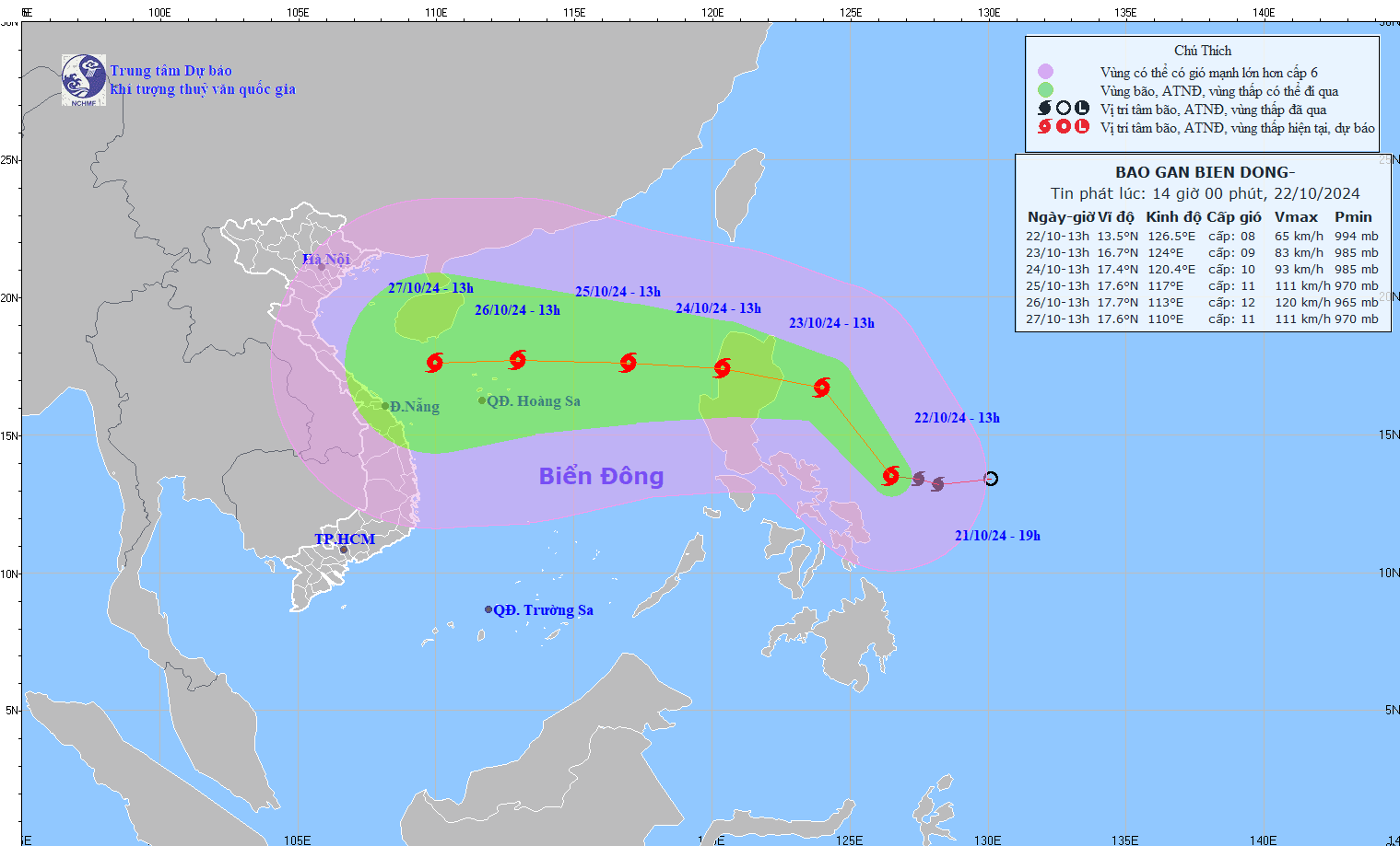
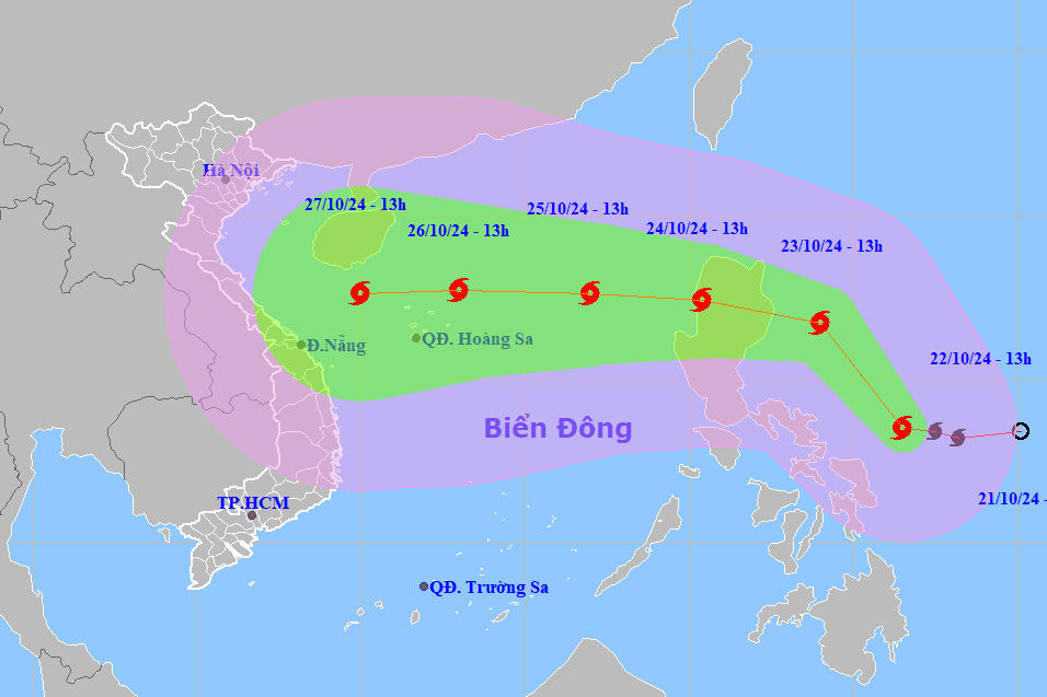
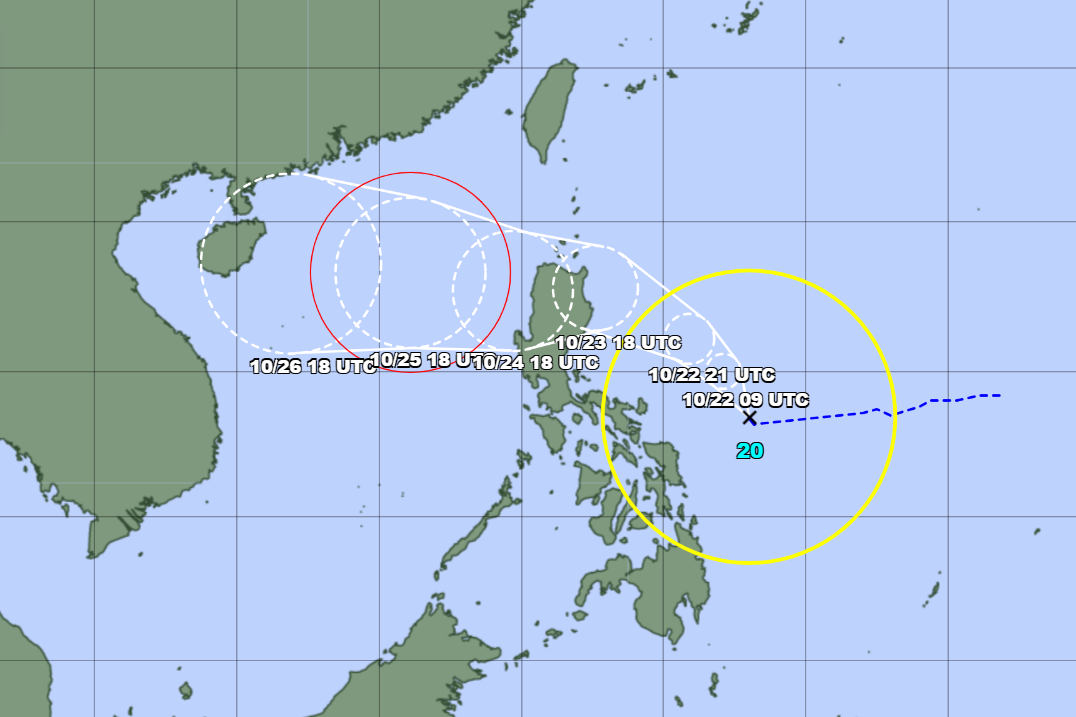
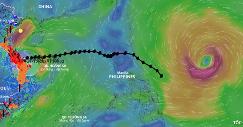
According to the forecast bulletin of the National Center for Hydro-Meteorological Forecasting, the tropical depression in the sea east of the Philippines has strengthened into storm Tra Mi.
It is forecasted that by the afternoon of October 24, the storm will enter the East Sea at level 10, gusting to level 12. By 1:00 p.m. on October 25, the storm will strengthen to level 11, gusting to level 14, with a dangerous area from latitude 15 to 20 degrees North, east of longitude 115 degrees East.
To proactively respond to the developments of storm Tra Mi, the Minister of Agriculture and Rural Development requested ministries, departments, branches, and Chairmen of People's Committees of coastal provinces and cities from Quang Ninh to Binh Thuan to closely monitor the developments of the storm.
At the same time, strictly manage vehicles going out to sea, organize counting, notify vehicle owners, captains of ships and boats operating at sea of the location, direction of movement and developments of the storm so that they can proactively avoid, escape or not move into dangerous areas.
Ministries, departments, branches and Chairmen of People's Committees of coastal provinces and cities need to prepare forces and means for rescue when requested.
The coastal information system and mass media agencies from central to local levels have increased measures to inform authorities at all levels, owners of vehicles operating at sea and people about the storm's developments so that they can proactively prevent and respond.

After the heavy damage caused by Typhoon Yagi, AI is needed for early forecasting
Storm Trami moves fast, level 14 gusts when entering the East Sea
Typhoon Tra Mi forms in the East of the Philippines, forecast to enter the East Sea
Source: https://vietnamnet.vn/cac-tinh-tu-quang-ninh-binh-thuan-chu-dong-ung-pho-voi-bao-tra-mi-2334451.html


![[Photo] Prime Minister Pham Minh Chinh chairs Government Conference with localities on economic growth](https://vstatic.vietnam.vn/vietnam/resource/IMAGE/2025/2/21/f34583484f2643a2a2b72168a0d64baa)


Comment (0)