
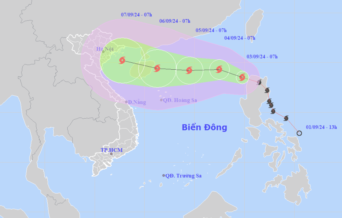
This morning (September 3), storm Yagi entered the northeastern sea of the North East Sea, becoming storm number 3 in 2024.
At 7:00 a.m., the center of the storm was located at approximately 18.4 degrees North latitude; 119.8 degrees East longitude, in the northeastern sea area of the North East Sea. The strongest wind near the center of the storm was level 8 (62-74 km/h), gusting to level 11, moving in the West Northwest direction, at approximately 20-25 km/h.
Mr. Nguyen Van Huong - Head of Weather Forecast Department, National Center for Hydro-Meteorological Forecasting said that when the storm moves into the East Sea, atmospheric conditions (wind, air pressure), ocean (sea water temperature in the East Sea area is 30-31 degrees) are favorable for the storm to strengthen and move westward.
According to the Head of the Weather Forecasting Department, although forecasters agree that Typhoon Yagi will be strongest east of Hainan Island (China), the forecast intensity is significantly different. Japan forecasts the strongest storm at level 13, gusting to level 17, while China forecasts level 15 and the US forecasts level 16, gusting above level 17.
At present, it is uncertain whether Typhoon Yagi will pass Hainan Island and enter the Gulf of Tonkin, directly affecting the Vietnamese mainland. However, Mr. Huong warned that from September 3, the northeastern sea area of the North East Sea will be affected by Typhoon Yagi's circulation.
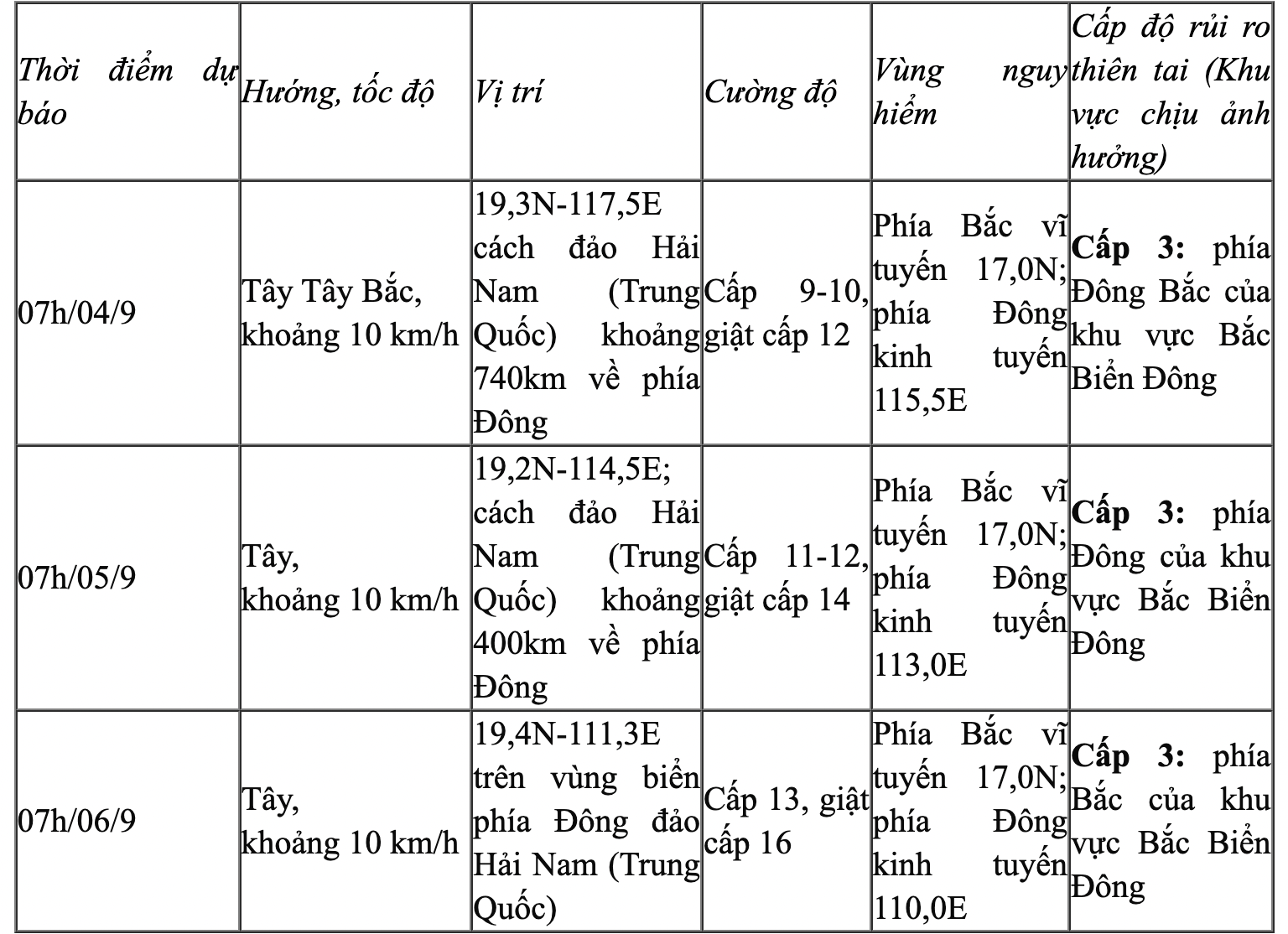
It is forecasted that in the next 72 to 120 hours, the storm will move mainly in the West Northwest direction, traveling 10-15km per hour, with the possibility of strengthening.
From September 3, the northeastern sea area of the North East Sea will gradually increase to level 6, near the storm center it will increase to level 8-9, gusting to level 11-12; rough seas. It is forecasted that from September 4-6, Typhoon Yagi may reach very strong storm level in the northeastern East Sea area, with maximum strong winds reaching level 12-13, gusting to level 16 near the storm center.
In the next 24 hours, the sea in the eastern part of the North East Sea will have waves 2.0-4.0m high, near the storm center 3.0-5.0m. After that (September 4-6), they may increase to 5-7m. The sea will be rough and very dangerous for ships.
Source: https://vietnamnet.vn/bao-yagi-sang-nay-di-vao-bien-dong-tiep-tuc-manh-len-2318004.html

![[Photo] Prime Minister Pham Minh Chinh chairs the Government's special meeting on law-making in April](https://vstatic.vietnam.vn/vietnam/resource/IMAGE/2025/4/13/8b2071d47adc4c22ac3a9534d12ddc17)


![[Photo] Closing of the 11th Conference of the 13th Central Committee of the Communist Party of Vietnam](https://vstatic.vietnam.vn/vietnam/resource/IMAGE/2025/4/12/114b57fe6e9b4814a5ddfacf6dfe5b7f)


Comment (0)