
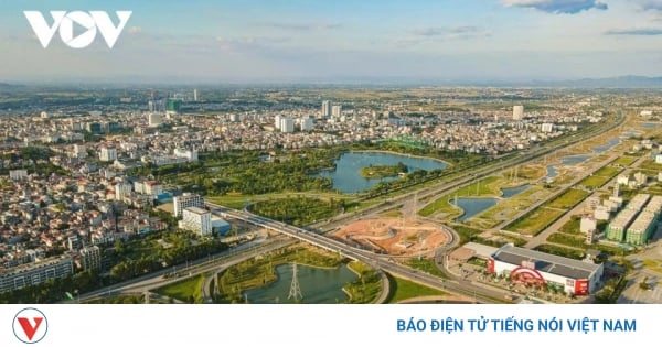
In ancient times, Can Tho belonged to the land of Tran Giang, which was considered to have a strong position to fight against invaders. Meanwhile, the name Hau Giang was introduced in 1975, based on the merger of Phong Dinh, Ba Xuyen and Chuong Thien provinces. Although formed later, Hau Giang is the province with the most central location in the Mekong Delta.
Can Tho - the ancient land of Tran Giang has a strategic location
Since ancient times, in the history of our ancestors' land reclamation in the South, Can Tho belonged to Tran Giang land. This is a land with a strategic location to be a solid base for Ha Tien to fight against the Siamese and Chenla armies that frequently invaded and harassed, so the Governor at that time, Mac Thien Tich, built Tran Giang land in all fields of military, economy, trade and culture.
The great mandarin Nguyen Cu Trinh, who was sent to the South by Lord Vo Vuong Nguyen Phuc Khoat in 1753 after meeting with Governor Mac Thien Tich, also agreed with his strategy. From then on, Tran Giang developed further and became a strong "headquarters" in the Hau Giang region. Not only was it a garrison at a key waterway location, the Tran Giang headquarter - located on the west bank of the Can Tho River - was also a place where people from all over gathered to explore and establish their careers.

Can Tho City has been a centrally governed city since January 1, 2004.
The late 19th century and early 20th century were a period of intense historical upheaval in the six provinces of Cochinchina. The French colonialists occupied the three eastern provinces according to the concession treaty of the Hue court in 1862. On June 20, 22 and 24, 1867, the French colonialists violated the 1862 treaty and occupied the three western provinces of Vinh Long, An Giang and Ha Tien.
On January 1, 1868, Governor of Cochinchina Bonard decided to merge Phong Phu district (Tran Giang - Can Tho) with Bai Sao (Soc Trang) to form a district, and established a court in Sa Dec.
On April 30, 1872, the Governor of Cochinchina issued a decree to merge Phong Phu with Bac Trang (a region under Lac Hoa prefecture, Vinh Long province) into one district, with the provincial office located in Tra On. One year later, the provincial office of Tra On was moved to Cai Rang (Can Tho).
On February 23, 1876, the Saigon Governor issued a new Decree to take Phong Phu district and part of An Xuyen and Tan Thanh districts to establish Can Tho district (arrondissement de Cantho) with its capital being Can Tho (Tan An village, the district administration of the old Phong Phu district). In 1889, France changed the district-level administrative units into provinces and districts into districts.
From 1876 to 1954, the administrative boundaries of Can Tho province during the French colonial period remained unchanged.
However, during the resistance war against France, the resistance government adjusted part of the administrative boundaries of Can Tho province. In particular, Can Tho received Thot Not district (Long Xuyen province), Long My, Go Quao, Giong Rieng districts, Rach Gia town (Rach Gia province) and Ke Sach district (Soc Trang province) and transferred Tra On and Cau Ke districts to Vinh Tra province (Vinh Long - Tra Vinh).

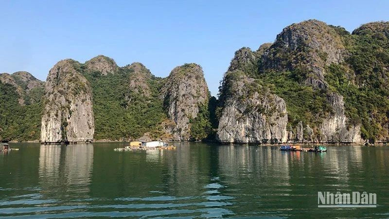
Floating market is a typical water culture in Can Tho. Photo: IT
After the Geneva Agreement in 1954, the US imperialists turned South Vietnam into a new type of colony. Since then, the administrative boundaries of Can Tho province under the old regime in the South have changed a lot. In 1956, the Ngo Dinh Diem government decided to change the name of Can Tho province to Phong Dinh province. In 1961, a land area in Long My, Vi Thanh was separated to form Chuong Thien province. After that, the districts, communes and cantons in Phong Dinh province and Chuong Thien province were all re-divided.
On the revolutionary government side, the name Can Tho was still maintained. The administrative boundaries were partially changed. In November 1954, Long My and the districts of Go Quao, Giong Rieng, and Rach Gia town were returned to Rach Gia province. Ke Sach district was returned to Soc Trang province. Thot Not district was returned to Long Xuyen province. Can Tho received the two districts of Tra On and Cau Ke as before. In 1956, Tra On and Cau Ke districts were returned to Vinh Long (at the time when the US puppet regime established the new province "Tam Can"). In 1957, Long My district was returned to Can Tho province. In 1958, Ke Sach district (belonging to Soc Trang province) was also transferred to Can Tho province.
In 1963, Thot Not district (Long Xuyen province) was transferred to Can Tho province. In 1966, Vi Thanh town was formed under Can Tho province. In 1969, Can Tho town was separated from Can Tho province under the Southwest region. In 1971, Can Tho town returned to Can Tho province. In 1972, Can Tho town became Can Tho city, under the Southwest region.
After the liberation of the South and the reunification of the country, the Government issued Decree No. 03/ND-76 dated March 24, 1976 merging Can Tho province, Soc Trang province and Can Tho city to establish a new province called Hau Giang, with the provincial capital being Can Tho city.
In December 1991, the National Assembly of the Socialist Republic of Vietnam (VIII term) issued a Resolution separating Hau Giang province into Can Tho province and Soc Trang province.
On January 1, 2004, Can Tho province was separated into Hau Giang province and Can Tho city. Since then, Can Tho has been a centrally-governed city.
Taking on the responsibility of a centrally-run city, Can Tho is making every effort to promote its geographical advantages, economic, trade, science and technology potential, human resources, and traditions of solidarity, dynamism and creativity to rise up and innovate, worthy of its position as a dynamic city, the "locomotive" of development in the Mekong Delta region.
Hau Giang – the center of the Mekong Delta
If before 1897, the district area of Giong Rieng, Go Quao, Long My (Rach Gia province) had only 2 communes, less than 10 villages - then by 1939, Long My district alone had 3 communes, 12 villages:
An Ninh commune includes the villages: Hoa An, Hoa Luu, Long Binh, Vi Thuy, Vinh Thuan Dong and Vinh Tuong. Thanh Tuyen commune includes the villages: Luong Tam, Thuan Hung, Vinh Tuy, Vinh Vien and Xa Phien. Thanh Giang commune includes the villages: An Loi, Long Phu, Phuong Binh, Phuong Phu, Tan Long and Long Tri. The land belonging to Vi Thuy district today is Vi Dong commune, Vi Thanh (formerly belonging to Giong Rieng district). Phung Hiep district, before the canal was dug, was only within the scope of a few villages, by 1939, there were 2 communes, 14 villages. Dinh Hoa commune includes the villages: Hoa My, My Phuoc, Tan Binh, Tan Hung, Tan Lap, Thanh Hung, Thanh Xuan, Truong Hung. Dinh Phuoc commune includes the villages: Dong Son, Nhu Lang, Phung Hiep, Long My, Thuong Phuoc, Truong Thanh Son. Thus, the old land is mainly Long My district (Rach Gia province) and Phung Hiep district (Can Tho province), the administrative boundaries were still maintained until the entire period of resistance against the French.
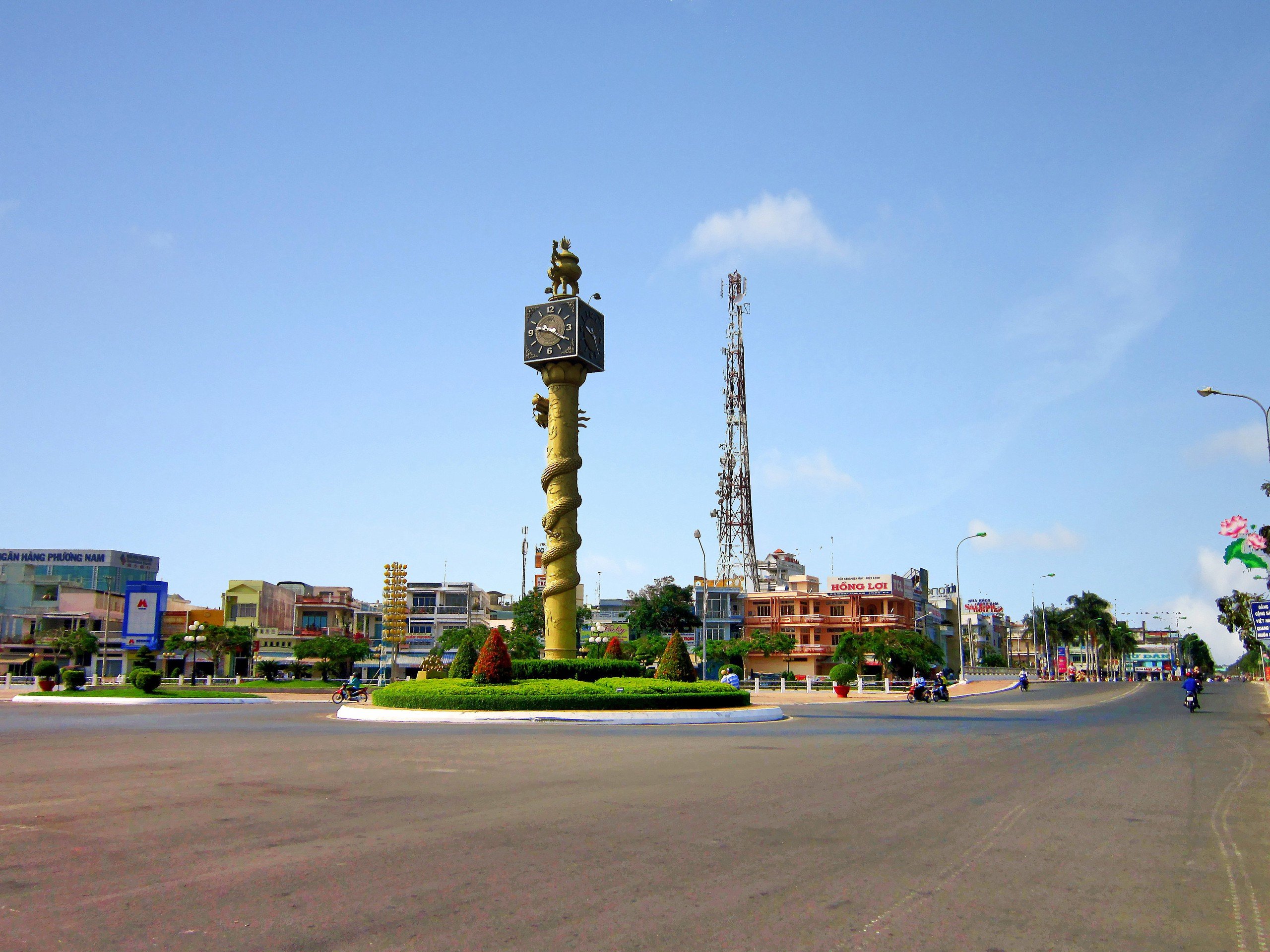
Central clock tower of Vi Thanh city, Hau Giang province.
After the Geneva Agreement of 1954, when France withdrew, the US intervened in the South, establishing the Ngo Dinh Diem regime, the Long My - Phung Hiep area had many changes: Around 1960, Long My district was separated, establishing a new district named Duc Long. Both districts were under Phong Dinh province, including the communes: Vi Thanh, Vi Thuy, Vinh Tuong, Hoa Luu, Vi Duc, Hoa An (later adding 1 commune from Giong Rieng district, Ngoc Hoa). Duc Long district was located in Hoa Luu commune, in 1963 moved to Vi Thuy commune (Nang Mau bridge foot), in the process of establishing the new Duc Long district - the Ngo Dinh Diem government built 2 densely populated areas: Vi Thanh - Hoa Luu, inaugurated on March 1, 1961.
With the intention of blocking the revolutionary forces from the U Minh gateway, tightening control over the people, protecting Can Tho and the 4th tactical zone - President of the puppet regime Ngo Dinh Diem signed a decree to establish Chuong Thien province on December 21, 1961. After that, the inauguration ceremony of Chuong Thien province was solemnly held on January 3, 1962.
Chuong Thien province includes 5 districts: Long My, Duc Long, Kien Hung (Go Quao district, Kien Giang today), Kien Thien district (Hong Dan district, Bac Lieu today), Kien Long district (Vinh Thuan district, Kien Giang today). During the anti-American war, on our side, Chuong Thien province was still under the command of Can Tho and Rach Gia provinces. Long My district, Vi Thanh town belonged to Can Tho, Go Quao, Giong Rieng, Vinh Thuan belonged to Kien Giang. After the liberation day, the administrative boundaries of Long My - Vi Thanh land were adjusted: At first, Vi Thanh town belonged to the old Hau Giang province (1975-1977). On January 1, 1978, Vi Thanh town was merged with Long My district, the inner city and suburbs of the town became Vi Thanh town.
From February 15, 1982, Long My district was divided into two districts: Vi Thanh and Long My. On July 1, 1999, the Government signed Decree No. 45/CP to establish Vi Thanh town and renamed Vi Thanh district to Vi Thuy district, all of which belonged to Can Tho province. On January 1, 2004, Can Tho province was divided into Can Tho city under the Central Government and Hau Giang province today.
If counting from the time of Mac Thien Tu, the land range west of Hau River has been exploited for nearly 300 years. If counting from the large exploitation periods, the last decades of the 19th century, a large part of Hau Giang land today, has a formation and development process of over 100 years.
The famous bustling intersection in Hau Giang province.
Hau Giang is currently a province in the center of the Mekong Delta, the provincial capital Vi Thanh (now Vi Thanh city) is 240 km southwest of Ho Chi Minh City; located in the center of the Mekong Delta, among a dense network of rivers and canals such as: Hau River, Can Tho River, Cai Tu River, Quan Lo Canal, Phung Hiep Canal, Xa No Canal, Cai San River... The major roads running through the province are National Highway 1A, National Highway 61, National Highway 61B.
Hau Giang has a moderate climate, few storms, hot and humid all year round, with two seasons (no cold season). Rainy season from May to November, dry season from December to April of the following year.
Hau Giang province has three ethnic groups: Kinh, Khmer, and Chinese, with a tradition of solidarity, hard work, and creativity in building the homeland, bringing diversity in culture, beliefs, customs, and practices.
Hau Giang currently has 7 administrative units, including 5 districts: Phung Hiep, Long My, Vi Thuy, Chau Thanh, Chau Thanh A, 2 towns: Nga Bay and Vi Thanh city. In the 7 administrative units, there are 74 communes, wards and towns.
Source: https://danviet.vn/trong-lich-su-tinh-hau-giang-tung-thuoc-tpcan-tho-sau-chia-tach-tinh-nao-so-huu-vi-tri-dac-dia-trung-tam-dbscl-20250323202048009.htm

![[Photo] Head of the Central Propaganda and Mass Mobilization Commission Nguyen Trong Nghia received the delegation of Nhan Dan Daily](https://vstatic.vietnam.vn/vietnam/resource/IMAGE/2025/3/25/cdb71275aa7542b082ec36b3819cfb5c)
![[Photo] Nhan Dan Newspaper Youth Union visits Vietnam Military History Museum](https://vstatic.vietnam.vn/vietnam/resource/IMAGE/2025/3/25/374e4f70a35146928ecd4a5293b25af0)

![[Photo] Prime Minister Pham Minh Chinh meets with the Ministry of Education and Training; Ministry of Health on the draft project to be submitted to the Politburo](https://vstatic.vietnam.vn/vietnam/resource/IMAGE/2025/3/25/c0e5c7348ced423db06166df08ffbe54)


![[Photo] General Secretary To Lam chairs the Standing Meeting of the Central Steering Committee on preventing and combating corruption, waste and negativity](https://vstatic.vietnam.vn/vietnam/resource/IMAGE/2025/3/25/839ea9ed0cd8400a8ba1c1ce0728b2be)


Comment (0)