
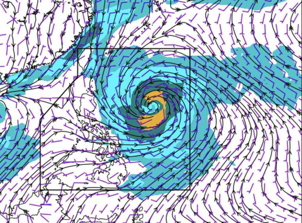
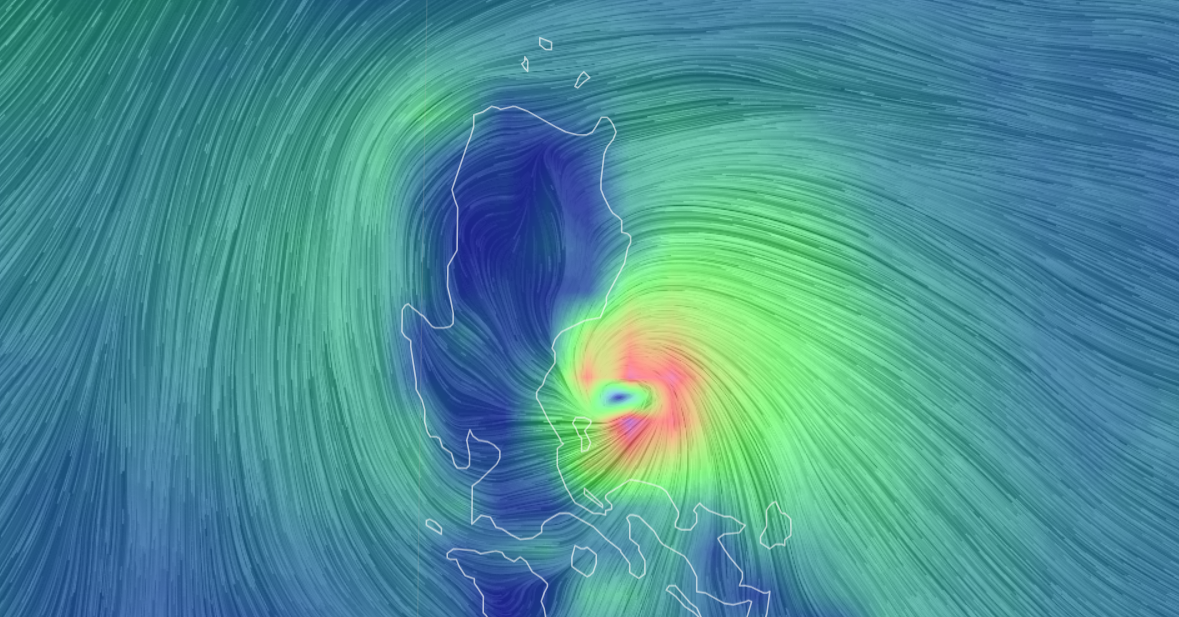
A new storm named Kong-rey has just formed off the coast of the Philippines with the intensity of a level 8-9 storm, and is expected to strengthen in the coming days. The National Center for Hydro-Meteorological Forecasting said that Kong-rey is moving west, with a tendency to shift slightly to the right.
A new storm has appeared off the coast of the Philippines. Will it make landfall in the East Sea?
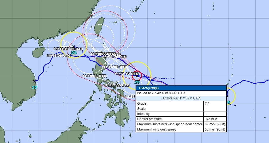
According to information from the Philippine Atmospheric, Geophysical and Astronomical Services Administration (PAGASA) on the morning of October 28, Typhoon Kong-rey, the latest storm to approach the East Sea, still maintains its intensity but its speed of movement over the Philippine Sea has gradually decreased. The center of the storm is currently about 840 km east of Central Luzon, Philippines, with a speed of 10 km/h. Maximum sustained winds are 85 km/h and gusts reach 105 km/h.
Storm Kong-rey is the latest storm right after storm Tra Mi - storm number 6 in the East Sea. Photo: PAGASA
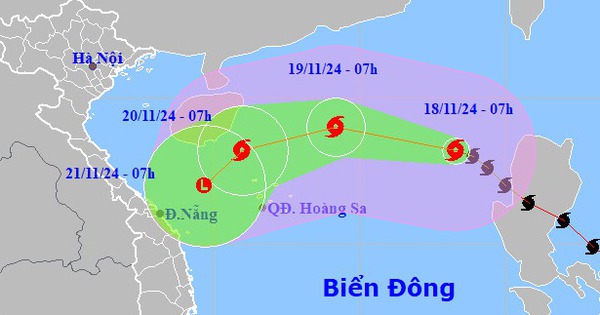
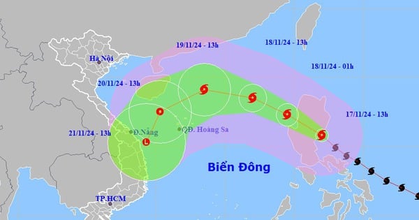
The storm is forecast to move westward over the next 12 hours before turning west-northwest in the early morning of October 29. According to PAGASA, the possibility of Kong-rey continuing to move westward and then turning northwest from October 30 to 31 is still considered.
Typhoon Kong-rey is forecast to make landfall in Taiwan (China) early on November 1 before turning north-northeast into the East China Sea. The Japan Meteorological Agency (JMA)'s typhoon forecast model also predicts that the latest typhoon after Typhoon Tra Mi will also make landfall in Taiwan (China) on November 1.
According to the track forecast released by PAGASA, Typhoon Kong-rey is likely to pass near the Batanes region of the Philippines on October 30 or 31.
Mr. Vu Anh Tuan, Deputy Head of the Weather Forecast Department, National Center for Hydro-Meteorological Forecasting, said that storm Kong-rey is currently about 1,000 km east of Luzon Island of the Philippines, and is showing signs of moving west but also tends to deviate to the left compared to initial predictions.
"Currently, we are closely monitoring this storm. It is possible that Kong-rey will enter the East Sea. Forecasting agencies will continue to update information in the coming time," Mr. Tuan shared.
Flood and heavy rain situation in Central region after storm No. 6
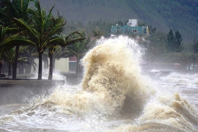
While typhoon Kong-rey is approaching, in Vietnam, typhoon No. 6 (Tra Mi) has weakened into a tropical depression after passing through the coastal area of Quang Nam - Da Nang in the early morning of October 28. Typhoon No. 6 caused strong winds in many coastal areas of the Central region, with winds of level 8 recorded at Con Co Island (Quang Tri) and Cu Lao Cham (Quang Nam); in Nam Dong (Thua Thien Hue) and Son Tra (Da Nang), gusts reached level 10.
Right after storm number 6 Tra Mi, a new storm appeared off the coast of the Philippines. Will it make landfall in the East Sea?
In the next 12 hours, the low pressure area is forecast to continue moving east-northeast and gradually weaken. Although the storm has weakened, heavy rain is still affecting the provinces from southern Ha Tinh to Thua Thien Hue. At the same time, the sea area from Quang Tri to Ninh Thuan and the northern East Sea still has strong winds and large waves, posing a danger to ships.
According to the National Center for Hydro-Meteorological Forecasting, from now until October 29, water levels on rivers in Quang Binh and Quang Tri may rise to alert level 2 - alert level 3, in some places exceeding alert level 3. The risk of landslides in mountainous areas, river banks, and the risk of localized flooding in low-lying areas and urban areas in Quang Binh, Quang Tri, and Thua Thien Hue is very high.
Last night and this morning, the area from South Ha Tinh to Quang Tri recorded very heavy rainfall. Some rain gauges reached 325 mm such as in Lam Thuy (Quang Binh) and 243.8 mm at Kim Son Lake (Ha Tinh). From now until the night of October 29, rainfall in this area may range from 100-200 mm, with some places reaching over 350 mm.
With prolonged heavy rain, the risk of flooding in low-lying areas, along with the risk of flash floods and landslides on steep slopes, is very high. The National Center for Hydro-Meteorological Forecasting recommends that people regularly monitor flash flood and landslide warning bulletins on the portal of the General Department of Hydro-Meteorology, especially in high-risk areas.
Source: https://danviet.vn/nong-ngay-sau-bao-so-6-ngoai-khoi-philippines-xuat-hien-con-bao-moi-lieu-co-do-bo-vao-bien-dong-20241028114800304.htm


Comment (0)