
Da Nang adjusts local planning of many important subdivisions
The planning of High-tech Zones, Innovation Zones, Danang Bayside Zones, and Hillside Urban Zones has been locally adjusted by Da Nang City.
Da Nang City has just issued a Decision approving the Local Adjustment of the City's Master Plan to 2030, with a vision to 2045, in which many important zoning plans have been locally adjusted.
Specifically, for the Hillside Urban Subdivision Area, in Hoa Son, Hoa Ninh, Hoa Nhon, Hoa Phu communes - Hoa Vang district, the locally adjusted planning area is about 457 hectares.
The local planning adjustment includes: Organizing and reallocating 03 lake locations, adding more green spaces. Indicators for using some basic functions: New residential land decreases by about 20 ha, Mixed-use land decreases by about 12 ha, Agricultural land decreases by about 23 ha, Water surface land decreases by about 101 ha (due to the current steep slope); Urban-level public green land combined with water surface increases by about 48 ha, Production forest land increases by about 108 ha.
In addition, adjust the production forest area in Truoc Dong lake area into a thematic park. Swap the location of mixed-use land to develop a non-tariff complex project at the intersection of Ba Na - Suoi Mo road and the planned 29m road axis. Indicators for using some basic functions: Mixed-use land increases by about 18 hectares, New residential land decreases by about 18 hectares.
Adjusting Industrial Land in the West of the South Hai Van Tunnel Bypass into Warehouse Land to expand the logistics area in Hoa Nhon area and Land for key technical infrastructure works to arrange Hoa Nhon dry port.
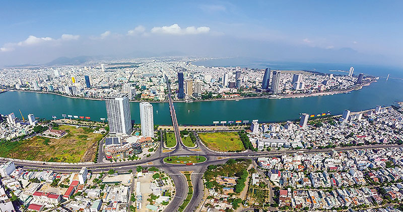 |
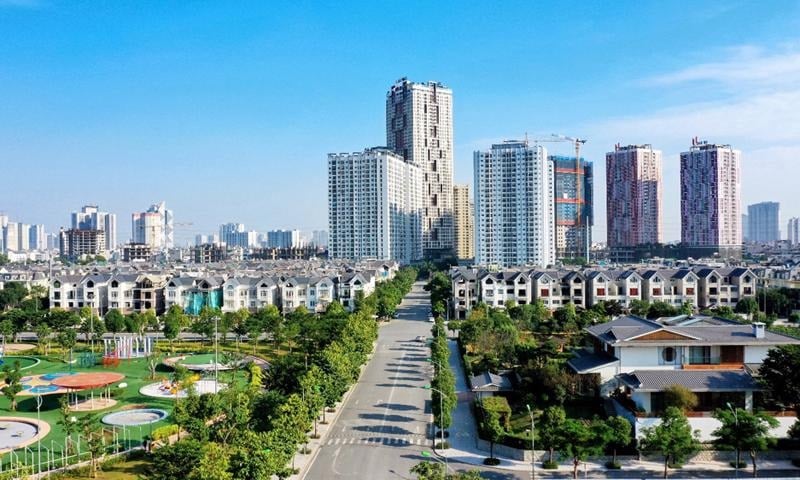
| Da Nang City approved the Local Adjustment of the City's Master Plan to 2030, with a vision to 2045. |
Da Nang City also adjusted the local planning of about 404 hectares for the High-Tech subdivision.
In which, the allocation of social infrastructure clusters (swapping locations) is suitable for the actual situation and existing residential areas. The use index of some basic functions: no change in high school land; urban public service land increases by about 4 ha; urban public green land increases by about 13 ha; medical center land increases by about 2 ha; new residential land decreases by about 11 ha; water surface land decreases by about 8 ha.
In addition, organize and reallocate the green area of the water surface of the Hoa Lien drainage canal. Of which, there is no change in urban public service land, mixed-use land; urban public green land increases by about 9 hectares, specialized green land (isolated green trees) increases by about 11 hectares; water surface land decreases by about 20 hectares...
Adjust the location of the Northern Bus Station from Thanh Vinh Industrial Park to the intersection of the South Hai Van Tunnel bypass and the Western Ring Road 2.
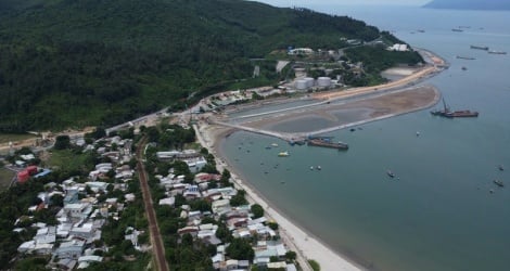
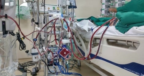
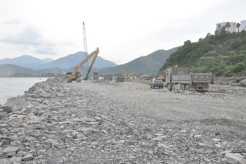 |
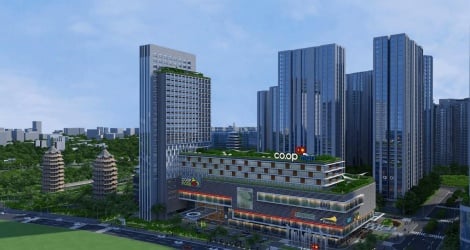
| Lien Chieu port project is under construction. |
Also according to this decision, Da Nang will locally adjust the planning of the Innovation and Creativity sub-zone with an area of about 34 hectares. In particular, the social infrastructure cluster (swapping locations) in the area west of Tran Nam Trung Street will be reallocated to the areas east of Hoa Xuan Sports Complex, southwest of Nguyen Xuan Lam - Do Doc Tuyet intersection, northeast of Tran Nam Trung - Pham Huu Nghi intersection, west of Cau Do water plant, east of Ba Xa Hoa Phuoc new market in accordance with the actual situation and existing residential areas.
Specifically, urban public land increased by about 9 hectares, high school land increased by about 2 hectares, agency land decreased by about 11 hectares, and medical center land and residential land remained unchanged.
In addition, with the Bayside subdivision, Da Nang will locally adjust about 31 hectares. Of which, the area west of the Hue intersection (about 9 hectares) will be adjusted from high school land, medical land and urban public service land to actual residential land. The area of 29-3 Textile Joint Stock Company (about 5 hectares) will be adjusted from urban public service land to mixed-use land (about 4 hectares, to arrange social infrastructure), high school land (about 1 hectare). The Coca-Cola Factory area (about 4 hectares) will be adjusted from residential land to medical center land.
The old railway station area (about 12 hectares) is adjusted from mixed-use land to urban public service land (about 9 hectares), at the same time, the high school land is moved to the East (adjacent to Me Suot Street with an unchanged area of about 3 hectares.
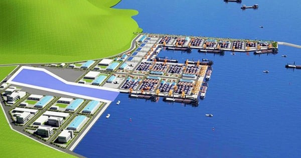
In the Lien Chieu seaport subdivision, the land area for warehouses and residential units is adjusted from warehouse land and residential land to other technical infrastructure land outside the urban area (Bus station). Land for technical infrastructure hubs increases by about 46 hectares, residential unit land decreases by about 34 hectares, warehouse land decreases by about 12 hectares (the location of the Northern Bus Station before adjustment in the High-tech subdivision)...
Source


Comment (0)