
If you plan to travel by motorbike from Ho Chi Minh City to your hometown during Tet, you can refer to the route, sightseeing stops and safety notes during the trip along 4 main routes.
From Ho Chi Minh City to the provinces, there are many routes suitable for motorbike trips, which are also the route to go home for Tet for many people. There are popular routes including Ho Chi Minh City to the Central region through coastal localities; Ho Chi Minh City to the Central Highlands, divided into two directions, to Da Lat or to Dak Nong, Buon Ma Thuot; from Ho Chi Minh City to the Western provinces.
Below are suggested routes, sightseeing stops, places to stay, places to eat and drink, and safety tips for the trip, based on advice from several groups who have traveled these routes and surveys from Google Maps.
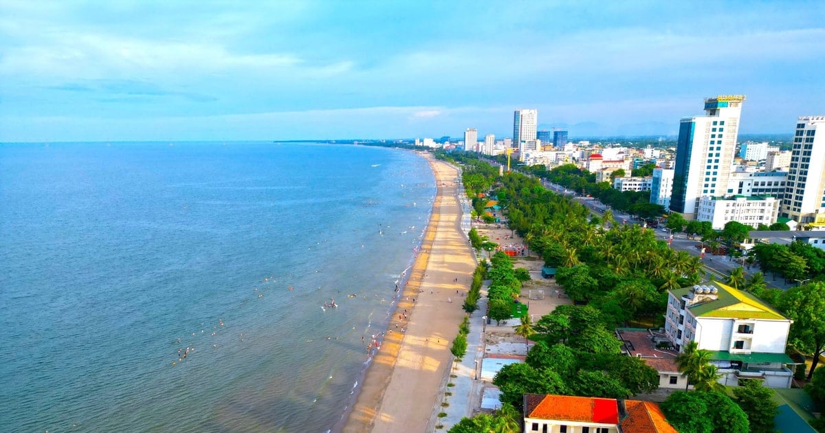
Ho Chi Minh City to Central region
From Ho Chi Minh City, the popular routes are to stop at one of the 8 provinces in the South Central Coast, further to Quang Nam, Quang Ngai, Da Nang, Hue and Quang Tri. The shortest route is from Ho Chi Minh City to Binh Thuan, about 200 km, the farthest is from Ho Chi Minh City to Quang Tri, about 1,079 km.
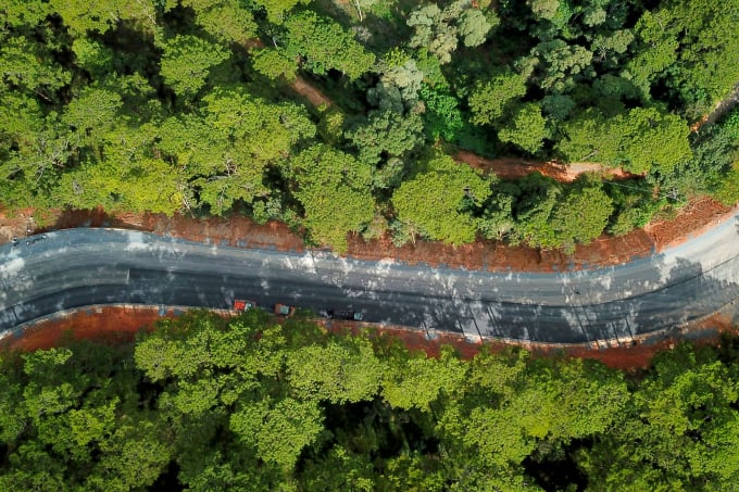
In addition to going straight on National Highway 1A, you can choose to follow the coastal route. From Ho Chi Minh City to Quang Tri, you will pass through 10 coastal provinces including Binh Thuan, Ninh Thuan, Khanh Hoa, Phu Yen, Binh Dinh, Quang Ngai, Quang Nam, Da Nang, Hue and Quang Tri.
If your stop is from Nha Trang to Quang Ngai, you can spend more time exploring the Central Highlands, visiting the Indochina junction in Kon Tum, checking in at the easternmost point at Mui Dien, Phu Yen.
This route has no travel time limit. Depending on the need to stop and visit, visitors can choose a suitable schedule. If you only focus on driving and checking in at some points along the way, the minimum time for the longest route from Ho Chi Minh City to Quang Tri is about 24-30 hours. If you are not pressured by time, you should stay overnight at some tourist destinations such as Phu Yen, Khanh Hoa, Da Nang to regain strength, conveniently walk around and sightsee, then continue the journey.
According to the experience of a tourist who has run this route 2-3 times, you should travel from Ho Chi Minh City early in the morning, and rest early in the afternoon before 5pm, avoiding driving at night because it is easy to get sleepy and there are many large vehicles passing by. Driving requires the correct speed and lane, on National Highway 1A, many large vehicles drive very fast, even vehicles going in the opposite direction, so you need to be alert, observe and drive in two people taking turns driving.
There should be a short break of 15-30 minutes at hammock cafes along the way. Accommodation is available on this route, from motels along the national highway to hotels in the city.
Ho Chi Minh City to Central Highlands
Ho Chi Minh City - Da Lat
This route is considered easy to travel and has many directions. In addition to running along Highway 20, there are 5 directions to travel by motorbike from Ho Chi Minh City to Da Lat, suitable for sightseeing along the way, passing many famous tourist attractions.
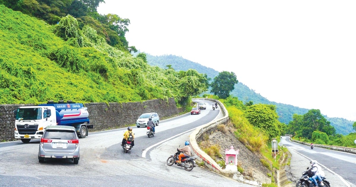
Direction: Ho Chi Minh City - Tri An - Nam Cat Tien - Da Teh - Con O Pass - Bao Lam - Ta Nung Pass - Da Lat. Total distance is about 360 km, so you should spend a day and a half traveling. Spend the night in Nam Cat Tien or Da Teh, and arrive in Da Lat at noon the next day. This route has smooth asphalt roads, few vehicles, and steep passes without many sharp turns like Gia Bac, Dai Ninh or Song Pha passes.
Direction: Ho Chi Minh City - Ba Ria - Lagi - Phan Thiet - Bau Trang - Vinh Hy - Cam Ranh - Song Pha - Da Lat. Total distance is 515 km, should be done in 2 days if traveling by motorbike, stopping to see many places.
A section of Prenn Pass, Da Lat, photo taken in August 2023. Photo: Hai Dang
Direction: Ho Chi Minh City - Ba Ria - Ho Coc - Lagi - Tanh Linh - Dami Lake - Bao Loc - Ta Nung - Da Lat. This route is about 430 km, the road is deserted. It should take 2 days if traveling by motorbike. Song Pha Pass has many trucks running on the Phan Rang - Da Lat route, tourists should observe carefully.
Direction: Ho Chi Minh City - Ba Ria - Ho Coc - Lagi - Ke Ga - Phan Thiet - Gia Bac Pass - Di Linh - Ta Nung - Da Lat, 443 km route, should travel in 2 days. Gia Bac Pass has few vehicles but is quite small, many hairpin bends so be careful when driving.
Direction: Ho Chi Minh City - Ba Ria - Ho Coc - Lagi - Ke Ga - Phan Thiet - Luong Son Pass - Dai Ninh - Duc Trong - Ta Nung - Da Lat. This route is more than 400 km, instead of climbing Gia Bac Pass, climb Luong Son - Dai Ninh Pass.
These routes are divided into mountain and sea routes. The mountain route passes through places worth visiting such as Tri An, Nam Cat Tien, Ta Nung, Ponguar Waterfall. The sea route includes Ho Coc - Ho Tram, Phan Thiet - Mui Ne, Mui Ke Ga - Lagi, Co Thach beach.
These routes all pass through tourist attractions, with available overnight accommodations. However, you should determine the route in advance, proactively search for and book motels and hotels at the intended stopover points. If you take a short break in the middle of the journey, you can stop at a local house along the road, where there are hammocks to take a nap. Since the main route is to travel, you can choose to eat along the way to save time.
Ho Chi Minh City - Buon Ma Thuot, Dak Nong
The total route from Ho Chi Minh City to Buon Ma Thuot City, Dak Lak is about 320 km long. This route is flat, easy to travel, passing through famous tourist destinations of Binh Phuoc, Dak Nong and Dak Lak provinces. From the center of Saigon, follow Highway 13 towards Binh Duong, to Dai Nam tourist area, you will see a large intersection called So Sao intersection.
Continue on Highway 13 to Loc Ninh, Hoa Lu border gate of Binh Phuoc province. From here turn right onto Highway 741, passing through Tan Uyen and Phu Giao districts, stopping at Dong Xoai city, Binh Phuoc. If you leave from 5am in Ho Chi Minh City, you will arrive in Dong Xoai at around 7am. Continue on Highway 14 towards Dak Lak, passing through Bu Dang district, Dac R'Lap district and by noon you will arrive in Gia Nghia (Dak Nong).
In Dak R'Lap, there is a road running along the Cambodian border, National Highway 14C. At the end of this road, you will reach Dak Mil town (Dak Nong), without going through Gia Nghia. This road is not considered beautiful by many people, but in return, there are many beautiful scenes and few vehicles. From Dak Mil to Buon Ma Thuot, the distance is about 60 km. On this road, there are famous tourist destinations such as Dray Sap and Dray Nur waterfalls located between the Dak Nong - Dak Lak border.
This journey usually moves within this area. If you want to have fun and sightsee, you can stop in Gia Nghia. There are some homestays and farmstays here such as Yumin Farm house, Hoa Dat Garden, Ngo Gia Trang; in Dak R'Lap district there is Molly Home; in Dak Mil there is Montagnards Home Farm, with prices ranging from 150,000 to 1 million VND per night.
From Gia Nghia city center, within a radius of about 50 km, Dak Nong has many places to explore such as Ta Dung National Park, Nam Kar Volcanic Range, Lieng Nung Waterfall, Dak G'lun Waterfall.
Ho Chi Minh City to the West
There are many ways to travel from Ho Chi Minh City to 12 provinces in the West, including 4 routes for motorbikes. Depending on the stop, you can choose the appropriate route.
From Ho Chi Minh City, take National Highway 1 - Phu My Intersection (Tien Giang) - Provincial Road 866 - Provincial Road 865 - Provincial Road 867 - National Highway 1.
From Ho Chi Minh City, take Highway 1 - Provincial Road 868 - Tu Kiet Street - Highway 1. This route is prone to traffic jams at Cai Lay intersection (Tien Giang).
From Ho Chi Minh City, take National Highway 1 - Vo Viet Tan (Tien Giang) - Thanh Tam, Cai Lay (Tien Giang) - Provincial Road 868 - Tu Kiet Road (Tien Giang) - National Highway 1.
From Ho Chi Minh City, take National Highway 1 - Vinh Long City (Pho Co Dieu) - National Highway 57 - Provincial Highway 882 - National Highway 60 - Ham Luong Bridge (Ben Tre) - National Highway 60 - Rach Mieu Bridge - Trung Luong intersection - National Highway 1.
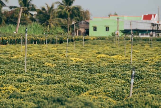
The chrysanthemum garden in Tien Giang is in full bloom, photo taken in January. Photo: Thanh Dat Phan
The Western provinces are less than 200 km from Ho Chi Minh City, the farthest stop is Ca Mau province, 179 km away, the closest is Long An province, about 55 km away. Traveling by motorbike is mainly done during the day. The roads in the West are generally easy to travel, but there are some sections with many potholes, so you should pay attention.
Coming to the West in spring, you can visit flower villages in full bloom such as Tan Quy Dong flower village in Sa Dec, Dong Thap; Phuoc Dinh apricot village in Vinh Long; Cai Mon bonsai village in Ben Tre; Vi Thanh flower village in Hau Giang and My Phong flower village in Tien Giang.
Bich Phuong
Source link


![[Photo] Looking back at the impressive moments of the Vietnamese rescue team in Myanmar](https://vstatic.vietnam.vn/vietnam/resource/IMAGE/2025/4/11/5623ca902a934e19b604c718265249d0)

![[Photo] "Beauties" participate in the parade rehearsal at Bien Hoa airport](https://vstatic.vietnam.vn/vietnam/resource/IMAGE/2025/4/11/155502af3384431e918de0e2e585d13a)


![[Photo] Summary of parade practice in preparation for the April 30th celebration](https://vstatic.vietnam.vn/vietnam/resource/IMAGE/2025/4/11/78cfee0f2cc045b387ff1a4362b5950f)


Comment (0)