
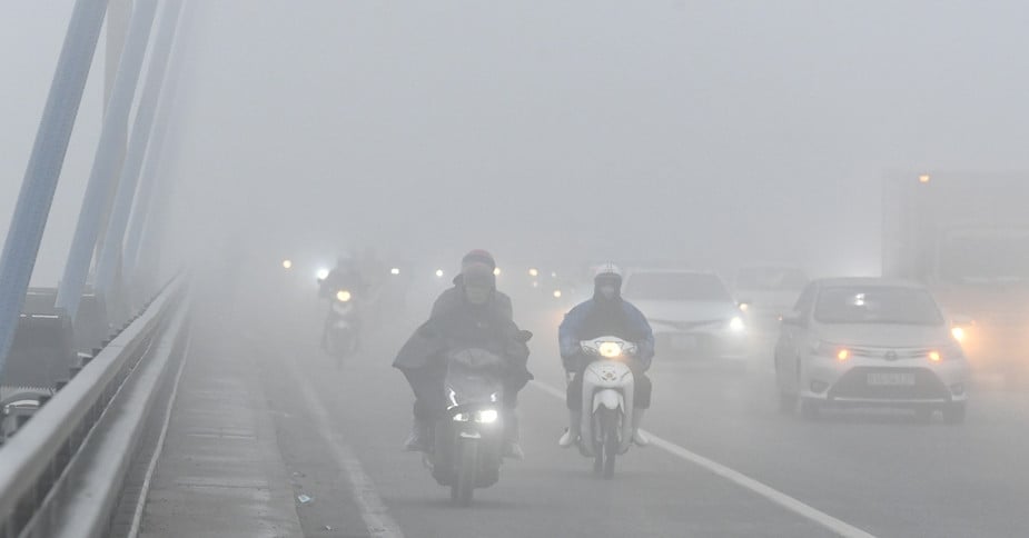
Weather forecast October 25, 2024, storm Tra Mi enters the East Sea causing 5-7m high waves near the storm center, rough seas. On land, the North has few clouds, no rain at night, fog in some places in the early morning, sunny during the day, the temperature difference between day and night is up to 14 degrees.
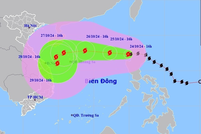
According to the National Center for Hydro-Meteorological Forecasting, at 1:00 p.m. on October 24, the center of storm Tra Mi was located at about 17.3 degrees North latitude; 120.3 degrees East longitude, on the mainland northwest of Lu Dong island (Philippines).
The strongest wind near the storm center is level 9 (75-88km/h), gusting to level 11. The storm moves west at a speed of 15-20km/h.
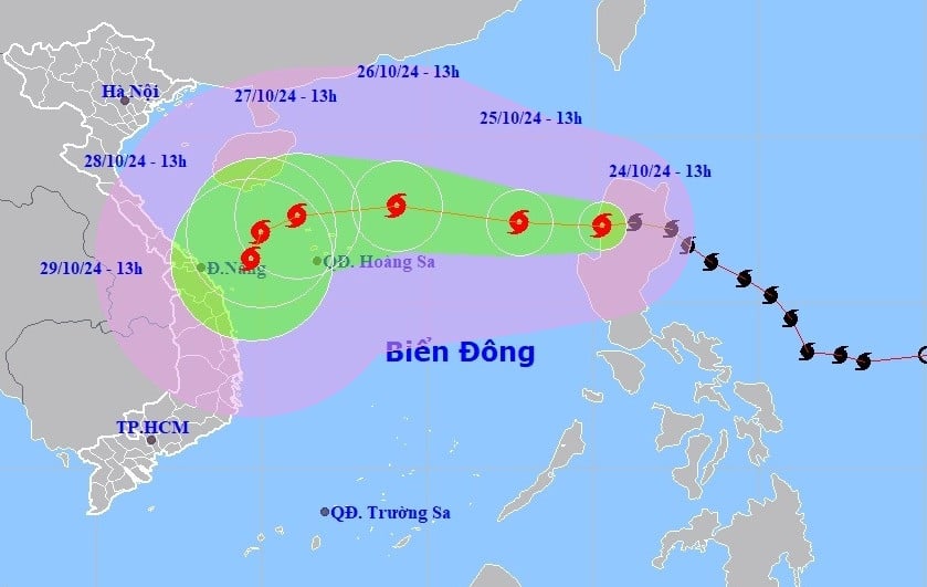
Forecast for the storm in the next 24 - 72 hours, storm Tra Mi will move west and enter the East Sea ( becoming storm number 6 - PV ). At 13:00 on October 25, the storm center was at about 17.4 degrees North latitude; 117.8 degrees East longitude; in the eastern sea of the North East Sea; 690km east of Hoang Sa archipelago. The storm is level 9-10, gusting to level 12.
At 1:00 p.m. on October 26, the storm was 320km east-northeast of Hoang Sa archipelago, with a level 11-12 intensity and gusts of level 15.
At 1:00 p.m. on October 27, storm Tra Mi was in the sea northwest of Hoang Sa archipelago, level 11, gusting to level 13.
From the next 72 - 120 hours, the storm will move slowly in the West Southwest direction, traveling 5-10km per hour, then it is likely to change direction to the South Southwest.
Due to the impact of the storm, the eastern sea area of the North East Sea has strong winds of level 6-7, then increasing to level 8, the area near the storm's eye has level 9-10 (89-102km/h), gusting to level 12, waves 3-5m high, the area near the storm's eye has 5-7m; the sea is very rough.
Ships operating in the above mentioned dangerous areas are susceptible to the effects of storms, whirlwinds, strong winds and large waves.

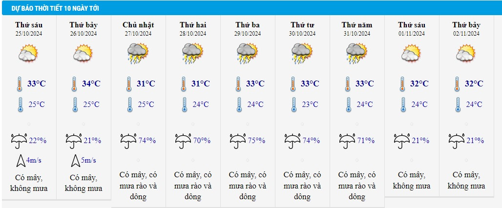
Detailed weather forecast for tonight and October 25, 2024 for regions across the country:
Hanoi
Partly cloudy, no rain at night, some fog in the early morning, sunny during the day. Northeast to north wind level 2-3. Cold at night and early morning.
Lowest temperature: 18-21 degrees.
Highest temperature: 30-32 degrees.
Northwest
Cloudy, no rain at night, foggy in some places early morning, sunny during the day. Light wind. Cold at night and early morning.
Lowest temperature: 18-21 degrees.
Highest temperature: 29-32 degrees.
Northeast
Few clouds, no rain at night, some fog in the early morning, sunny during the day. Northeast to north wind level 2-3. Cold at night and early morning, cold in mountainous areas.
Lowest temperature: 18-21 degrees, mountainous areas 16-18 degrees.
Highest temperature: 29-32 degrees.
Thanh Hoa - Thua Thien Hue
Cloudy, no rain at night, sunny during the day. North to northwest wind level 2-3.
Lowest temperature: 20-23 degrees.
Highest temperature: 28-31 degrees.
Da Nang - Binh Thuan
Cloudy, some showers at night, sunny during the day. Northeast to north wind level 2-3.
Lowest temperature: 22-25 degrees.
Highest temperature: 30-33 degrees.
Central Highlands
Cloudy, some showers at night, sunny during the day. Northeast wind level 2-3.
Lowest temperature: 18-21 degrees.
Highest temperature: 28-31 degrees.
Southern Vietnam
Cloudy, with showers and thunderstorms at night, sunny during the day. Light wind.
Lowest temperature: 23-26 degrees.
Highest temperature: 30-33 degrees.
Weather in Ho Chi Minh City in the coming days:
Source: https://vietnamnet.vn/du-bao-thoi-tiet-ngay-mai-25-10-bao-tra-mi-tro-thanh-bao-so-6-2335112.html


![[Photo] Prime Minister Pham Minh Chinh chairs Government Conference with localities on economic growth](https://vstatic.vietnam.vn/vietnam/resource/IMAGE/2025/2/21/f34583484f2643a2a2b72168a0d64baa)


Comment (0)