
Around the morning of February 23, cold air will flow in, the North will turn to severe cold. Localized heavy rain with thunderstorms will appear from Da Nang to Khanh Hoa, the Southern Central Highlands and the South.
According to the National Center for Hydro-Meteorological Forecasting, currently (February 22), the cold air mass is moving south.
Around tomorrow morning (February 23), this cold air mass will affect the Northeast region, then the North Central region, the Northwest region and the Central Central region. The Northeast wind inland is strong at level 3-4, coastal areas at level 4-5, with gusts of level 6 in some places.
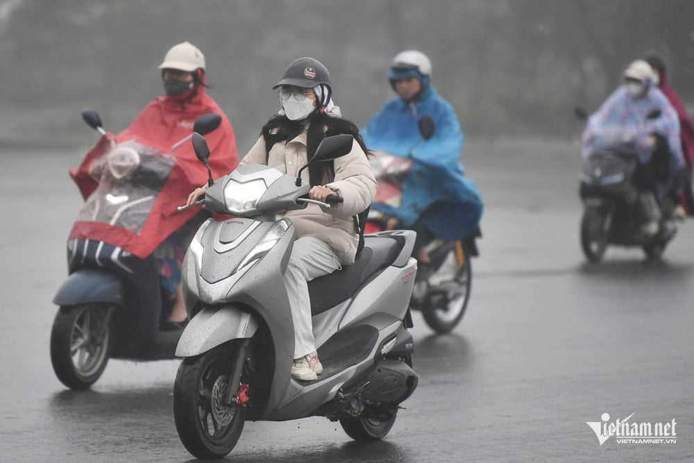
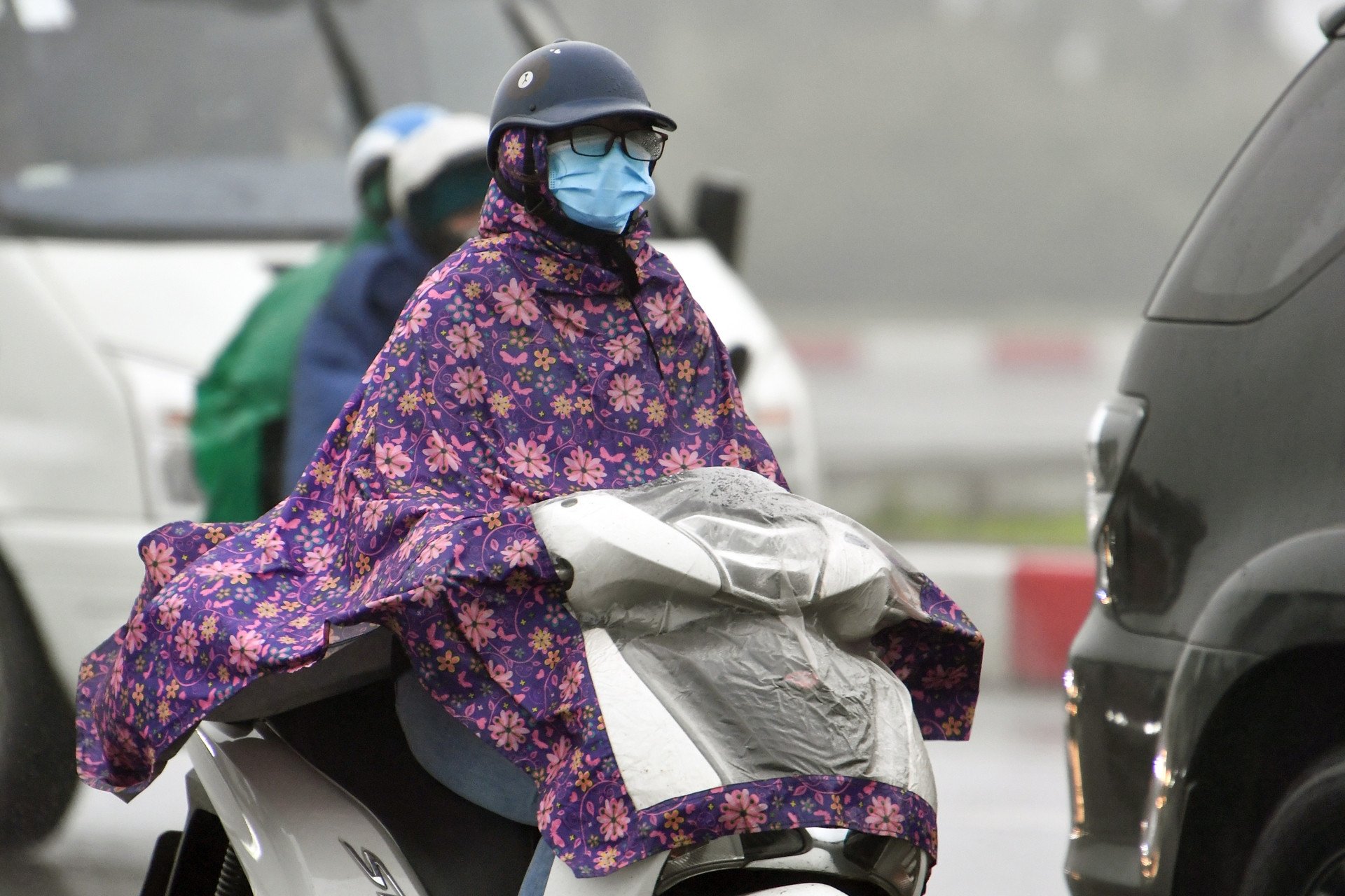
In the North from tomorrow night, it will be very cold, with some mountainous areas experiencing severe cold; in the North Central region, it will be very cold, with some northern areas experiencing severe cold. The lowest temperature during this cold spell in the North will generally be from 11-14 degrees Celsius, with some mountainous areas experiencing below 7 degrees Celsius; in the North Central region, 13-16 degrees Celsius; and in the Central Central region, 17-20 degrees Celsius.
As for the weather in Hanoi , from tomorrow night it will be very cold. The lowest temperature in this cold air mass is commonly 12-14 degrees.
Due to the influence of cold air strengthening combined with strong currents in the upper westerly wind zone on February 23-24, the Northern and North Central regions will have rain, light rain.
In addition, the meteorological agency also said that today, in the area from Quang Nam to Khanh Hoa, there was rain, showers, locally moderate rain, heavy rain and thunderstorms. The rainfall from 7am to 3pm was over 35mm in some places such as: Hoa Xuan Nam (Phu Yen) 38.4mm, Dam Dau Moi - Da Den (Khanh Hoa) 45.6mm,...
It is forecasted that tonight and tomorrow, in the area from Da Nang to Khanh Hoa, there will continue to be rain, moderate rain, locally heavy rain to very heavy rain and thunderstorms with rainfall of 20-40mm, some places over 100mm.
At the same time, the Southern Central Highlands and the Southern region also have scattered showers and thunderstorms, locally with moderate to heavy rain (rain concentrated in the late afternoon and evening) with rainfall of 10-30mm, in some places over 60mm.
Thunderstorms may produce tornadoes, lightning and strong gusts of wind. Localized heavy rains may cause flash floods on small rivers and streams, landslides on steep slopes and flooding in low-lying areas.
Also due to the influence of the cold air, from tomorrow, in the Gulf of Tonkin, the Northeast wind will gradually increase to level 6, sometimes level 7, gusting to level 8-9, rough seas, waves 2-3.5m high; in the North East Sea (including the sea area of Hoang Sa archipelago), the Northeast wind will increase to level 6, sometimes level 7, gusting to level 8-9, from early morning on February 24, it will gradually increase to level 7, gusting to level 9, rough seas, waves 4-6m high. From the night of February 23, the sea area from Quang Tri to Binh Thuan will have strong Northeast wind at level 6, gusting to level 7-8, rough seas, waves 3-5m high, especially from Binh Dinh to Binh Thuan 2-4m.
The meteorological agency warns that severe cold weather can affect livestock and poultry and the growth and development of crops.
Strong winds and large waves at sea are likely to affect boating and other activities.

Strong cold air returns, the North is cold and has continuous rain
Weather forecast for the next 10 days: Welcoming strong cold air, the North will have severe cold
Source: https://vietnamnet.vn/khong-khi-lanh-manh-sap-do-bo-trung-va-nam-bo-mua-lon-cuc-bo-2374008.html
![[Photo] The moment Harry Kane lifted the Bundesliga trophy for the first time](https://vphoto.vietnam.vn/thumb/1200x675/vietnam/resource/IMAGE/2025/5/11/68e4a433c079457b9e84dd4b9fa694fe)

![[Photo] Discover the beautiful scenery of Wulingyuan in Zhangjiajie, China](https://vphoto.vietnam.vn/thumb/1200x675/vietnam/resource/IMAGE/2025/5/11/1207318fb0b0467fb0f5ea4869da5517)
![[Photo] National Assembly Chairman works with leaders of Can Tho city, Hau Giang and Soc Trang provinces](https://vphoto.vietnam.vn/thumb/1200x675/vietnam/resource/IMAGE/2025/5/11/c40b0aead4bd43c8ba1f48d2de40720e)

![[Photo] Prime Minister Pham Minh Chinh chairs the fourth meeting of the Steering Committee for Eliminating Temporary and Dilapidated Houses](https://vphoto.vietnam.vn/thumb/1200x675/vietnam/resource/IMAGE/2025/5/11/e64c18fd03984747ba213053c9bf5c5a)


Comment (0)