
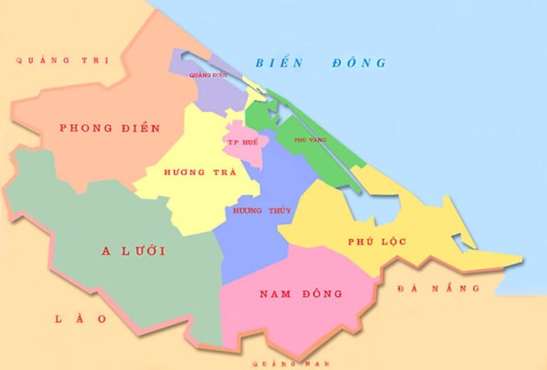
In the territory of Thua Thien Hue, following the coastal plain, there are lagoons, then sand dunes and finally the coastal sea. The outer boundary of the coastal sea is conventionally 12 nautical miles (equivalent to 22.224 km). Lagoons, sand dunes and coastal seas, although different in morphology and distribution, have a mutual relationship, determining each other throughout the process of forming this entire territorial system. Therefore, it can be considered that the territory including lagoons, sand dunes and coastal seas belongs to the same geosystem and is called the coastal zone.
The terrain of the lagoon and coastal sea area of Tam Giang - Cau Hai - An Cu includes lagoons , sand dunes and coastal sea which have created the attractive appearance as it is today. The area of sand dunes and lagoons accounts for nearly 9% of the province's area.
The system of lagoons, bays, estuaries, seaports and beaches of Thua Thien Hue contributes significantly to the socio-economic development of the locality, including scientific tourism, eco-tourism, resorts as well as protecting the regional ecological environment.
* Tam Giang - Cau Hai lagoon , An Cu lagoon : This is a closed lagoon system, the largest compared to other lagoons in our country and is one of the largest in the world. This lagoon system includes Tam Giang - Cau Hai lagoon system and An Cu isolated lagoon (Lap An).
Tam Giang - Cau Hai lagoon system It is 68km long, has a total water surface area of 216km2 and is composed of three lagoons: Tam Giang lagoon, Thuy Tu lagoon and Cau Hai lagoon.
Tam Giang Lagoon: Stretches from the O Lau River mouth (Lai Ha village) to the Thuan An estuary (Thuan An bridge) with a length of 25km and an area of 52km2 . The shore and bottom of the lagoon are mainly composed of Holocene sediments. In which, modern sediments including silty mud - clay account for 3/4 of the central area of the lagoon, then meet silty clay at the O Lau River mouth, less with coarse sand, medium sand and fine sand distributed near the Thuan An estuary area. A large amount of modern bottom sediments participate in the structure of alluvial flats along the lagoon, island-shaped alluvial flats, delta-shaped alluvial flats at the O Lau River mouth and the Huong River mouth. The lagoon is separated from the East Sea by a series of sand dunes blocking the shore 10-30m high, 0.3 to 5km wide. In the southeast, Tam Giang Lagoon is connected to the East Sea through an estuary that arose during the historic flood in 1404 near Hoa Duan village. The second sea gate, Hoa Duan (also known as Yeu Hai Mon, Noan Hai Mon, Nhuyen Hai Mon, Thuan An, Hai Khau, Cua Lap) existed for 500 years before being naturally filled in 1904 (Cua Lap). Although it was still in operation, its aperture gradually narrowed, reducing the ability to drain floods through Hoa Duan estuary. Therefore, from the end of the 17th century to the beginning of the 18th century onwards, in years of great floods, in addition to Hoa Duan estuary, flood water was also discharged into the sea through a creek that became deeper and wider, cutting through a narrow and low sand dune range in the middle of Thai Duong Ha village. During the tsunami on October 15, 1897, the creek was deepened and widened into a new sea gate and was called Cua Sut. Cua Sut was filled in again later and during the storm on September 19, 1904, it was cleared and widened into a large sea gate named Thuan An until today. Conversely, during this storm, Hoa Duan estuary was completely filled in. During the historic flood on November 2, 1999, the Hoa Duong estuary was reopened, but the following year it was blocked by the Hoa Duong dam.
Thuy Tu Lagoon : Including An Truyen, Thanh Lam, Ha Trung and Thuy Tu lagoons stretching from Thuan An bridge to Con Trai over a length of 33km and an area of up to 60km2 . Here, there are also Quaternary sedimentary formations with shore and bottom structures similar to Tam Giang lagoon. For modern bottom sediments, the majority are ash-gray silty mud - clay and rich in organic matter distributed in the center of the lagoon (accounting for 4/5 of the area) followed by medium sand, fine sand. Coarse sand, medium sand and fine sand are often found in alluvial flats along the lagoon, delta-shaped alluvial flats in the Huong River estuary, Thuy Tu lagoon mouth. The sand dune range separating the lagoon from the East Sea is from 2-2.5m high (Thuan An - Hoa Duan) to 10-12m (Vinh Thanh, Vinh My), from 0.2-0.3km wide (near Hoa Duan) to 3.5-5km (Vinh Thanh, Vinh My).
Cau Hai Lagoon: Has a semicircular basin shape, is relatively isometric and has an area of 104km2 . Unlike Tam Giang Lagoon, Thuy Tu Lagoon, Cau Hai Lagoon's shore and bottom structure has both loose Quaternary soft sediments and Hai Van Complex granite. In which, the top part of the most common modern bottom sediments (accounting for 2/3 of the area) has dark gray, blue-gray clay mud distributed in the center, followed by fine sand, medium sand and coarse sand forming the alluvial plain along the southwest coast, delta alluvial plain at the mouth of Dai Giang River, Truoi River, Cau Hai River, and tidal delta alluvial plain near Vinh Hien estuary. Cau Hai Lagoon is connected to the East Sea through Tu Hien estuary, sometimes Vinh Hien estuary. The sand dune range on Vinh Hien - Tu Hien coast has a width of about 100-300m, a height of 1-1.5m, and is always changing like a flat. According to historical records, Tu Hien estuary existed long before Hoa Duan estuary, Thuan An (possibly about 3,500-3,000 years ago) and also had many names such as O Long, Tu Dung, Tu Khach, Tu Hien. Although Tu Hien estuary has not been closed since the opening of the second seaport Hoa Duan in 1404, from the beginning of the 18th century onwards, due to the increasing volume of water passing through Hoa Duan estuary and the channel between Thai Duong Ha, the volume of water exchanged at Tu Hien estuary decreased and as a result, this estuary was gradually narrowed and filled up. It was not until 1811, when a severe flood occurred, that the flood water broke through the sandbank blocking the Phu An bank, creating a new Tu Hien estuary (Vinh Hien) 3km north of the old Tu Hien estuary. Also from this time onwards, the old and new Tu Hien gates closed and opened with shorter cycles, sometimes alternating (one gate closed, the other opened), in which the new Tu Hien gate (Vinh Hien) often did not last long and was sealed when the dry season came.
Thanks to its huge water storage capacity (from 300-350 million m3 to 400-500 million m3 in the dry season, even up to 600 million m3 in the flood season), the Tam Giang - Cau Hai lagoon system also plays a decisive role in the phenomenon of flood delay in the delta territory as well as the issue of stabilizing the estuary (closing - opening) and the sand dunes blocking the shore when historical floods occur (floods in 1409, 1999).
An Cu lagoon (also known as Lap An, Lang Co): Compared to the Tam Giang - Cau Hai lagoon system, An Cu lagoon is a separate water body, extending almost in the North - South direction and located in the North of the Bach Ma - Hai Van range. This is also a type of lagoon that is almost closed, relatively isometric and covers an area of 15km2 . Similar to Cau Hai lagoon, in addition to Quaternary marine sediments in the sand dunes 3-10m high, 0.3 - 1.5km wide, the banks of An Cu lagoon are also made of granite. At the bottom of the lagoon, on the rough granite surface, there is often sand and gravel containing shells, snails, less often there is ash gray powder distributed in the center. An Cu lagoon is connected to the sea through a 6-10m deep estuary in the South of Loc Hai (Lang Co estuary).
* Sand dunes: Located between the coastal plain or lagoon inside and the East Sea outside is a sand dune range stretching in the general Northwest - Southeast direction from Dien Huong to the foot of Hai Van Pass. Since ancient times, the sand dune range stretching from Cua Viet to Vinh Phong mountain has been called Dai Truong Sa. Participating in the structure of the sand dune range here are turmeric yellow sand of the Phu Xuan formation, gray-white sand of the Nam O formation and gray-yellow wind sand, rich in ilmenite of the Phu Vang formation . The presence of these marine sedimentary formations proves that the sand dune range was formed from the end of the Pleistocene and completed in the late Holocene. The total area of the sand dune range is about 4% of the province's natural area.
Excluding the granite shoreline, the sand dune range has a total length of about 100km. From Dien Huong to Vinh Hien estuary, although there is Linh Thai granite cape, the coastline is still almost straight. Starting from Nam Vinh Hien to An Cu lagoon estuary (the foot of Hai Van pass), the coastline is no longer straight but winding, concave and convex due to the granite capes Chan May Tay and Chan May Dong protruding out to the sea. From Chan May Dong cape to An Cu lagoon estuary, the coastline becomes straight, restoring the original Northwest - Southeast direction.
If going from Northwest to Southeast, it is easy to see that the width of the sand dunes decreases from 4,000-5,000m in Dien Huong to about 200-300m in Thuan An, Hoa Duan, then widens again to 3,500-4,000m in Vinh Giang, Vinh Ha. Unlike the northern sand dunes, the sand dunes from Vinh Hien estuary to An Cu lagoon estuary are both discontinuously distributed, have insignificant width and complex variations. The width of the sand dunes in Vinh Hien and Tu Hien is only about 100-300m. From Chan May Tay to An Cu lagoon estuary, the width of the sand dunes is wider, but does not exceed 300-1,000m.
Similar to the width, the height of the sand dunes also changes continuously and complexly in space. In Dien Mon, Dien Loc, the height reaches 20-25m, from Dien Hoa to Quang Ngan it decreases to 10-15m, from Quang Cong to Hai Duong it increases again to 32-35m. The shore section from the south of Thuan An to Phu Dien is the lowest area with a height of 2-2.5m (Hoa Duan) to 5-8m (Phu Dien). From Phu Dien to Vinh Hien estuary, the height of the sand dunes rarely fluctuates and fluctuates between 5-12m. For Vinh Hien and Tu Hien sections, not only the width but also the height of the sand dunes blocking the shore only reaches 1-1.5m and always fluctuates. From Chan May Tay cape to An Cu lagoon estuary, the height of the sand dunes is raised but does not exceed 3-10m. In addition, the sand dune surface is generally concave and convex, with complex ripples. Where the sand dunes are highest, the ground is least flat and also where the sand is most strongly moved by the wind towards the plain or lagoon. Here, the sand dunes have an asymmetrical structure (Thai Duong): the southwest slope (25-30 0 ) is steeper than the northeast slope (5-15 0 ).
Continuing the coastal section of sand dunes and sand dunes interspersed with granite promontories in the North (over 110km long) is the Hai Van granite erosion coastline (Bai Chuoi). Along this coastal section, not only are the sand accumulation beaches and the eroded seabed very narrow and discontinuously distributed, but in many places, boulders are piled up and scattered from the foot to the middle of the mountain slopes sloping towards the sea (Bai Chuoi).
* Coastal waters : For Thua Thien Hue, the coastal waters are also characterized by two parts: sandy coastal waters (Dien Huong - Loc Hai) and granite coastal waters of Hai Van.
For the sandy coastal section, within 12 nautical miles, the coastal seabed is relatively flat and slopes gently towards the center of the East Sea. On that relatively flat and gentle seabed surface, there is almost only Quaternary sediment cover, in which modern coastal marine sediments include four main types: beach sediments, delta estuary sediments (delta), bay sediments and nearshore marine sediments.
The most common beach sediments, distributed almost along the entire length of over 100km of accumulated coastline. They are pale yellow, gray-white quartz sand with medium grain (0.25-0.5mm), less often coarse-grained sand (0.5-1mm) and fine-grained sand (0.1-0.25mm). The sand contains many shells, some places contain ilmenite...
The sea area near Thuan An and Tu Hien estuaries has silty sand sediments (0.05-0.1mm). Delta river mouths are in the form of dykes and sand islands. The dykes and sand islands often change shape , especially during the rainy and flood season or when there are storms and strong northeast monsoons. The main source of materials for building dykes and islands is the river. In Chan May Bay, about 300-500m from the shore, you will encounter fine-grained sand, then silty sand. Coarse-grained sand and light yellow medium-grained sand are only limitedly distributed at the Bu Lu estuary. Bay sediments as well as beach sediments are brought from offshore to shore by waves and coastal currents.
Following the beach sediment strip, delta estuary sediment, nearshore bay sediment meets coastal seabed sediment. Coastal seabed sediment is mainly composed of: fine-grained sand, silty sand, silt, and less clay. Fine-grained sand is distributed up to the 15m depth contour, and from a depth of 15-20m and above there is silt (0.05-0.1mm), silt (0.002-0.05mm), and in some places clay (<0.002mm). However, at a depth of about 10m in the Southeast there are also pebbles.
In terms of geomorphology, the coastal area accumulates sand on the continental shelf of the Gulf of Tonkin. From the shore to a depth of 90m (coastal area), the average seabed slope is about 0.0025. It is worth noting that the closer to the shore, the steeper the seabed. The coastal zone of the North Thuan An sea has a common seabed slope of 0.052, with a 10m isobath. located 100-2,000m offshore. But from a depth of 90-150m the seabed is very gentle with an average slope of 0.00075. From a depth of over 150m the seabed slope increases again. On the general surface of the seabed is relatively flat but gentle towards the center of the East Sea, recently some micro-terrain forms have been discovered. First of all, outside Thuan An estuary there are two rows of ancient accumulated sand dunes distributed at depths of 16-20m and 25-30m. Inside the sand dunes there are shallow channels located almost parallel to the shoreline. In addition, an ancient riverbed is 300-500m wide, stretching 12km starting from the 34m isobath along the continental shelf. In the depth range of 90-100m there are many ancient eroded channels with depths from 2-3m to 9-10m.
Unlike the open coastal area where sand accumulates, on the surface of the submerged slope adjacent to the Hai Van granite, there is mainly sand, with some places containing a lot of gravel, pebbles, and even boulders. Beach sand sediments are also found on Son Cha Island. In addition to the sand, gravel, pebble, and boulder formations, biological sediments in the form of coral reefs from 10-20m to 100-200m wide are also developed here. The submerged slope of the Hai Van granite, in general, is less flat and very steep. The general slope of the seabed fluctuates within the range of 0.035 - 0.176, even up to 0.287.
According to Thua Thien Hue Gazetteer - Natural Section
(Social Sciences Publishing House - 2005)

![[Photo] Prime Minister Pham Minh Chinh chairs the Government's special meeting on law-making in April](https://vstatic.vietnam.vn/vietnam/resource/IMAGE/2025/4/13/8b2071d47adc4c22ac3a9534d12ddc17)


![[Photo] Closing of the 11th Conference of the 13th Central Committee of the Communist Party of Vietnam](https://vstatic.vietnam.vn/vietnam/resource/IMAGE/2025/4/12/114b57fe6e9b4814a5ddfacf6dfe5b7f)


Comment (0)