
River of history, river of culture
From its distant source, the Red River carries its flowing waters, creating fertile fields and nurturing the lives of millions of people. Since the beginning of time, the Vietnamese people have been closely attached to this river, forming fishing villages, towns, and riverside houses reflecting in the red water filled with alluvium.

.")
.")


According to historical documents, the Red River is not only an economic and commercial artery, but also witnessed the heroic history of the nation. On its flowing waters, the Tay Son navy in 1786 went upstream to destroy the Trinh Lord's warships, opening the way for unification of the country. It was also here, in the spring of Ky Dau 1789, the great army of Quang Trung marched at lightning speed, crossed the river to Thang Long, and defeated 290,000 Qing troops. The red water of that day was once stained with the blood of the enemy, witnessing the glorious feats of our ancestors.


For generations, the Red River has not only been a witness to history but also the soul of Northern culture. Folk songs, Cheo and Quan Ho songs echoing along the riverbanks, and riverside markets bustling with boats, all create a vivid picture of the lives of the people here.

Towards the river - awakening a potential
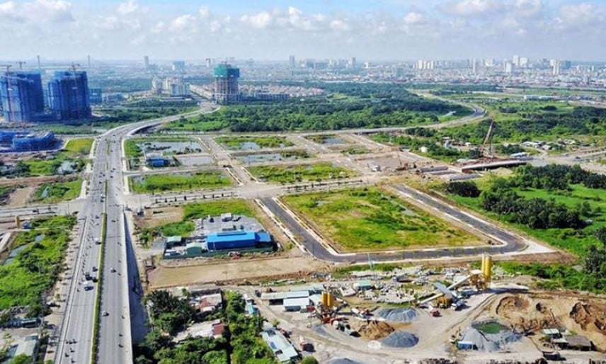
Through many changes of the times, at times, people turned their backs on the Red River, urban areas along the river developed widely, lacking connection with the flow of history. But today, a new way of thinking is gradually taking shape, a new approach is opening up. Provinces along the Red River are orienting urban areas towards the river to exploit economic and cultural potential while still preserving and protecting historical values.

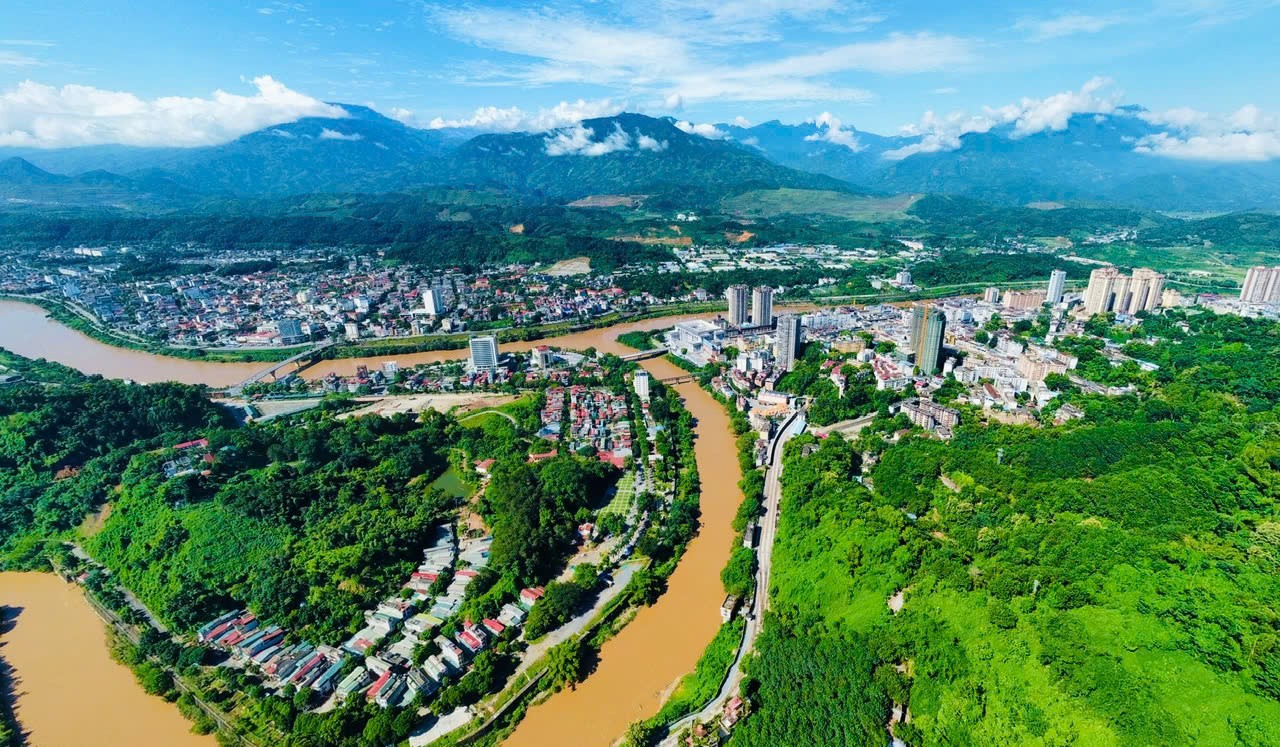
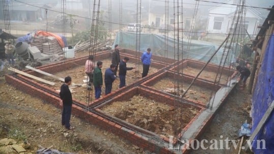
In Lao Cai, the provincial planning for the period 2021 - 2030, with a vision to 2050, has clearly defined: Developing a dynamic economic axis along the Red River, connecting the Southwest region of China with the whole country. Not just a trade axis, this place also forms growth poles, modern urban areas that are still in harmony with nature.
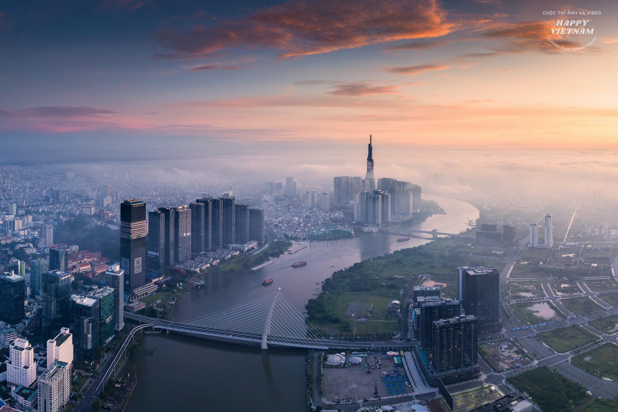
In Lao Cai city, a modern and dynamic urban area on both sides of the river has been creating a new look for the river. The river creates poetry for the street, the street reflects on the river in harmony, like a watercolor painting.

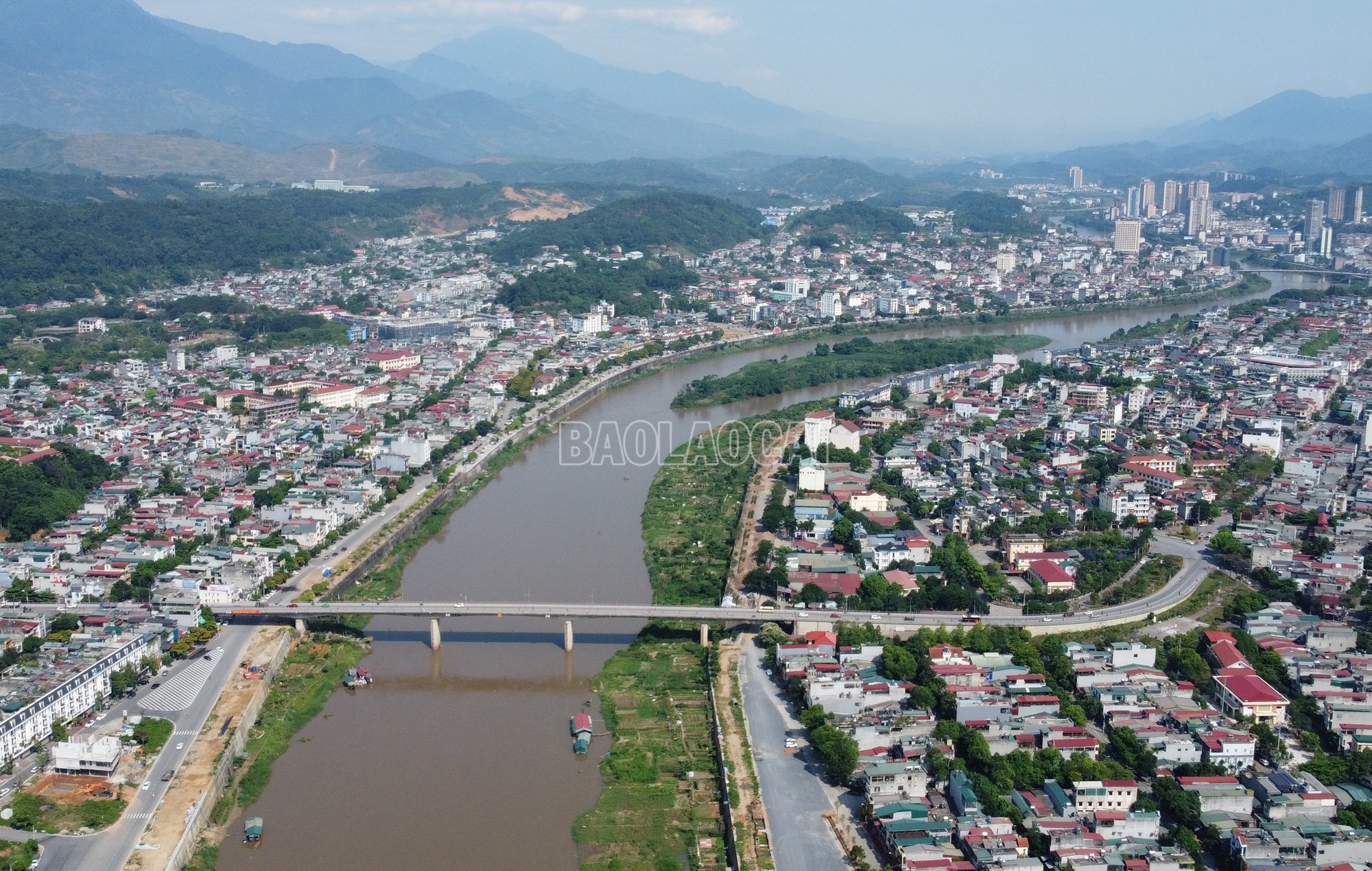
Downstream to Yen Bai, Yen Bai city is striving to become an urban area on both sides of the Red River, playing the role of the “heart” of the Northwest region. According to the plan, along the Red River, 7 urban areas will appear, each with its own unique features but with the common goal of maximizing the advantages that the river brings.

At Bach Hac intersection, Viet Tri city is also changing strongly. Oriented to develop according to the model of "One corridor, one green belt", Viet Tri not only expands urban space but also preserves natural landscapes, creating an ecological urban area along the river. Phu Tho province also aims to increase the urbanization rate to 32% by 2030, turning Viet Tri into a festival city, a place where the national soul converges.

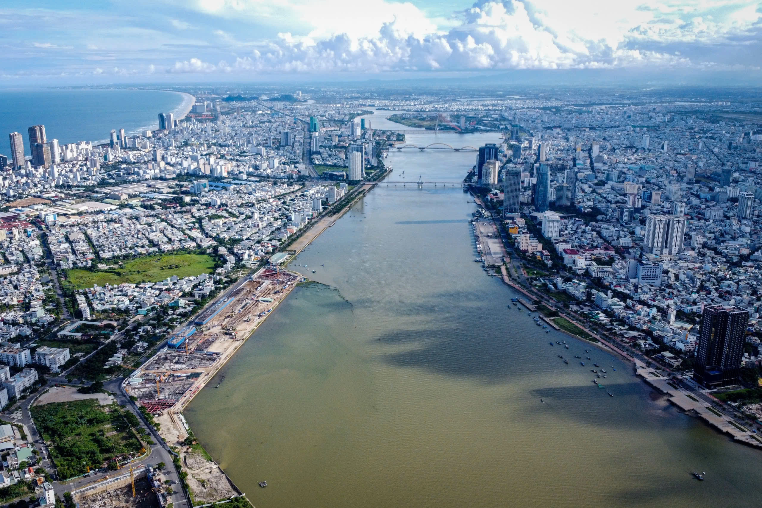
In Hanoi, the Red River is being upgraded to become the main landscape axis, economic, commercial, tourism and cultural axis. According to the plan until 2045, the Red River will become a symbol of the development of a green, ecological and modern Hanoi.
In a broader view, the development of riverside urban areas is not only local but requires a comprehensive strategy, with close coordination between the provinces and cities where the river flows. Each locality cannot develop in a separate direction, but needs to be integrated in regional planning, creating a complete economic - cultural - tourism corridor.
The policy of merging provinces that the Central Government is implementing also opens up a great opportunity to optimize resources, improve the ability to balance the budget and increase competitiveness. When small provinces merge, economic potential will be exploited more effectively, large economic centers will be formed, attracting stronger investment.
Developing riverside urban areas is not simply about building high-rise buildings and expanding roads, but more importantly, creating a harmonious combination between nature and people, placing each province in the overall inter-regional, regional and national context. The river ports will no longer be deserted, the streets will face the river instead of turning their backs as before. A riverside city not only has economic value but is also a living space, a cultural space, where people and nature harmonize in a sustainable whole.
Ensuring comprehensiveness, consistency and unity in planning
Along the river, urban areas from Lao Cai, Yen Bai, Viet Tri to Hanoi and Thai Binh have been formed and developed over the centuries, becoming economic, cultural and transport centers. Urban planning along the Red River not only effectively exploits land funds but also orients sustainable development, preserves natural beauty and harmonizes with the environment. However, current planning work still has many limitations, posing an urgent need for a comprehensive strategy and regional linkage to ensure sustainable development for the river and riverside urban areas.

One of the biggest limitations in urban planning along the Red River is the lack of close linkages between localities. Each province and city carries out urban planning in its own way, leading to a lack of synchronization in economic development, transportation and environmental protection. This lack of uniformity reduces the efficiency of exploiting the river’s potential and causes inadequacies in resource management.
- Dr., architect Dao Ngoc Nghiem, Vice President of Vietnam Urban Planning and Development Association.
Due to differences in economic resources, design language and planning vision, riverside cities are shaped with diverse styles, but lack uniformity. For example, Hanoi focuses on developing modern urban areas and new urban areas, sometimes overshadowing the historical and cultural values along the river; Viet Tri city has not fully exploited the cultural and tourism potential along the river, focusing on industry and transportation; Thai Binh focuses on developing agriculture as the main, but residential areas and ecological urban areas have not yet received synchronous investment... This difference not only reduces the aesthetics of the area but also affects the ability of cooperation between localities in economic development and environmental protection.
Urban planning along the Red River sometimes does not ensure sustainability, leading to the risk of encroachment on the river's flood corridor, water quality degradation and ecological imbalance. Along with that, pressure from rapid urbanization quickly destroys the natural beauty and green living space along the river.

To overcome the current limitations, a master planning strategy is needed for urban areas along the Red River, including developing a master plan for the entire area along the Red River, from upstream (Lao Cai, Yen Bai) to downstream (Hanoi, Thai Binh), ensuring close coordination between localities. Shaping a synchronous planning style, suitable for the natural and cultural characteristics of the river, creating beautiful and harmonious riverside urban areas. Putting environmental protection at the forefront of planning, with solutions such as building green urban areas, limiting encroachment on flood escape corridors and handling water pollution.
Planning also needs to focus on long-term, sustainable development projects to preserve the river's natural beauty and protect resources for future generations.
The Red River sings a new song
Since the early days of the country's founding, the Red River has embraced many cultural and historical sediments. On that river, boats have gone back and forth carrying the desire to expand the territory. The flowing water has witnessed many ups and downs of the country, sometimes calm and gentle, sometimes surging violently like the soul of the Vietnamese people.
.")
Today, the Red River is gradually awakening, riverside cities are growing strongly, bridges connect the two banks, new roads open up vast horizons. A river is no longer just a witness to history but is becoming a driving force for development, a vibrant economic axis, a symbol of change.
Then, when the sunset dyes the water red, the riverside streets sparkle in the lights, the bridges connecting the two banks are bustling with people and vehicles, the Red River will no longer be just the flow of the past but will sing the song of a new day. A song of development, of integration, of a nation that is rising strongly, ready to enter a new era - an era of great aspirations.
Source: https://baolaocai.vn/bai-cuoi-kien-tao-khong-gian-phat-trien-moi-post399349.html
![[Photo] Third meeting of the Organizing Subcommittee serving the 14th National Party Congress](https://vstatic.vietnam.vn/vietnam/resource/IMAGE/2025/4/2/3f342a185e714df58aad8c0fc08e4af2)
![[Photo] Relatives of victims of the earthquake in Myanmar were moved and grateful to the rescue team of the Vietnamese Ministry of National Defense.](https://vstatic.vietnam.vn/vietnam/resource/IMAGE/2025/4/2/aa6a37e9b59543dfb0ddc7f44162a7a7)
![[Photo] Close-up of Vietnam's sniffer dog team searching for earthquake victims in Myanmar](https://vstatic.vietnam.vn/vietnam/resource/IMAGE/2025/4/1/d4949a0510ba40af93a15359b5450df2)


Comment (0)