
Experts propose planning Thanh Da into a park instead of building an urban area
Planning experts say that climate change is getting worse, so building parks along the Saigon River like the Binh Quoi - Thanh Da peninsula will be a long-term strategy to protect people.
This proposal was proposed by French planners to the Ho Chi Minh City People's Committee at the Workshop on developing functional spaces and the Saigon River corridor based on France's experience on the Seine River, which took place on March 2 in Ho Chi Minh City.
At the workshop, the consulting consortium of the Vietnam Science and Expert Organization Global (AVSE Global) and the Paris Regional Planning Institute (IPR) presented research results and initial ideas for the planning of the Saigon River corridor.
 |
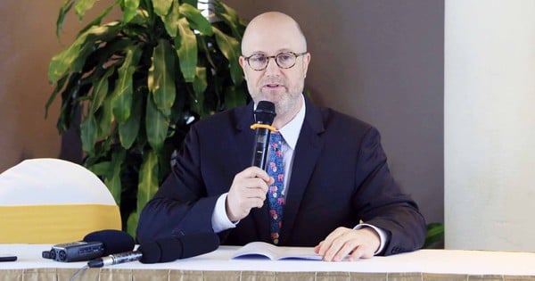
Mr. Laurent Perrin, Paris Regional Planning Institute, commented on the development of space along the Saigon River. |
After research, the consulting consortium proposed developing the Saigon River corridor with 4 sub-zones.
Zone 1, from Thu Dau Mot town (Binh Duong) to the border of Ho Chi Minh City and Tay Ninh province, is 48 km long . This area is proposed to be developed in the form of a new natural park to preserve and enhance the agriculture, landscape and heritage of the suburban area.
Zone 2, from the railway bridge to Thu Dau Mot bridge with a length of 25 km. This area will create a new space between urban and rural areas, so it is necessary to convert the remaining large areas of cultivated land into agricultural - recreational and ecological parks.
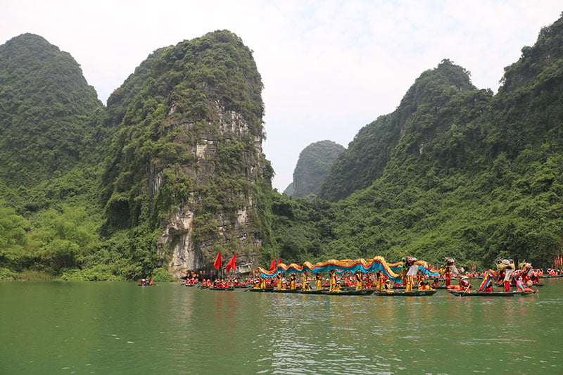
Zone 3, including Thanh Da peninsula and the surrounding area from National Highway 52 to the Ho Chi Minh City-Hanoi railway, is 13.5 km long. The consultant proposed that this area be developed into a high-density mixed-use urban area and a 300-hectare flooded agricultural-recreational park.
Zone 4 (the future gateway central area) is 16 km long, running from the Dong Nai/Nha Be River junction to National Highway 52. This is the entrance to the urban center of Ho Chi Minh City, passing through some of the oldest and most populous districts.
Giving comments on the planning of the Saigon River corridor, Mr. Laurent Perrin, Paris Regional Planning Institute, stated that the problem of climate change is getting worse, so building parks along the river will be a long-term strategy to protect people.
In particular, he proposed to plan the Binh Quoi - Thanh Da peninsula into a multi-functional park instead of developing urban areas here. This expert believes that it is necessary to preserve the Thanh Da peninsula in its current state, so that water from the Saigon River can penetrate as much as possible and not build too many roads on the surface or concretize the peninsula.
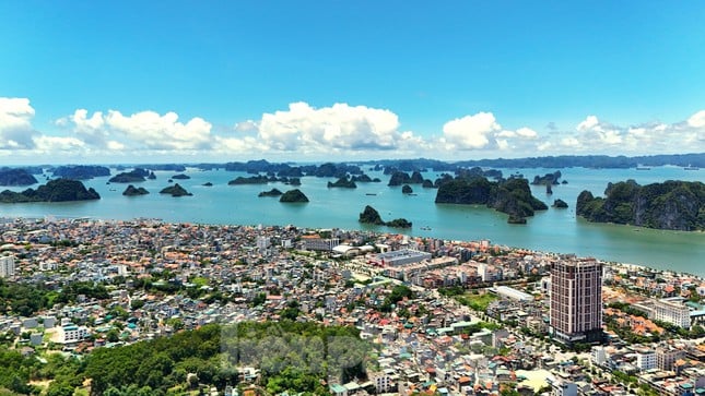
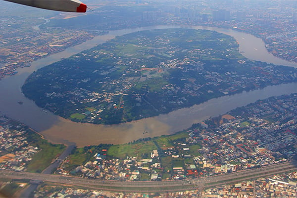 |
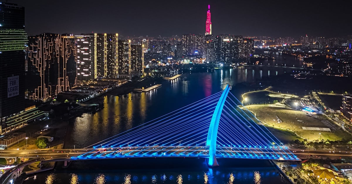
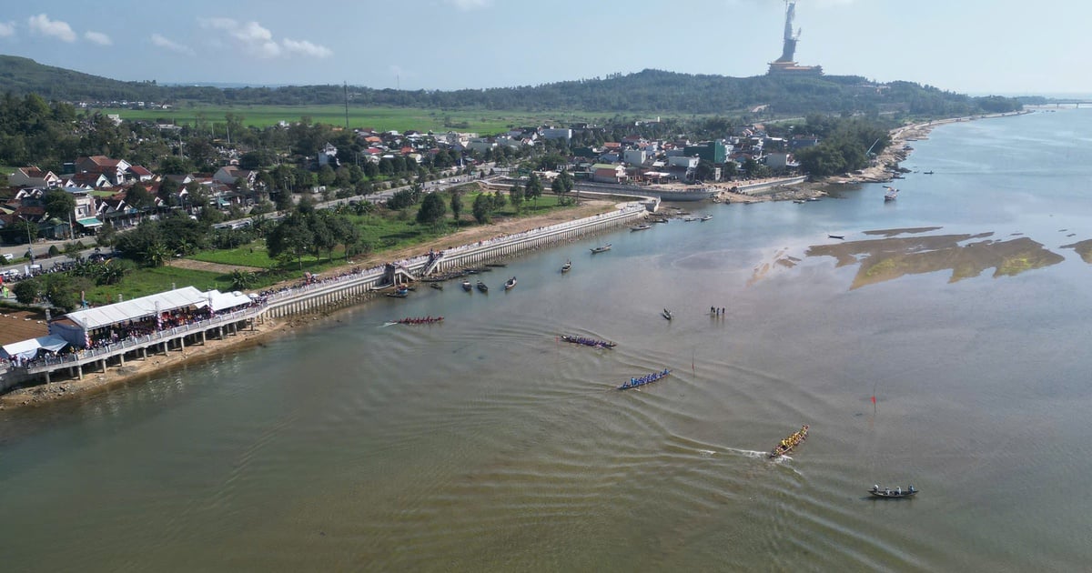
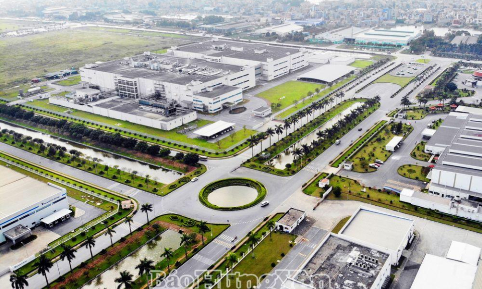
| Thanh Da Peninsula seen from above - Photo: Le Toan |
In addition, the northern area of Ho Chi Minh City (Cu Chi) is a suitable place to consider building a national park. Mr. Laurent Perrin also recommended that the City should introduce good management policies to promote economic value while still maintaining and preserving the heritage associated with the river.
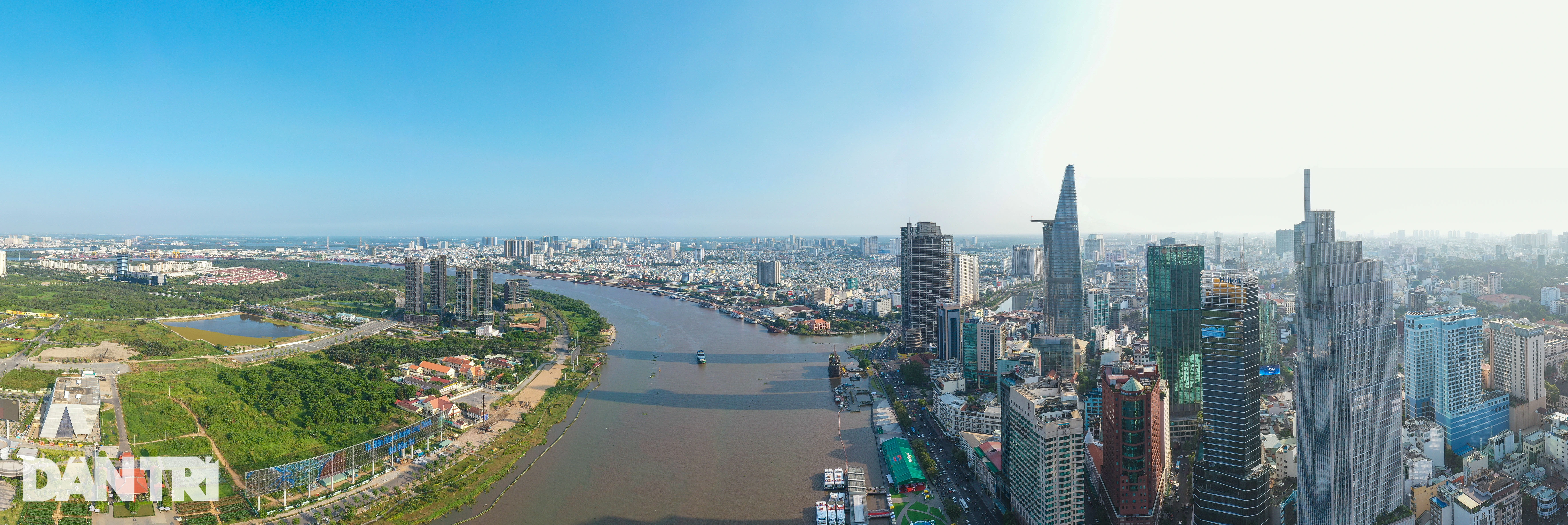
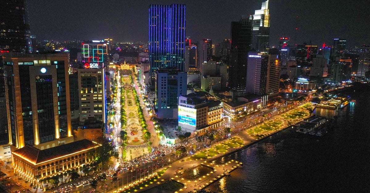
At the workshop, experts said that with a length of 256 km, of which the section flowing through Ho Chi Minh City is 80 km long, the Saigon River has enormous potential for socio-economic development of the Southeast region. If the importance of the river to the development of the City is properly assessed, this will be the key to opening up development opportunities in the next 30 years.
Mr. Tran Ngoc Chinh, Chairman of the Vietnam Urban Planning and Development Association, said that the City can focus on developing the first 15-20 km of Saigon River through Thu Thiem area and Thanh Da - Binh Quoi peninsula, because this is considered the "pearl" of the City.
"If planned and implemented well, in 10-15 years the Saigon River will not only be a highlight of the city but will also be famous in the world," Mr. Chinh commented.
Speaking at the workshop, Mr. Phan Van Mai, Chairman of the Ho Chi Minh City People's Committee, said that the city is implementing three very important plans, including the Ho Chi Minh City planning for the 2021-2030 period with a vision to 2050; reviewing and adjusting the Ho Chi Minh City master plan to 2040, with a vision to 2060; and building the Thu Duc City master plan.
The Chairman of the Ho Chi Minh City People's Committee said that in the upcoming planning, the City determined that the planning of the Saigon River is the center, which is very important for the development of the City.
"The City will incorporate the comments and discussions into the master plan. The City will also seek different approaches and apply specific mechanisms to implement strategies and develop the Saigon River in the coming time," Mr. Mai emphasized.
Source
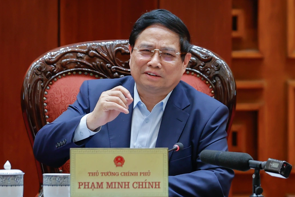
![[Photo] Prime Minister Pham Minh Chinh chairs meeting after US announces reciprocal tariffs](https://vstatic.vietnam.vn/vietnam/resource/IMAGE/2025/4/3/ee90a2786c0a45d7868de039cef4a712)
![[Photo] Prime Minister Pham Minh Chinh chairs the first meeting of the Steering Committee on Regional and International Financial Centers](https://vstatic.vietnam.vn/vietnam/resource/IMAGE/2025/4/3/47dc687989d4479d95a1dce4466edd32)
![[Photo] General Secretary To Lam receives Japanese Ambassador to Vietnam Ito Naoki](https://vstatic.vietnam.vn/vietnam/resource/IMAGE/2025/4/3/3a5d233bc09d4928ac9bfed97674be98)
![[Photo] Ho Chi Minh City speeds up sidewalk repair work before April 30 holiday](https://vstatic.vietnam.vn/vietnam/resource/IMAGE/2025/4/3/17f78833a36f4ba5a9bae215703da710)
![[Photo] A brief moment of rest for the rescue force of the Vietnam People's Army](https://vstatic.vietnam.vn/vietnam/resource/IMAGE/2025/4/3/a2c91fa05dc04293a4b64cfd27ed4dbe)


Comment (0)