
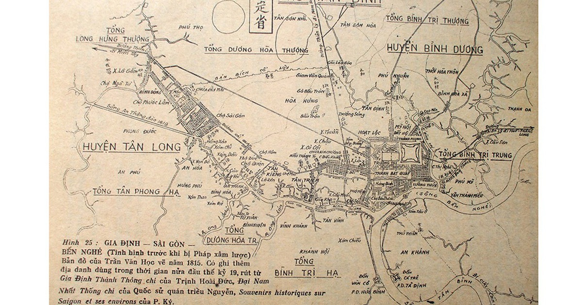
At this moment, the "vague" road, sometimes hidden, sometimes visible, as if it existed or not since the 1860s, suddenly appeared, becoming clearer and clearer, becoming the main road from the area near Lang Cha Ca, going diagonally down to the area near the old Hue bridge, crossing Nhieu Loc canal, "taking over" the small extended road (of the current Dang Van Ngu street) to the other side of Nhieu Loc canal to Thien Ly street (at that time named Thuan Kieu street, then Verdun street, now Cach Mang Thang Tam street).
At the end of Dang Van Ngu street, overlooking Nhieu Loc canal, there used to be a bridge, that was Lao Hue bridge.
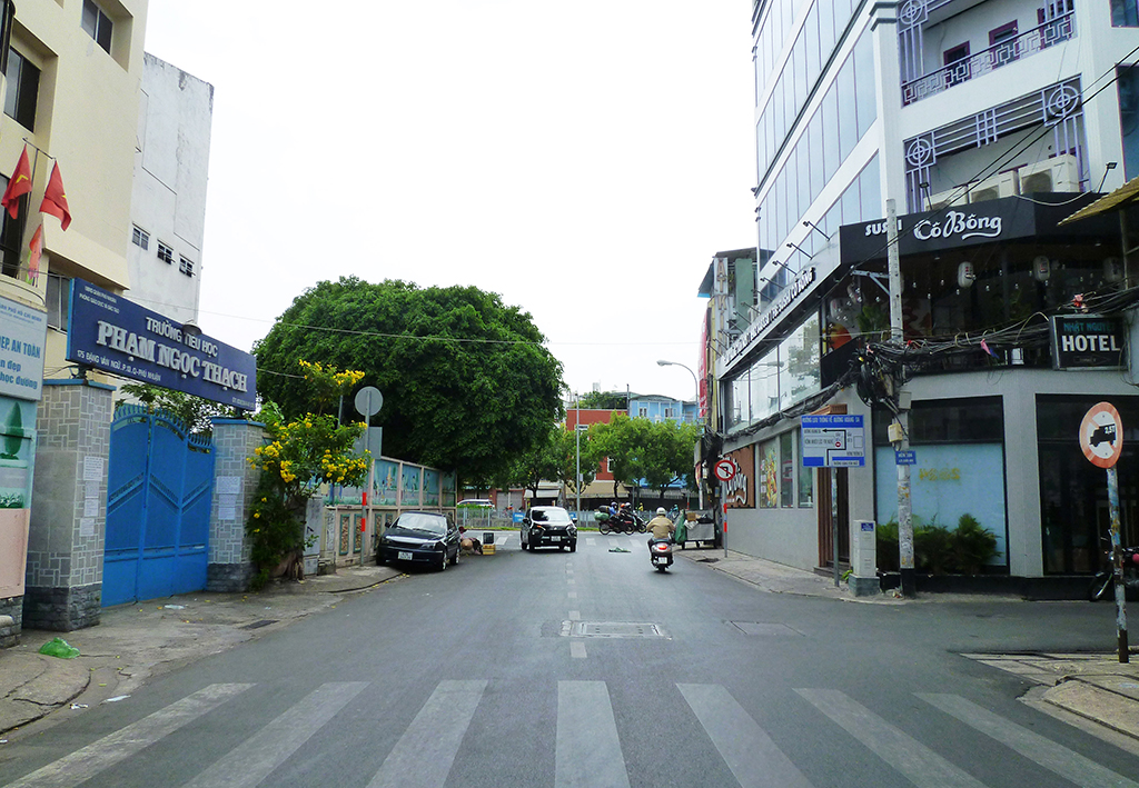
Photo: CMC
That road (now Bui Thi Xuan Street) must have had a bridge to connect it. And maps from the early 1910s onwards already had this bridge, but the name was not shown. The new bridge was only about 50 - 60 meters from the old bridge.
As mentioned in previous issues, there were four main bridges recorded along the Nhieu Loc - Thi Nghe canal before and after the French colonial period. According to the author of the research book on Saigon - Cho Lon Urban Area before 1945, only Diem/Cho Moi/Kieu bridge remained in its original position, while Thi Nghe and Bong bridges had moved their positions.
Specifically, Thi Nghe bridge changed its location twice. The current bridge is more than 360 meters away from the first bridge (in the Nguyen Ngoc Phuong apartment area, at the end of Huynh Man Dat Street, Ward 19, Binh Thanh District today); the current Cao Mien bridge/Bong bridge was originally located at the Sat bridge, which is the current Bui Huu Nghia bridge (next to this bridge is still Cau Bong canal), 170 meters away (Saigon - Cho Lon Urban Area before 1945, pages 235 - 240).
Despite the move, these two bridges still carry their old names. Compared to the displacement distance of Thi Nghe Bridge and Bong Bridge (360 m and 170 m), the "new Lao Hue Bridge" has a much smaller displacement. However, to be honest, I don't know if it is still called Lao Hue because no map or local people call it by this name anymore. Maybe because it is in a remote area, "same origin", only has local value, so people have completely forgotten about it.
And a direct reason that decided the miserable fate of the San bridge (to the point that until now, although it has completely disappeared for more than 20 years, until now, no one has had a picture of this bridge): Huong Lo 16 (since the mid-1960s became Thoai Ngoc Hau Street, now Pham Van Hai) was wider and paved. People grew vegetables in the vegetable gardens of Vuon Rau hamlet along both sides of the unnamed trail, later named Truong Minh Ky (now Le Van Sy) , from Lang Cha Ca, past the current train gate No. 6 about 250 m - towards District 3.
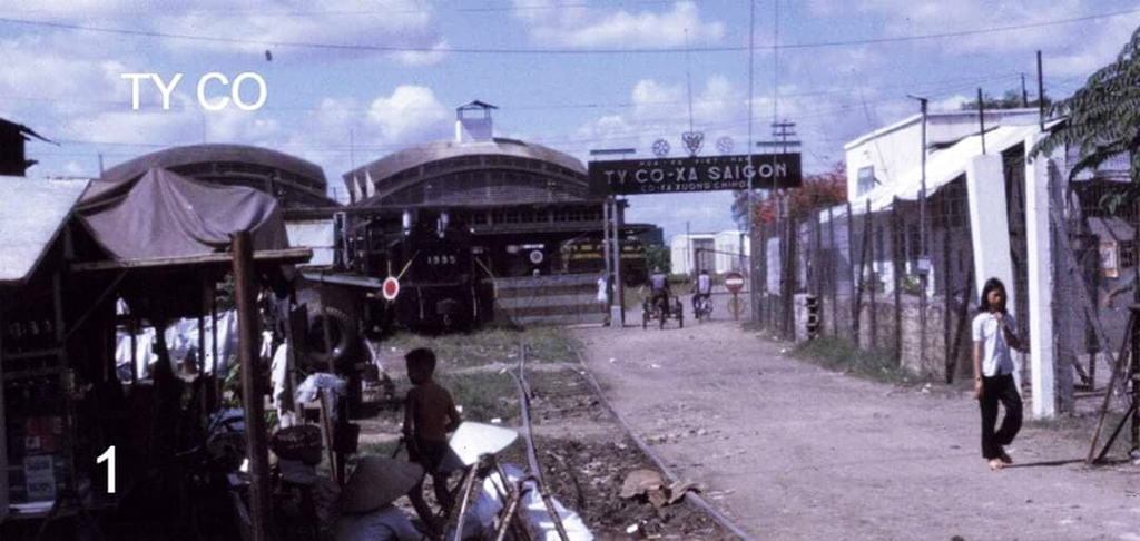
Ty Co Xa before 1975 (Hoa Hung Locomotive Repair Workshop and Goods Warehouse, now Saigon Railway Station) intersects the road connecting Bui Thi Xuan to Cach Mang Thang Tam today.
Photo: Document
After 1954, people in vegetable growing areas who wanted to transport vegetables by horse-drawn carriage or lam car had to go on Thoai Ngoc Hau Street (now Pham Van Hai), through the old bustling Ong Ta market to Ong Ta intersection, to Le Van Duyet - Pham Hong Thai Street to go to Hoa Hung, Saigon, or down to Ba Queo, Hoc Mon.
The width of San Bridge at that time was reduced to a pitiful size, only a few meters, almost half of Ong Ta Bridge . The bridge was also low. In the late 1960s, whenever it rained heavily, the water only reached the edge of Ong Ta Bridge, but flooded the entire surface of San Bridge. The memory of my childhood, in the late 1960s, of my friends in the neighborhood, was of the flooding rain, all clinging to the iron bars on both sides of San Bridge to splash water on the bridge to play with each other.
And an important reason: after being present for about twenty years, in the early 1930s, a locomotive maintenance and repair workshop and a goods storage warehouse (before 1975, it was the Saigon Railway Company, now the Saigon Locomotive Enterprise) was built, blocking the road connecting this bridge to Verdun Street (renamed Thuan Kieu Street, after 1954 it was Le Van Duyet, now Cach Mang Thang Tam).
It can be said that from now on, the "new Lao Hue bridge" no longer has the position to "go straight" from Lang Cha Ca to the old Thien Ly/Thuan Kieu/Verdun street. The remaining road on both sides of this factory is increasingly "shrinking", now it is just a small, slightly curved alley, one or two meters wide.
Let me add: if the old Lao Hue bridge still existed today, it would have suffered the same fate when the Hoa Hung locomotive repair workshop and goods warehouse - now the Saigon train station - also crossed it in the 1930s. (to be continued)
Source: https://thanhnien.vn/cau-lao-hue-bien-mat-hay-van-con-185250223213917263.htm

![[Photo] Visiting Cu Chi Tunnels - a heroic underground feat](https://vstatic.vietnam.vn/vietnam/resource/IMAGE/2025/4/8/06cb489403514b878768dd7262daba0b)


Comment (0)