
According to Tran Van Hoc's map in 1815, compared with the current field, the bridge is located near the middle of two 90-degree bends at the headwaters of Nhieu Loc - Thi Nghe canal (HCMC), that is, the bend from Bung Binh canal (now Rach Bung Binh street) to the current bends of bridges number 4 and 5.
More specifically, the location of this bridge seems to be around bridge number 6 and 7; in the middle is the railway bridge to Saigon train station (Hoa Hung). The pair of railway tracks is alley 115 to Le Van Sy street today, which is train gate number 6.

The map of Gia Dinh in 1815 drawn by Tran Van Hoc, annotated by Nguyen Dinh Dau, has all four bridges on Nhieu Loc - Thi Nghe canal.
It is a bit "strange" because all historical documents and old maps do not record any bridge at this location, although the military general and city supervisor Tran Van Hoc drew this map in the Western scientific style of that time, quite accurately. At that time, measuring equipment was still very limited and Saigon at that time was still a wild land.
The name Lao Hoa is also a "strange" bridge name, causing confusion for many interested people, including the profound researcher Nguyen Dinh Dau. In the book Brief History of Saigon from the 17th century to the French invasion (1859) (Tre Publishing House - 2023), page 65, he wrote: "On the map Tran Van Hoc drew in 1815, there is a mark of Cuu Luy , that is "Ban Bich Co Luy", the details are exactly as Trinh Hoai Duc described, the only difference is one place name, Lao Hue bridge is written as Lao Hoa bridge". And he also wondered: "I don't know which side is correct, or maybe there was a name change".
In 1882, scholar Truong Vinh Ky published Ancient Gia Dinh landscape of the bay , which noted four bridges: "Ba Nghe (Ba Nghe canal, Ba Nghe bridge) is the intersection of Bong bridge, Kieu bridge, Nhieu Loc bridge" ( Gia Dinh landscape of the bay - Tre Publishing House 2023, page 19). Was Lao Hoa bridge/Lao Hue bridge/(bridge) Hue later called Nhieu Loc bridge?

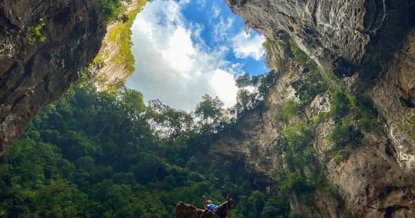
Location of Lao Hoa bridge on Gia Dinh map in 1815 drawn by Tran Van Hoc, annotated by Nguyen Dinh Dau
The name Nhieu Loc bridge was recorded right at the beginning of the French colonial period. The "plot-selling" map posted with the announcement in the Courrier de Saigon on May 10, 1864, at the location outside the Bao Ngan canal as planned, there was a bridge crossing a trail (now Dang Van Ngu street). This location was numbered 34 and clearly noted (written verbatim); "Nhieu Loc bridge (près du fort de Chi-hoa): Nhieu Loc bridge (near Chi Hoa fort)". This fort was located at one of the two sharp corners of the gate area of the Chi Hoa fort that we all know.
Also in the 1815 map, there was a road running across the bridge, from the northeast (Phu Nhuan) to the southwest (Thien Ly street, now Cach Mang Thang Tam). This road was drawn very clearly in the topographical map of the 20th Tham Bien District and its vicinity (Plan Topographicque 20 eme Arrondissement et ses environs) in 1882 and 1885: running alongside a branching canal leading to Nhieu Loc canal; with the note "chemin vicinal" (village road). This road initially had a trail (the map drew intermittently) passing through Hoang Van Thu street, now the Tan Son Nhut (Nhat) village area, up to Hanh Thong Tay. Ten years later, when the Tan Son Nhut village area formed a number of private farms, the road was basically circled at the Dang Van Ngu - Nguyen Trong Tuyen intersection as it is today.
About Lao Hue bridge, old books recorded quite consistently:
Le Quang Dinh wrote in 1806, with a passage: "(From Diem bridge go) 347 spans (one span is about 1,825 m), both sides of the road are adjacent gardens, at the fork, the southern branch goes 1,663 spans to Lao Hue bridge" (Hoang Viet Nhat Thong Dia Du Chi - Phan Dang translated - Thuan Hoa Publishing House 2005, page 293).
Trinh Hoai Duc wrote around 1820: "Binh Tri River (...) flows south about 4 miles to Phu Nhuan (bridge), 6 and a half miles to Hue bridge, the same source, everywhere there are scattered ponds" (Gia Dinh Thanh Thong Chi , Thuong volume - Tu Trai Nguyen Tao translated - Nha Van Hoa, Phu Quoc Vu Khanh Dac Chuoc Van Hoa - Saigon 1972, page 40).
The National History Institute of the Nguyen Dynasty wrote during the Tu Duc period, in the second half of the 19th century, in the "Gia Dinh province" section, the Son Xuyen section wrote about the Binh Tri River (Binh Tri Giang - the current Nhieu Loc - Thi Nghe canal), recording 5 bridges, specifically (please quote the original, including spelling rules):
"In the north of Binh Duong district, 6 miles from Ben Nghe River (ie Saigon River) through Ngang Bridge (Thi Nghe Bridge?) then flows upstream 4 miles to Cao Man Bridge (Bong Bridge), flows northwest 2 miles to Cho Chieu Bridge (?), flows around to the east 4 miles to Phu Nhuan Bridge (Kieu Bridge), 6 miles to Hue Kieu Bridge is the end of the line, everywhere there are scattered ponds, commonly called Hau Giang" (Dai Nam Nhat Thong Chi , volume Thuong - Tu Trai Nguyen Tao translated - Culture Department, Ministry of National Education 1959).
Note: A mile was used by Vietnamese people in the past, some documents say 444.44 m, some documents say 576 m. A span is also not consistent, some documents say 1.825 m, some say about 2.12 m, some authors multiply and divide by 2.48 m. Therefore, the measurements are only estimates, not necessarily 100% correct. And the old Binh Duong district is not the current Binh Duong province but a district of Tan Binh district, Gia Dinh province before the French colonial period. (to be continued)
Source: https://thanhnien.vn/cay-cau-bi-an-tren-rach-nhieu-loc-thi-nghe-cay-cau-la-185250220214643569.htm

![[Photo] Unique folk games at Chuong Village Festival](https://vstatic.vietnam.vn/vietnam/resource/IMAGE/2025/4/10/cff805a06fdd443b9474c017f98075a4)
![[Photo] April Festival in Can Tho City](https://vstatic.vietnam.vn/vietnam/resource/IMAGE/2025/4/10/bf5ae82870e648fabfbcc93a25b481ea)
![[Photo] Opening of the 11th Conference of the 13th Party Central Committee](https://vstatic.vietnam.vn/vietnam/resource/IMAGE/2025/4/10/f9e717b67de343d7b687cb419c0829a2)


Comment (0)