
According to the National Center for Hydro-Meteorological Forecasting, today (June 11), the North and Central regions will have hot weather, some places will have extremely hot weather with temperatures at 1 p.m. of 35-36 degrees, some places will have temperatures above 37 degrees such as: Bac Me (Ha Giang) 38.6 degrees, Bao Lac (Cao Bang) 37.9 degrees, Cho Ra (Bac Kan) 37.8 degrees,... Relative humidity at 1 p.m. 45-65%.
It is forecasted that in the next 1-2 days, both the North and Central regions will continue to experience intense heat with temperatures higher than 35-37 degrees, with some places over 37 degrees.
However, the heat in the North will gradually decrease from June 13, when this area will experience showers and thunderstorms.
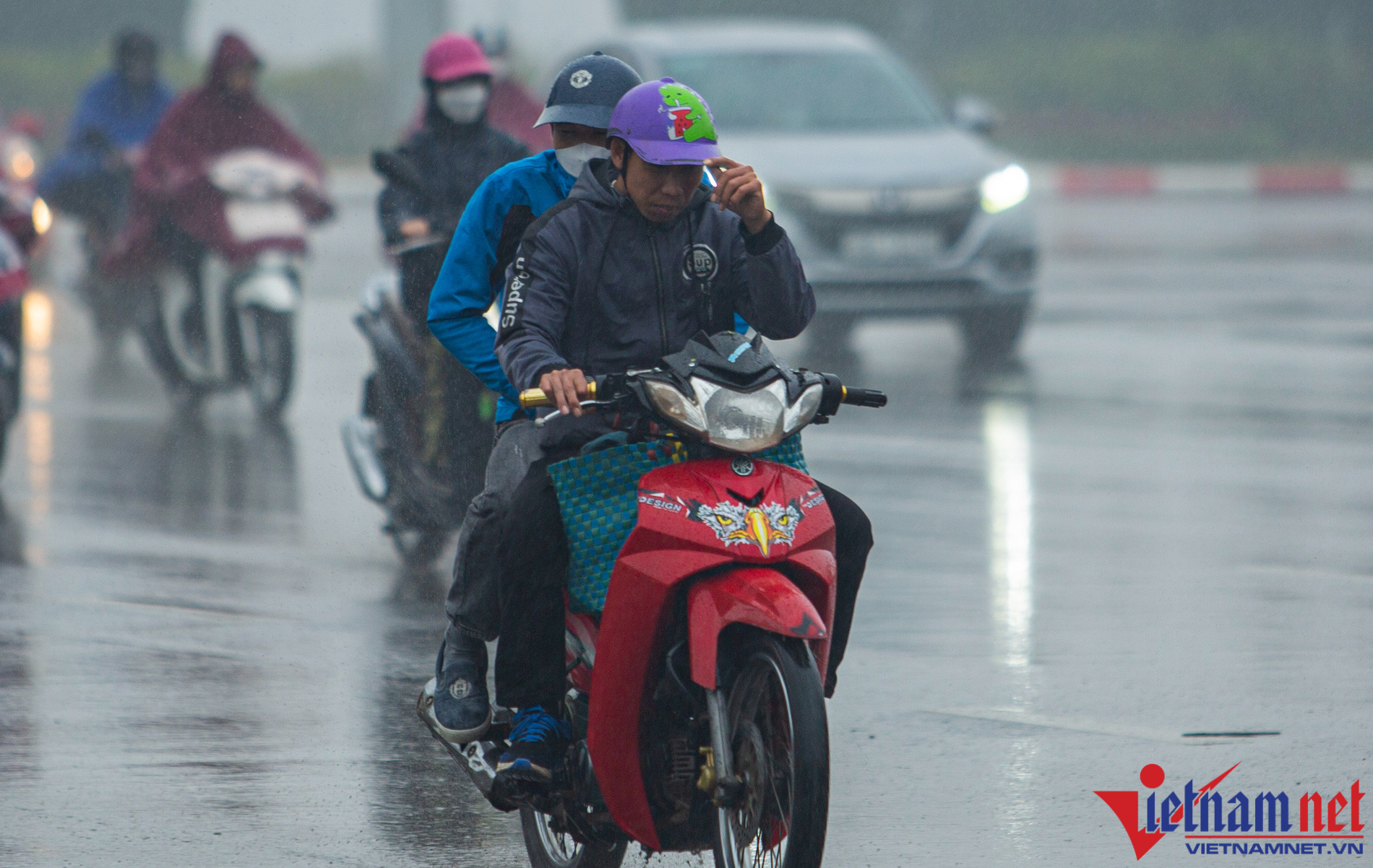
Specifically, from the evening and night of June 12, in the North, there will be scattered showers and thunderstorms, especially in mountainous areas, there will be moderate rain and thunderstorms, locally heavy rain with rainfall from 15-30mm, in some places over 50mm.
Even from June 13-14, rain in the Northern region and Thanh Hoa tends to increase, with localized very heavy rain.
In the Central region alone, the heat wave will continue for many days with temperatures ranging from 35-37 degrees, some places above 37 degrees.
For the Central Highlands and the South, tonight and tomorrow (June 12), there will be rain, showers and scattered thunderstorms, locally moderate rain, heavy rain with rainfall from 10-30mm, some places over 40mm. Rain will be concentrated in the afternoon and evening.
The meteorological agency noted that during hot days, in the late afternoon in the North and mountainous areas of the Central region, there is a possibility of thunderstorms with tornadoes, lightning, hail and strong gusts of wind. Localized heavy rain can cause flooding in low-lying areas.
In addition, the National Center for Hydro-Meteorological Forecasting said that the low pressure area in the northern part of the Gulf of Tonkin is moving slowly to the East.
Due to the influence of the low pressure area, there will be thunderstorms in the eastern sea of the Gulf of Tonkin. During the thunderstorms, there is a possibility of tornadoes and strong gusts of wind of level 6-7, affecting ships operating in this area.
The southwest monsoon is also operating at medium to strong intensity, so tonight and tomorrow, the sea area from Binh Thuan to Ca Mau, Ca Mau to Kien Giang, the Gulf of Thailand, the northern and central East Sea (including the sea area of Hoang Sa archipelago) will have showers and strong thunderstorms.
Source


Comment (0)