
A tropical depression in the eastern Philippines is about to strengthen into a storm. It is forecasted that around October 25, the storm will likely move into the East Sea with wind gusts of level 12.
According to the National Center for Hydro-Meteorological Forecasting, currently (October 21), there is a tropical depression active in the eastern region of the Philippines.
At 4 p.m., the center of the tropical depression was at about 13.5 degrees North latitude; 131.0 degrees East longitude, about 1,300 km southeast of Luzon Island (Philippines). The strongest wind near the center of the tropical depression was level 7 (50-61 km/h), gusting to level 9.
It is forecasted that in the next 24 hours, the tropical depression will move mainly in a West-Northwest direction and is likely to strengthen into a storm. At 4:00 p.m. on October 22, the center of the storm will be in the sea east of the Philippines. The strongest wind near the center of the storm is level 8 (62-75 km/h), gusting to level 11. Waves will be 3-4m high.
The meteorological agency said that around October 25, the storm is likely to move into the East Sea.
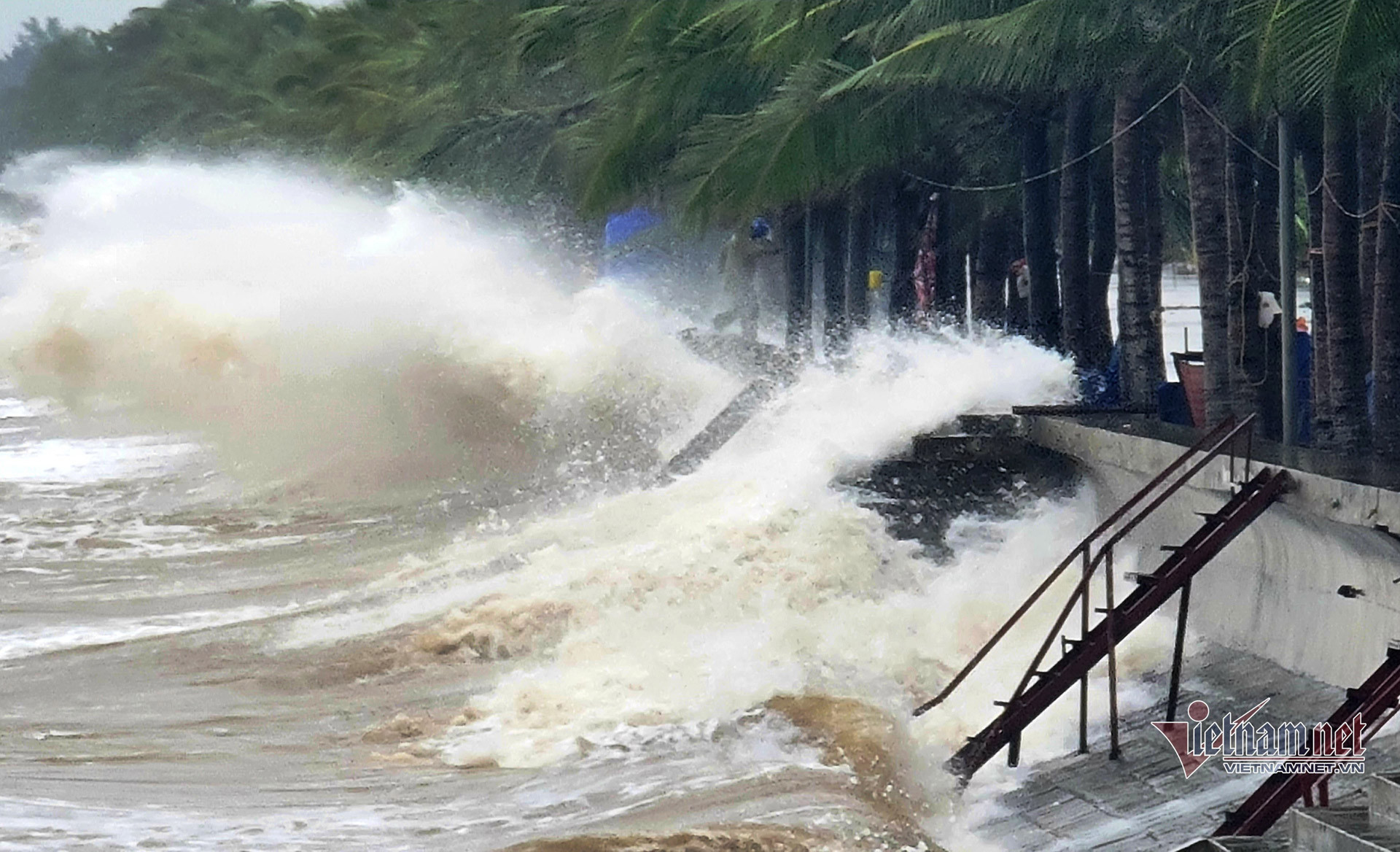
From around the afternoon and night of October 24, the eastern sea area of the North East Sea (east of 118.5 degrees East longitude) will have winds gradually increasing to level 8, near the storm center at level 9-10, gusting to level 12; very rough seas, waves 3-5m high, thunderstorms with dangerous whirlwinds.
Development of 2 cold air waves, the East Sea is likely to have a tropical depression/storm
Hanoi weather for the next 3 days: Cold air increases, showers and thunderstorms
Source: https://vietnamnet.vn/bien-dong-kha-nang-sap-don-bao-cuong-do-gio-giat-cap-12-2334112.html

![[Photo] National Assembly Chairman Tran Thanh Man attends the Policy Forum on Science, Technology, Innovation and Digital Transformation](https://vstatic.vietnam.vn/vietnam/resource/IMAGE/2025/4/13/c0aec4d2b3ee45adb4c2a769796be1fd)

![[Photo] National Assembly Chairman Tran Thanh Man attends the ceremony to celebrate the 1015th anniversary of King Ly Thai To's coronation](https://vstatic.vietnam.vn/vietnam/resource/IMAGE/2025/4/13/6d642c7b8ab34ccc8c769a9ebc02346b)
![[Photo] Prime Minister Pham Minh Chinh chairs the Government's special meeting on law-making in April](https://vstatic.vietnam.vn/vietnam/resource/IMAGE/2025/4/13/8b2071d47adc4c22ac3a9534d12ddc17)


Comment (0)