
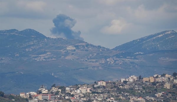
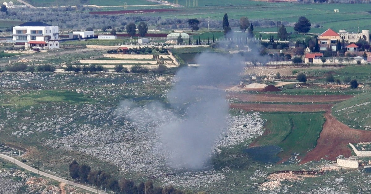
Israeli strikes have reduced entire neighborhoods to rubble, obliterated centuries-old mosques and churches and destroyed vital agricultural land.
The scale of destruction in this small area of just 365 square kilometres was so great that many residents were unable to return home – and likely will not be able to return for the foreseeable future.
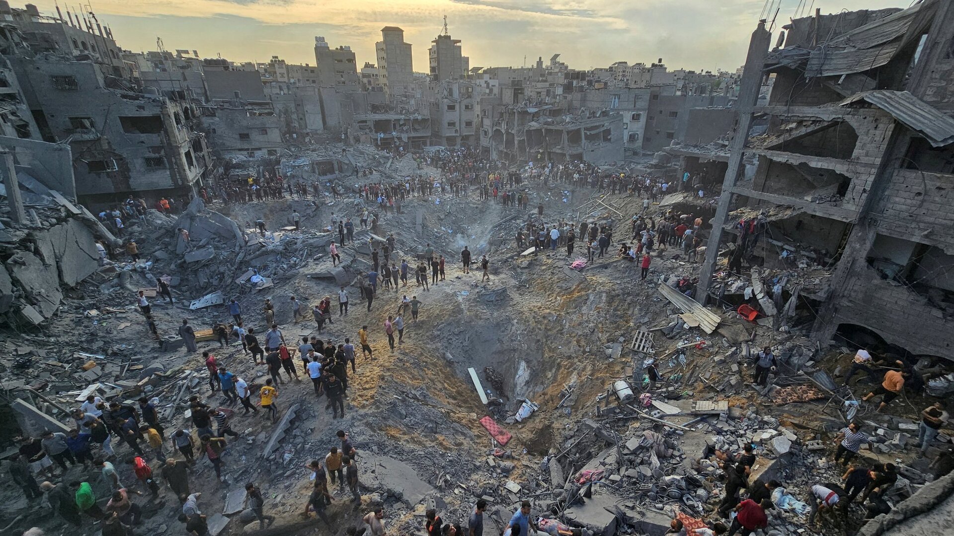
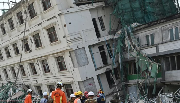
Giant bomb crater in Jabalia refugee camp. Photo: BBC
Satellite images show cratered terrain, scorched fields and flattened buildings in grey. Here is a look at the damage stretching from northern Gaza to Rafah:
Attacks on refugee camps
Jabalia, located in northern Gaza, is the largest of the eight refugee camps in the Gaza Strip. Established in 1948 after the Israeli army displaced more than 750,000 Palestinians from their homes, the camp covers just 1.4 square kilometers and is one of the most densely populated refugee camps in the Gaza Strip.
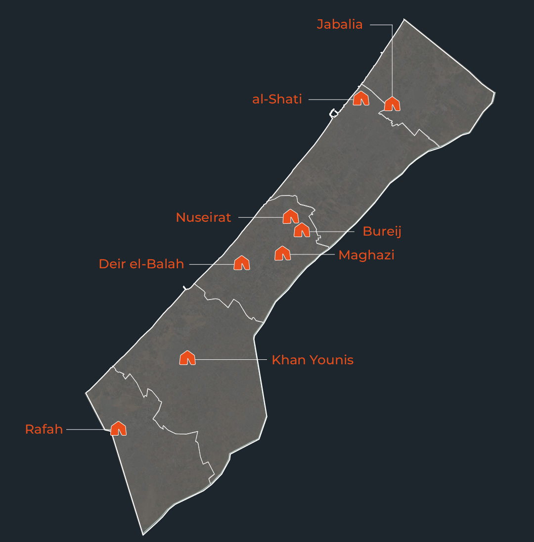
Jabalia (top) and seven other refugee camps in the Gaza Strip have been hit by bombardment over the past year. Graphics: Al Jazeera
The Israeli army has repeatedly attacked the Jabalia camp, using 1-ton bombs. These bombs are very destructive, as evidenced by the craters dozens of meters in diameter in the Jabalia camp.
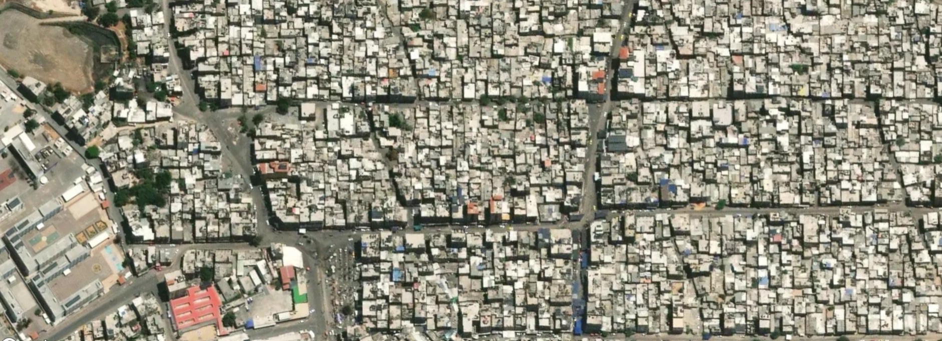
Jabalia refugee camp before the airstrike. Photo: Al Jazeera
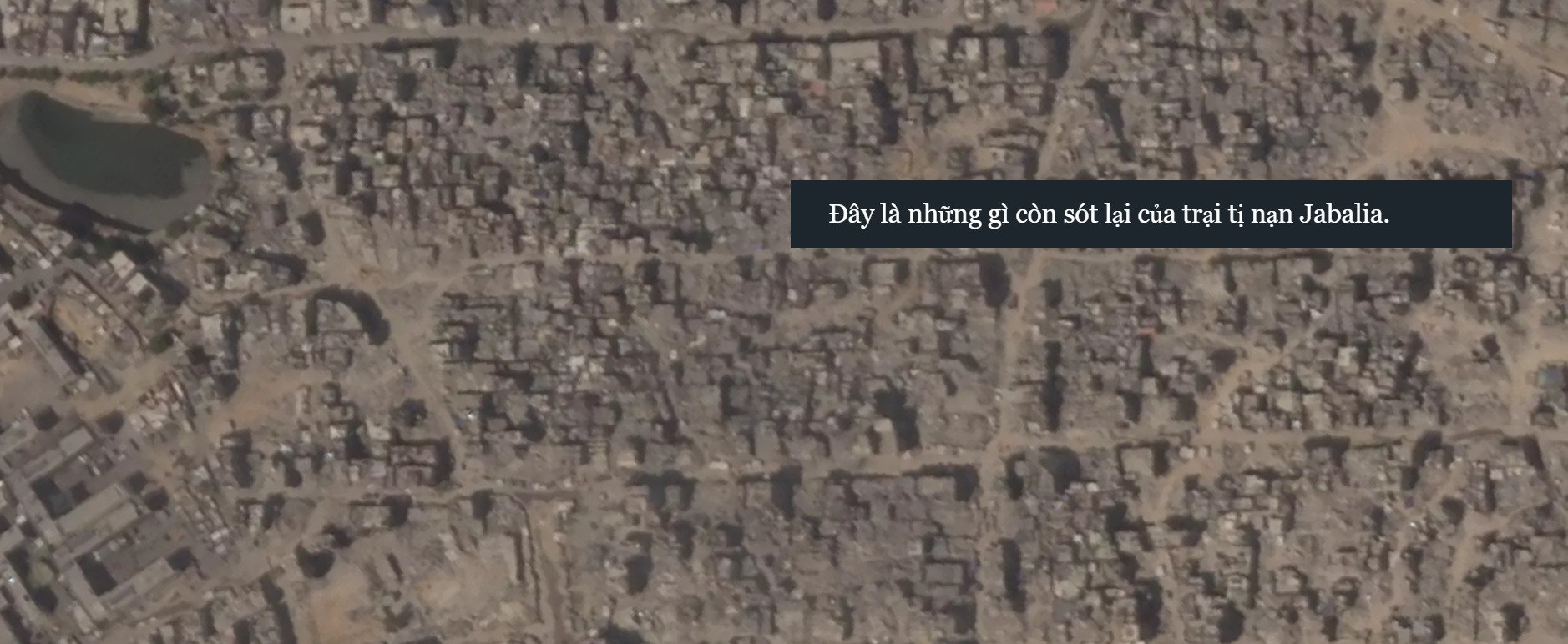
Jabalia refugee camp after an airstrike. Photo: Al Jazeera
Attacks on churches
About 3 km south of Jabalia is Gaza's Old Town, home to some of the Middle East's oldest cultural heritage, dating back to the 5th century.
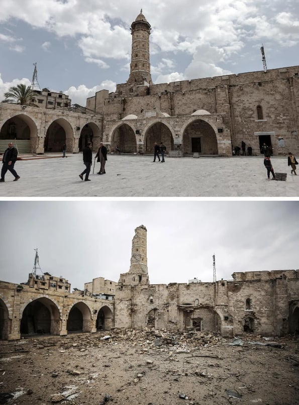
The Great Omari Mosque before and after the airstrike. Photo: Anadolu Agency
Notable landmarks in the old town include important places of worship, including the Great Omari Mosque, also known as the Great Mosque of Gaza, along with two famous Christian churches: the Chapel of St Philip the Evangelist and the Church of Saint Porphyrius. All three were devastated by bombing.
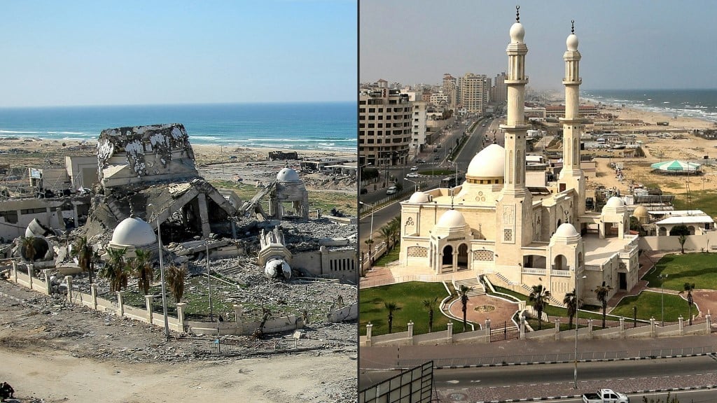
Al-Hasayna Mosque, near Gaza City's seaport, before and after being bombed. Photo: AFP
Additionally, the Ahmed Yasin Mosque and Al-Hasayna Mosque in Gaza City, the Salim Abu Mosque in Beit Lahia and the Khalid bin Al-Walid Mosque in Khan Younis were also left unscathed by airstrikes.
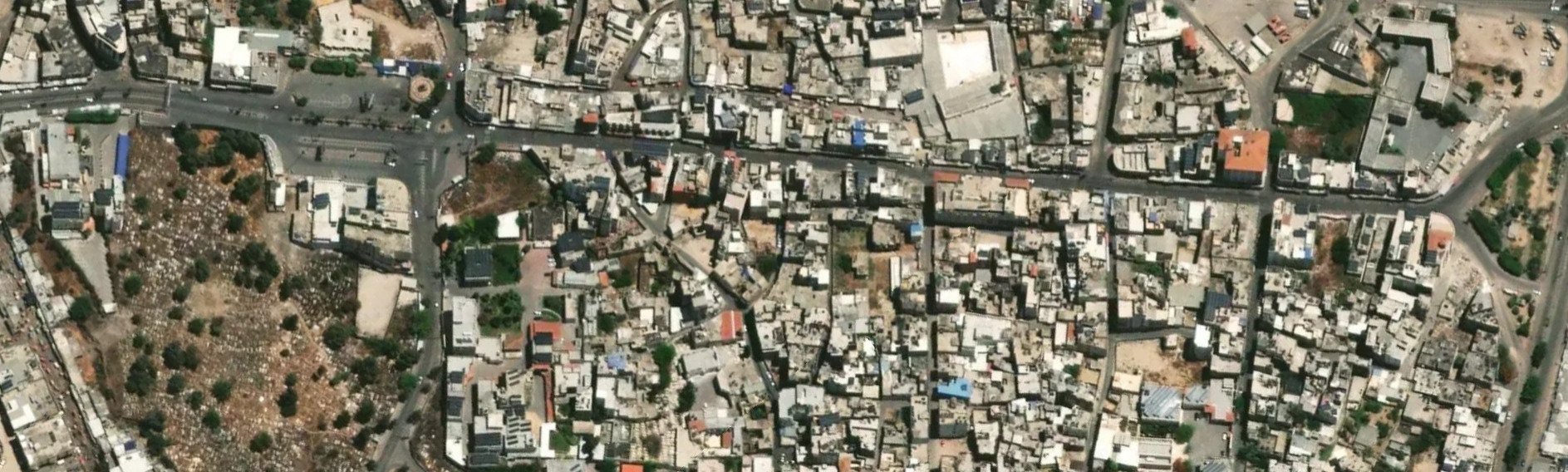
Gaza's Old City before the war. Photo: Al Jazeera
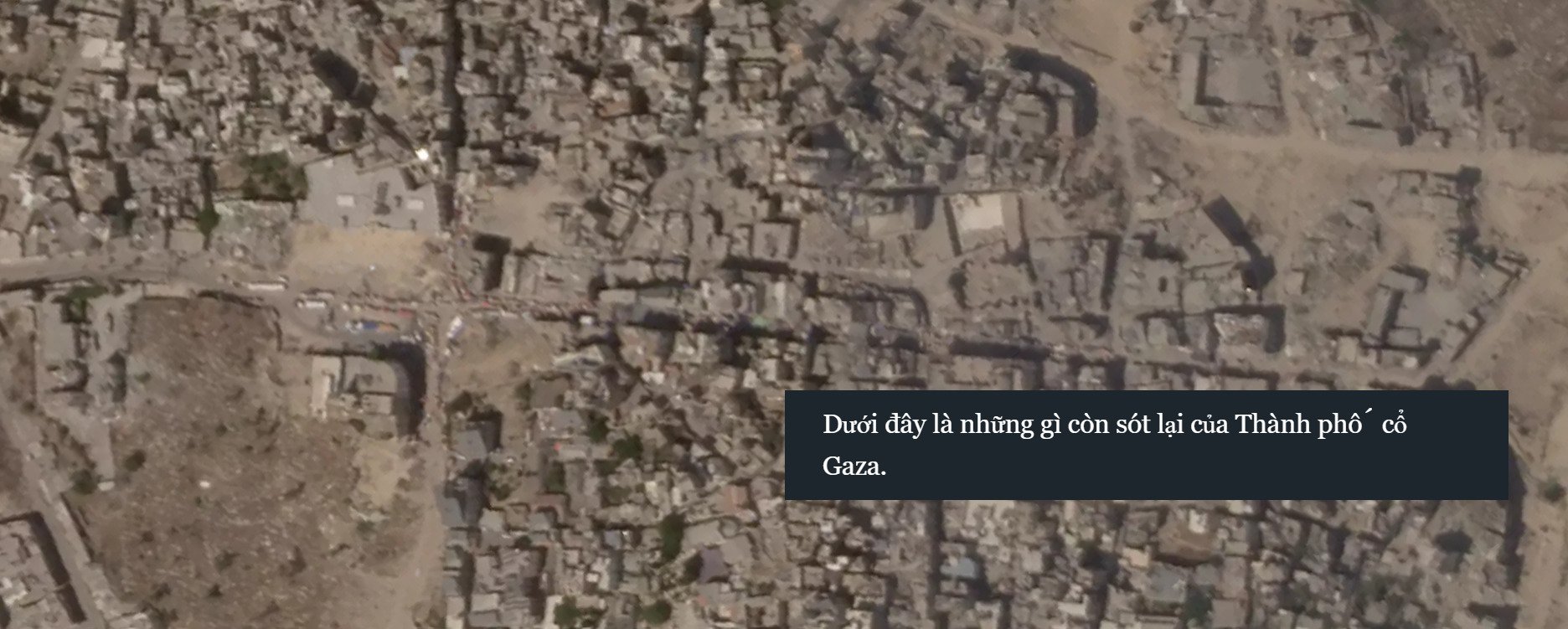
Gaza's Old City after a year of war. Photo: Al Jazeera
Attacks on schools and universities
Not far down the road from the Old City, in the heart of Gaza City's Remal neighborhood, is the Islamic University of Gaza (IUG).
IUG, along with Al-Azhar University, are the two leading universities in the Gaza Strip, providing higher education to tens of thousands of students each year.
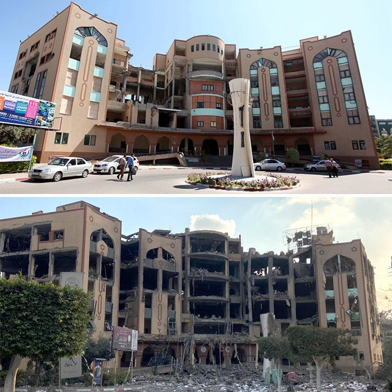
The once beautiful Islamic University of Gaza is now in ruins. Photo: Nature
Although both universities have been targeted in previous wars, this latest war has left their campuses completely devastated.
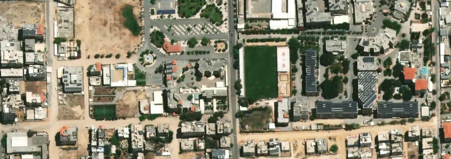
An aerial view of the university campus in Gaza, before the war. Photo: Al Jazeera
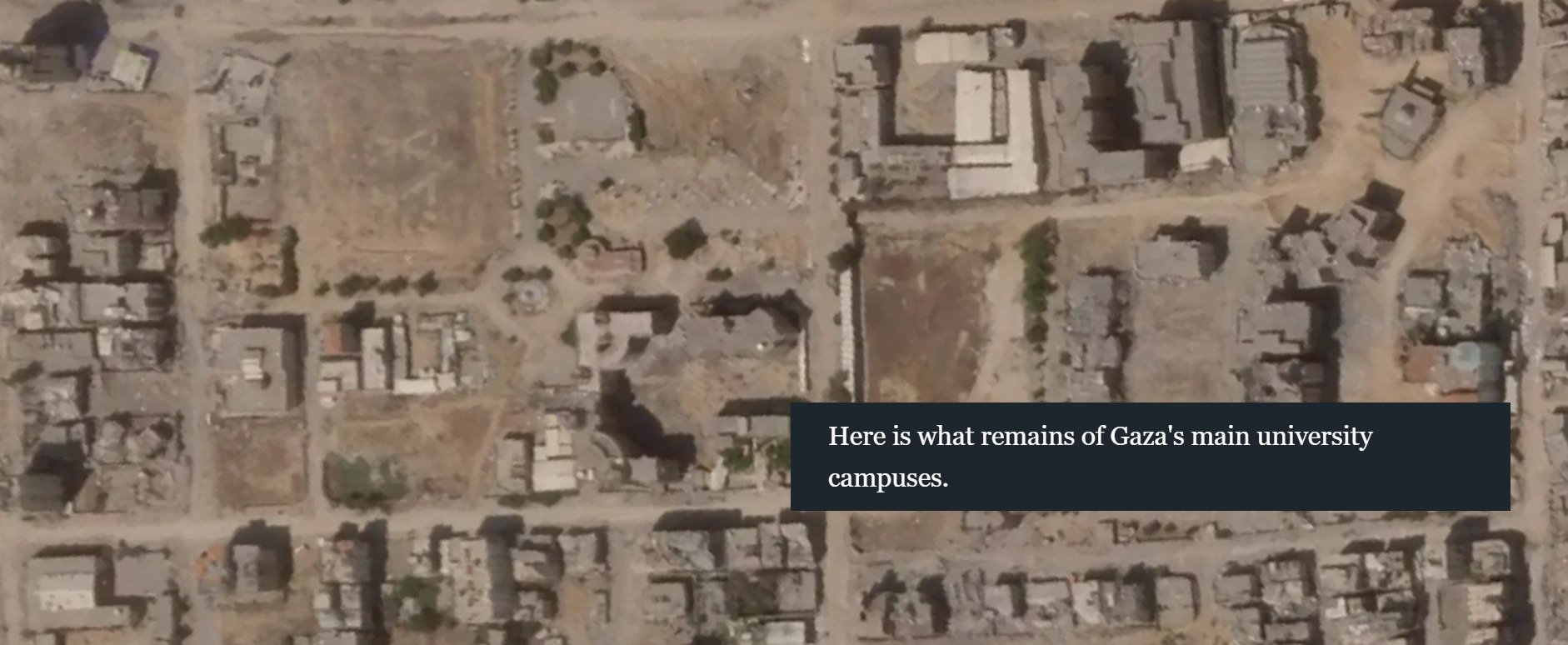
What remains of the once bustling student and university campuses in Gaza. Photo: Al Jazeera
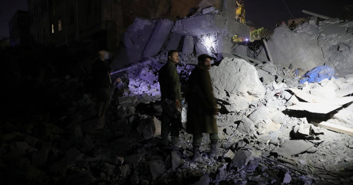
Attacks on hospitals
Al-Shifa Hospital, the largest medical complex in Gaza and one of the first hospitals to be hit.
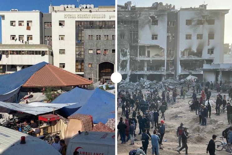
Al-Shifa Hospital before and after the attack. Photo: Al Jazeera
On November 15, 2023, the Israeli army raided the Al-Shifa Hospital, where thousands of Palestinians were sheltering, claiming that there were Hamas tunnels under the medical complex. In March, Israel raided the hospital again in search of Hamas militants. The attacks left the medical facility in serious disrepair.
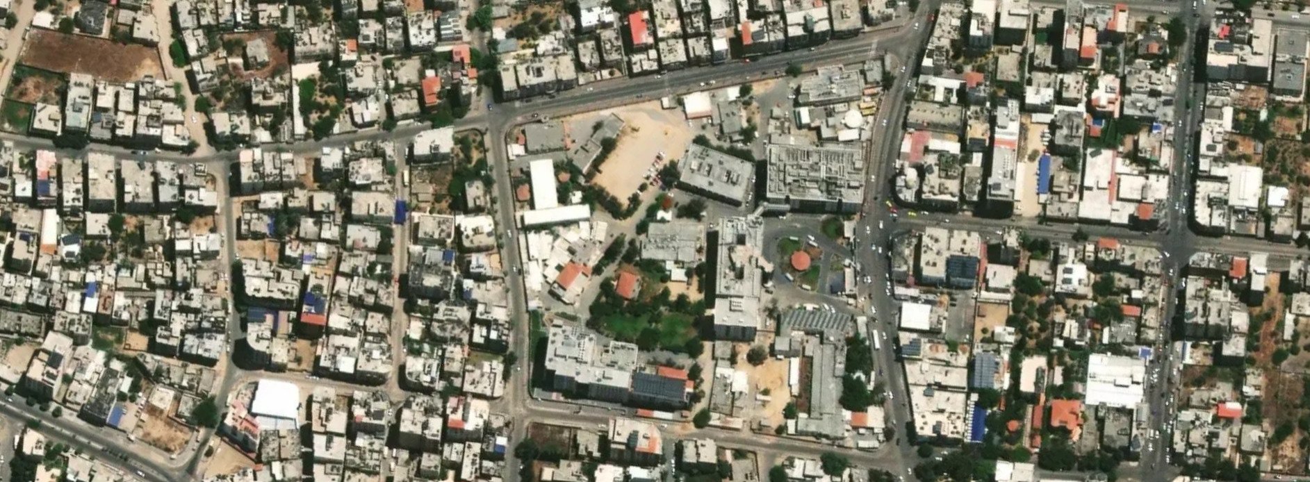
Al-Shifa Hospital complex before the fighting. Photo: Al Jazeera
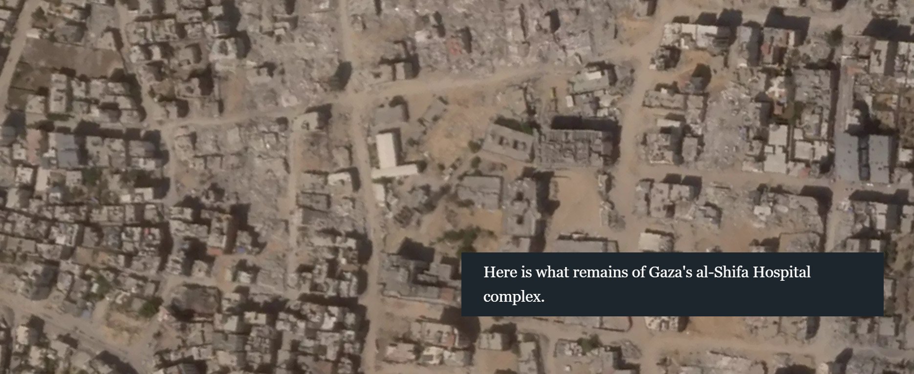
The current Al-Shifa Hospital complex. Photo: Al Jazeera
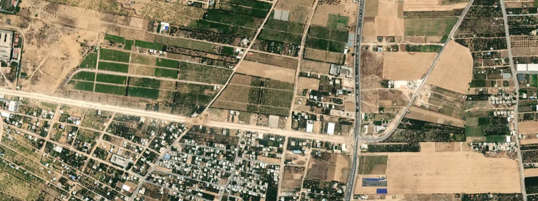
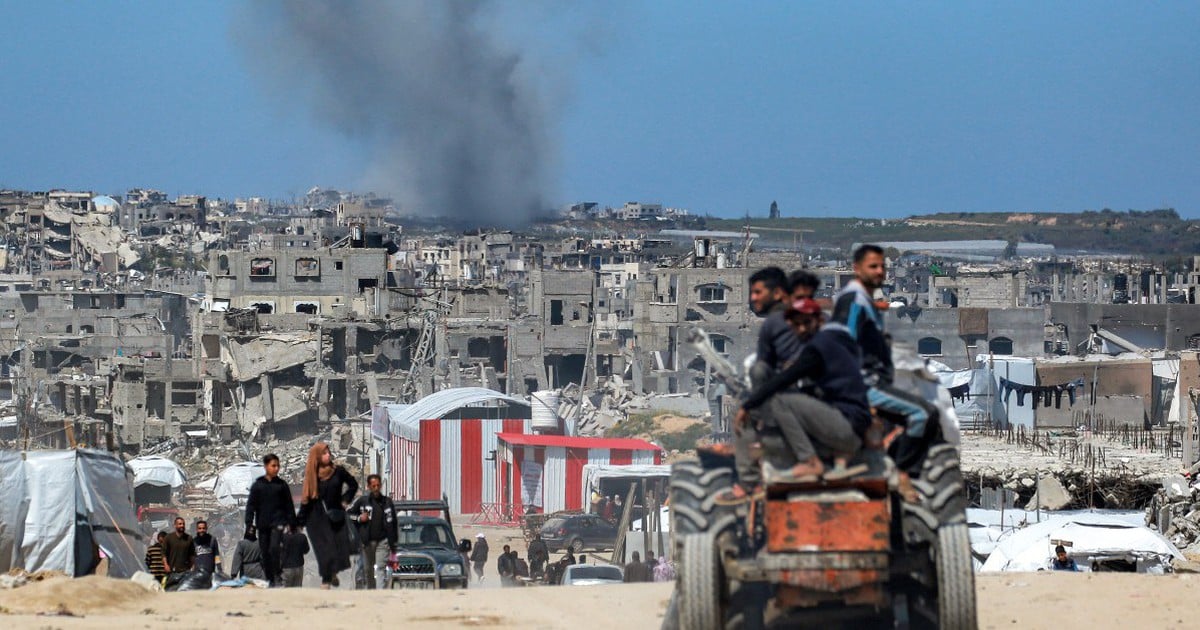
Split Gaza
In addition to the widespread destruction in Gaza, the enclave's borders have also been shrinking as Israel creates buffer zones.
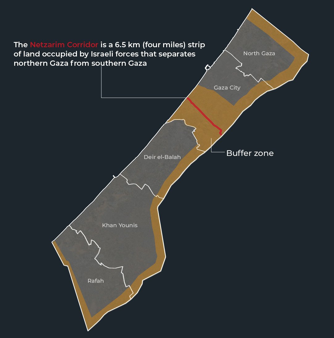
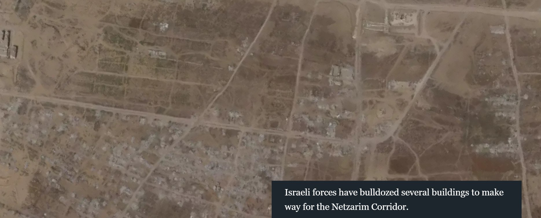
Netzarim Corridor, a new border with Gaza. Graphics: Al Jazeera
The Gaza Strip was pushed inward and a 1.5km wide strip, stretching 6.5km east to west from the Israeli border to the Mediterranean Sea, was called the Netzarim Corridor. Many buildings were destroyed to fortify this corridor.
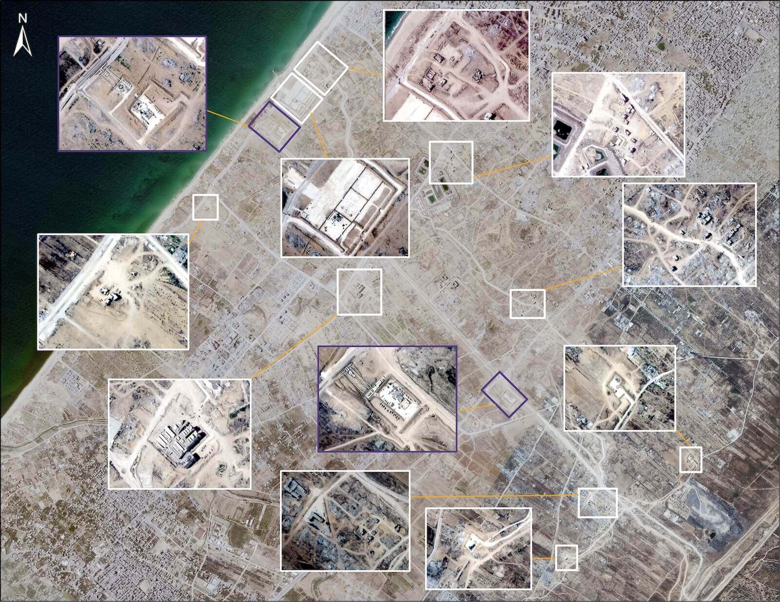
Satellite imagery shows some of the buildings that have been demolished to make way for the Netzarim Corridor, taken on August 7, 2024. Photo: Al Jazeera
Satellite image of an area before it was demolished to make way for the Netzarim Corridor. Photo: Al Jazeera
Satellite image of an area destroyed to make way for the Netzarim Corridor. Photo: Al Jazeera
Destruction of agricultural land
Further south, in central Gaza, lies Deir el-Balah, one of Gaza's main agricultural centers, famous for its cultivation of oranges, olives and especially dates.
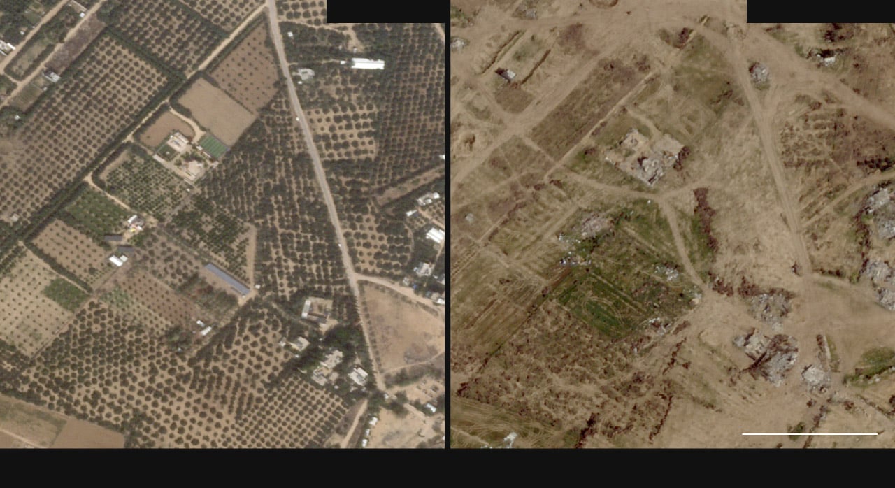
Farms in the Maghazi region before and after destruction. Photo: Washington Post
But now, farms, roads and homes in these areas are also heavily damaged.
Nguyen Khanh (according to AJ, WP)
Source: https://www.congluan.vn/nhung-hinh-anh-cho-thay-su-hoang-tan-cua-gaza-sau-mot-nam-chien-su-post315785.html
![[Photo] Prime Minister Pham Minh Chinh receives CEO of Standard Chartered Group](https://vstatic.vietnam.vn/vietnam/resource/IMAGE/2025/4/2/125507ba412d4ebfb091fa7ddb936b3b)
![[Photo] Prime Minister Pham Minh Chinh receives Deputy Prime Minister of the Republic of Belarus Anatoly Sivak](https://vstatic.vietnam.vn/vietnam/resource/IMAGE/2025/4/2/79cdb685820a45868602e2fa576977a0)
![[Photo] Comrade Khamtay Siphandone - a leader who contributed to fostering Vietnam-Laos relations](https://vstatic.vietnam.vn/vietnam/resource/IMAGE/2025/4/3/3d83ed2d26e2426fabd41862661dfff2)


![[Photo] Special relics at the Vietnam Military History Museum associated with the heroic April 30th](https://vstatic.vietnam.vn/vietnam/resource/IMAGE/2025/4/3/a49d65b17b804e398de42bc2caba8368)


Comment (0)