
Commenting on typhoon Man-yi, before entering the East Sea as a super typhoon, meteorological experts said that interaction with cold air would cause the intensity and direction of the storm to change and weaken, so why did this phenomenon occur?
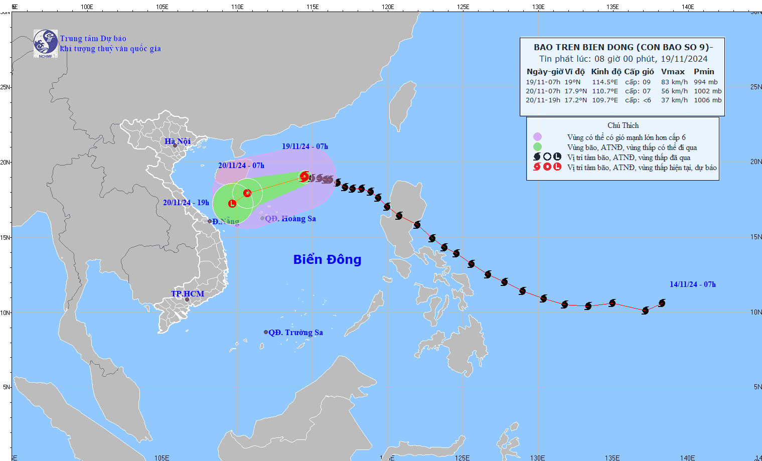
Storm No. 9 Man-yi entered the East Sea on the night of November 17 and early morning of November 18, with wind intensity reaching level 12, decreasing by 2 levels after passing Lu Dong Island (Philippines). Off the coast of the Philippines, storm Man-yi has reached super typhoon level.
Upon entering the East Sea, in just over a day, storm No. 9 continued to weaken rapidly. By the morning and afternoon of November 19, storm No. 9 was only level 9 and weakened into a tropical depression in the evening of the same day; dissipating this morning (November 20), over the Central Central Coast.
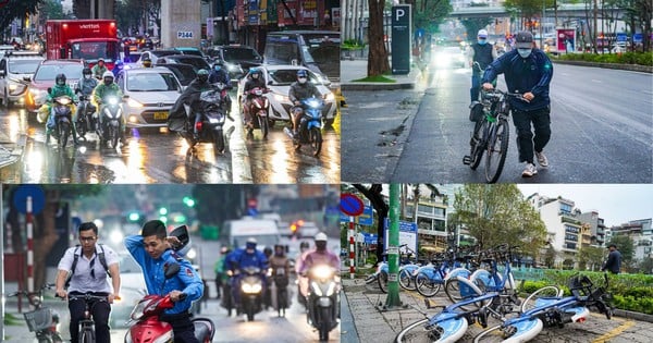
On November 18, a cold air mass swept into our country, just as storm Man-yi entered the East Sea. Experts previously predicted that storm Man-yi, when entering the East Sea, would interact with the cold air mass and weaken and dissipate quickly, with the possibility of not affecting our mainland.
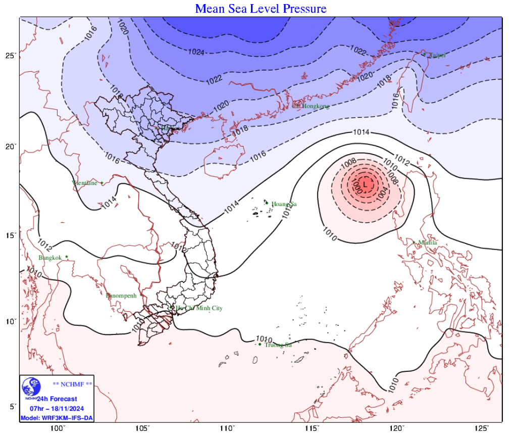
Explaining this phenomenon, experts said that the East Sea is located in a hot and humid tropical monsoon area. The storm season usually begins at the end of May, with August-November being the period of strong storm/tropical depression (ATND) activity.
In addition, Vietnam's climate is also strongly influenced by seasonal air masses with two main wind seasons: the Northeast monsoon (also known as cold air) lasting from November to April of the following year and the Southwest monsoon starting from May to October.
The period when strong storms often appear is when the southwest monsoon is also active, the sea surface is still warm, making storms often very strong, greatly affecting the places where the storms sweep through.
However, around November-December, the end of the rainy and stormy season, storms operating in the East Sea are often affected by cold air flowing down from the North. At this time, the interaction between cold air and storms/ tropical depressions causes very complex and unpredictable weather patterns.
The reason why storms will weaken when they encounter cold air
According to experts, in reality, there are a number of reasons why storms often weaken when they encounter cold air. Specifically, storms need warm sea surface temperatures to develop, and need strong convection to transport moisture and energy from the sea surface to the upper atmosphere, maintaining energy for the storm to exist.
At the same time, cold air is usually drier than warm air. The reduced humidity of the air causes a lack of conditions necessary for convection to form, making it difficult for the storm to maintain its intensity.
Areas with cold air often have low sea surface temperatures, and storms lose the heat and energy needed to maintain their intensity.
In addition, normally storms entering the East Sea often have a trajectory moving in the West-Northwest direction. However, when there is a strong impact of cold air, this trajectory will be pushed down to the West and Southwest.
It is clear that storm Man-yi, when entering the East Sea, moved in a West, then West Northwest direction. When moving to the Hoang Sa archipelago, the trajectory of storm No. 9 was pushed to the Southwest, entered the sea area of the Central Central region and gradually dissipated.
However, there are also cases where, even though the storm weakens, the interaction with cold air can cause the storm to cause more rain, especially in the Central region. Part of the reason is the terrain of the Truong Son mountain range, and because weakened storms often move more slowly, they have more time to pour rain. Typically, at the end of October, storm No. 6 Tra Mi , although its intensity weakened, caused exceptionally heavy rain when moving inland, especially when combined with cold air moving in. This is also the reason why a storm that weakens into a tropical depression causes very heavy rain that lasts for a long time, leading to flooding, landslides, etc.
In addition, there are also cases where the storm interacts with cold air and becomes stronger. According to experts, this case is when cold air (essentially an extratropical high pressure system, cold and dry) approaches the storm, causing the temperature and pressure contrast to increase. This contrast causes convection to increase and makes the storm stronger.
But as cold air begins to penetrate the storm, it weakens rapidly.
However, experts say that this is just theory and requires further research from practice to analyze and test.
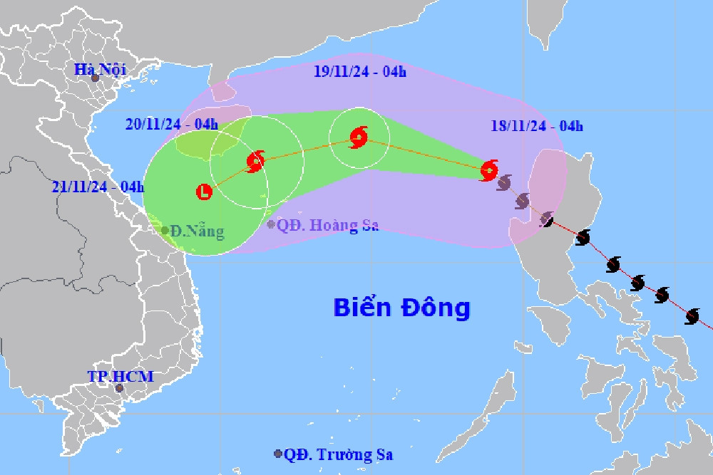
Storm No. 9 enters the East Sea, meets cold air weakening in the Central Central Coast

La Nina develops unexpectedly, coldest air in the second half of December
Source: https://vietnamnet.vn/ly-giai-bat-ngo-ve-bao-khi-gap-khac-tinh-khong-khi-lanh-2343422.html


![[Photo] Overcoming all difficulties, speeding up construction progress of Hoa Binh Hydropower Plant Expansion Project](https://vstatic.vietnam.vn/vietnam/resource/IMAGE/2025/4/12/bff04b551e98484c84d74c8faa3526e0)


![[Photo] Closing of the 11th Conference of the 13th Central Committee of the Communist Party of Vietnam](https://vstatic.vietnam.vn/vietnam/resource/IMAGE/2025/4/12/114b57fe6e9b4814a5ddfacf6dfe5b7f)


Comment (0)