
According to the National Center for Hydro-Meteorological Forecasting, after two days of intense heat, with temperatures exceeding 40 degrees Celsius in many places, tonight, many places in the North will experience scattered showers and thunderstorms.
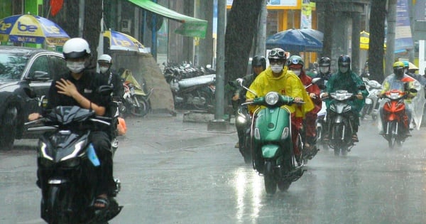
However, the "cooling" rain did not last long. During the day, the area continued to be hot and extremely hot.
Specifically, the North is hot and extremely hot with the highest temperature commonly 35-38 degrees Celsius, some places over 38 degrees Celsius, the lowest relative humidity commonly 45-60%.
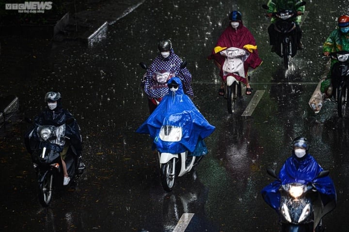
Many places in the North will experience scattered showers and thunderstorms tonight. (Illustration photo: Dac Huy)
Thanh Hoa to Phu Yen maintains a hot and sunny weather pattern, some places are especially hot with the highest temperature commonly 36-39 degrees Celsius, some places above 39 degrees Celsius, the lowest relative humidity commonly 35-50%.
Heat and severe heat in the North and the area from Thanh Hoa to Phu Yen is likely to last until May 23.
From the evening and night of May 23-28, these areas will have scattered showers and thunderstorms. After this thunderstorm, the hot weather will return.
The National Center for Hydro-Meteorological Forecasting said that people in the North and Central regions of our country will experience a hotter and more intense summer than in 2022 when the number of hot days in May, June, and July is forecast to appear more frequently and more severely than in the same period in 2022. The average temperature across the country during this period is also generally about 0.5 degrees Celsius higher.
Mr. Mai Van Khiem, Director of the National Center for Hydro-Meteorological Forecasting, said that the El Nino phenomenon may appear in the second half of summer 2023 and last until 2024 with a probability of about 70 - 80%.
El Nino is the term used to describe the phenomenon of abnormal warming of the surface ocean water in the central and eastern equatorial Pacific Ocean, lasting 8-12 months or longer, usually occurring every 3-4 years, but sometimes more or less frequent.
According to Mr. Khiem, under El Nino conditions, in most regions of the country, the average monthly temperature tends to be higher than normal, heat waves may be more frequent and more severe, and there is a possibility of many records for absolute maximum temperatures. Storm and tropical depression activities may not be as numerous but will be concentrated in the middle of the season, with more unusual characteristics, both in intensity and trajectory.
It is worth noting that El Nino often causes rainfall deficits in most areas of the country, with a common level of 25 to 50%, so there is a high risk of local or widespread drought in places with high water demand for production and daily life, during the dry months of 2023.
It is necessary to guard against low rainfall leading to drought, saltwater intrusion, and water shortages nationwide in the first months of 2024. The most obvious example of the impact of El Nino was causing record droughts and saltwater intrusions in 2015-2016 and 2019-2020.
According to Mr. Khiem, under El Nino conditions, rainfall tends to decrease, but records for the heaviest rainfall in 24 hours may appear.
"With the high possibility of El Nino, we need to review and assess the demand for water for production and daily life to adjust plans accordingly, especially for the summer-autumn crop in the North Central and Central regions, or areas with large tourism development activities in the dry months of 2023. Reservoirs also need to consider adjusting their operation and production plans to cope with the risk of rainfall deficit under El Nino conditions.
Besides coping with water shortages and droughts in El Nino conditions, we must not lose our vigilance against the possibility of unusual floods and rains as happened in previous El Nino years," Mr. Khiem emphasized.
Nguyen Hue
Useful
Emotion
Creative
Unique
Wrath
Source
![[Photo] Overcoming all difficulties, speeding up construction progress of Hoa Binh Hydropower Plant Expansion Project](https://vstatic.vietnam.vn/vietnam/resource/IMAGE/2025/4/12/bff04b551e98484c84d74c8faa3526e0)


![[Photo] Closing of the 11th Conference of the 13th Central Committee of the Communist Party of Vietnam](https://vstatic.vietnam.vn/vietnam/resource/IMAGE/2025/4/12/114b57fe6e9b4814a5ddfacf6dfe5b7f)


Comment (0)