
Although not located in the coastal area of the Mui Ne National Tourist Area planned by the Government from Phan Thiet city to Phan Ri Cua - Tuy Phong, according to Decision No. 1772/QD-TTg (2018), with the development perspective stated: "Developing Mui Ne National Tourist Area in close connection with tourist destinations in Binh Thuan province, in the South Central Coast and Southeast tourist areas".
Including the southern coastal area of Binh Thuan from Phan Thiet to Ba Ria - Vung Tau. From here, looking back at the history of the primitive roads that still hold an important position for the economic and defense development of a land and especially located in the tourist triangle linking Binh Thuan - Lam Dong - Ho Chi Minh City.
Nature and isolation
Empathy sometimes makes it easy for the human soul to recognize strange things, wonderful emotions that are sometimes almost hidden by the noise and bustle of life. There are times when I hesitate in the vast space of the sea and sky, slowly walking barefoot on the beaches here and there in Da Nhay, Hon Lan, Tam Tan, Doi Duong, Cam Binh... to appreciate the smooth grains of sand still warm with the salty taste. In La Gi, it is difficult to recognize the different phenomena of the seasons, but with the signs of movement, especially in the winter, it is easy to be startled by the waves of high and low tides. A little offshore, the waves toss high like the manes of a herd of white horses chasing each other hastily to the shore.
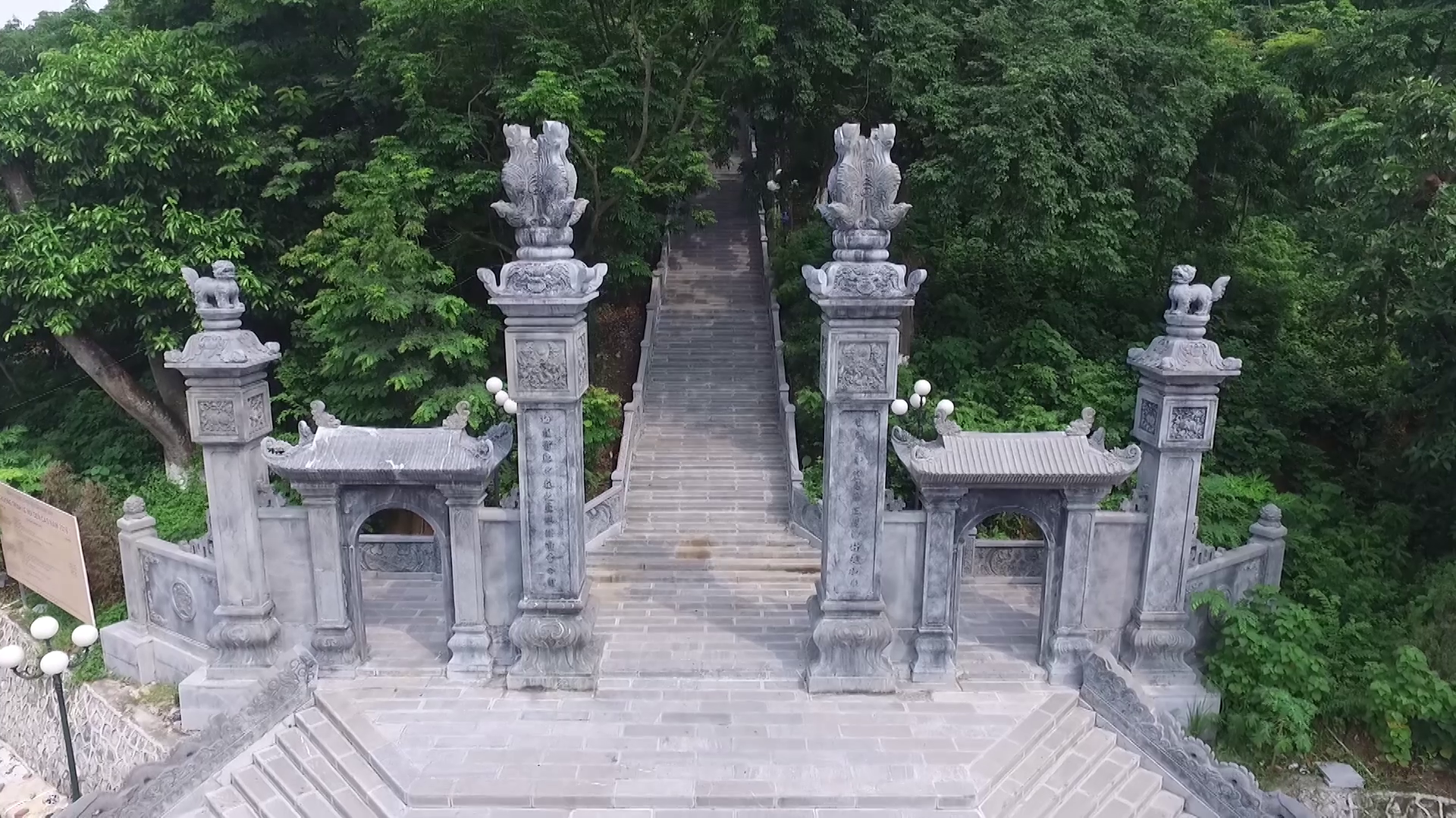
When talking about the sea of our homeland, we must mention Hon Ba with its lonely appearance. I prefer to call this place name rather than Ba Chua Ngoc Island or Thien YA Na… because it is closely associated with and has been transformed into the ups and downs of life of fishermen in this coastal area for hundreds of years. Although the story is influenced by the legend of the Cham god Poh Yang Ina Nagar incarnated through the image of a piece of agarwood with the power to create a land that gives birth to human life. But for ancient Vietnamese fishermen, it is considered the image of the Mother of the land with a spirit of aspiration in the worship of Vietnamese Mother Goddess… through rituals, prayers, and offerings.
I remember the path with the footprints of pedestrians from the countryside of La Gi to the city of Phan Thiet, perhaps the primitive main road along the coast, through caves, through fields... still remaining traces from the mid-19th century during the Nguyen Dynasty through the post stations from Phan Thiet to Thuan Ly (Xom Tram), Thuan Trinh (Tam Tan), Thuan Phuoc (Phuoc Loc), Thuan Phuong (Phu Mi) - and Thuan Bien station (Mo Xoai - Ba Ria) in Bien Hoa is the end point of the coastal official road. The post stations in Binh Thuan all take the word Thuan at the beginning of the station name, meaning smoothness and harmony. Gradually, they were replaced by places like fishing villages, Doc Can fishing village, Quan Thung, Xom Tram, Bung Co Ke, Bau Tram, Thanh My, Cua Can, Dong Trang, Tam Tan branch, Tan Long ferry... Perhaps the most civilized means of transport at that time was from 1888, when the French established a steel line (information) connecting from the north to the south along these stations, but in Binh Thuan it was not until 1894 that it was connected to the stations. Also on the old land, the old villages have changed with roads, from the names and the roads that once carried the burden of many generations of hardship, but why are hearts still so peaceful and innocent?
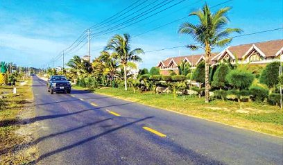
The road is a step forward
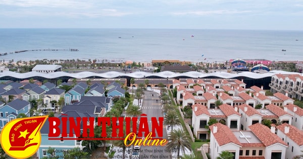
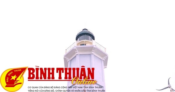
Now the roads are truly paved, spacious... Sitting in the car, just taking a nap and listening to the wind from the corner of Ke Ga cape, I realized a magical natural wonder. Nowadays, with means of transport, distance is not calculated in kilometers but only based on time, hours, minutes. Villas and resorts with strong Western features are growing up by the sea and the forest. The rocks that seem to be pushed by the waves and tilted to the shore are also the image of a herd of wild horses rearing up on the mysterious "red soil" sand dunes like the legend of Cam Ke Son in Tan Thanh land... Hundreds of years ago, the land strip of Ke Ga cape, Khe Ca with terrain close to the sea waves, was a thorny forest, rocky cliffs, undulating, only inhabited by wild animals such as leopards and tigers. It was not until the last decade of the 20th century that DT.712 was extended from National Highway 1A (Tan Thuan intersection), then opened the DT.719 and DT.719B sections to Thuan Quy - Tien Thanh today.
In La Gi/Ham Tan, there is a road from Truong Tien (Tan Nghia) intersection of National Highway 1A, one branch to Song Phan - Tanh Linh station in 1927 and one branch down to La Gi beach, 20 km long, called the envoy road. When Binh Tuy province was established (1956), it was changed to Provincial Road 2 and a few years later, the La Gi - Xuyen Moc road, 30 km long, or Provincial Road 23, was opened. This road is part of National Highway 55 through Ham Tan, La Gi, Tanh Linh (Binh Thuan), Lam Dong, from Ba Ria to the end point of Bao Loc city, 217 km long...
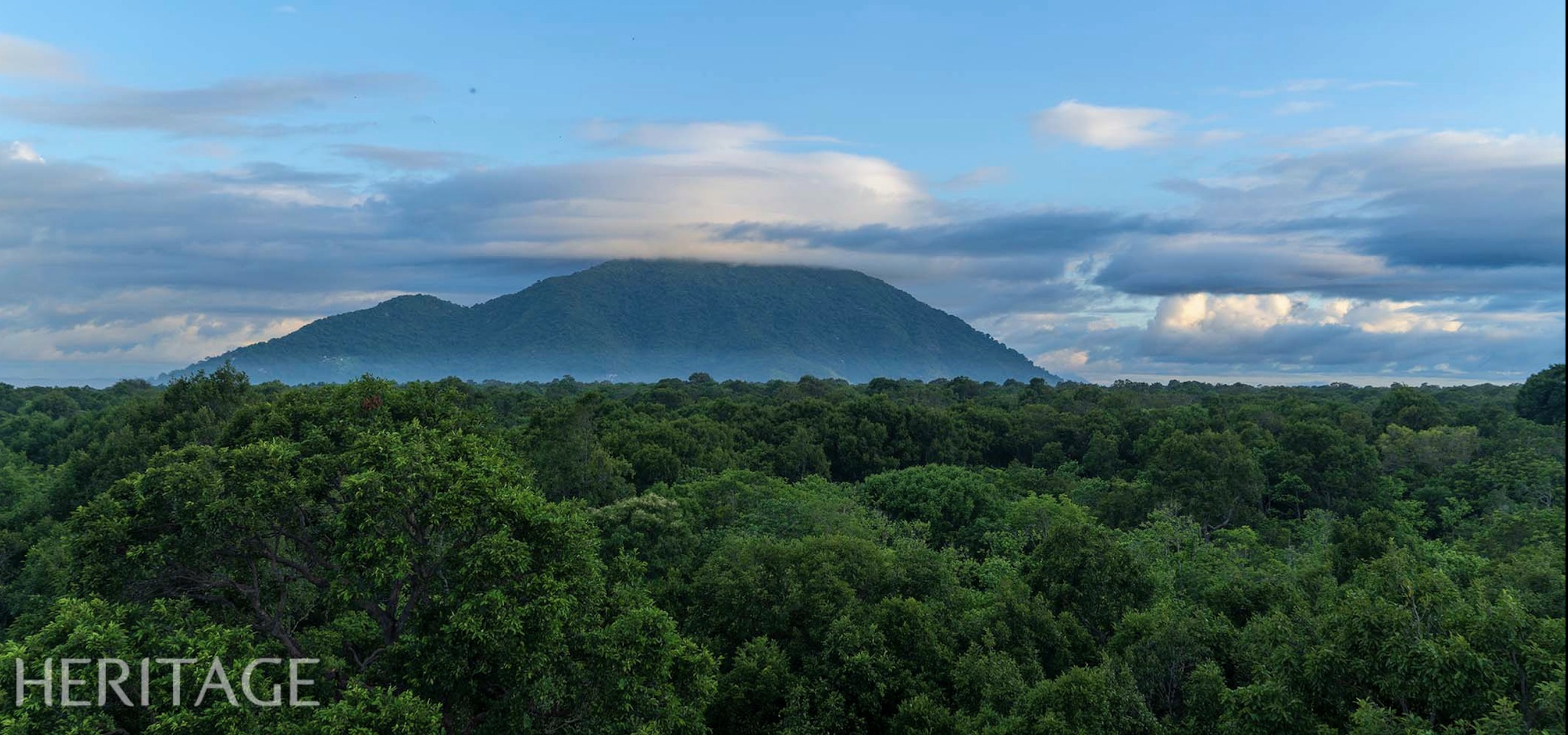
The southern gateway of Binh Thuan is a place with rich tourism potential, typical of regional cultural identity. That is the ancient village of Cu Mi Ha (Binh Chau) connecting with Cu Mi Thuong (Pho Tri, Tan Thang today) belonging to Phuoc Thang commune, Ham Tan district (Binh Thuan). After 1954, during the Republic of Vietnam period, Cu Mi (Ha) village was changed to Binh Chau commune, Xuyen Moc district, Phuoc Tuy new province. But before 1975, the natural reserve forest surrounding the Hot Spring, which was more than 1.2 km2 wide, belonged to Binh Tuy province. In 1928, the French discovered a mineral water source with special value for health recovery, especially natural landscapes, with the name of Dr. Sallet's Indochina Research project as "Cu Mi Stream", the old name of this land. The book Local History of Binh Tuy Province (Republic of Vietnam - 1974) with the page of local relics and landscapes records this place name as "Hiep Hoa Hot Spring" in Hiep Hoa commune, Ham Tan district (Binh Tuy).
In 1995, the Government's decision determined the administrative boundary between the two provinces of Binh Thuan and Ba Ria - Vung Tau, based on the top of May Tao mountain following the western branch of Ta Rang stream along Du Du river, then Co Nhi river (now Chua river, Thang Hai commune) flowing into the East Sea. Thus, the Suoi Nuoc Nong area is located on the other side of the new boundary, in Xuyen Moc district, Ba Ria - Vung Tau province.
The ancient relationship through the legend of Hon Ba in the local folklore of Binh Tuy is quite popular, the character Ba is the incarnation of the Goddess Thien Y and the story of a troubled love affair. Her anger caused her to knock over a pot of boiling water, which is the trace of Suoi Nuoc Nong (Binh Chau) and Ong, the husband with late remorse, wandered to the high mountains of Ong Mountain (Tanh Linh)...
Chorus from the streets
In 1809, France built the southern colonial road No. 1, including the provinces from Quang Nam to Khanh Hoa, Binh Thuan, later National Highway 1A. But the explanation according to the 12th grade textbook (2009) unified the name National Highway 1 from Lang Son to Ca Mau (*). From here, the roads, from coastal small roads with many names such as quan bao/ quan lo/ cai quan/ thien ly... and the post station system have returned to the past. Mountain roads due to rugged terrain, steep book trade, only developed locally, through populated areas. But that was the foundation for the local road network. In Binh Thuan, in 1896, when France built colonial road No. 1, it did not follow the coastal route south of Phan Thiet, that is, the section from Thuan Ly post station (Xom Tram) to Thuan Bien station (Bien Hoa), but replaced it with a new road from Phan Thiet straight to Bien Hoa. With nearly 200 km of National Highway 1A, it awakens a remote mountainous land and over the years has transformed with a new look.
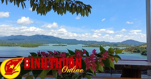
The North-South National Highway 1 creates a chorus, converging local and regional branches and from the old railway to the parallel trans-Vietnam highway. In the south of the coastal area of Binh Thuan, there is National Highway 55, inter-provincial and district roads that have become "tourist routes" to and from, connecting a series of famous landmarks with the amazing landscapes of the sea. If you choose to follow the beautiful, peaceful coastal road to feel the poetic and charming space, this is a new route opened in recent years. From Vung Tau, passing Long Hai and going to Phuoc Hai, Loc An estuary with unnumbered ships. Then you will be surprised by the sky and seascape of Ho Tram, Ho Coc, the primeval forest of Suoi Nuoc Nong Binh Chau... and set foot on Binh Thuan land, connecting with National Highway 55 straight to La Gi town. Next to it is the Cu Mi village beach with nearly ten kilometers, many streams winding through the mangrove forest, with the advantage of developing diverse types of eco-tourism...
People say that transportation is the lifeblood of a land, which is not wrong. Wherever the road goes, villages and residents develop accordingly and become more and more modern. Therefore, the official road/official road during the Nguyen Dynasty, for the need of communication and transportation, set up many stations and gates to open routes for migrants to explore and conquer the wild and heroic land of the South. Obviously, it is difficult to have the same concept, even surprised by the simple view of writer Lu Xun more than a century ago when he said: "In fact, there are no roads on the ground, people just walk forever to create roads".
(*) There are many different opinions, calling National Highway 1A from Lang Son to Ca Mau 2,300km long, then there must be National Highway 1B, 1C. But according to the 12th grade textbooks - GDVN Publishing House and in the Vietnam Geography Atlas from 2009, as well as in Decision 3937/QD-TCĐVN dated December 1, 2015, there is no National Highway 1A but only National Highway 1.
Source
![[Photo] President Luong Cuong receives Lao Prime Minister Sonexay Siphandone](https://vstatic.vietnam.vn/vietnam/resource/IMAGE/2025/4/17/337e313bae4b4961890fdf834d3fcdd5)
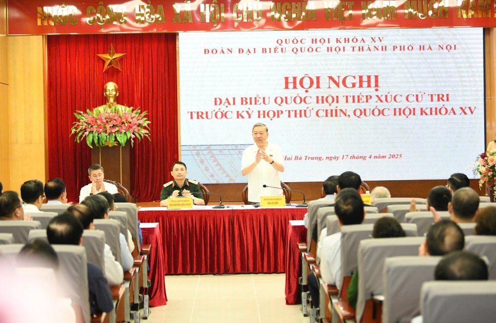
![[Photo] General Secretary To Lam attends conference to meet voters in Hanoi city](https://vstatic.vietnam.vn/vietnam/resource/IMAGE/2025/4/17/889ce3da77e04ccdb753878da71ded24)
![[Photo] Many practical activities of the 9th Vietnam-China border defense friendship exchange](https://vstatic.vietnam.vn/vietnam/resource/IMAGE/2025/4/16/3016ed3ef51049219574230056ddb741)
![[Photo] North-South Expressway construction component project, Bung - Van Ninh section before opening day](https://vstatic.vietnam.vn/vietnam/resource/IMAGE/2025/4/17/ad7c27119f3445cd8dce5907647419d1)


![[Photo] Opening of the 4th Summit of the Partnership for Green Growth and the Global Goals](https://vstatic.vietnam.vn/vietnam/resource/IMAGE/2025/4/16/488550ff07ce4cd9b68a2a9572a6e035)


![[Video] Viettel officially puts into operation the largest submarine optical cable line in Vietnam](https://vstatic.vietnam.vn/vietnam/resource/IMAGE/2025/4/17/f19008c6010c4a538cc422cb791ca0a1)


Comment (0)