
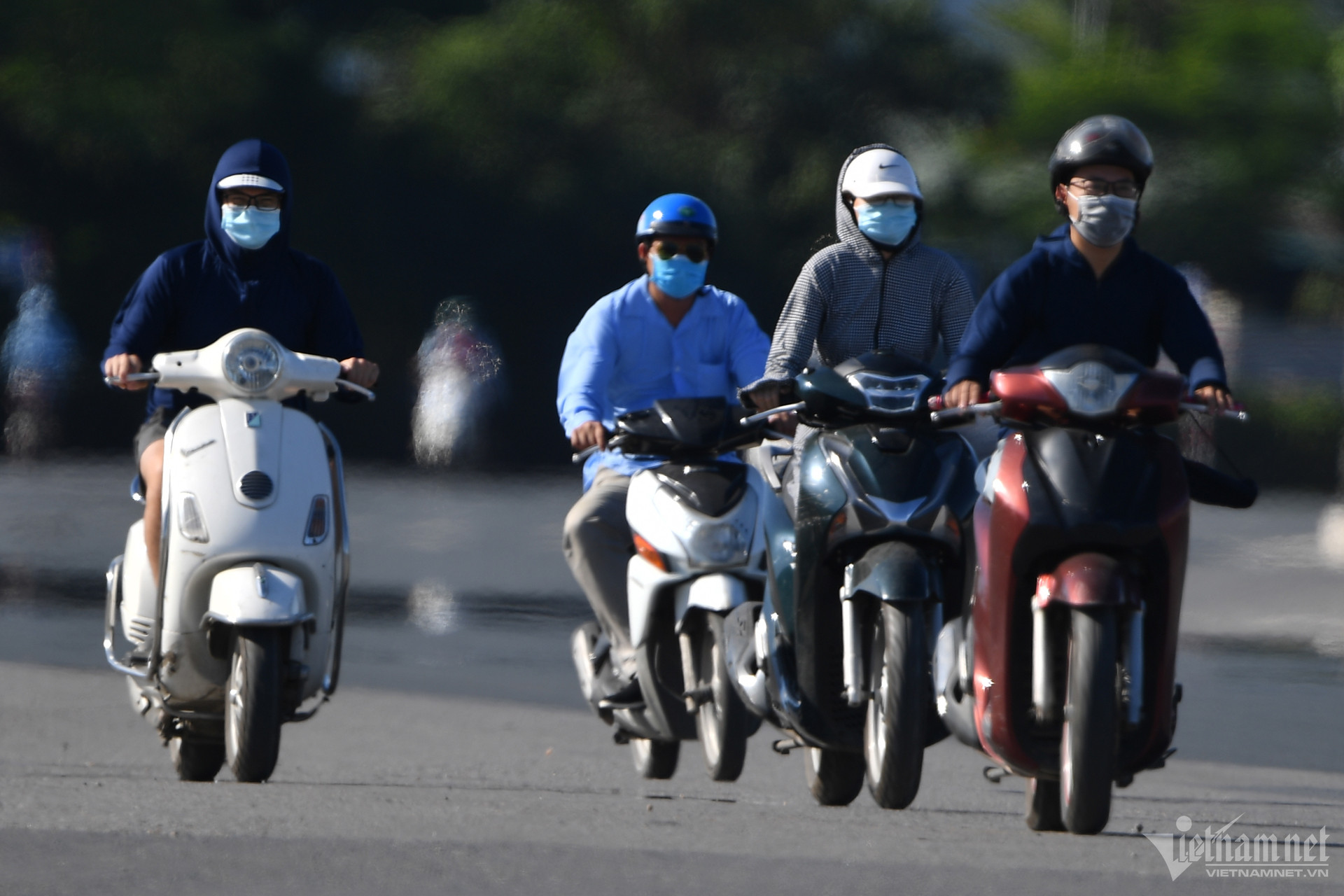
According to the National Center for Hydro-Meteorological Forecasting, today (June 13), in the midlands and deltas of the North, Hoa Binh and the Central region, there will be hot weather, some places will be extremely hot with temperatures at 1pm, some places will be over 36 degrees such as: Hoa Binh City 37.6 degrees, Lang (Hanoi) 37.2 degrees, Phu Ly (Ha Nam) 37.7 degrees, Nho Quan (Ninh Binh) 36.9 degrees...; Tinh Gia (Thanh Hoa) 37.2 degrees, Ha Tinh City 37.4 degrees, Tuyen Hoa (Quang Binh) 37.6 degrees, Tam Ky (Quang Nam) 37.5 degrees, Hoai Nhon (Binh Dinh) 38.2 degrees,...
It is forecasted that on June 14, the midlands and the Northern Delta, the south of Son La and Hoa Binh will continue to experience hot weather and severe heat with the highest temperature commonly ranging from 35-38 degrees, some places above 38 degrees; the lowest relative humidity is 50-60%. From June 15, the heat will tend to ease.
For the area from Thanh Hoa to Binh Thuan, on June 14-15, the heat will increase, some places will reach a particularly severe level with the highest temperature from 36-39 degrees, some places over 39 degrees; the lowest relative humidity is 50-55%. Warning, the heat in the Central region is likely to last for many days to come.
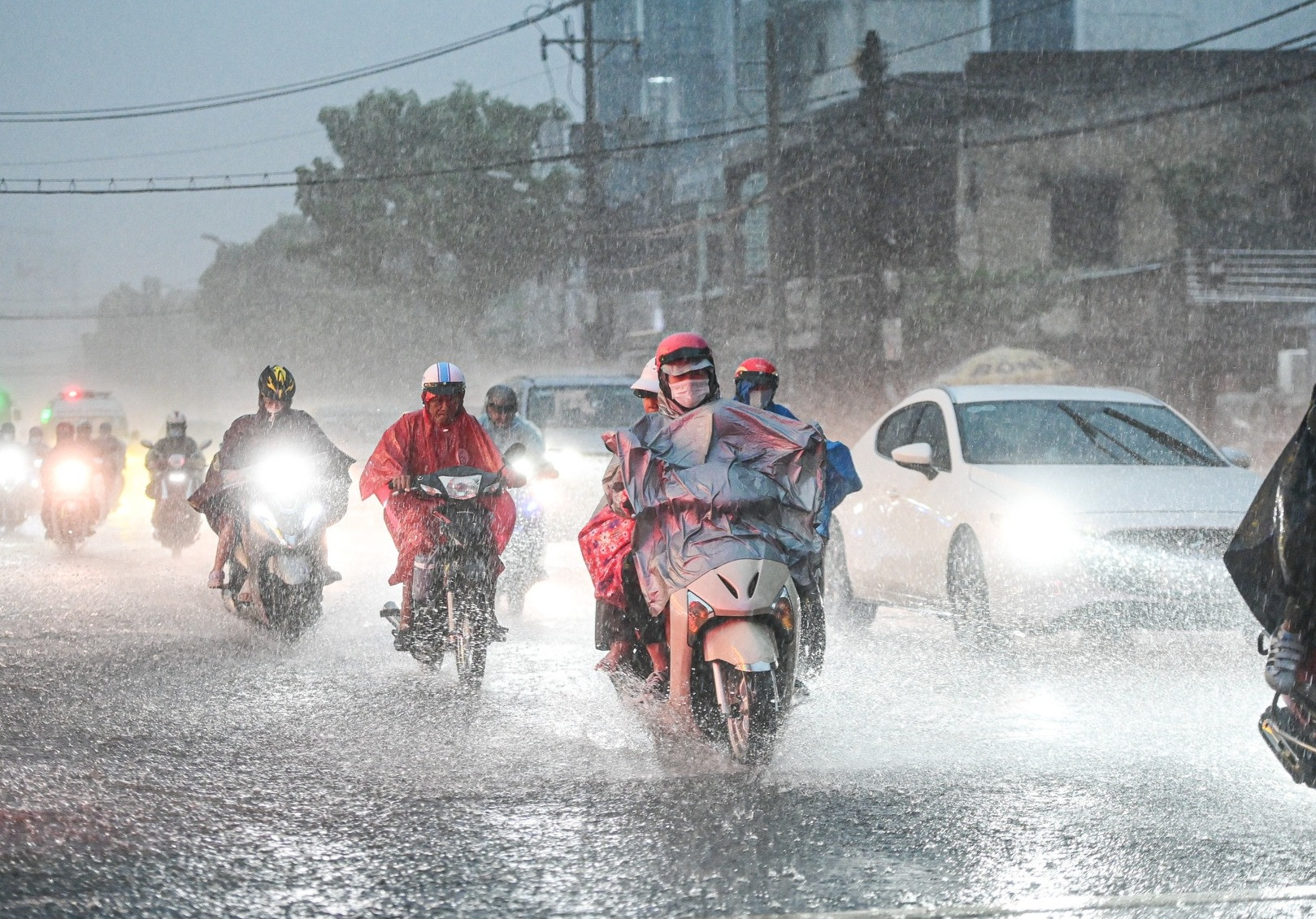
On June 13-14, there will be hot weather. In the North, there will be showers and thunderstorms in some places in the late afternoon and at night. In mountainous areas, there will be scattered showers and thunderstorms in some places.
Notably, from the night of June 14-16, the weather in the North is likely to have moderate rain, heavy rain and thunderstorms, locally very heavy rain, in which, the mountainous and midland areas of the North will have common rainfall of 40-100mm, some places over 150mm; other places 20-40mm, some places over 80mm; heavy rain will be concentrated at night and in the morning. In addition, from June 17-20, the mountainous areas of the North will have scattered showers and thunderstorms, concentrated in the late afternoon and at night.
Previously, Mr. Nguyen Van Huong, Head of the Weather Forecast Department, also stated that around June 14-16 (and possibly extending to June 17), the Northern region is likely to experience a widespread period of moderate to heavy rain again. In particular, the midlands and mountainous areas may experience moderate to heavy rain again. These are also the rain-causing conditions that often appear during this June period and localities need to proactively implement response plans, closely monitor forecasts and warnings in the coming time.
Particularly for the Central Highlands and Southern regions, in the coming time, there will likely be more rain, even increasing in both quantity and area.
According to the weather forecast for the mid-June week (June 11-20) in Ho Chi Minh City by the Southern Hydrometeorological Station, the low pressure trough with its axis passing through the Northern region is gradually weakening. The southwest monsoon will dominate the area with an average intensity lasting for the next 10 days and will tend to gradually increase in activity. Above, the subtropical high pressure will continue to encroach on the West, around June 15-16, forming a wind convergence zone above 6,000m right above the area and from June 17-20, the southwest monsoon will operate up to 6,000m.
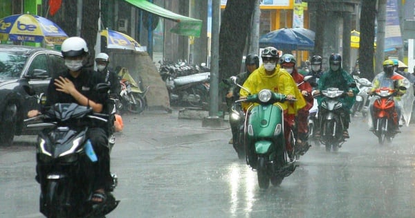
With the above situation, from now until June 14, Ho Chi Minh City area will have sunny days, scattered showers and thunderstorms in the evening and at night, locally with moderate rain, heavy rain and thunderstorms.
In particular, from June 15-20, rain will increase in both area and volume, with scattered to widespread rain; some places will have moderate, heavy to very heavy rain and thunderstorms. During thunderstorms, it is necessary to be on guard against tornadoes and strong gusts of wind that can be dangerous to people and cause property damage.
During this period, the average temperature in Ho Chi Minh City is 0.2-0.7 degrees higher than the average of many years (TBNN) in the same period, with the lowest level of 24-27 degrees and the highest of 30-34 degrees.
Total weekly rainfall is higher than the average, generally ranging from 80-180mm. Beware of heavy rain that may cause deep flooding on some roads, likely to occur between June 15-20.
Storms/Tropical Degeneration Likely to Appear in Early July
The National Center for Hydro-Meteorological Forecasting has just made an assessment of the weather situation for the next month (June 11 - July 10, 2024).
Specifically, the average temperature across the country is generally 0.5-1 degree Celsius higher than the average; in the South Central, Central Highlands and Southern regions, it is about 1 degree higher. Rainfall is approximately the same as the average for the same period.
The meteorological agency warns that during this period, there is a possibility of storms/tropical depressions appearing in the East Sea, with a higher probability of occurring in early July 2024.
This is also the period of continued heat in the Northern and Central regions.
Also in the next month, the Northern and North Central regions will have many days of showers and thunderstorms, including the possibility of some widespread moderate and heavy rain lasting about 2-4 days. In the Central Highlands and Southern regions, the southwest monsoon continues to operate strongly with moderate to strong intensity, with rain likely to increase in both area and concentrated rainfall in the second half of the forecast period.
According to the meteorological agency, dangerous weather phenomena such as storms/tropical depressions and southwest monsoons are likely to cause strong winds and large waves, affecting activities in the East Sea. Strong thunderstorms accompanied by tornadoes, lightning, hail and strong gusts of wind can greatly affect production and people's activities. In the Central region during this period, there is still a possibility of little rain and hot weather, especially in the Central and South Central regions, leading to drought, water shortages and a very high risk of fire and explosion.

Source: https://vietnamnet.vn/mien-bac-lai-sap-mua-lon-trung-bo-nang-gat-trien-mien-2291023.html
![[Photo] Overcoming all difficulties, speeding up construction progress of Hoa Binh Hydropower Plant Expansion Project](https://vstatic.vietnam.vn/vietnam/resource/IMAGE/2025/4/12/bff04b551e98484c84d74c8faa3526e0)


![[Photo] Closing of the 11th Conference of the 13th Central Committee of the Communist Party of Vietnam](https://vstatic.vietnam.vn/vietnam/resource/IMAGE/2025/4/12/114b57fe6e9b4814a5ddfacf6dfe5b7f)


Comment (0)