
The new "Lao Hue Bridge" was made of wood, not very durable, and had probably been repaired and rebuilt many times. Until after 1954, both the old-timers and the parishioners of An Lac parish on the other side of the bridge remembered that it was still a "nailed plank bridge", with many panels falling off the bridge surface; the handrails were made of temporary round cajuput trees, the beams were shaky, some had fallen off. The bridge was mainly for pedestrians or people carrying goods back and forth. Horse-drawn carriages did not use this bridge but instead used Ong Ta bridge. The bridge had no nameplate, some called it a plank bridge, some called it a wooden bridge ... It didn't matter when in reality this bridge no longer had its original important trading position.
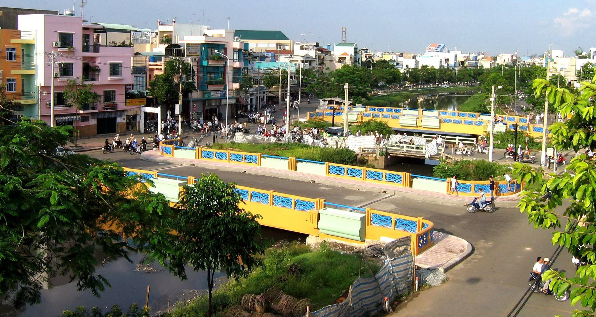
In July 2004, after completing bridges 1, 2, 3, 4, 5..., all the bridges upstream of Nhieu Loc - Thi Nghe canal were dismantled. In the photo: dismantling Ong Ta bridge, on both sides are bridge number 2 (left) and bridge number 3
PHOTO: TRAN TIEN DUNG
Around the end of the 1950s, the population on both sides of the bridge grew. Seeing that the bridge was unstable and dangerous, the Tan Son Hoa Commune Council (Tan Binh District) demolished the old wooden bridge and built a new bridge made of concrete, cement mixed with 1x2 stone and gravel. The bridge was about 3-4 meters wide, more than ten meters long, with iron handrails and no pedestrian walkway. People, bicycles , motorbikes and horse carts shared the road.
Because the concrete was mixed with gravel and not paved, after a while, the surface cement layer gradually peeled off, revealing the gravel underneath. The people around called it the Sand Bridge. After that, it was repaired many times.
This bridge until 1975 was only an internal bridge in the area, dividing two communities, one side was the majority of the old Southerners on this side of the bridge and the other side was the Northerners from 1954 in An Lac area on the other side of the bridge. The demarcation is true and has concrete evidence. People who used to live on both sides of the bridge all know this "border" bridge with the "foot-to-foot, hand-to-hand" battles between the young men on both sides of the bridge, lasting for decades - since 1954.
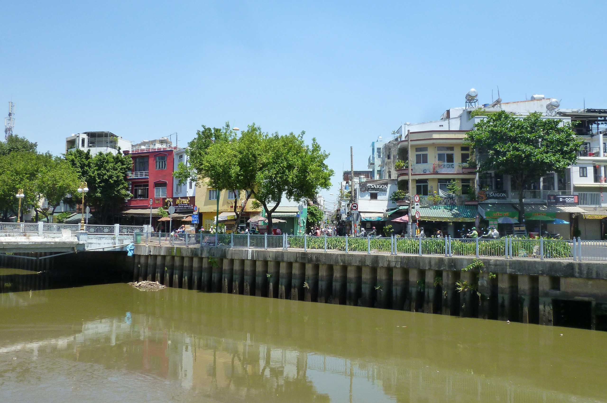
Bui Thi Xuan Street seen from An Lac area (now Ward 5, Tan Binh District). Before 2004, there was San bridge here. The bridge on the left of the photo is now bridge number 4.
PHOTO: CMC
In the late 1960s, I went to the foot of this bridge and saw two rusty iron gates at both ends, but they were still locked - I don't know who installed them. Rumor has it, though I don't know if it's true, that these two gates were put up to prevent teenagers from bumping into each other on both sides of the bridge. In fact, I know and have heard of bloody fights on this bridge between teenagers from both sides of the bridge.
Built at the same time in the early 1910s, another unnamed bridge across Huong Lo 16 (now Pham Van Hai) also had no name. Until after 1954, at first people called it Buc Bridge, then Duc Bridge or Concrete Bridge..., anyone could call it whatever. Later and recently it was called Ong Ta Bridge.
At first, Ong Ta bridge leading to Ong Ta market was also made of wood like San bridge on the other side. Before 1954, the area around these two bridges was like a "death zone". Viet Minh who went to the free zone (Ba Queo) were captured by the enemy, their heads were cut off and thrown into Nhieu Loc canal. Conversely, the French and Vietnamese traitors who were punished were also cut off and thrown into the canal.
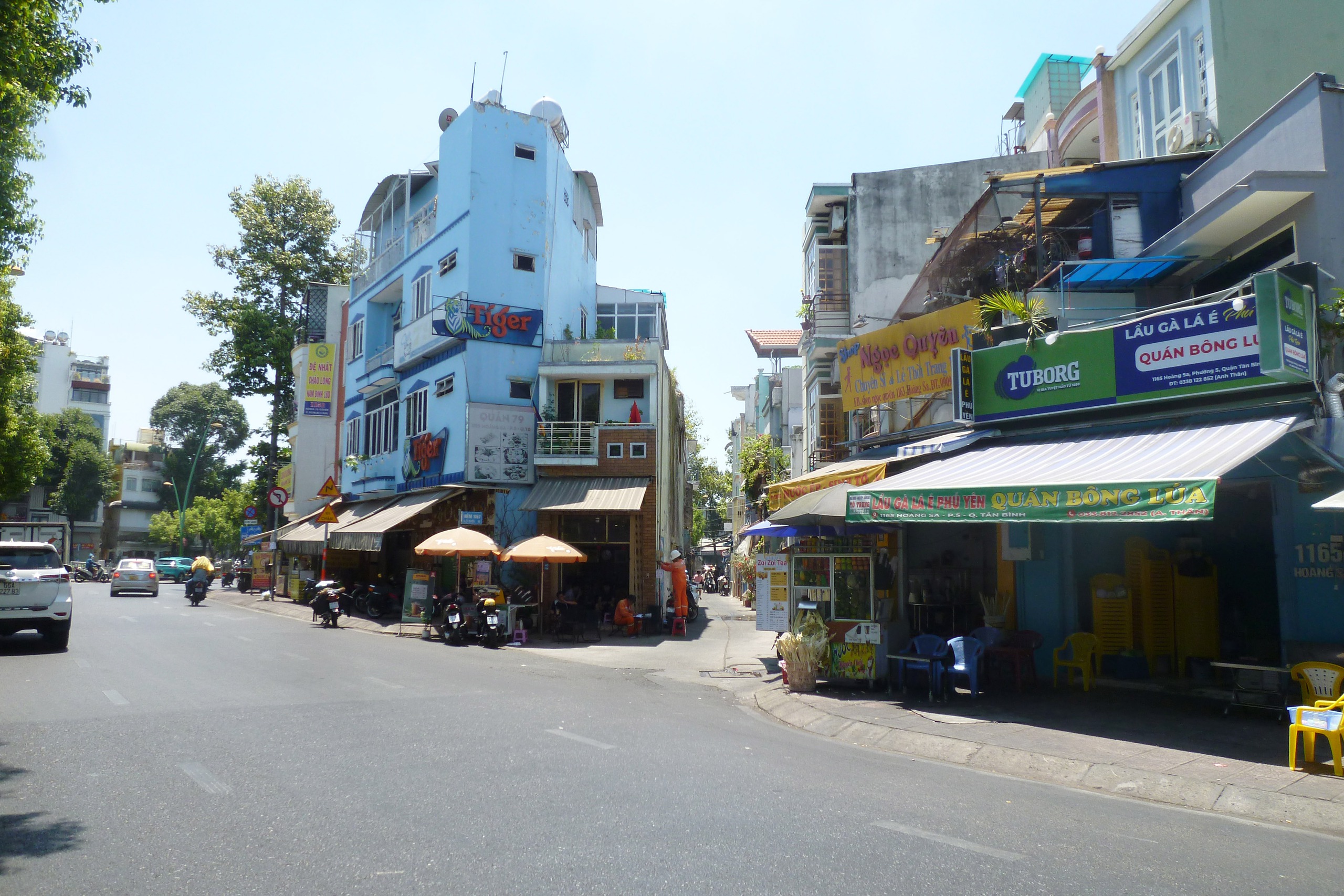
Bui Thi Xuan Street in An Lac area when passing San Bridge was actually as small as an alley before 1975. Some houses here still have the address of Bui Thi Xuan Street.
PHOTO: CMC
After 1954, the migrants in the Wind Steel House area (now Loc Hung Vegetable Garden area) whenever they saw an empty space nearby, they would "pull over" to set up tents and houses on the canal, around San Bridge and Ong Ta Bridge, forming many hamlets: Ca Trac Hamlet, Vua Mam Hamlet or Mam Hamlet (from San Bridge and Ong Ta Bridge to near Bay Hien intersection, at that time, some houses made fish sauce)...
The road running through Ong Ta Bridge before 1957 was called village road/rural road 16. Later, as the main road running from Hoa Hung, Ong Ta intersection to the General Staff of the Army of the Republic of Vietnam and Tan Son Nhut airport, it was quickly concreted, widened, extended, and paved. Until and before the demolition to build the current bridges No. 2 and 3 (July 2004), this bridge was still quite sturdy, about ten meters wide, nearly 20 meters long, with concrete handrails and pedestrian walkways on both sides. Trucks, trucks, etc. could pass freely.
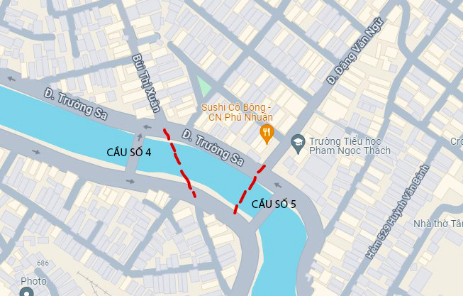
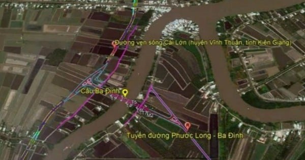
Location of two old bridges between bridges 4 and 5 on Nhieu Loc - Thi Nghe canal today
PHOTO: GOOGLE MAPS - NOTE: CMC
With Ong Ta bridge increasingly showing its vital position, San bridge has gradually lost its original position, becoming only a small bridge in the area. Even though it is a bridge in Ong Ta area, there are people who have never been on it, do not know this bridge. Since mid-2004, along with the bridges in the upper reaches of Nhieu Loc canal, San bridge was demolished, replaced by bridges number 4 and 5 on both sides.
The old San bridge is located next to bridge number 4. But its role is completely different: it mainly serves traffic on the Hoang Sa - Truong Sa road pair, no longer for internal travel.
Revisiting the past from a limited perspective , the article may still have some shortcomings and short-sightedness. I respectfully ask for the forgiveness of intellectuals, intellectuals and readers, and further guidance. Please listen and thank you.
Source: https://thanhnien.vn/hau-than-cua-cau-lao-hoa-lao-hue-cau-so-4-185250224232850115.htm
![[Photo] Looking back at the impressive moments of the Vietnamese rescue team in Myanmar](https://vstatic.vietnam.vn/vietnam/resource/IMAGE/2025/4/11/5623ca902a934e19b604c718265249d0)


![[Photo] "Beauties" participate in the parade rehearsal at Bien Hoa airport](https://vstatic.vietnam.vn/vietnam/resource/IMAGE/2025/4/11/155502af3384431e918de0e2e585d13a)


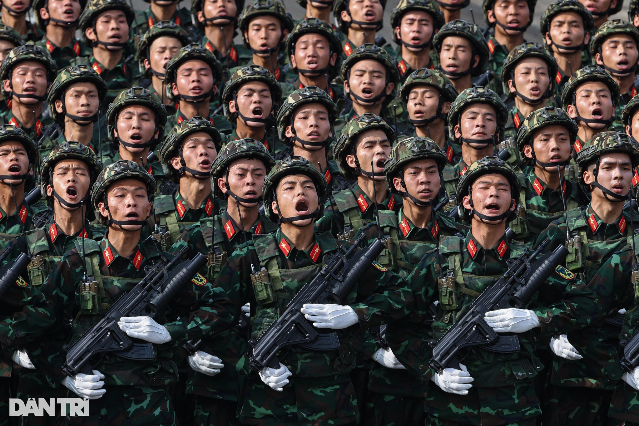
![[Photo] Summary of parade practice in preparation for the April 30th celebration](https://vstatic.vietnam.vn/vietnam/resource/IMAGE/2025/4/11/78cfee0f2cc045b387ff1a4362b5950f)


Comment (0)