
According to Hue researchers, before Thuan An estuary was built, Tam Giang - Cau Hai lagoon had only one estuary, Tu Hien, located in present-day Vinh Hien commune, Phu Loc district. At that time, the flow of Yeu Luc river (Huong river) followed the ancient An Cuu river branch to Ha Trung - Cau Hai lagoon and then merged into the East Sea through Tu Hien estuary. In 1404, after a major flood, Huong river eroded violently, opening another estuary to drain water into the sea - Eo estuary.

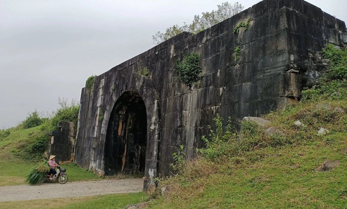
Thuan An Gate today
Right after Eo Gate appeared, Ho Dynasty King Ho Han Thuong (1401 - 1407) mobilized soldiers in Thuan Hoa to dig and fill it up. However, in the following years, every rainy season, the dug and filled soil would erode, and the new sea gate would still open as before. In 1467, under King Le Thanh Tong, Eo Gate was filled up again to break Tam Giang, leaving only Tu Hien Gate operating as before. During the period of 1498 - 1504, under King Le Hien Tong, Eo Gate broke again, deeper than before, and people could not fill it up again. Since then, Tam Giang lagoon has had two sea gates, Tu Hien and Eo Gate.
After such natural events, the flow of the ancient An Cuu River became a tributary of the Huong River, many sections were interrupted, causing Tu Hien estuary to gradually be filled up, Eo estuary became the most important seaport in the area near the capital Phu Xuan - the capital of Hue. Over time, the new seaport was recorded in history books with the following names: Yeu Hai Mon, Noan Hai Mon, Nhuyen Hai Mon, Non Mon. The name Thuan An estuary became the official name of Eo estuary from the beginning of the Nguyen Dynasty.

Carving of Thuan An gate on Nghi Dinh
Before 1835, Thuan An estuary was fed by three rivers (O Lau River, Bo River, and Huong River). In 1835, King Minh Mang ordered the digging of the Pho Loi River to facilitate trade between the seaport and the interior, making Thuan An estuary even more bustling. Minh Mang was also the king who ordered the carving of "Thuan An seaport" on the Nghi Dinh, one of the nine large bronze cauldrons in The Mieu. During the Thieu Tri period, the king ranked Thuan An 10th in the "Than Kinh Nhi Thap Canh", including 20 famous landscapes of Hue under the eyes of the third king of the Nguyen Dynasty.
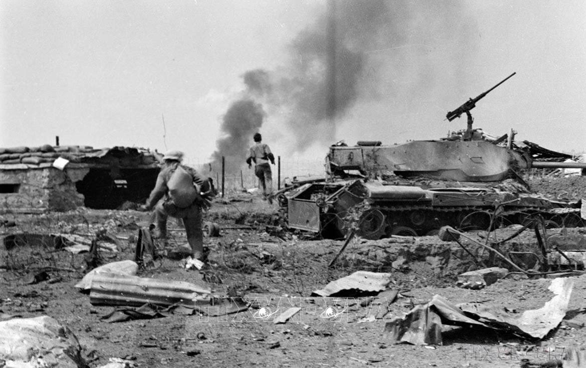
Under the Nguyen Lords, especially the Nguyen King, Thuan An and its vicinity were built into a solid, interconnected defense system combining forts, naval and land forts, forming a solid defense network with a wide range of protection. The book Dai Nam Nhat Thong Chi compiled by the National History Institute of the Nguyen Dynasty stated that in 1813, King Gia Long ordered the construction of Tran Hai Citadel, establishing a headquarters with 3 military teams tasked with patrolling the sea. In April 1847, after the French Navy's attack on Da Nang, King Thieu Tri ordered the construction of another fort in Hoa Duan village, in today's Phu Thuan commune. In August 1883, the French army launched an attack on Thuan An gate. Tran Hai Citadel fell after a fierce artillery barrage from French warships. Losing its protective outpost, the Hue capital was threatened, forcing the Nguyen Dynasty to sign the Quy Mui Peace Treaty, recognizing the French protectorate over the entire territory of Vietnam.

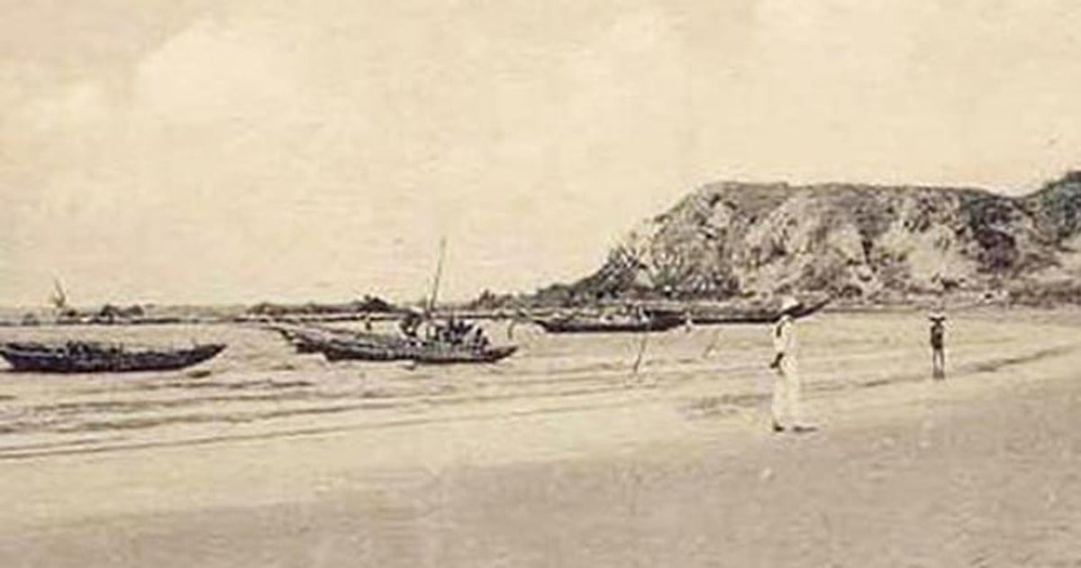
French ship at Thuan An port on August 18, 1883
Source: The Northern War by author L.Huard, Paris 1887
On October 15, 1897, a fierce tsunami pushed sand ashore, narrowing Eo estuary and opening a new seaport, which the locals called Sut estuary. In September 1904, after a big storm, Sut estuary was deepened, while Eo estuary was silted up and disappeared after 500 years of formation. The name Thuan An was used for Sut estuary, while Eo estuary (old Thuan An estuary) was called Lap estuary.
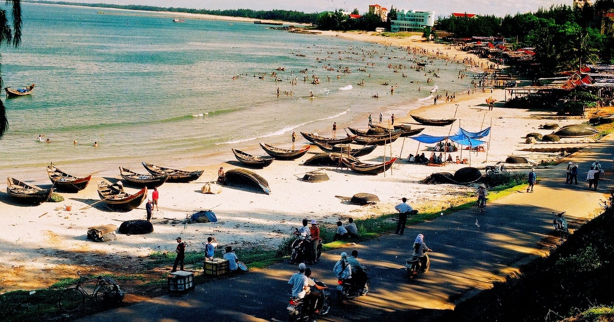
In November 1999, the old Thuan An estuary reappeared after a major flood. At that time, there were two seaports close to each other. The newly formed seaport separated the population, so in 2000, Thua Thien-Hue province built a dam to block the water flow and named it Hoa Duan dam. Just a few years later, Hoa Duan dam was filled with sand, then a pine forest grew, over the years forming the famous Thuan An beach in Hue city.

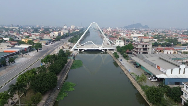
Thuan An Bridge Construction
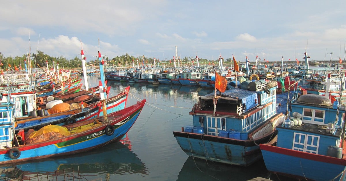
Currently, a new bridge is being built across Thuan An estuary, connecting Thuan An ward and Hai Duong commune. This is the longest sea-crossing bridge in the Central region, with the main span using mixed cables with the longest length and height in Vietnam. The bridge is part of the coastal road project through Hue city.
In early 2025, Hue City will be directly under the Central Government, based on the entire natural area of more than 4,900 km² and population of about 1.2 million people of Thua Thien-Hue province. The bridge across Thuan An gate is also expected to be completed and put into use in March 2025. Another important historical milestone of Hue City - a city with a heritage complex recognized by UNESCO as a world cultural heritage since 1993. (continued)
Source: https://thanhnien.vn/nhung-cua-bien-mien-trung-huyen-thoai-cua-thuan-an-va-nhung-bien-thien-ky-la-185250306213026723.htm

![[Photo] April Festival in Can Tho City](https://vstatic.vietnam.vn/vietnam/resource/IMAGE/2025/4/10/bf5ae82870e648fabfbcc93a25b481ea)
![[Photo] Opening of the 11th Conference of the 13th Party Central Committee](https://vstatic.vietnam.vn/vietnam/resource/IMAGE/2025/4/10/f9e717b67de343d7b687cb419c0829a2)

![[Photo] Prime Minister Pham Minh Chinh commends forces supporting Myanmar in overcoming earthquake consequences](https://vstatic.vietnam.vn/vietnam/resource/IMAGE/2025/4/10/e844656d18bd433f913182fbc2f35ec2)


![[Photo] Reliving the heroic memories of the nation in the program "Hanoi - Will and belief in victory"](https://vstatic.vietnam.vn/vietnam/resource/IMAGE/2025/4/10/19ce7bfadf0a4a9d8e892f36f288e221)


Comment (0)