
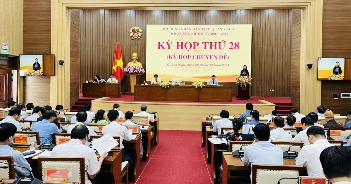
Kinhtedothi - From 7am on October 26, all meetings that are not really necessary must be postponed to focus on storm and flood prevention and control.
This is one of the contents in the urgent dispatch just signed and issued by the Standing Vice Chairman of the Provincial People's Committee, Tran Hoang Tuan, regarding the implementation of measures to respond to storm No. 6 (storm Tra Mi).
Accordingly, all vehicles, ships, and boats are prohibited from operating at sea (including passenger transport vehicles on the Sa Ky - Ly Son route and vice versa) from 10:00 a.m. on October 26 until there is an official announcement of stable weather from the Quang Ngai Hydrometeorological Station.

Closely monitor the developments of storm No. 6; promptly notify and guide owners of vehicles and captains of ships and boats operating at sea to know the location, direction of movement and developments of the storm so that they can proactively take measures to prevent, avoid, escape or not move into the storm's dangerous area. Complete before 10:00 a.m. on October 26.
Notify, guide and request cage and raft owners who are raising aquatic products at sea and along the coast to urgently move to safe places. Organize anchoring of ships, boats and cages to ensure safety at anchorage; proactively bring small boats ashore to limit damage.
Absolutely do not leave people on ships, boats, and rafts when there are strong waves and winds; pay special attention to sea transport ships and fishing boats anchoring in the Sa Can estuary area, Dung Quat, Sa Ky, and Tinh Hoa waters. Complete anchoring and arranging ships, boats, and rafts at the anchorage area before 5:00 p.m. on October 26.
Ly Son, Binh Son districts and Quang Ngai city (expected to be the areas most affected by the storm) have developed detailed scenarios to respond to storm situations for coastal communes (expected scenario: Ly Son has strong winds of level 10, gusts of level 11; coastal communes of Binh Son district and Quang Ngai city: levels 8, 9, gusts of level 10).
In addition, direct coastal communes to review, inspect and mobilize forces and means to reinforce and brace constructions, offices, and trim tree branches to ensure safety; guide and support people to reinforce and brace houses, prioritizing support for families with elderly people living alone, people with disabilities, women, etc. Complete before 6:00 p.m. on October 26.
Coastal communes of Binh Son district and Quang Ngai city will organize the evacuation of households to safe places, to be completed before 7:00 a.m. on October 27; Ly Son district will complete the evacuation before 10:00 p.m. on October 26.
Implement measures to restrict people and vehicles from operating on the road during storms causing strong winds in the area; organize control, regulation, and restriction of vehicles entering areas expected to be affected by storms.
Permanent Vice Chairman of the Provincial People's Committee Tran Hoang Tuan requested localities and units to be on guard against situations of heavy rain causing the risk of landslides and flash floods in mountainous districts and rapid floods in small rivers and streams (especially rivers: Tra Bong, Phuoc Giang, Ve).
According to the Quang Ngai Hydrometeorological Station, under the influence of storm No. 6, the sea area of Quang Ngai (including Ly Son island district) has north to northwest winds of level 6-7, gusting to level 8, rough seas, and waves 2.0-4.0m high.
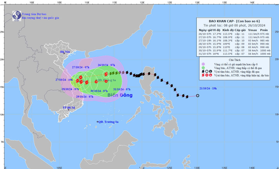
From the evening and night of October 26, the storm wind will gradually increase to level 8, 9, gusting to level 10-11, waves 3.0-5.0m high; the area near the storm center will have strong winds of level 9, gusting to level 11, 12, waves 4.0-6.0m high; the sea will be very rough.
On land, from the evening and night of October 26, coastal areas will have winds gradually increasing to level 6, gusting to level 7-8; areas near the storm center will have winds of level 7, gusting to level 8-9 (especially pay attention to coastal areas in the north of the province such as Binh Son, Quang Ngai City).
Quang Ngai province has showers and thunderstorms, with the possibility of moderate rain, heavy rain, and very heavy rain and thunderstorms from the afternoon of October 26-28. The total rainfall forecast in Binh Son, Son Tinh districts, Quang Ngai city, Tra Bong, Son Ha and Ly Son island district is generally 200-400mm, with some places over 500mm. Warning of the risk of localized heavy rain (>100mm/3 hours).
Heavy rains can cause flooding in low-lying areas; flash floods in small rivers and streams; and landslides in mountainous areas. During thunderstorms, be on guard against tornadoes, lightning, and strong gusts of wind.
Source: https://kinhtedothi.vn/quang-ngai-hoan-hop-de-uu-tien-ung-pho-bao.html
![[Photo] General Secretary To Lam receives King Philippe of Belgium](https://vstatic.vietnam.vn/vietnam/resource/IMAGE/2025/4/1/e5963137a0c9428dabb93bdb34b86d7c)
![[Photo] Prime Minister Pham Minh Chinh meets with King Philippe of Belgium](https://vstatic.vietnam.vn/vietnam/resource/IMAGE/2025/4/1/be2f9ad3b17843b9b8f8dee6f2d227e7)


![[Photo] Close-up of Vietnam's sniffer dog team searching for earthquake victims in Myanmar](https://vstatic.vietnam.vn/vietnam/resource/IMAGE/2025/4/1/d4949a0510ba40af93a15359b5450df2)
![[Photo] President Luong Cuong and King Philippe of Belgium visit Thang Long Imperial Citadel](https://vstatic.vietnam.vn/vietnam/resource/IMAGE/2025/4/1/cb080a6652f84a1291edc3d2ee50f631)


![[Photo] Myanmar's capital in disarray after the great earthquake](https://vstatic.vietnam.vn/vietnam/resource/IMAGE/2025/4/1/7719e43b61ba40f3ac17f5c3c1f03720)


Comment (0)