
Lying along the banks of the blue bay, Ha Long city rests peacefully on the high mountains covered in mist. Among those blue mountains and water are peaceful villages and hamlets beside streams and forests. Son Duong commune is one of the highland communes located in such valleys.
Son Duong has a back of Hung Mo
There is King Ngu hill, there is Van Phong pagoda...
Long ago, several hundred years ago, before 1925, Son Duong commune had only four villages, each village had a communal house, which were Tien La (Tien Lu), Van Phong, Dong Giang and Dong Dang communal houses. There was an ancient pagoda on the high slopes of Dia Thau mountain range in Van Phong village. In front of the pagoda was a large stream, commonly called Khe Nganh. Khe Nganh originated from Da Dun mountain range behind the pagoda. Van Phong village pagoda and the people around the area all used water from Khe Nganh, which was later called Khe Chua. On the old foundation of Thuong pagoda (to distinguish it from the current lower location of the pagoda), there were still many ancient artifacts such as six round stone pillars, approximately 40cm in diameter, Buddha bathing pool, incense tree... made of monolithic green stone. Lung Hung Mo is located in Vuon Cau village, belonging to Khe Soong branch. It is a small cave, surrounded by mountain rocks like a sky well. Water from the back pours down over large and small slate rocks, of various shapes, forming a crystal clear stream. Today, our group will make a "mountain climb" to Vua Ngu hill, in the northwest of Ha Long city.
The road to Vua Ngu hill can be taken from Vuon Cau village or from Vuon Ram village. It can also be taken by 4WD car or motorbike. The condition is that the driver is strong and knows the road well. Talking about “silk drivers” here, it is difficult for anyone to surpass the drivers transporting acacia wood. Wherever there are planted acacia forests, there will be new “trails and paths”. Looking at the trucks laden with acacia wood, crawling on the “roads” that are bumpy, rugged, and winding on steep, rocky slopes... we can see how difficult and dangerous the livelihood of the people in the mountainous areas is.
The simplest way is to walk. If you want to try, want to lose weight and are willing to be a little adventurous, you can walk. The roads are paved by friendly drivers so you don’t have to worry about getting lost. The estimated time for the round trip is about 3 hours to reach (nearly) the top of the mountain. Not including the time to stop, rest, play and explore.
This time, we chose the path from the Areca Garden, passing through several guava gardens in harvest season. On the left side of Vua Ngu hill, close to Dong Lam commune, is a winding road leading to the sacred rock. According to the locals here, the rock is exactly the shape of Buddha. The road is quite difficult because there are many steep slopes and rough rocks, but it is not a problem for those who are eager for adventure. Only when we get close to the foot of the mountain, where the trees are completely cut off, can we see the majestic rock. It seems that someone has carved a statue of Bodhisattva Guanyin holding a bottle of nectar, looking far away to the West. The mountainside is steep and covered with vines, so we can only worship from afar. The guide showed us a rock shaped like an elephant lying right at the foot of the mountain, next to a flat rock that looks like a bed.
He said: In the past, when King Dong Quanh was still ruling this area. When he passed by here, the forest was very dense. The king clasped his hands and prayed towards the top of the mountain. Immediately, this huge rock rolled down to make a place for the king to rest. That is why the rock was named King Ngu hill. As for why this mountain is called King Ngu hill, we only know that it has been called that way since ancient times. The people here simply distinguish mountains as rocky mountains. As for dirt mountains, they call them "hills" or "places". Opposite the foot of Buddha Mountain is a valley of lush green trees, lush acacia forests and shrubs. On the other side of the slope, about 1km away, is a Dao village in Dong Lam commune. There, there is a custom that when guests come to visit, they must first drink 3 cups of wine. If they cannot drink, they must stay 3 nights. Therefore, we will need to take another trip to prepare mentally to visit the villages of some friends we already know.
Resting and relaxing for a few minutes on the old King Ngu rock, we continued our journey to the top of King Ngu hill. The road from here to the top of the mountain was more difficult to walk. The road was quite steep and slippery with orphan rocks. Each of us had to find a stick to lean on. It was indeed much easier to walk. In return, on the left side of the road, the scenery was truly peaceful. Vuon Ram village, Vuon Cau, Dong Vang... spread out before our eyes. The golden rice fields in harvest season were interspersed with guava gardens and green acacia patches. Occasionally, a few strings of birds chirped excitedly across the forest. Just like the old song "Thirty-six kinds of birds in the forest".
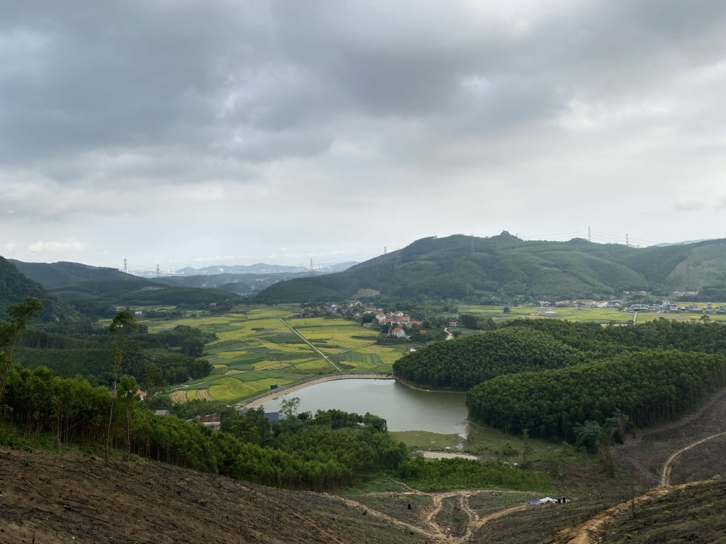
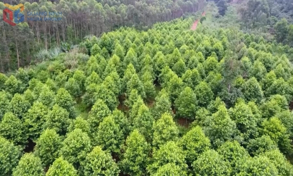
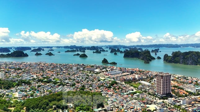
About an hour later, we arrived at our destination. The hillside here was clear and windy. The surrounding view was quite open, perfect for admiring Ha Long from above. Although I had been here more than once, each time I still felt overwhelmed and happy amidst the green mountains and blue water, the rolling hills, the dark green winding in the clouds. To the southeast was Ha Long city. Chimneys of cement and thermal power plants, high-rise buildings clearly defined on the shore of the bay. The elegant Bai Chay Bridge crossed the Cua Luc bay, connecting the two lands to the east and west of the city. Ha Lung mountain, Mot mountain, Hai mountain, Dia Thau range and Son Duong villages spread out before our eyes. The Hai Phong - Ha Long highway meandered in the distance... On the right were the green pine forests in the resin season. It was a pity that this time we did not bring hammocks to enjoy more of the pure natural atmosphere, the fragrant scent of pine leaves and forest trees.
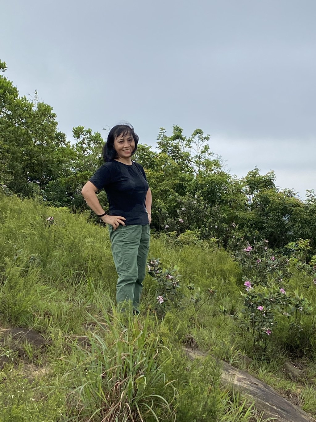
Fortunately, when we reached the hillside, the sky was completely cool and cloudy. That made the scenery even more magical and vague. This hillside is often used as a starting point by the Northeast parachute team. On days with light winds and nice weather, the colorful parachutes like giant kites flying in the sky looked so serene and peaceful. We took the opportunity to "check in" next to some sim flower bushes growing next to some large rocks on the hillside. The fresh, wild beauty of that mountain flower seemed to be imprinted on the radiant frames. I thought to myself: If only in the future there was a smoother, easier road for those who love rustic, wild natural scenery, this route would surely become a noteworthy destination for those who like to travel. Even for the whole family to experience the open space of nature, breathe the fresh air of the green forest, immerse themselves in the choir of "Thirty-six kinds of birds" and experience the chirping of insects. It is also a way for us to live slowly, to enjoy and cherish the true values of life!
Source
![[Photo] Capital's youth enthusiastically practice firefighting and water rescue skills](https://vstatic.vietnam.vn/vietnam/resource/IMAGE/2025/4/3/3f8481675271488abc7b9422a9357ada)
![[Photo] A brief moment of rest for the rescue force of the Vietnam People's Army](https://vstatic.vietnam.vn/vietnam/resource/IMAGE/2025/4/3/a2c91fa05dc04293a4b64cfd27ed4dbe)
![[Photo] Prime Minister Pham Minh Chinh chairs meeting after US announces reciprocal tariffs](https://vstatic.vietnam.vn/vietnam/resource/IMAGE/2025/4/3/ee90a2786c0a45d7868de039cef4a712)
![[Photo] Prime Minister Pham Minh Chinh chairs the first meeting of the Steering Committee on Regional and International Financial Centers](https://vstatic.vietnam.vn/vietnam/resource/IMAGE/2025/4/3/47dc687989d4479d95a1dce4466edd32)
![[Photo] Ho Chi Minh City speeds up sidewalk repair work before April 30 holiday](https://vstatic.vietnam.vn/vietnam/resource/IMAGE/2025/4/3/17f78833a36f4ba5a9bae215703da710)
![[Photo] General Secretary To Lam receives Japanese Ambassador to Vietnam Ito Naoki](https://vstatic.vietnam.vn/vietnam/resource/IMAGE/2025/4/3/3a5d233bc09d4928ac9bfed97674be98)


Comment (0)