
According to the Southern Hydrometeorological Station, after a few days of decreasing intensity, widespread heat has returned. Since March 22, severe heat has appeared in many places in the East and locally in the West with common temperatures ranging from 35 - 37 degrees Celsius.

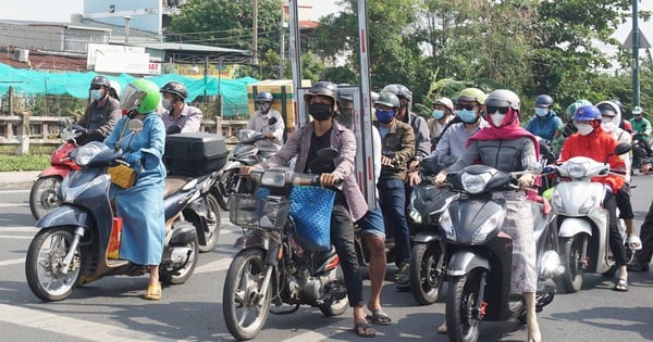
Ho Chi Minh City residents find ways to "live with" the heat
On March 23, the highest temperature recorded in Dong Phu (Binh Phuoc) was 37.8 degrees Celsius; and in Chau Doc (An Giang) it was 35.7 degrees Celsius.
Temperatures are likely to increase in the coming days. The highest temperatures in the Eastern provinces are generally between 36 and 38 degrees Celsius, while in the Western provinces they are between 35 and 37 degrees Celsius.
Up to this point, the highest temperature recorded in 2024 was 38.5 degrees Celsius in Bien Hoa (Dong Nai) in early March.
Explaining the increasing heat trend, MSc. Le Thi Xuan Lan, a hydrometeorological forecaster, said: March 21 is the vernal equinox, after which the sun is closest to the equator. According to its orbit, the sun will gradually move north, or what people call apparent motion. Because the sun is closest to the equator, the heat is especially intense. Along with that, radiation rays such as ultraviolet rays are also stronger. Therefore, the period from March 21 to mid-April is the peak of heat in the South.
"Along with the issue of climate change and the impact of El Nino (which is weakening), the peak of this year's heat wave could reach the old record in the 1997/98 dry season of 39 - 40 degrees Celsius in the Eastern provinces. Places that are likely to reach this temperature level are still familiar places such as: Dong Phu, Dong Xoai, Xuan Loc, Bien Hoa; while the West can reach 37 - 38 degrees Celsius in Chau Doc, Can Tho, Vinh Long... The heat wave lasts continuously for many hours a day and many consecutive days as well as the temperature difference between day and night is quite high. These are factors that negatively affect health, everyone needs to pay attention", Ms. Lan warned.
If from now until mid-April the temperature is high but the humidity in the air is low, causing intense heat, then from the second half of April onwards is the transitional period, the humidity in the air is high, creating a very uncomfortable heat. "From late April to mid-May is the transitional period, often with extreme weather phenomena such as thunderstorms with heavy rain, tornadoes, waterspouts, hail, lightning... They usually appear in the late afternoon. Because this year the heat is more intense than usual, extreme phenomena have also increased in intensity. People need to pay special attention to prevention," Ms. Lan advised.
In recent days, the National Center for Hydro-Meteorological Forecasting has continuously issued heat wave warning bulletins in the South and advised people: Due to the effects of intense heat combined with low humidity in the air, there is a risk of explosions and fires in residential areas due to increased demand for electricity and the risk of forest fires. In addition, heat wave can also cause dehydration, exhaustion, and heat stroke to the human body when exposed to high temperatures for a long time.
In addition, it should be noted that the forecast temperature in the heat bulletin and the actual felt temperature outside can differ by 2 - 4 degrees Celsius, or even higher depending on the conditions of the surface such as concrete and asphalt.
Quick view 12:00 on March 24: Weather forecast
Source link
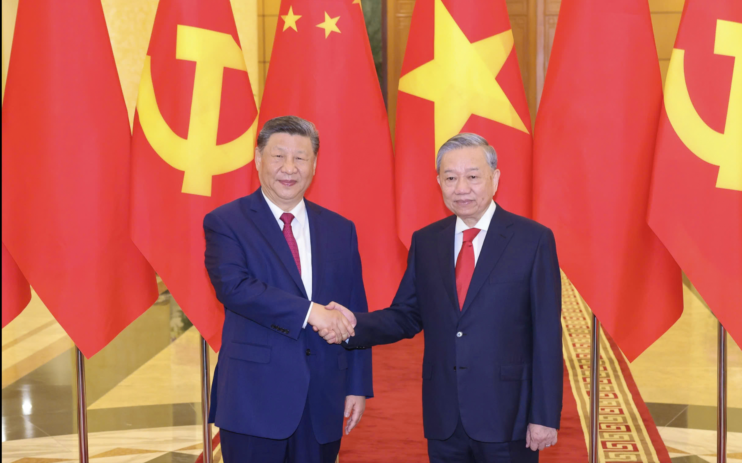
![[Photo] Reception to welcome General Secretary and President of China Xi Jinping](https://vstatic.vietnam.vn/vietnam/resource/IMAGE/2025/4/15/ef636fe84ae24df48dcc734ac3692867)
![[Photo] Tan Son Nhat Terminal T3 - key project completed ahead of schedule](https://vstatic.vietnam.vn/vietnam/resource/IMAGE/2025/4/15/85f0ae82199548e5a30d478733f4d783)
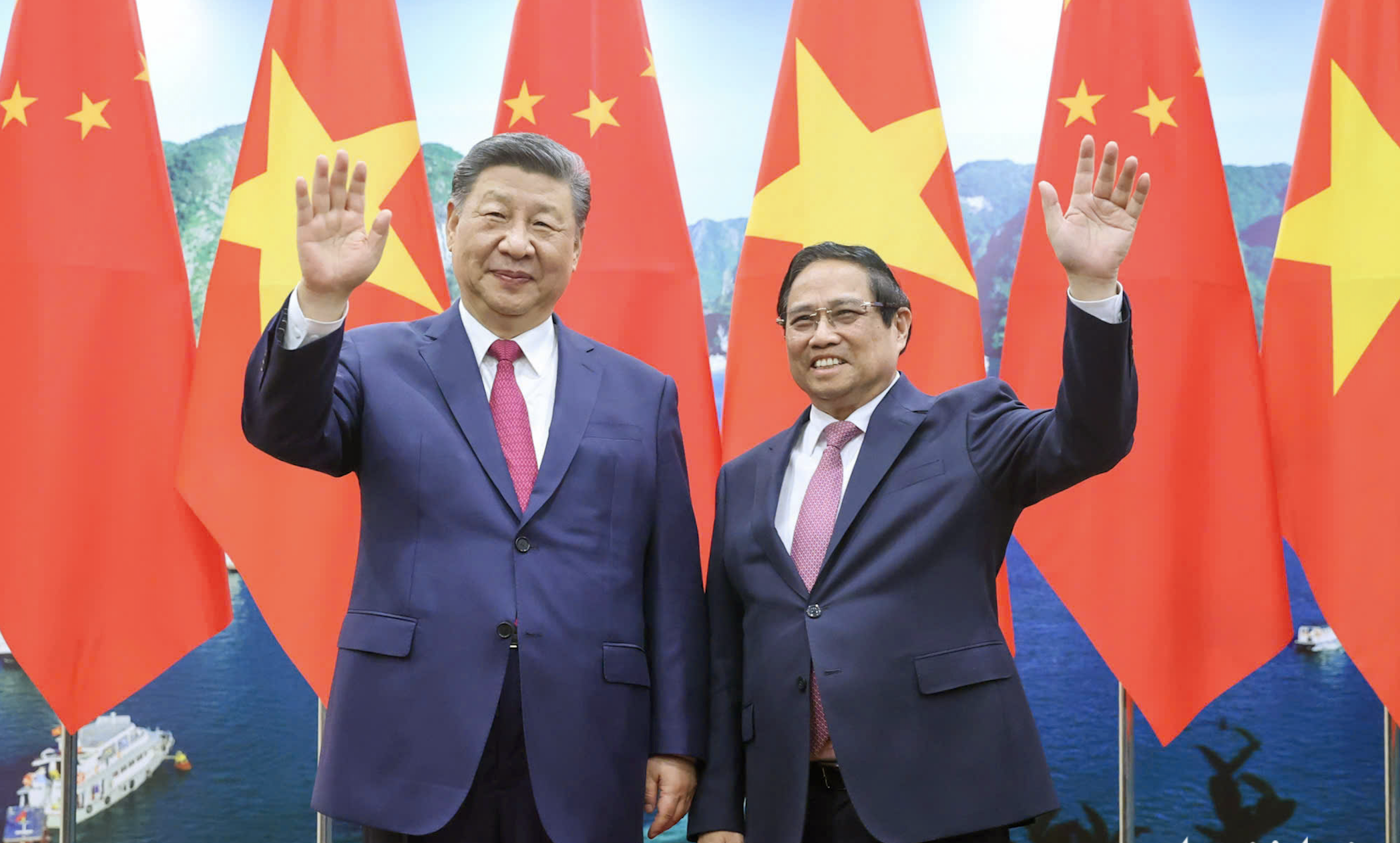
![[Photo] Prime Minister Pham Minh Chinh meets with General Secretary and President of China Xi Jinping](https://vstatic.vietnam.vn/vietnam/resource/IMAGE/2025/4/14/893f1141468a49e29fb42607a670b174)
![[Photo] National Assembly Chairman Tran Thanh Man meets with General Secretary and President of China Xi Jinping](https://vstatic.vietnam.vn/vietnam/resource/IMAGE/2025/4/14/4e8fab54da744230b54598eff0070485)


Comment (0)