
Green park - landscape highlight
According to the Planning Project of Subdivision 3 (scale 1/2,000) - the residential subdivision in the inner city area of Southern Tam Ky approved by the Provincial People's Committee, the city will renovate and embellish existing residential areas to improve land use efficiency, with an area of over 289.8 hectares. The Northwest is limited by Ton Duc Thang Street, the Southwest is limited by the railway; the Southeast from the railway borders Tam Ky River extending to the border of Huong Tra Sua flower village, the Northeast borders the 69m road. Reserve land to develop riverside parks to create unique landscapes and at the same time respond to flooding.
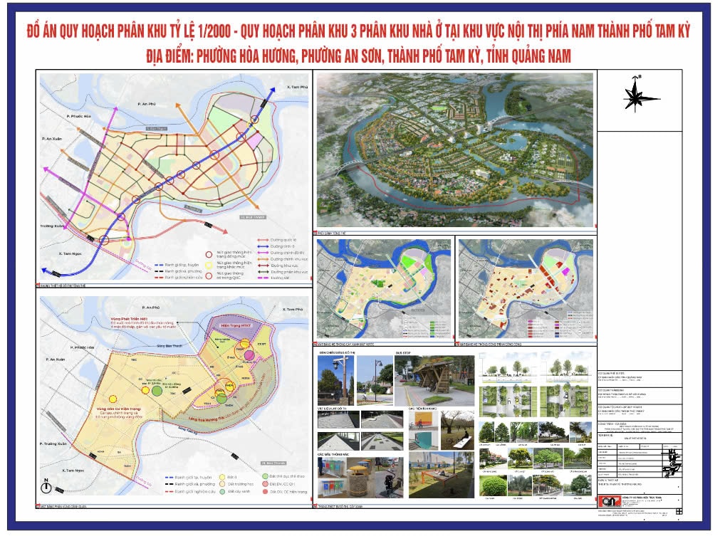
Looking at the planning map, there is a system of green parks formed such as the Park along Thanh Hoa road axis and the buffer space of Huong Tra eco-village area with a total area of 17.69ha. Another park with a scale of 10.69ha located at the river junction, is identified as a landscape highlight, with the function of preserving biodiversity, contributing to flood prevention in the area. And, Tam Ky riverside park along the boundary of the planning study of Subdivision 3 is arranged with a total area of 14.1ha and will be a river protection corridor.
The plus point in the housing zoning plan in the inner city area of South Tam Ky is to preserve and promote the value of the Huong Tra ecological village with a scale of 96.3 hectares, aiming to stabilize the existing population associated with the development of eco-tourism. In addition, developing more than 107 hectares of the remaining area of Division 3, currently low-lying agricultural land along the Ban Thach River and Tam Ky River of the people who are cultivating.
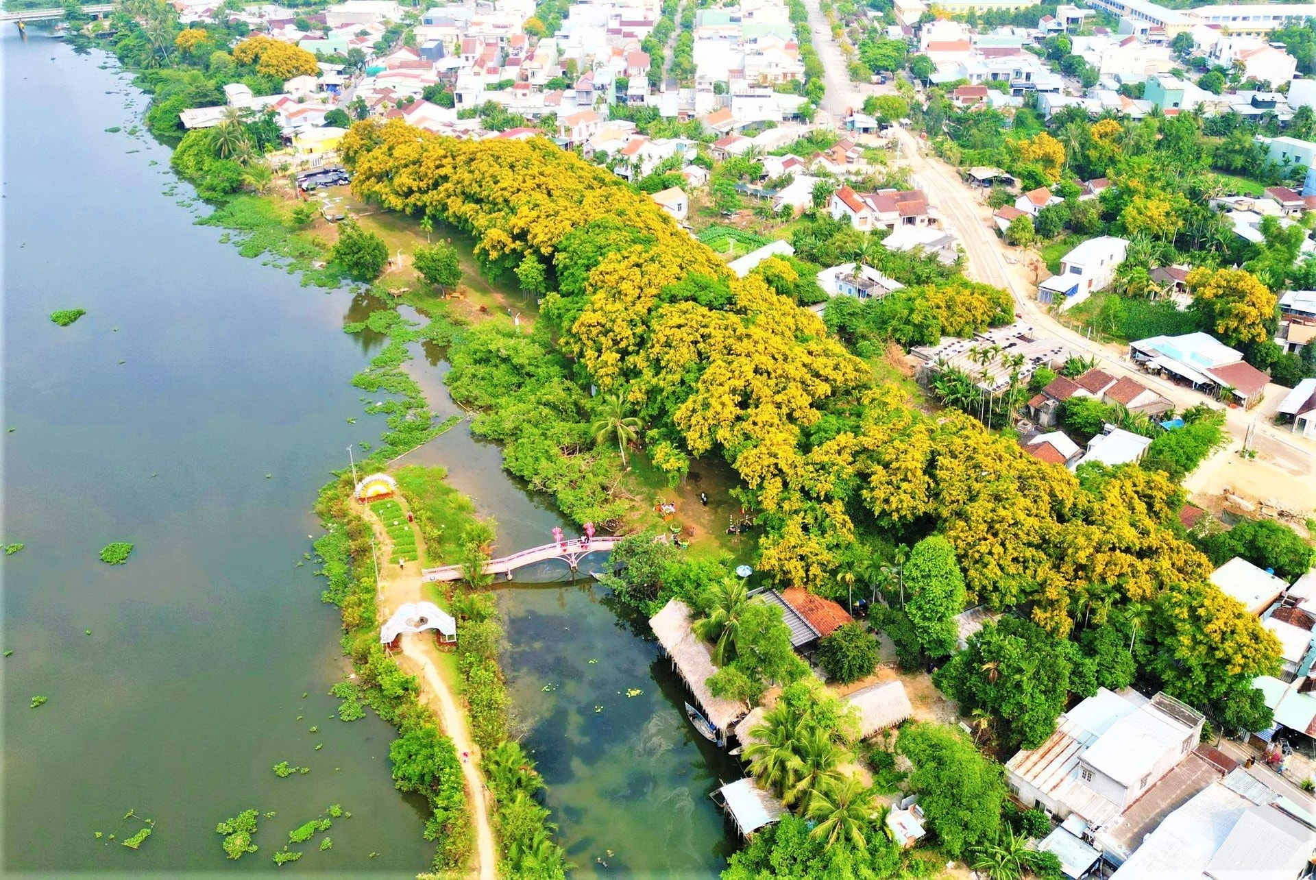
With the new open space, the city proposes a multi-functional urban area, associated with trees and water surfaces as one of the solutions to prevent urban flooding and towards an ecological urban area; with a buffer space as a transitional area between the new area and Huong Tra ecological village. With the housing zoning plan in the inner city area of southern Tam Ky, the purpose of building a "village in the city, city in the village", establishing a "green lung" in the heart of the residential area is clearly demonstrated.
The entire housing zoning plan in the inner city area of Southern Tam Ky is determined in the General Planning Project of Tam Ky City to 2030, with a vision to 2050, approved by the Provincial People's Committee in Decision No. 3500/QD-UBND dated November 6, 2014. The planning boundary is limited from Ton Duc Thang Street to the southern boundary of Sub-Zone 2. The eastern boundary is adjacent to Tam Ky River; the western boundary is adjacent to Ton Duc Thang Street; the southern boundary is adjacent to the North-South railway and the northern boundary is adjacent to Ban Thach River. The planning area is about 524.89 hectares.
Residential subdivision in the inner city area of Southern Tam Ky with the orientation of building low-density residential area associated with the improvement of village space in Hoa Huong area; connecting the infrastructure framework between the East and West of Phan Chau Trinh route; forming landscape space along Tam Ky river, creating a green corridor connecting with the riverside strip in subdivision 3 to Phu Ninh lake.
Reasonable urban space development
The planning project has proposed 3 zones with different functions. One is the current residential area, a densely populated area in the center of Hoa Huong ward and An Son ward with quite complete social infrastructure and economic infrastructure. The second is the new development area - the current area is a low-lying rice field area in Hoa Huong ward, adjacent to Huong Tra eco-village. The third is the conservation area - Huong Tra eco-village on the left bank of Tam Ky river, where the 3 rivers Tam Ky, Truong Giang and Ban Thanh meet.
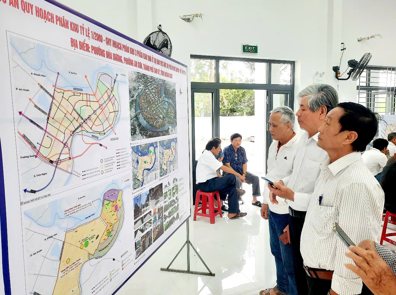
According to the Project Appraisal Council of the Department of Construction, the project has strictly complied with the provisions of the Law on Urban Planning. Specifically, it meets the regulations on minimum height for each block; protection range, safety corridor of technical infrastructure works (river corridor, flood drainage ...), underground works; conservation area, renovation, embellishment of historical and cultural relics, scenic spots, landscape terrain and environmental protection; principles of conduct for the current residential strip along the Tam Ky River, which is located in the green strip along the river and in the area of restricted urban development.
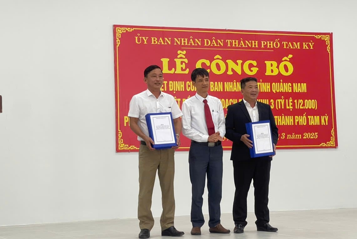
Mr. Ho Minh Son - Chairman of Hoa Huong Ward People's Committee (Tam Ky City) said that the city's announcement of the housing zoning plan in the inner city area of Southern Tam Ky not only helps organizations and individuals understand the direction to implement investment and construction in accordance with the plan, but also contributes to raising awareness of compliance with regulations on urban planning management, minimizing violations, ensuring effective exploitation of planned land funds.
“This planning has been carefully researched, ensuring synchronous connectivity, maximizing the potential and advantages of the locality, overcoming shortcomings and limitations; aiming to build a civilized and beautiful urban area. Therefore, the locality commits to strictly comply with regulations on planning management, not violating construction, and effectively implementing projects according to the approved plan,” said Mr. Son.
After the planning is announced, Tam Ky will proceed to set up boundary markers according to the approved master plan. The two wards of An Son and Hoa Huong and related units will tighten planning management, land management, status management, construction order, and urban order.
According to the People's Committee of Tam Ky City, the city's upcoming task is to attract and call on businesses to invest in housing development in the southern inner city of Tam Ky. Priority investment resource categories include upgrading Thanh Hoa Road, investing in the Tam Ky - Nui Thanh route, improving the water supply and drainage system, developing multifunctional urban areas, etc.
Source: https://baoquangnam.vn/chu-trong-mang-xanh-trong-quy-hoach-khu-nha-o-noi-thi-phia-nam-tam-ky-3151729.html
![[Photo] General Secretary To Lam receives Russian Ambassador to Vietnam](https://vstatic.vietnam.vn/vietnam/resource/IMAGE/2025/4/2/b486192404d54058b15165174ea36c4e)
![[Photo] Prime Minister Pham Minh Chinh receives Deputy Prime Minister of the Republic of Belarus Anatoly Sivak](https://vstatic.vietnam.vn/vietnam/resource/IMAGE/2025/4/2/79cdb685820a45868602e2fa576977a0)

![[Photo] Prime Minister Pham Minh Chinh receives CEO of Standard Chartered Group](https://vstatic.vietnam.vn/vietnam/resource/IMAGE/2025/4/2/125507ba412d4ebfb091fa7ddb936b3b)
![[Photo] Comrade Khamtay Siphandone - a leader who contributed to fostering Vietnam-Laos relations](https://vstatic.vietnam.vn/vietnam/resource/IMAGE/2025/4/3/3d83ed2d26e2426fabd41862661dfff2)


Comment (0)