
Quick note from last night to this morning, due to the impact of storm No. 6, in Quang Nam there was moderate to heavy rain, in coastal areas this morning there were big waves and strong winds. Particularly in Cu Lao Cham Island, wind level 8 was recorded, the sea waves were rough, and gusts of wind were howling.
According to the National Center for Hydro-Meteorological Forecasting, at 7:00 a.m. on October 27, storm No. 6 was at about 16.8 degrees North latitude; 108.6 degrees East longitude, about 95km East Northeast of Da Nang. Strongest wind: Level 9 (75-88km/h), gusting to level 11. Forecast: In the next 3 hours, the storm will move in a West Southwest direction, at a speed of about 15km/h.
Due to the impact of storm No. 6, Quang Nam has recorded strong winds and waves in coastal areas.
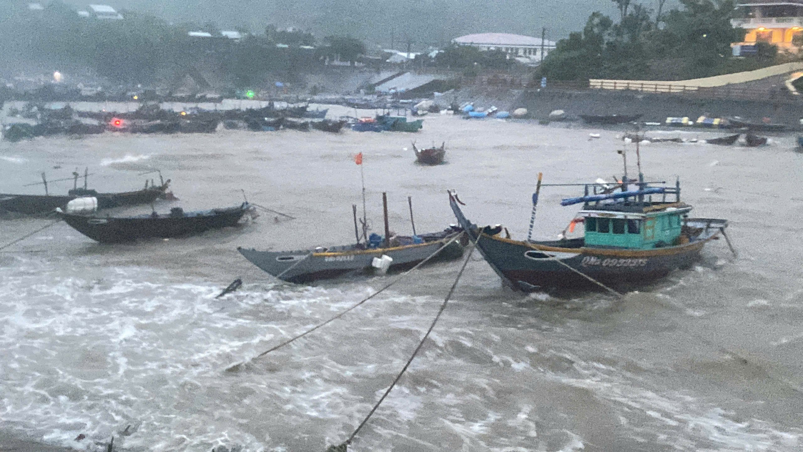
Strong winds and big waves appeared on Cu Lao Cham Island, Quang Nam Province this morning. Photo: Contributor
Clip of strong winds and big waves at Cu Lao Cham Island. Video sent by NVH
Quick note in Quang Nam from last night to this morning, many places in Quang Nam have seen moderate to heavy rain, in coastal areas this morning there were big waves and strong winds. Particularly in Cu Lao Cham Island, winds of level 8 were recorded, the sea waves were rough, and gusts of wind were howling.
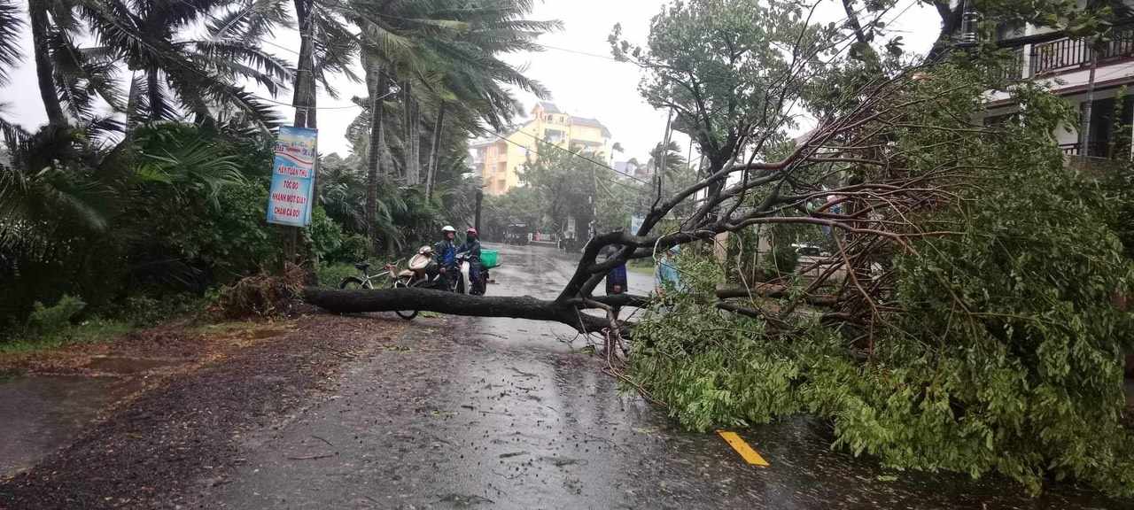
Storm No. 6 caused some trees on the streets of Hoi An, Quang Nam to fall. Photo: Contributor
Localities in Quang Nam province have rain, moderate rain, heavy rain. Total rainfall from 7:00 p.m. on October 25 to 5:00 a.m. on October 27 at some stations such as Phuoc Thanh (Phuoc Son) 94.00mm; Tra Giap (Bac Tra My) 83.8mm; Dien Ngoc (Dien Ban) 83.8mm; Tra Don (Nam Tra My) 81.8mm; Tam Tra (Nui Thanh) 75.2mm, Tra Van (Nam Tra My) 73.8mm, Phuoc Cong 71mm, the remaining localities have rain under 70mm.
The constant howling winds and big waves at the boat anchorage area of Cu Lao Cham Island. Photo: Contributor
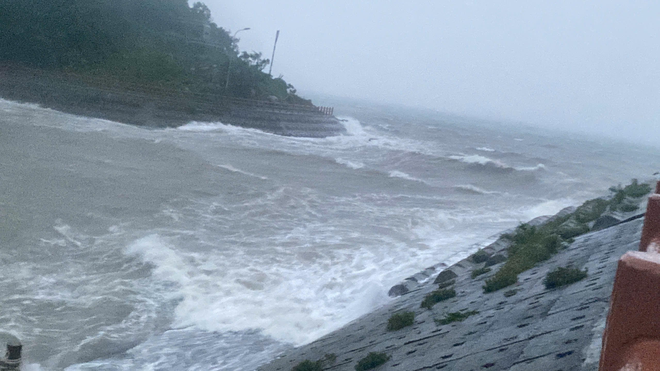
Early this morning, strong waves and howling winds appeared in Hoi An area, Quang Nam province. Video sent by NVH
Violent waves at Cua Dai, Hoi An. Video: CTV
From today, October 27 to October 29, rivers in Quang Nam province are likely to experience a flood. During this flood, the flood amplitude in the upstream reaches from 3.0 - 5.0m, downstream reaches from 1.5 - 3.0m. The flood peak on specific rivers such as, on Vu Gia river is at alert level 1 to alert level 2, on Thu Bon river is at alert level 1 to below alert level 2. - On Tam Ky river is at alert level 1 to below alert level 2.
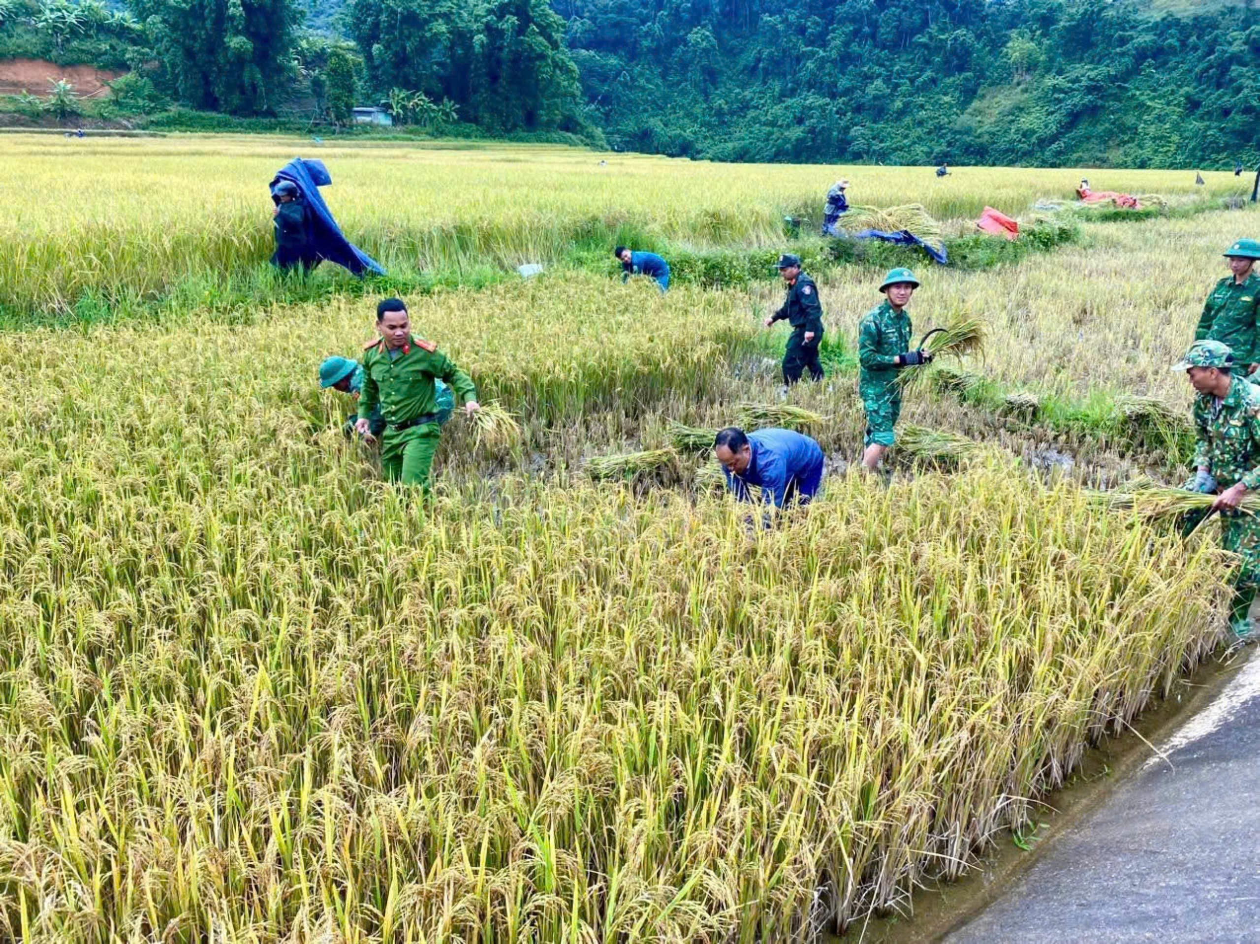
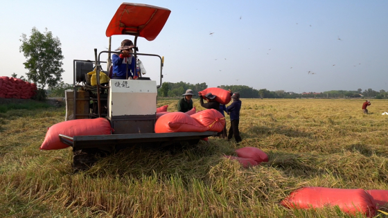
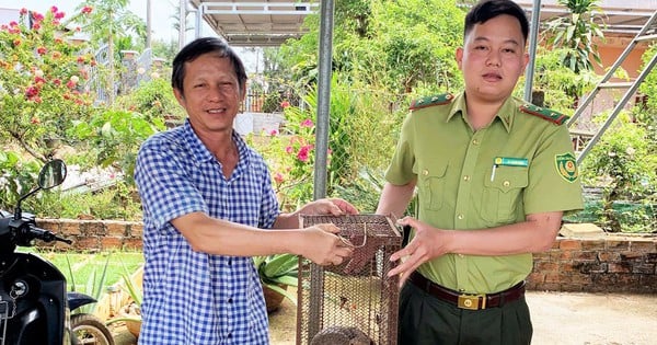
Police and military forces help mountainous people harvest rice to escape storm No. 6 - Photo: CAQN
To date, 4,412 households/18,306 people in 10 localities including Duy Xuyen, Phuoc Son, Tay Giang, Dai Loc, Hiep Duc, Tam Ky, Tien Phuoc, Hoi An, Nam Tra My, Phu Ninh of Quang Nam province have been evacuated to safety. Localities are implementing evacuation and relocation of people out of dangerous areas.
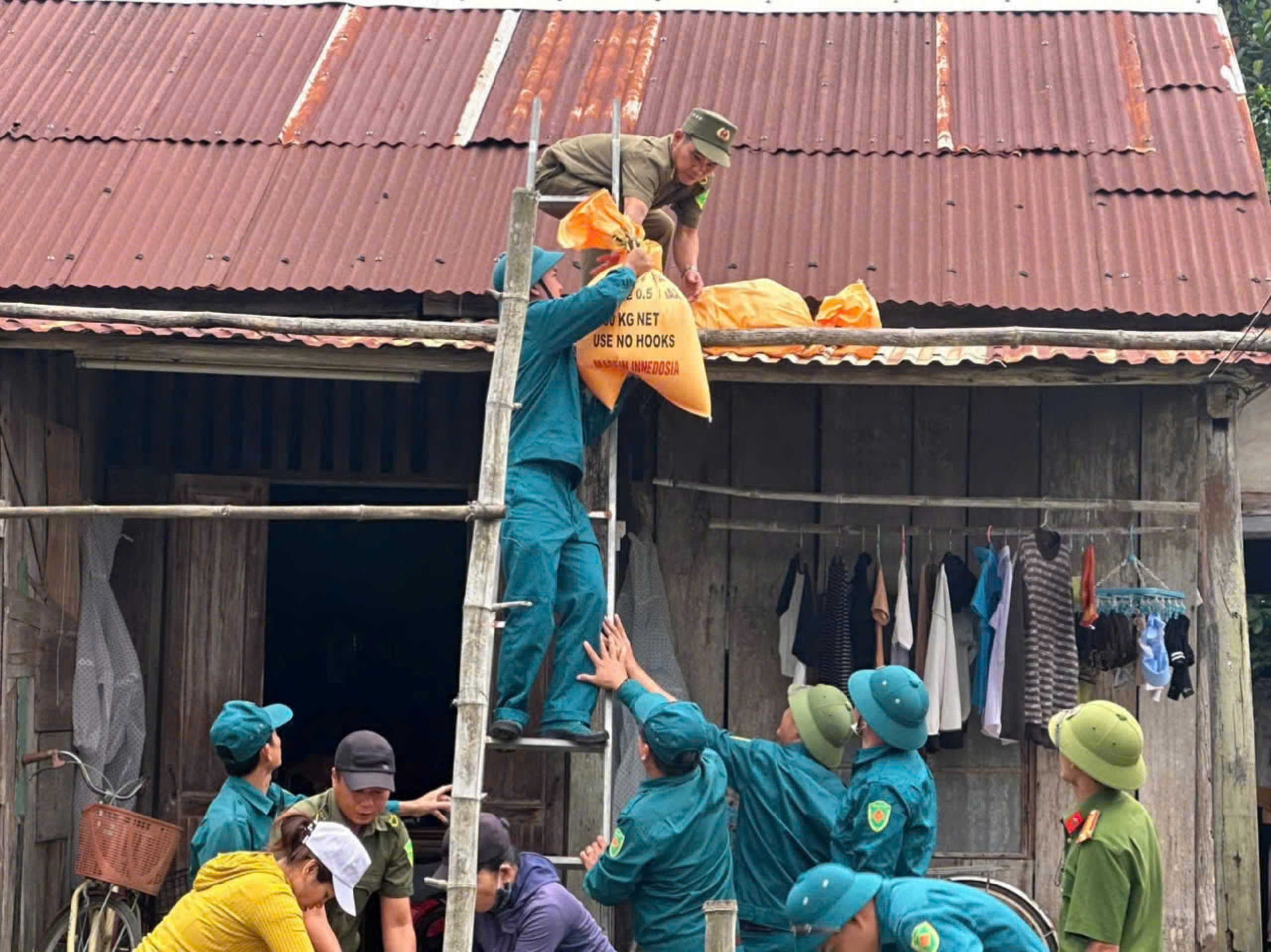
Helping people to reinforce their houses to avoid storm number 6 - Tra Mi. Photo: Contributor
According to the report of the Provincial Border Guard, they are currently coordinating with localities to deploy storm response plans. The force is on duty with 28 teams with 202 officers and soldiers, and 5 canoes ready to evacuate 1,046 households with 3,981 people to safety according to local plans.
Source: https://danviet.vn/cap-nhat-tin-ve-bao-so-6-cach-da-nang-khoang-90km-giat-cap-11-cu-lao-cham-song-to-gio-rit-lien-hoi-20241027073432884.htm

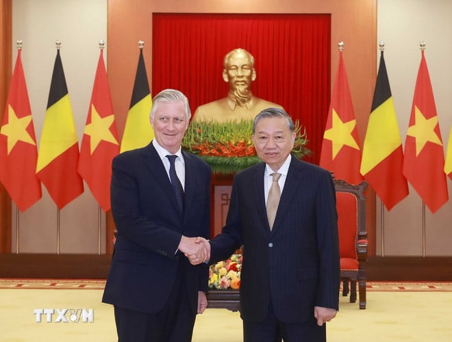
![[Photo] President Luong Cuong and King Philippe of Belgium visit Thang Long Imperial Citadel](https://vstatic.vietnam.vn/vietnam/resource/IMAGE/2025/4/1/cb080a6652f84a1291edc3d2ee50f631)
![[Photo] Prime Minister Pham Minh Chinh meets with King Philippe of Belgium](https://vstatic.vietnam.vn/vietnam/resource/IMAGE/2025/4/1/be2f9ad3b17843b9b8f8dee6f2d227e7)
![[Photo] Queen of the Kingdom of Belgium and the wife of President Luong Cuong visit Uncle Ho's Stilt House](https://vstatic.vietnam.vn/vietnam/resource/IMAGE/2025/4/1/9752eee556e54ac481c172c1130520cd)
![[Photo] Myanmar's capital in disarray after the great earthquake](https://vstatic.vietnam.vn/vietnam/resource/IMAGE/2025/4/1/7719e43b61ba40f3ac17f5c3c1f03720)


![[Photo] President Luong Cuong and the King of Belgium witness the Vietnam-Belgium document exchange ceremony](https://vstatic.vietnam.vn/vietnam/resource/IMAGE/2025/4/1/df43237b0d2d4f1997892fe485bd05a2)


Comment (0)