

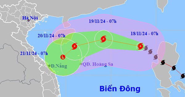
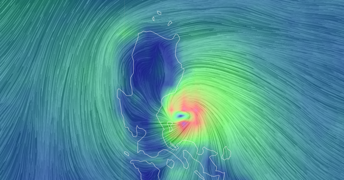
Storm No. 2 is gusting at level 11, updated wind direction layer at sea at 7:00 a.m. on July 23. Photo: Vietnam Disaster Monitoring System
Latest update from the National Center for Hydro-Meteorological Forecasting, due to the influence of storm No. 2 circulation, Bach Long Vi island has strong winds of level 10, gusting to level 12; Co To island has strong winds of level 6, gusting to level 9; Cua Ong has strong winds of level 6, gusting to level 7; Dam Ha (Quang Ninh) has strong winds of level 6, gusting to level 9.
The coastal areas of the Northeast have had moderate to heavy rain, and some places have had very heavy rain such as: Cat Ba (Hai Phong) 215mm, Van Don (Quang Ninh) 108mm...
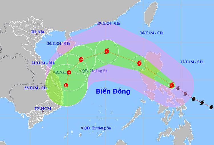
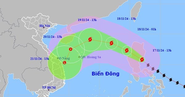
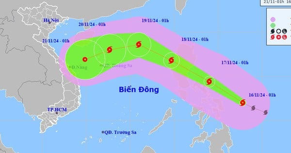
At 4:00 a.m. on July 23 , the center of storm No. 2 was at about 21.1 degrees north latitude; 107.6 degrees east longitude, on the coastal area of Quang Ninh - Hai Phong. The strongest wind near the center of the storm was level 8 - 9 (62 - 88 km/h), gusting to level 11, moving northwest at a speed of about 10 km/h.
It is forecasted that in the next 12 hours , storm No. 2 will move northwest at a speed of about 5-10km/h and weaken into a tropical depression. At 4:00 p.m. on July 23, the center of the tropical depression will be at about 21.6 degrees north latitude - 106.8 degrees east longitude; in the Northeast region of the North.
Forecast in the next 24 hours , the tropical depression will weaken into a low pressure area over the northern mountainous region.
Regarding the impact of storm No. 2 at sea , the sea area of Bac Bo Gulf (including Bach Long Vi and Co To islands) has strong winds of level 6-7, the area near the storm's center has strong winds of level 8-9, gusts of level 11, and very rough seas.
In the Gulf of Tonkin (including Bach Long Vi and Co To islands), wave height is 2-4m, in the coastal waters of Quang Ninh - Hai Phong, wave height is 2-3m.
On the afternoon of July 23, the coastal areas of the provinces from Quang Ninh to Nam Dinh had high tides, with water levels at Hon Dau 3.8 - 4m and Cua Ong 4.6 - 4.8m, slowing down the flood drainage process on rivers, causing flooding in low-lying coastal and riverside areas.
On land , the Quang Ninh - Hai Phong area has strong winds of level 6 - 7, near the storm center level 8, gusting to level 10; the Lang Son, Bac Giang, Thai Binh areas have strong winds of level 5, in some places level 6, gusting to level 7.
From early morning of July 23 to the end of July 24, the Northern region and Thanh Hoa will have moderate rain, heavy rain and thunderstorms, with some places having very heavy rain.
Source: https://laodong.vn/moi-truong/bao-so-2-gay-mua-to-du-bao-dien-bien-moi-nhat-1370210.ldo
![[Photo] Many practical activities of the 9th Vietnam-China border defense friendship exchange](https://vstatic.vietnam.vn/vietnam/resource/IMAGE/2025/4/16/3016ed3ef51049219574230056ddb741)
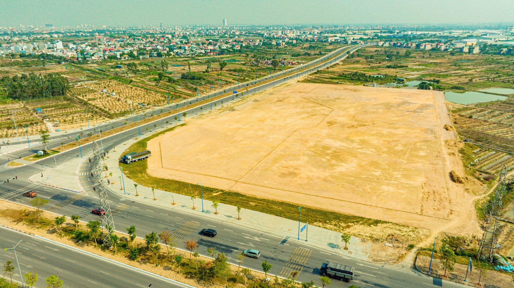
![[Photo] North-South Expressway construction component project, Bung - Van Ninh section before opening day](https://vstatic.vietnam.vn/vietnam/resource/IMAGE/2025/4/17/ad7c27119f3445cd8dce5907647419d1)
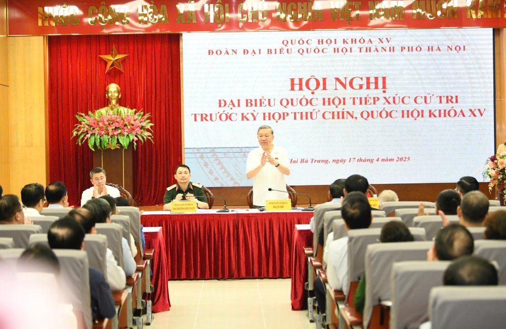
![[Photo] General Secretary To Lam attends conference to meet voters in Hanoi city](https://vstatic.vietnam.vn/vietnam/resource/IMAGE/2025/4/17/889ce3da77e04ccdb753878da71ded24)
![[Photo] President Luong Cuong receives Lao Prime Minister Sonexay Siphandone](https://vstatic.vietnam.vn/vietnam/resource/IMAGE/2025/4/17/337e313bae4b4961890fdf834d3fcdd5)


![[Photo] President Luong Cuong receives Ethiopian Prime Minister Abiy Ahmed Ali](https://vstatic.vietnam.vn/vietnam/resource/IMAGE/2025/4/16/504685cac833417284c88a786739119c)
![[Photo] National Assembly Chairman Tran Thanh Man meets with Ethiopian Prime Minister Abiy Ahmed Ali](https://vstatic.vietnam.vn/vietnam/resource/IMAGE/2025/4/16/c196dbc1755d46e4ae7b506c5c15be55)
![[Photo] Opening of the 4th Summit of the Partnership for Green Growth and the Global Goals](https://vstatic.vietnam.vn/vietnam/resource/IMAGE/2025/4/16/488550ff07ce4cd9b68a2a9572a6e035)


![[Video] Viettel officially puts into operation the largest submarine optical cable line in Vietnam](https://vstatic.vietnam.vn/vietnam/resource/IMAGE/2025/4/17/f19008c6010c4a538cc422cb791ca0a1)


Comment (0)