
 |
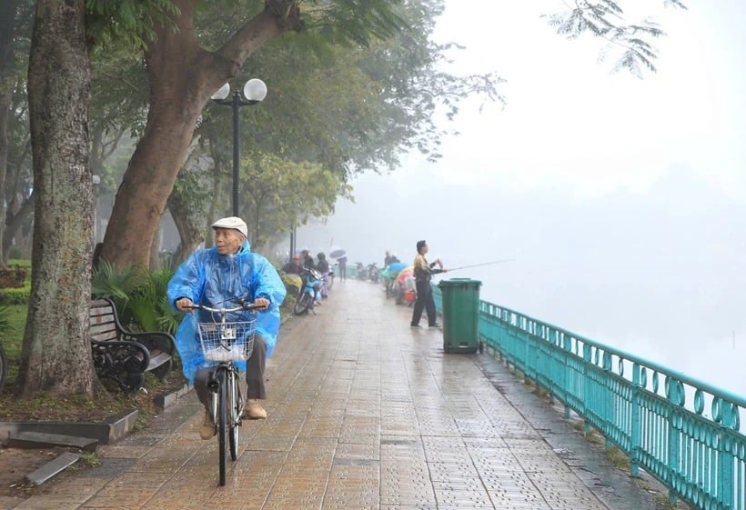
| On the day and night of March 28, the Northeast region and the capital Hanoi will have rain and fog in the morning. (Photo: Nguyen Hoa/VNA) |
According to the National Center for Hydro-Meteorological Forecasting, on the day and night of March 28, the Northeast region and the capital Hanoi will have rain and fog in the morning.
The Northwest, Central, Central Highlands and Southern regions will have sunny days, with some places experiencing hot weather with temperatures above 37 degrees Celsius.
According to Nguyen Van Huong, Head of Weather Forecasting Department, National Center for Hydro-Meteorological Forecasting, fog reduces visibility, potentially endangering traffic, especially on national highways, airport areas, and leaving smoke, dust, and toxic substances in the air.
To limit the effects of fog, when people go out they need to use medical masks to prevent toxic gases in the fog, keep their bodies warm, and not dry clothes outside overnight.
Before wearing, people need to iron clothes to kill mold on clothes, supplement nutrition to improve the immune system, avoid going out too early in the morning...
Regarding the development of cold air, early on the morning of March 28, Deputy Head of Weather Forecast Department, National Center for Hydro-Meteorological Forecasting Nguyen Huu Thanh said that the cold air mass is still moving south.
It is forecasted that from the afternoon and night of March 28, this cold air mass will affect the Northeast, North Central and some places in the Northwest, then affect other places in the Northwest and some places in the Central Central. Inland, the wind will gradually change to the Northeast, increasing to level 2-3, and coastal areas to level 3-4.
From the night of March 28, the weather in the North and North Central regions will turn cold. The lowest temperature in this cold air mass in the North is generally between 15-18 degrees Celsius, in mountainous areas below 13 degrees Celsius; in the North Central region, it is generally 17-19 degrees Celsius.
Hanoi area from the night of March 28, the weather turned cold. The lowest temperature in this cold air mass is commonly 16-18 degrees Celsius.
At sea, from the afternoon of March 28, the wind in the Gulf of Tonkin will change direction to Northeast and gradually increase to level 6, gusting to level 7-8, rough seas, waves 2-3m high. From the night of March 28, the sea area north of the North East Sea will change direction to Northeast, strong level 6, sometimes level 7, gusting to level 8, rough seas, waves 3-5m high.
Due to the influence of cold air, from the night of March 28, the Northern region will have scattered rain and light rain, the North Central region will have scattered rain and showers and thunderstorms in some places. Thunderstorms may include tornadoes, lightning, hail and strong gusts of wind.
Cold weather can affect livestock, poultry, and the growth and development of crops.
Thunderstorms accompanied by tornadoes, lightning, hail and strong winds can affect agricultural production, cause trees to fall, damage houses, traffic works and infrastructure.
Strong winds and large waves at sea are likely to affect boating and other activities.
Weather in regions day and night 28-3:
Northwest
- Sunny day, except for the Northwest region where it is hot; in the evening there will be showers and thunderstorms in some places, with the possibility of tornadoes, lightning, hail and strong gusts of wind.
- Lowest temperature 20-23 degrees Celsius, some places below 20 degrees Celsius. Highest temperature 31-34 degrees Celsius, in the Northwest region some places above 35 degrees Celsius.
Northeast
- Light rain, drizzle and scattered fog in the morning; scattered rain and showers at night, the weather turns cold at night. Southeast to South wind level 2-3, at night turning to Northeast wind level 2-3, coastal areas level 3-4.
- Lowest temperature 16-19 degrees Celsius, in mountainous areas some places below 15 degrees Celsius. Highest temperature 26-29 degrees Celsius, in some places above 29 degrees Celsius.
Hanoi capital
- Light rain, drizzle and fog in the morning; scattered rain and showers at night. Southeast to South wind level 2-3, at night changing to Northeast wind level 2-3.
- Lowest temperature 17-19 degrees Celsius. Highest temperature 26-28 degrees Celsius.
Provinces and cities from Thanh Hoa to Hue
- Sunny day, especially hot weather in the western mountainous areas; scattered showers and thunderstorms at night, South to Southwest wind level 2-3. In the North, scattered showers and thunderstorms are possible, with the possibility of tornadoes, lightning, hail and strong gusts of wind. At night, the northeast wind level 2-3, coastal areas level 3-4, and the weather turns cold.
- The lowest temperature in the North is 18-20 degrees Celsius, in the South is 20-22 degrees Celsius. The highest temperature in the North is 29-32 degrees Celsius, in the South is 31-34 degrees Celsius, especially in the mountainous areas in the West is 35-37 degrees Celsius, some places are over 37 degrees Celsius.
Provinces and cities from Da Nang to Binh Thuan
- Sunny day, showers and thunderstorms at night in some places. East to Southeast wind level 2-3.
- Lowest temperature 22-25 degrees Celsius. Highest temperature 31-34 degrees Celsius, some places above 34 degrees Celsius.
Central Highlands region
- Sunny day, hot in some places, showers and thunderstorms in the evening and at night. Light wind.
- Lowest temperature 19-22 degrees Celsius. Highest temperature 31-34 degrees Celsius, some places over 35 degrees Celsius.
Southern Region
- Sunny day, hot in some places, showers and thunderstorms in the evening and at night. Light wind.
- Lowest temperature 22-25 degrees. Highest temperature 32-35 degrees Celsius, some places over 35 degrees Celsius.
According to vietnamplus.vn
Source: https://baodanang.vn/xa-hoi/202503/bac-bo-va-bac-trung-bo-troi-chuyen-ret-tu-dem-nay-28-3-4002754/

![[Photo] Closing of the 11th Conference of the 13th Central Committee of the Communist Party of Vietnam](https://vstatic.vietnam.vn/vietnam/resource/IMAGE/2025/4/12/114b57fe6e9b4814a5ddfacf6dfe5b7f)
![[Photo] Overcoming all difficulties, speeding up construction progress of Hoa Binh Hydropower Plant Expansion Project](https://vstatic.vietnam.vn/vietnam/resource/IMAGE/2025/4/12/bff04b551e98484c84d74c8faa3526e0)


Comment (0)