
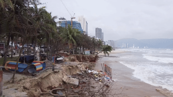
The Vietnam Meteorological Agency is monitoring the development of a tropical depression that has strengthened into a storm in the Northwest Pacific Ocean. According to the assessment, the storm is unlikely to move into the East Sea.
According to the National Center for Hydro-Meteorological Forecasting, currently (May 23), in the Northwest Pacific region (east of the southern Philippines), there is a tropical depression.
At 13:00, the location of the tropical depression was at about 7.1 degrees North latitude - 132 degrees East longitude. The tropical depression is currently moving in a West Northwest direction.

It is forecasted that in the next 24 - 48 hours, the tropical depression will move west, then change direction to northwest and possibly strengthen into a storm.
"When it strengthens into a storm, it will be the first storm in the Northwest Pacific region, a sign that the Northwest Pacific hurricane season has begun," the meteorological agency said.
After strengthening, storm No. 1 in the Northwest Pacific is forecast to move mainly northwest along the eastern part of the Philippines, then possibly move northeast and then back to the Northwest Pacific.
According to the National Center for Hydro-Meteorological Forecasting, current forecasts from international storm forecasting centers show that the storm will move to the deepest west (entering the meridian about 123 degrees east) and then change direction to go out.
"The current assessment is that the possibility of the storm entering the East Sea is not high," the meteorological expert predicted, adding that the impact of the storm causing strong winds and heavy rains on the eastern part of the East Sea is also very low. The National Center for Hydro-Meteorological Forecasting is still closely monitoring the development of this tropical depression, which will later strengthen into a storm.
According to this agency, in May every year, there are about 1.3 storms and tropical depressions appearing in the Northwest Pacific. Thus, almost every year, storms and tropical depressions appear in the Northwest Pacific.
Previously, at the National Conference on Disaster Prevention, Control and Search and Rescue in 2024, Mr. Hoang Duc Cuong, Deputy Director General of the General Department of Hydrometeorology, said that the El Nino phenomenon is gradually weakening and turning to a neutral state, forecasting the possibility of turning into La Nina in the last months of 2024.
Accordingly, Mr. Hoang Duc Cuong forecasted that in 2024, there will be about 11-13 storms in the East Sea and 5-7 storms affecting our mainland. Storm and tropical depression activities are likely to concentrate in the second half of the storm season (from September to November).
Source
![[Photo] General Secretary To Lam receives Japanese Ambassador to Vietnam Ito Naoki](https://vstatic.vietnam.vn/vietnam/resource/IMAGE/2025/4/3/3a5d233bc09d4928ac9bfed97674be98)
![[Photo] Special relics at the Vietnam Military History Museum associated with the heroic April 30th](https://vstatic.vietnam.vn/vietnam/resource/IMAGE/2025/4/3/a49d65b17b804e398de42bc2caba8368)
![[Photo] Moment of love: Myanmar people are moved to thank Vietnamese soldiers](https://vstatic.vietnam.vn/vietnam/resource/IMAGE/2025/4/3/9b2e07196eb14aa5aacb1bc9e067ae6f)


Comment (0)