

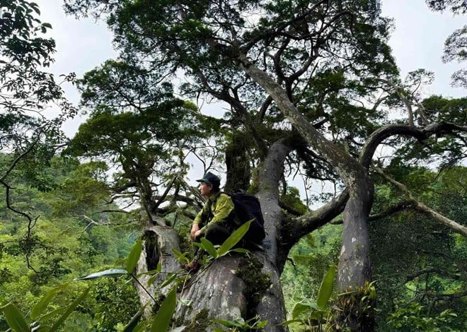
One of the most mentioned peaks in the Northwest mountain ranges because of its majesty, diverse terrain, and beautiful scenery is Ky Quan San - a place known as "White Cloud Paradise". This is an attractive destination for those who love to conquer heights.
 Ky Quan San, also known as Bach Moc Luong Tu, is the 4th highest mountain in Vietnam with an altitude of 3,046m above sea level, and the difficulty of conquering is rated at 4/5.
  The name Ky Quan San coincides with the name of a small village at the foot of the mountain in Sang Ma Sao commune, Bat Xat district, Lao Cai province. The Ky Quan San range runs along the border between Lao Cai and Lai Chau provinces (located between Sin Suoi Ho commune, Phong Tho district, Lai Chau province and Sang Ma Sao commune, Bat Xat district, Lao Cai province).
  The Ky Quan San range extends all the way to the Hoang Lien Son range to the southeast, creating and nurturing lush green hills, beautiful primeval forests, many waterfalls and especially the highest mountains in Vietnam.
  The best time to climb Ky Quan San starts from August when the climate is cool, sunny, and less rainy. The colder weather in the following months is suitable for “cloud hunting”, and it is also the season when maple leaves change color to red throughout the forest, at the same time the green color of moss grows on old tree trunks or large rocks thanks to the humidity brought by winter fog.
  Come March, the forest is ablaze with the bright colors of blooming rhododendrons. Temperatures remain mild from the last cold north winds before summer sets in.
  The journey from the starting point in Sang Ma Sao commune to the top of the mountain is about 15km long, passing through many different terrains. This will not be a walk for beginners, but if you have prepared your physical strength seriously, the reward you receive for the trip will be worthy.
  Those are unforgettable memories of forests covered in white mist, red maple leaves spreading along the paths, clear streams, precariousness on majestic cliffs and gentle sleep under the starry sky after a hard day of climbing.
  We started from the trail passing through the hills, bamboo forests, cardamom gardens and the fairly flat primeval forest until we heard the sound of a babbling brook in the quiet space of the old forest. The next stretch of road was more difficult with slippery moss-covered rocks and a continuous uphill slope, but in return was the wild beauty of the primeval forest.
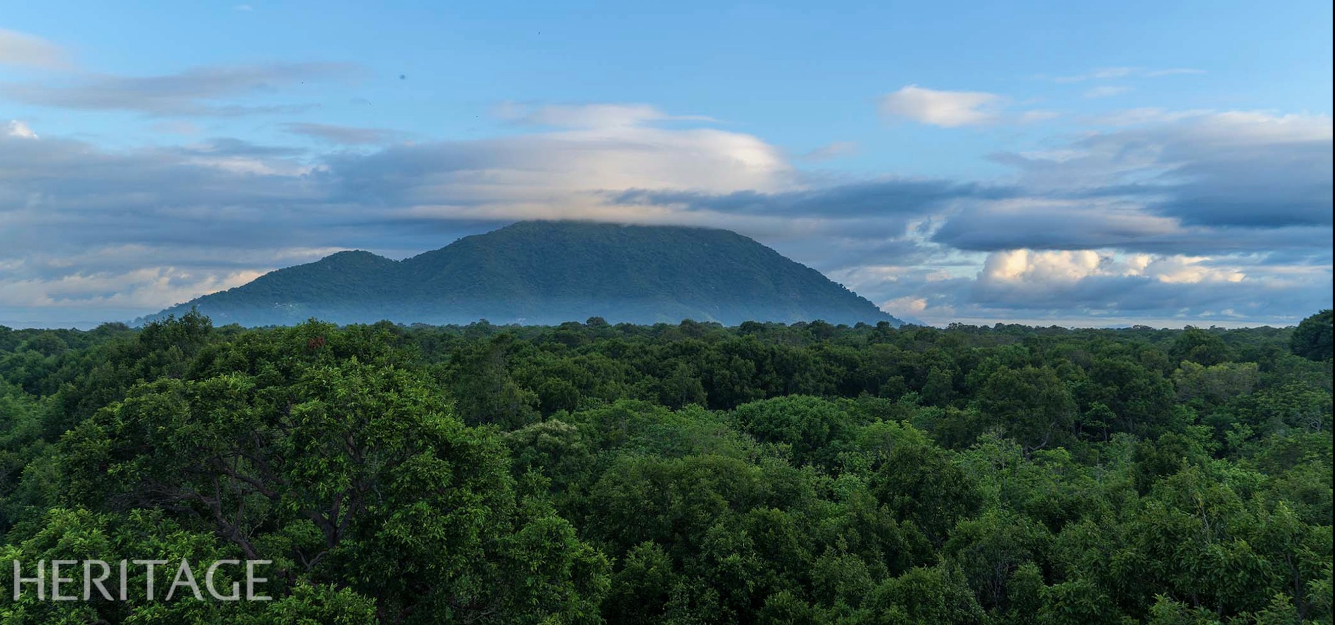
  From afar, you can see Ky Quan San peak standing tall on the massive mountain range stretching across the sky. The first destination to conquer is Muoi mountain at an altitude of 2,100m, which is also the resting place for the first day's journey. In a flash, the night has fallen, with a wide view from the Muoi mountain resting place, you can see the sparkling starry sky, and in the distance are the mountain peaks standing tall in the night. The space is absolutely quiet, and time passes slowly as if everything is standing still.
Heritage Magazine

![[Photo] Speeding up construction of Ring Road 3 and Bien Hoa-Vung Tau Expressway](https://vstatic.vietnam.vn/vietnam/resource/IMAGE/2025/3/31/f1431fbe7d604caba041f84a718ccef7)
![[Photo] General Secretary To Lam receives US Ambassador to Vietnam Marc E. Knapper](https://vstatic.vietnam.vn/vietnam/resource/IMAGE/2025/3/31/5ee45ded5fd548a685618a0b67c42970)
![[Photo] 2nd Conference of the Party Executive Committee of Central Party Agencies](https://vstatic.vietnam.vn/vietnam/resource/IMAGE/2025/3/31/8f85b88962b34701ac511682b09b1e0d)
![[Photo] Prime Minister Pham Minh Chinh receives delegation of leaders of US universities](https://vstatic.vietnam.vn/vietnam/resource/IMAGE/2025/3/31/8be7f6be90624512b385fd1690124eaa)


![[REVIEW OCOP] An Lanh Huong Vet Yen Cat](https://vstatic.vietnam.vn/vietnam/resource/IMAGE/2025/3/27/c25032328e9a47be9991d5be7c0cad8c)

Comment (0)