
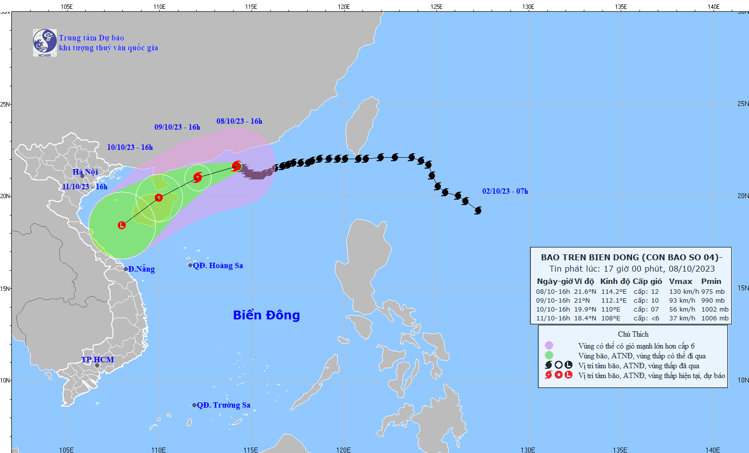
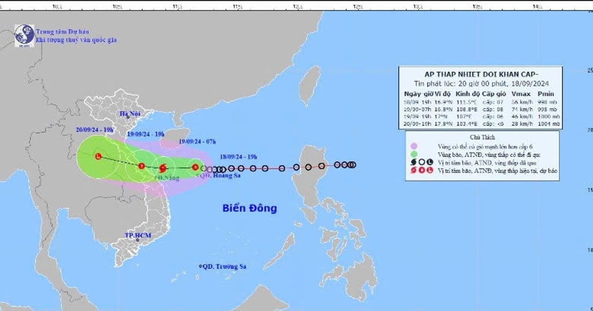
At 4:00 p.m. on October 8, the center of the storm was located at approximately 21.6 degrees North latitude; 114.2 degrees East longitude, approximately 100km south of Hong Kong (China). The strongest wind near the center of the storm was level 12 (118-133km/h), gusting to level 15, moving slowly in a West-Northwest direction at a speed of approximately 5km/h.
It is forecasted that by 4:00 p.m. on October 9, storm No. 4 will be about 200km east-northeast of Leizhou Peninsula (China), with the strongest wind near the storm center at level 9-10, gusting to level 13, moving in a West-Southwest direction at a speed of 5-10km/h and gradually weakening.
A day later, at 4:00 p.m. on October 10, storm No. 4 in the northern area of Hainan Island (China), the strongest wind near the storm center was level 7, gusting to level 9, continued to move in the West Southwest direction, traveling about 10km per hour and weakened into a tropical depression.
In the next 24 hours, specifically until 4:00 p.m. on October 11, the storm in the southern Gulf of Tonkin will change direction to the Southwest, maintaining a speed of about 10km/h and weakening into a low pressure area.
The Hydrometeorological Agency forecasts that in the next 24 to 48 hours, the northwest sea area of the North East Sea will have strong winds of level 7-9, near the storm center strong winds of level 10-12, gusting to level 15; the sea will be rough. In addition, due to the influence of strengthening cold air, from early morning on October 10, the sea area of the Gulf of Tonkin will have strong northeast winds of level 6, gusting to level 8; rough seas.
Source
![[Photo] Close-up of Vietnam's sniffer dog team searching for earthquake victims in Myanmar](https://vstatic.vietnam.vn/vietnam/resource/IMAGE/2025/4/1/d4949a0510ba40af93a15359b5450df2)

![[Photo] Prime Minister Pham Minh Chinh meets with King Philippe of Belgium](https://vstatic.vietnam.vn/vietnam/resource/IMAGE/2025/4/1/be2f9ad3b17843b9b8f8dee6f2d227e7)
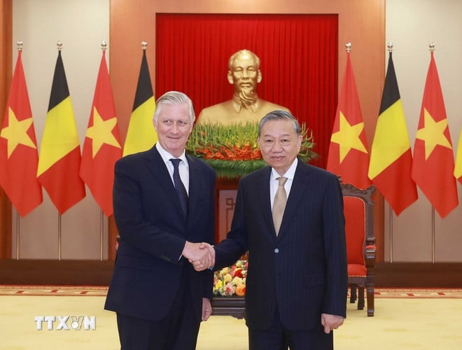
![[Photo] General Secretary To Lam receives King Philippe of Belgium](https://vstatic.vietnam.vn/vietnam/resource/IMAGE/2025/4/1/e5963137a0c9428dabb93bdb34b86d7c)
![[Photo] President Luong Cuong and King Philippe of Belgium visit Thang Long Imperial Citadel](https://vstatic.vietnam.vn/vietnam/resource/IMAGE/2025/4/1/cb080a6652f84a1291edc3d2ee50f631)


![[Photo] Myanmar's capital in disarray after the great earthquake](https://vstatic.vietnam.vn/vietnam/resource/IMAGE/2025/4/1/7719e43b61ba40f3ac17f5c3c1f03720)


Comment (0)