
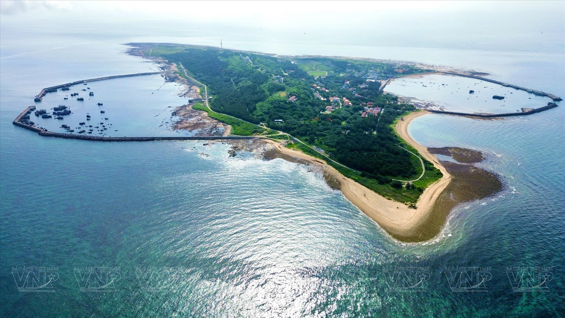
Vietnam's Bach Long Vi Island in the Gulf of Tonkin - Photo: VNA
On March 15, the Vietnamese Ministry of Foreign Affairs said that the United Nations Secretary-General has officially announced that Vietnam has completed the procedures for depositing nautical charts and a list of geographical coordinates related to the baseline used to calculate the width of territorial waters in the Gulf of Tonkin.
Specifically, the announcement dated March 12, 2025 of the United Nations Secretary-General to member countries stated that on March 7, 2025, in accordance with Clause 2, Article 16 of UNCLOS 1982, the Government of Vietnam deposited with the United Nations the nautical chart along with a list of geographical coordinates of the points determining the straight baseline for the mainland territory in the Gulf of Tonkin and the outer boundary of the territorial sea in this area.
On March 14, yesterday, the United Nations website posted detailed information about the depository content.
The UN Secretary-General's announcement also stated that the Vietnamese Government's statement dated February 21, 2025 on the baseline for calculating the breadth of the territorial sea in the Gulf of Tonkin will be published in the upcoming official publication of the United Nations entitled "Bullet on the Law of the Sea".
The baseline used to calculate the breadth of Vietnam's territorial waters in the Gulf of Tonkin is determined on the basis of the provisions of UNCLOS, in accordance with the geographical and natural characteristics of the Gulf of Tonkin and does not affect international treaties to which Vietnam participates or is a member.
This is a legitimate activity, exercising Vietnam's rights and obligations under the provisions of UNCLOS 1982 and in accordance with the 2012 Law of the Sea of Vietnam.
The baseline used to calculate the width of Vietnam's territorial waters in the Gulf of Tonkin is the basis for determining the boundaries and scope of Vietnam's maritime zones according to the provisions of UNCLOS and the Agreement on the Delimitation of the Gulf of Tonkin between Vietnam and China signed in 2000.
The clear determination of baselines in the Gulf of Tonkin creates additional legal basis to protect and enforce Vietnam's sovereignty, sovereign rights and jurisdiction, contributing to economic development, marine management and promoting international cooperation in the coming time.
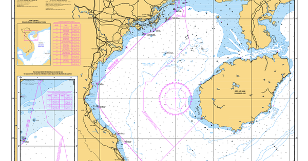
Baseline system in the Gulf of Tonkin
The baseline system in the Gulf of Tonkin consists of two parts:
The first is the straight baseline system starting from point A11 on Con Co island, passing through base points located along 10 coastal provinces and cities across the country (Quang Ninh, Hai Phong, Thai Binh, Nam Dinh, Ninh Binh, Thanh Hoa, Nghe An, Ha Tinh, Quang Binh, Quang Tri).
Second, the normal baseline surrounding Bach Long Vi Island is the low-water line along the island's coast.
Tuoitre.vn
Source: https://tuoitre.vn/viet-nam-chinh-thuc-nop-len-lien-hop-quoc-hai-do-va-toa-do-duong-co-so-tai-vinh-bac-bo-2025031514153868.htm


Comment (0)