
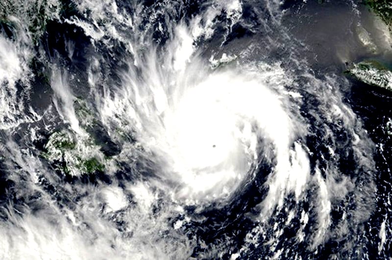
It is forecasted that in August, there will be 2-3 storms/tropical depressions in the East Sea that may affect the Northern and North Central regions. In addition, hot weather will continue to occur in the Northern and Central regions and there may be extremely hot days at the beginning of the month.
 |
| (Illustration) |
According to the National Center for Hydro-Meteorological Forecasting, in August, storms and tropical depressions are likely to appear 2-3 times in the East Sea and may affect the Northern and North Central regions.
In addition, in August, in the Northern region, hot weather continues to appear interspersed with rains. In the Central region, hot weather is likely to last in the first half of the month, with days of intense heat; in the second half of the month, hot weather tends to decrease compared to the first half of the month.
The average temperature in August in the Northern and Central regions is 0.5-1 degree Celsius higher than the average of many years, and even higher in some places; the Central Highlands and Southern regions are about 0.5 degree Celsius higher than the average of many years in the same period.
It is forecasted that during this period, the southwest monsoon in the south is likely to cause many days of showers and thunderstorms in the Central Highlands and the South, with some days of strong thunderstorms and heavy rain, with heavy rain concentrated in the late afternoon.
Rainfall in the Northern region is generally 10-25% lower than the average of many years, especially Lai Chau-Dien Bien at approximately the same level; the Central region is generally 15-30% lower; the Central Highlands and the Southern region are generally approximately the average of many years in the same period.
Warning, due to the impact of hot weather, concentrated in the Northern and Central regions, beware of the risk of fire and explosion in residential areas and production areas due to increased demand for electricity and high risk of forest fires, especially in the central region.
During this period, the tropical convergence zone continues to be active and is likely to form a tropical depression/storm in the East Sea. The tropical convergence zone combined with the strong southwest monsoon will cause strong winds and large waves in the southern seas. Therefore, fishermen need to pay attention to maritime and fishing activities to prevent danger to human life and property.
In addition, dangerous weather phenomena such as thunderstorms, tornadoes, lightning, and hail continue to appear nationwide, which can greatly affect production and people's activities.
Source link


Comment (0)