
According to current administrative geography, Binh Thuan province borders Lam Dong, Dong Nai and Ba Ria - Vung Tau provinces to the northwest, west and southwest. However, in history, the land bordering the Central, Southeast and Southern regions has undergone many changes and shifts due to the process of land reclamation, settlement and establishment of territorial sovereignty over the periods.
Follow the place name
Under the 13th year of Minh Mang (1832), Binh Thuan prefecture was changed to Binh Thuan province. It included Tuy Dinh district, but in the 7th year of Tu Duc (1854), it was changed to Tuy Ly district (still under Ham Thuan prefecture). Accordingly, this was the vast Tuy Ly district located in the southwest of present-day Binh Thuan, deeply encroaching on Bien Hoa province at that time, with borders with Dong Nai Thuong, Bien Hoa, and Ba Ria provinces. In particular, Tanh Linh district was established in the 13th year of Thanh Thai (1901) extracted from two cantons Cam Thang and Ngan Chu of Tuy Ly district, Ham Thuan prefecture to belong to Dong Nai Thuong province, established in 1899 in the upper Dong Nai river area (bordering Cochinchina). The remaining Tuy Ly district was Ham Tan district. After the August Revolution in 1945, the provinces of Binh Thuan, Ninh Thuan, Lam Vien, and Dong Nai Thuong belonged to Zone 6 (out of 14 zones nationwide). Then in 1948, the Zone was merged into Lien khu - Zone 5 and Zone 6 became Lien khu Nam Trung bo. After 1956, under the government of the Republic of Vietnam, Binh Tuy province was established, including parts of Dong Nai Thuong province, creating three districts: Tanh Linh, Hoai Duc, Ham Tan. At the same time, Lam Vien/Da Lat province and part of Dong Nai Thuong were merged to form Tuyen Duc province. Dong Nai Thuong province was renamed Lam Dong province.
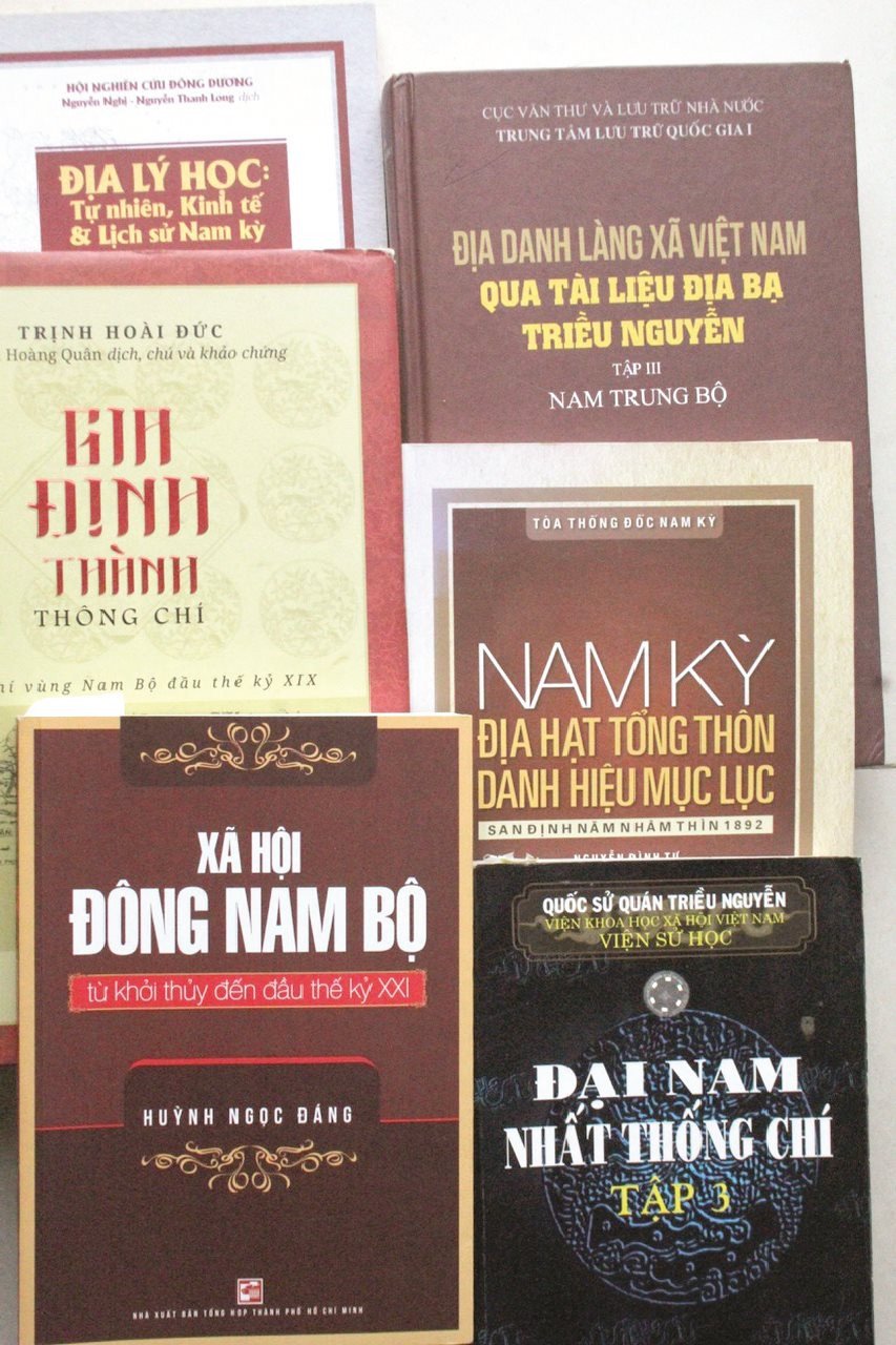
Many place names on the French map in the early 20th century are no longer there or have been changed due to local reading or naming according to the new administrative units of the contemporary government. However, based on many remaining place names currently belonging to Duc Linh and Tanh Linh districts (Binh Thuan), it can be determined that they were villages and cantons that previously belonged to Bien Hoa or Dong Nai Thuong provinces. With the Bien Hoa/Dong Nai district administrative unit, the administrative organization of the 6 provinces of Cochinchina (1874) had the names of cantons, villages Dinh Quan/Dinh Quat, Tuc Trung (previously belonging to Dong Nai Thuong province), Cao Cang/Cao Cuong belonging to Binh Tuy canton and villages Gia An, Tra Tan, Do Dat/Vo Dat belonging to Phuoc Thanh canton (on the old map of Binh Thuan), the western part in the early 20th century showed the Dong Nai river basin area... with Binh Tuy canton recorded. The book “Nam Ky Dia Huyen Tong Thon (1892)”, in the chapter of Bien Hoa District, recorded Binh Tuy commune and Phuoc Thanh commune, in which the names of the villages Cao Cang/Cao Cuong, Dinh Quan, Tuc Trung, Gia An, Tra Tan, Do Dat/Vo Dat, Do Mang (is Vo Mang)… are two adjacent communes, which now have villages in the border area or belong to Binh Thuan land(1).
In the petition “Nghi thinh thuong du don khan su nghi so” of the minister Nguyen Thong, a lecturer and scholar, holding the position of Doanh Dien Su of Binh Thuan province (Tu Duc 30 - 1877), who set foot in the southwestern region of Binh Thuan, he mentioned a number of place names that match the “wandering” places in Bien Hoa, Dong Nai Thuong. “The minister Nguyen Thong from the west of La Ngu River (La Nga) went down the northern bank of the river through Bac Da (Bac Ruong), the southern bank through Lac Da (Bien Lac) estuary. The lower bank is La Nga River. The upper bank goes through Chu Lu, Ba Ke, Con Hien, Dai Dong to Thang River, bordering Cao Cuong commune, Binh Tuy canton, belonging to the other district” (2). It also mentioned the place names Bac Da, also known as Bac Ruong, Lac Da, or Bien Lac… and Da An (Gia An) village of the highlanders and Vo Xu on the bank of La Ngu River (La Nga), which are communes belonging to Tanh Linh, Duc Linh today.
The cradle of history
During the Nguyen Dynasty, the Nguyen Lords focused their efforts on the reclamation work, affirming the geography of the Southeast region. Not only did they encroach deep into the remote mountainous areas. From the Dong Nai River up to the La Nga River, they established villages, shops, and books and integrated with the indigenous "mountain barbarians" of the Chau Ma people. A large number of them followed the Ba Ca route up the official road to Cu Mi Ha/Binh Chau village (belonging to Nhon Xuong commune, Ba Ria province) to join the military leader Truong Dinh in responding to the resistance war against the French, establishing the Giao Loan base. The name of the place Gia Loan is mentioned quite thoroughly in the book of Vietnamese History "Resisting Invasion - Vietnamese History" by Professor Tran Van Giau: "Truong Dinh is dead. Quang Quyen, Truong Dinh's right-hand man, although talented in organization, did not have enough leadership prestige; many local leaders proclaimed themselves heroes, conflicted with each other, fought for territory and influence with each other. Quang Quyen could not control them, so Quyen moved the base to Giao Loan to live with Phan Chinh (Phan Trung); Many patriotic people in Dinh Tuong, Bien Hoa, Gia Dinh gathered under Phan Chinh's flag at Giao Loan base area, a remote mountainous area located between Ba Ria and Binh Thuan (the character Quang Quyen and other books recorded as Truong Quyen).
There are also many historical documents mentioning Giao Loan base - a large area, deep and secret mountainous terrain, and especially a strategic location between the extreme South of Central Vietnam and the South, directly under the territorial management and ruling policies of the French authorities and the Nguyen Dynasty. Giao Loan was formed and became the starting point for enemy disturbances in the Ba Ria and Bien Hoa regions. Giao Loan base established a remote defense system. The French invaders many times "occupied Giao Loan fort and then advanced to Gia Lao fort (probably Gia Lao - Chua Chan mountain, tg) and Gia Phu near the border of Binh Thuan province. In this book, Nguyen Thong's comment is recorded: "Truong Dinh was a man of intelligence, knew how to be flexible, gave strict orders, and was admired by his generals and soldiers". Historian, Professor Tran Van Giau wrote: "It must be added that Truong Dinh was a man who, thanks to the people, kept his loyalty to the country, persistently fought with the people, resisted the court's order to stop the army, and died but his example was always bright".
Historically, after the Nham Tuat 1862 peace treaty - France planned to occupy the provinces of the Southeast, which would become French concessions (1861), many Southern scholars fled to Binh Thuan when Truong Dinh's resistance was suppressed. Phan Trung and Truong Quyen (son of Truong Dinh) withdrew to establish a base in Giao Loan, the border area between Binh Thuan (Central Vietnam) and Bien Hoa/Dong Nai (South Vietnam). Due to French pressure on the Hue court, in 1890, they had to "annex the Moi territory in Tanh Linh into Bien Hoa" (quoted from Dong Nai Gazetteer), showing that in Tanh Linh district, there was a hidden "logistics" force in the strategy of Phan Trung and Truong Quyen, which was a danger to France. Although the Hue court and France had signed a "peace and alliance" agreement, France recognized the sovereignty of the king of Nam with the territory from the north to the south of Binh Thuan. But many conditions forced the court not to "ignore" the ambush plans. The vestiges of a wild land, rugged mountains and forests, the indigenous people of Chau Ma, K'ho, Raglai live sparsely according to the trade, books, and man, only familiar with shifting cultivation with "mountainous rice fields" as described by the land envoy Nguyen Thong: "La Ngu in the east starts from Ong mountain, in the west to Ky Ton mountain (Ca Tong), in the north to the bank of La Ngu river, in the south to Ong mountain. The fields have been reclaimed for about 3,000 acres" (excerpt from "Request to reclaim plantations in the upper region - 1877"). Is that what remains of the period of chaos in the South, when Phan Trung recruited 1,000 brave soldiers and migrants to respond to Truong Dinh's movement to build bases and store military provisions to continue the fight against the French.
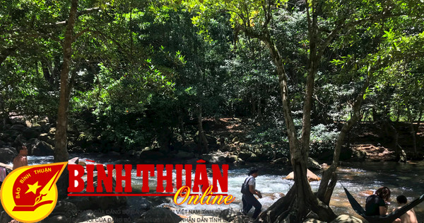
Giao Loan Base - Forest Leaves
Previously, under the Nguyen Dynasty (1802 - 1861), when Nguyen Anh recaptured Dong Nai - Gia Dinh, he predicted the situation and secretly expanded the La Buong/Giao Loan area, encouraging the forestry industry in the Chua Chan mountain area (Gia Lao - Gia Rai). On the French side, Long Khanh district was established to manage ethnic minorities. In 1899, Chua Chan mountain district (Bien Hoa province) was established, but later renamed Vo Dat district, with the district capital located in Gia Rai. At the same time, the Governor-General of Indochina separated the upper Dong Nai area from Binh Thuan to establish Dong Nai Thuong province, with the provincial capital located in Di Linh. In 1912, Vo Dat district (in Gia Rai) was abolished and Xuan Loc district was established. During the French colonial period, the peak of Chua Chan mountain, with an altitude of 847m, was an outpost for the southernmost region and monitored the movement of the Giao Loan/Rung La area connecting the border areas of the provinces of Binh Thuan, Ba Ria (3), Bien Hoa, Dong Nai Thuong, Lam Dong. The administrative boundaries between the provinces in the past with Binh Thuan and the adjacent provinces were based on natural factors, place names, and populations, so they always shifted, separated, and merged, not randomly but stemmed from the strategic calculations of each period and process in the long history of the country. However, with the southwestern part of Binh Thuan, it is quite clear that it is similar to the geography of Binh Tuy province of the Republic of Vietnam government (1956-1975), similar to the cultural region of the Southeast region, both in terms of natural geography, ecological environment, etc.
The name Giao Loan appeared earliest around the end of the 18th century. According to the Dong Nai Gazetteer, in an event it was recorded: “The commander of Thuan Thanh town, Nguyen Van Hao, and the chief of town, Nguyen Van Chan, submitted a petition saying: 38 Tra Nuong barbarians belonging to the town, previously forced to move to three districts of Dong Mon, Hung Phuoc and La Buong by bandits, have now become their property, so they now request to change to the Tran Bien population register to pay taxes annually. Nguyen Anh accepted this petition. In early 1791, the barbarians in Dong Mon district rebelled, Nguyen Anh ordered Tong Viet Phuoc to bring troops to Giao Loan to appease and prevent them”. The place name Dao Rung La/Giao Loan was mentioned from then on and was later considered a large resistance base in the wars to defend the country.
Talking about the place name Giao Loan in the history of the resistance war with the symbolic depiction of the banyan tree in the heroic, proud but also harsh and mysterious land. Giao Loan/Banyan forest became flesh and blood in the life of the swamp, spreading over a legendary border land. From the leaf sheaths, the shoots made the daily necessities of the indigenous people, the evacuees to the primitive weapons of bows and arrows, spikes in defense against the enemy. The book "Gia Dinh Thanh Thong Chi" recorded very clearly about the banyan tree with quite interesting characteristics. The Chinese name, read as Boi Diep Giang, should be La Buon because it comes from the name of the La Buon canal but the 1964 maps of the Republic of Vietnam recorded it as Buong.
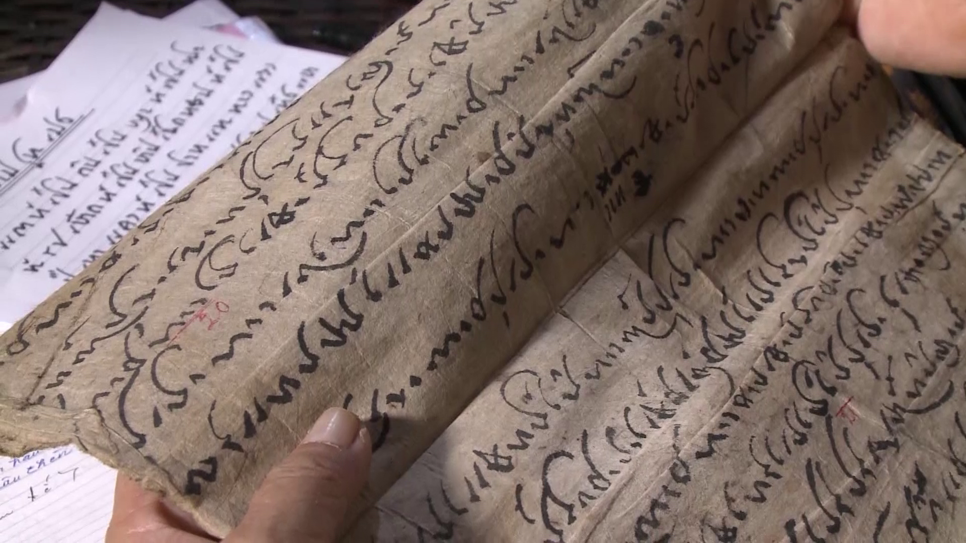
For the Cham people, the Buong Leaf writing is a miraculous cultural heritage. In the time when there were no other means, including writing paper, the Buong leaves were used to write texts for rituals, customary laws, and history (Buong leaf writing/ agal bac). With such skill, using only a sharp iron pen heated over a fire, writing on each set of Buong leaves, applying ink with charcoal powder with a respectful attitude from the monks and nuns, and preserving them as sacred treasures until later.
(1): Book "Nam Ky Dia Huyen Tong Thon" Publishing House. Ho Chi Minh City 2017. (2): Book "Nguyen Thong - People and works" - Publishing House. Ho Chi Minh City - 1984. La Nga/La Nha/La Ngu River originates from Pho Chiem mountain in Thuan Thanh town and flows south. From Pho Chiem flowing north is called Da Duong river (Da Dung/Da Dang). The upper Dong Nai river (HVNTDĐC/Hoang Viet Nhat Thong Dia Du Chi) - Vo Mang book borders Vo Dat village" - "Vo Xu borders Da An village". Ba Mountain (Lao Au). (3): In 1862, Ba Ria was upgraded to a province (DCĐN).
Source


Comment (0)