
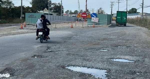
The inter-commune road worth over 400 billion VND with a length of 43.27 km has just been put into use and at least 58 landslides have appeared. The question of responsibility seems to remain unanswered.
Double cost incurred due to landslides
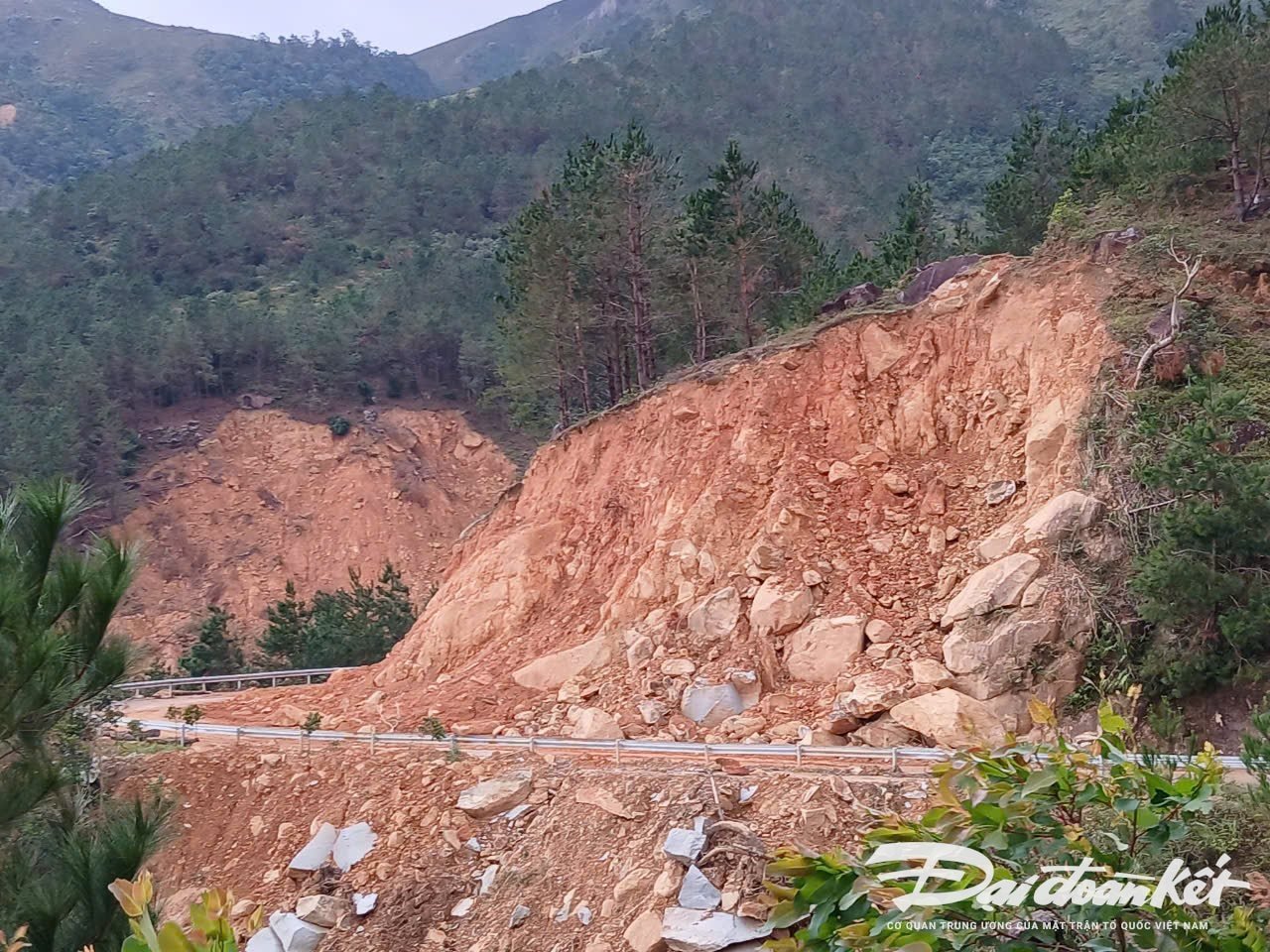
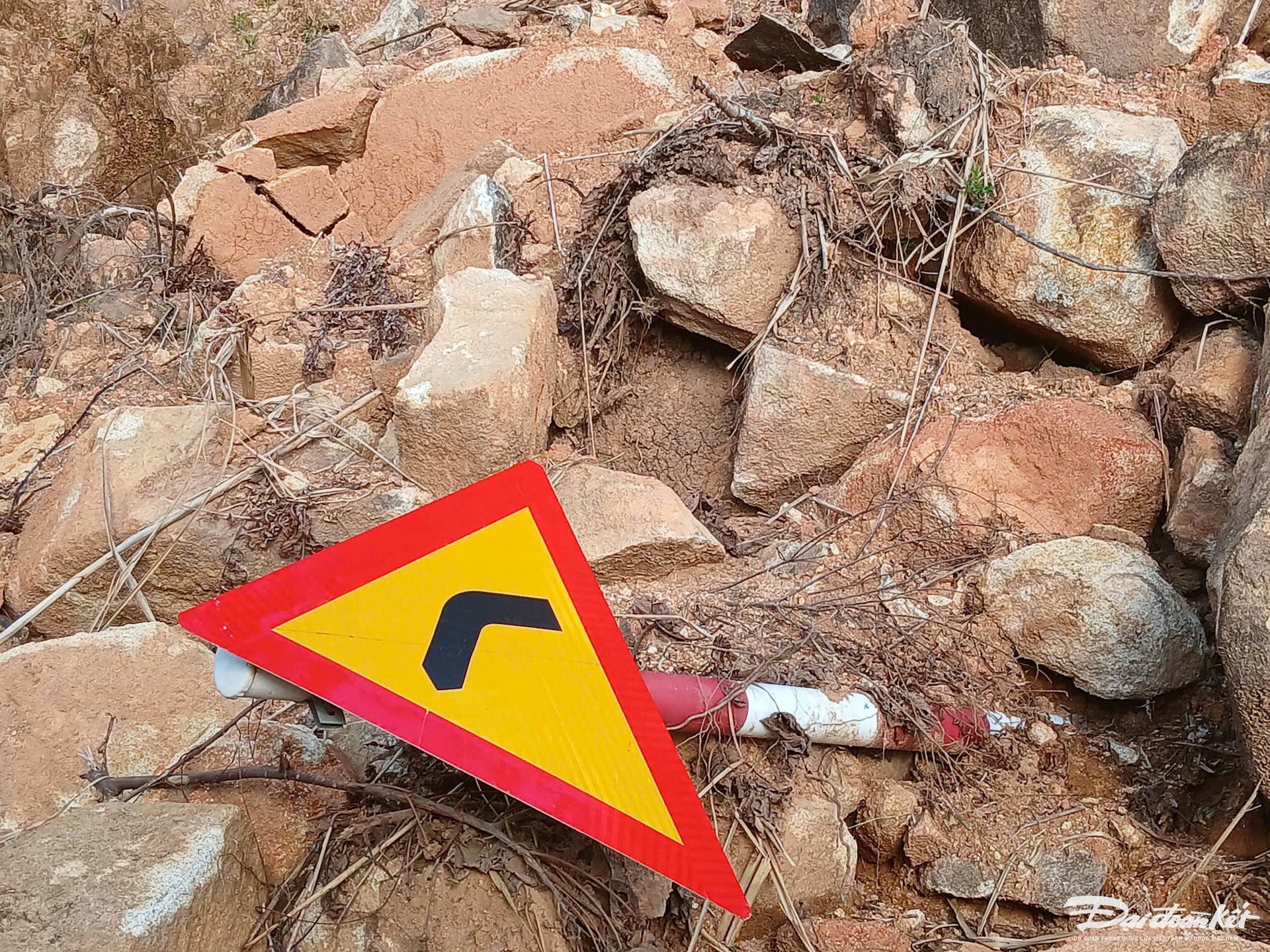
As Dai Doan Ket has reported in an article, the Huc Dong - Dong Van - Cao Ba Lanh inter-commune road project connecting with National Highway 18C in Binh Lieu district (Quang Ninh) with a total investment of more than 430 billion VND, has just been put into use for a few months and dozens of landslides have appeared. Many landslides have damaged the roadbed, guardrails, markers, signs...
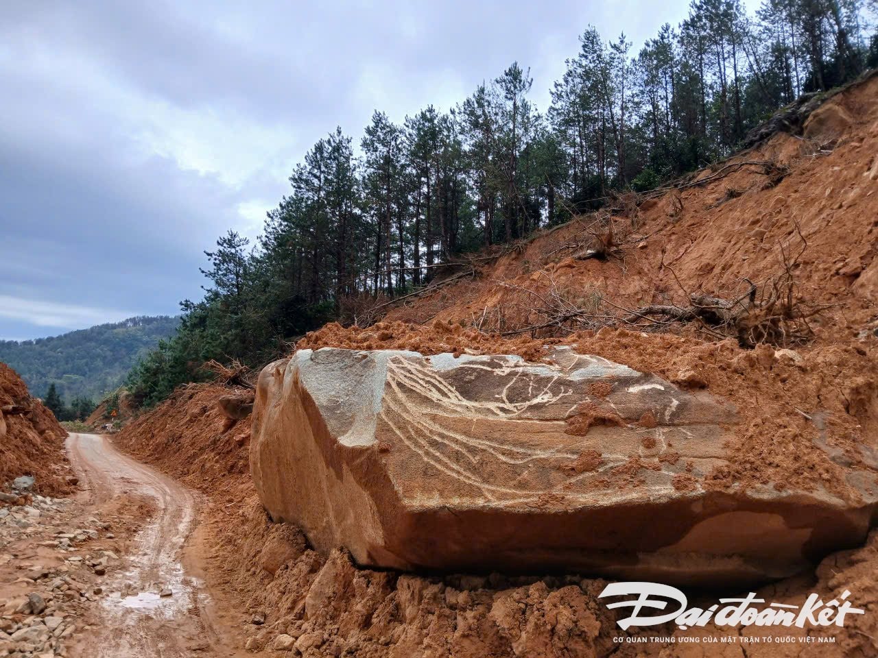
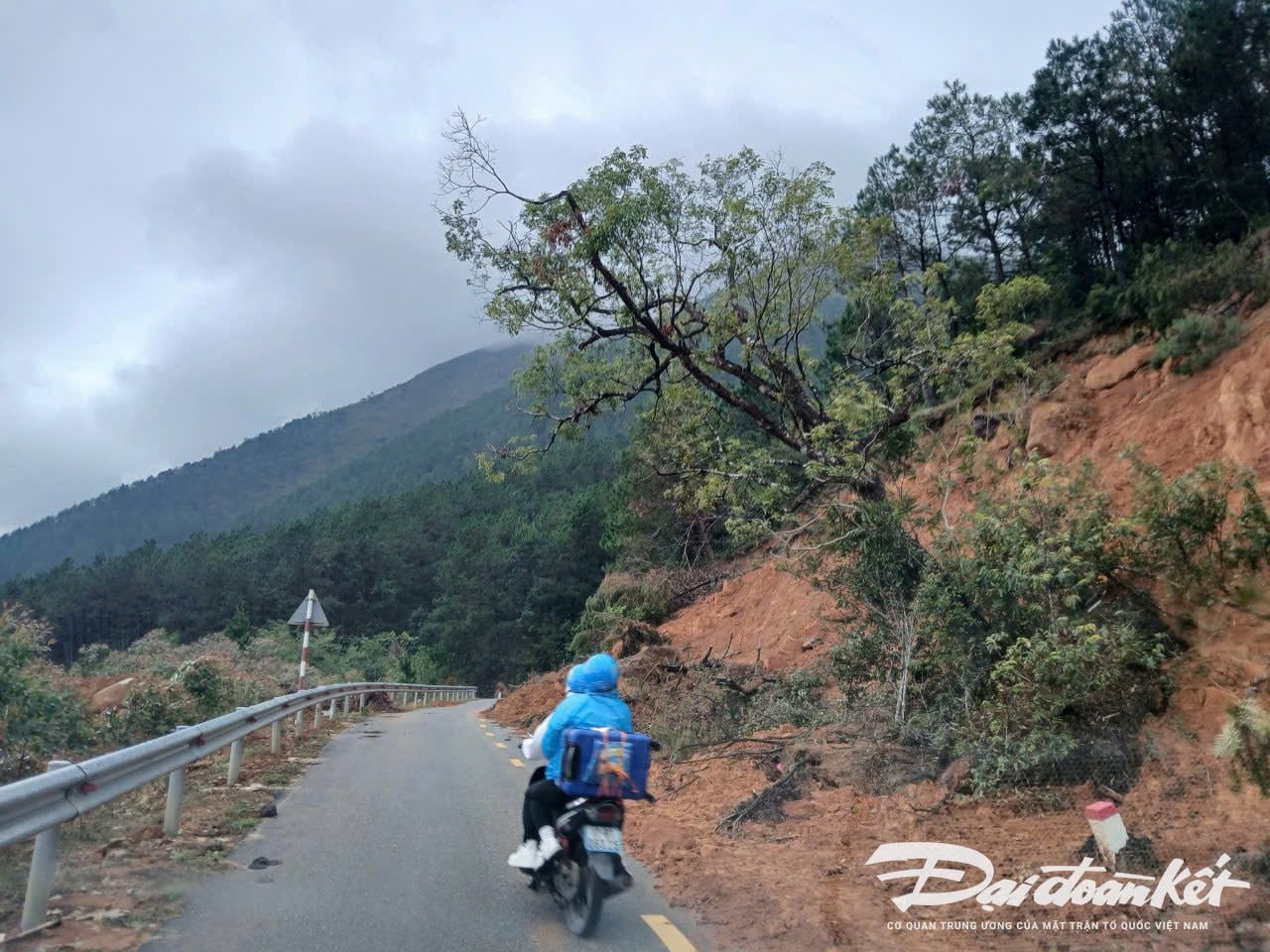
According to the feedback from local residents, landslides occurred on the Huc Dong - Hoanh Mo route before Typhoon Yagi (September 2024). Some hills on the route collapsed large areas of land, causing the positive slope of the road to collapse. After the storm, dozens of new landslides appeared on the new Huc Dong - Hoanh Mo - Dong Van road connecting with National Highway 18C, with hundreds of cubic meters of hill soil falling down at some points, causing traffic to be paralyzed. Although the soil and rocks were later cleared, many locals and tourists to Binh Lieu still did not dare to go through this route.
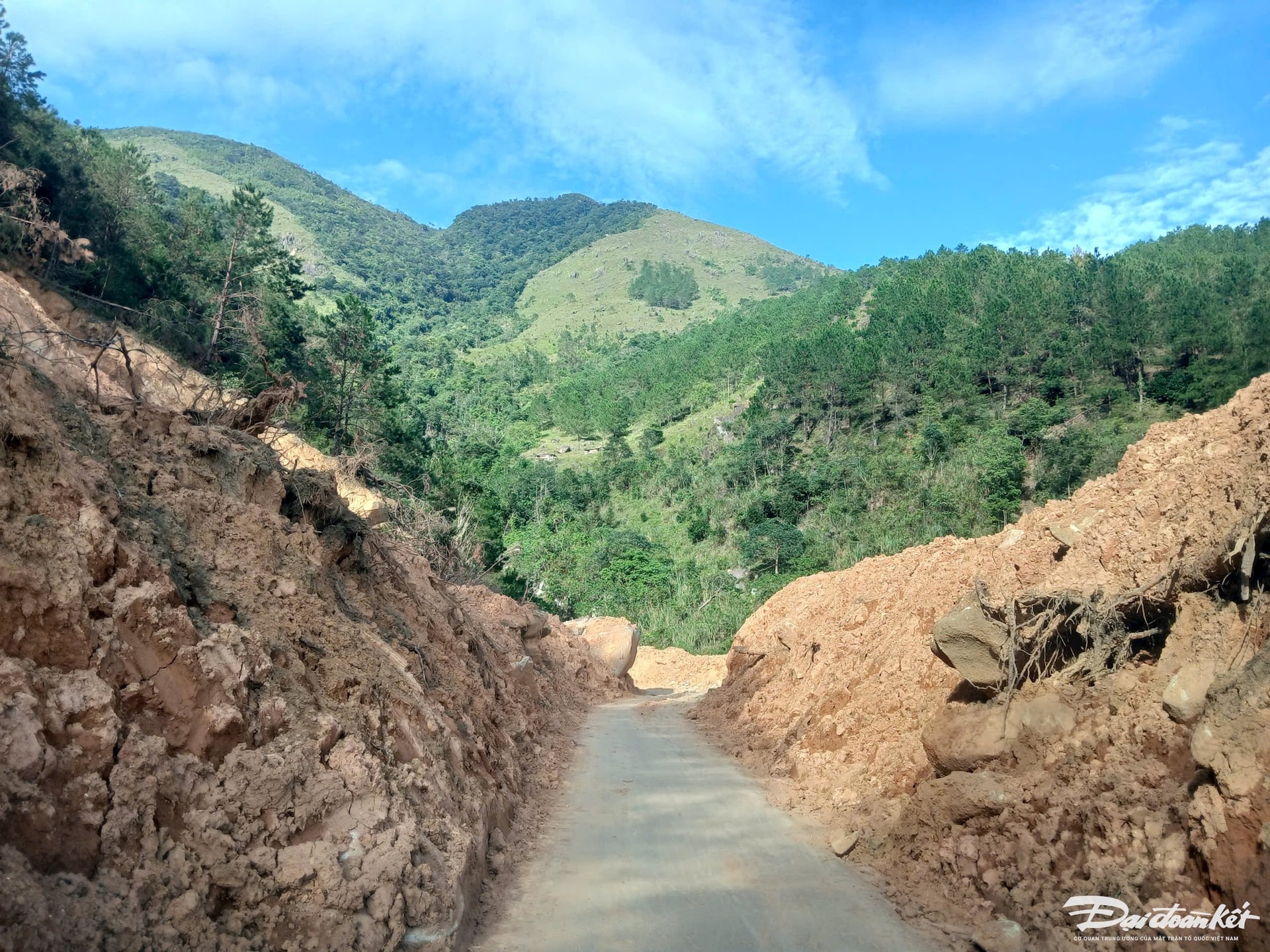
At the working session with the Binh Lieu District Construction Investment Project Management Board on November 5, a leader of the Board informed the reporter of Dai Doan Ket Newspaper: Through the inspection of the construction site after storm No. 3 (Yagi), the road was mainly affected by landslides on the negative and positive slopes, damaging the road surface and some completed construction items such as drainage ditches, reinforced curbs, guardrails, markers, and signs. Statistics show that there are about 58 landslide locations on the entire project, including both negative and positive slopes. Specifically, the Huc Dong - Dong Van route has 44 landslide locations; the Cao Ba Lanh route connecting to National Highway 18C has 14 locations, including 6 major landslide locations that damaged the roadbed, road surface, drainage ditches, and reinforced curbs. The District Construction Investment Project Management Board continues to direct the construction unit to clear the overflowing soil and rocks. Up to now, the traffic route has basically been cleared.
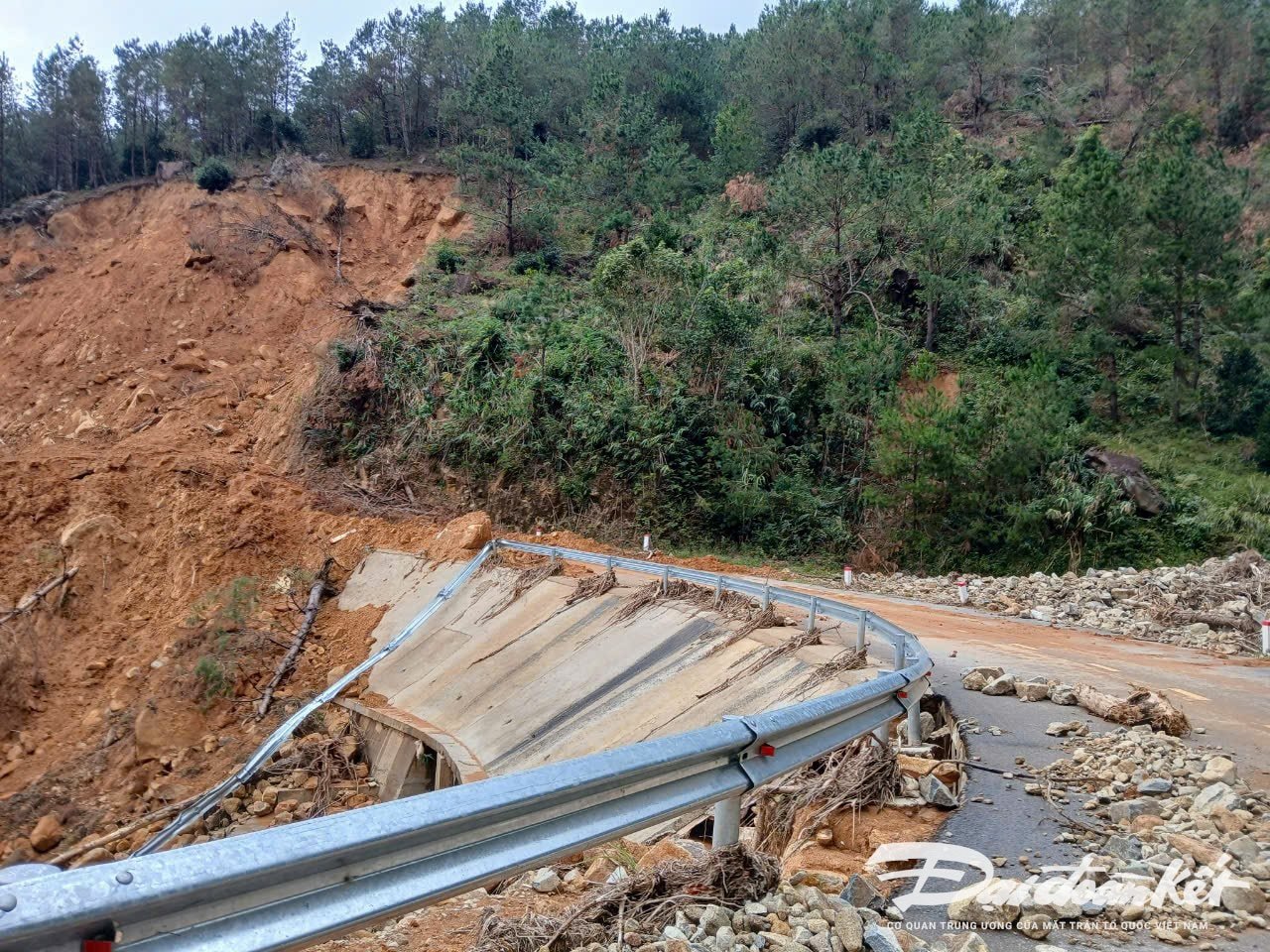
The leader of this Board added: Since June and July 2024, after heavy rains, some landslides appeared on the road, and the Board has proposed a plan to fix these locations. However, after storm No. 3, due to the appearance of many new landslides, the Board had to create a separate repair package, using funds from the project's reserve fund. Regarding the repair and remediation plan, embankments will be built on the negative slope and stone cages will be placed on the positive slope, trying to complete this year to hand over the project.
Survey and design are not guaranteed?
The leader of a survey and design consultancy unit in Quang Ninh said that construction survey is one of the particularly important construction activities, especially with complex geological mountainous terrain like Binh Lieu. It includes the work of checking, measuring, inspecting, exploring, analyzing, researching, and evaluating factors such as: Natural conditions, geology, engineering geology, hydrogeology, hydrometeorology, current status of the project..., in order to establish plans and solutions on techniques and economics so that they are reasonable when designing and constructing the project.
However, according to the representative of the Binh Lieu District Construction Investment Project Management Board, the exploration and survey drills are located far apart and are few in number. “With a terrain like Binh Lieu, the same hill but half of it could be of different geology, while the unit only calculated a few hundred meters per geological survey drill, so it is impossible to fully assess” – said the representative of the Binh Lieu District Construction Investment Project Management Board.
According to the representative of the Binh Lieu District Construction Investment Project Management Board, the cause of the landslide that appeared right after the road was completed was due to the geological conditions of this area with many high mountains, deep ravines, and loose soil and rocks. Meanwhile, the survey and design process did not take into account all objective factors.
Speaking with Dai Doan Ket reporters, a representative of the unit that carried out the construction of a part of the project said: This area has complex geology, many high mountains, so stratification and cutting layers to create a slope is very difficult. Therefore, although the construction was done according to the design, after many heavy rains, many landslides appeared along the route.
Previously, answering the question of the reporter of Dai Doan Ket Newspaper regarding the plan to repair the Huc Dong - Hoanh Mo - Dong Van route connecting with National Highway 18C, Mr. Pham Duc Thang, Chairman of Binh Lieu District People's Committee said: The project still has time to implement insurance, the District Construction Investment Project Management Board has also invited the insurance unit to inspect the site and coordinate to implement construction insurance according to the signed contract.
The Huc Dong - Dong Van - Cao Ba Lanh inter-commune road connecting to National Highway 18C has a total investment of over 430 billion VND, invested by the People's Committee of Binh Lieu district. The road is 43.27km long, 6.5m wide, and is a grade V mountainous traffic project. The project is funded by the budget, implemented by the People's Committee of Binh Lieu district and implemented by a consortium of contractors including GMC Development Investment Joint Stock Company; Quang Thao Construction Joint Stock Company; and Hoan Hao Company Limited.
Source: https://daidoanket.vn/quang-ninh-duong-hon-400-ty-vua-lam-xong-da-sat-lo-vi-sao-10294162.html

![[Photo] Nhan Dan Newspaper announces the project "Love Vietnam so much"](https://vstatic.vietnam.vn/vietnam/resource/IMAGE/2025/4/17/362f882012d3432783fc92fab1b3e980)
![[Photo] Closing of the 4th Summit of the Partnership for Green Growth and the Global Goals](https://vstatic.vietnam.vn/vietnam/resource/IMAGE/2025/4/17/c0a0df9852c84e58be0a8b939189c85a)
![[Photo] General Secretary To Lam receives French Ambassador to Vietnam Olivier Brochet](https://vstatic.vietnam.vn/vietnam/resource/IMAGE/2025/4/17/49224f0f12e84b66a73b17eb251f7278)
![[Photo] National Assembly Chairman Tran Thanh Man meets with outstanding workers in the oil and gas industry](https://vstatic.vietnam.vn/vietnam/resource/IMAGE/2025/4/17/1d0de4026b75434ab34279624db7ee4a)
![[Photo] Promoting friendship, solidarity and cooperation between the armies and people of the two countries](https://vstatic.vietnam.vn/vietnam/resource/IMAGE/2025/4/17/0c4d087864f14092aed77252590b6bae)


![[Photo] Welcoming ceremony for Chinese Defense Minister and delegation for friendship exchange](https://vstatic.vietnam.vn/vietnam/resource/IMAGE/2025/4/17/fadd533046594e5cacbb28de4c4d5655)


![[Video] Viettel officially puts into operation the largest submarine optical cable line in Vietnam](https://vstatic.vietnam.vn/vietnam/resource/IMAGE/2025/4/17/f19008c6010c4a538cc422cb791ca0a1)


Comment (0)