
 |
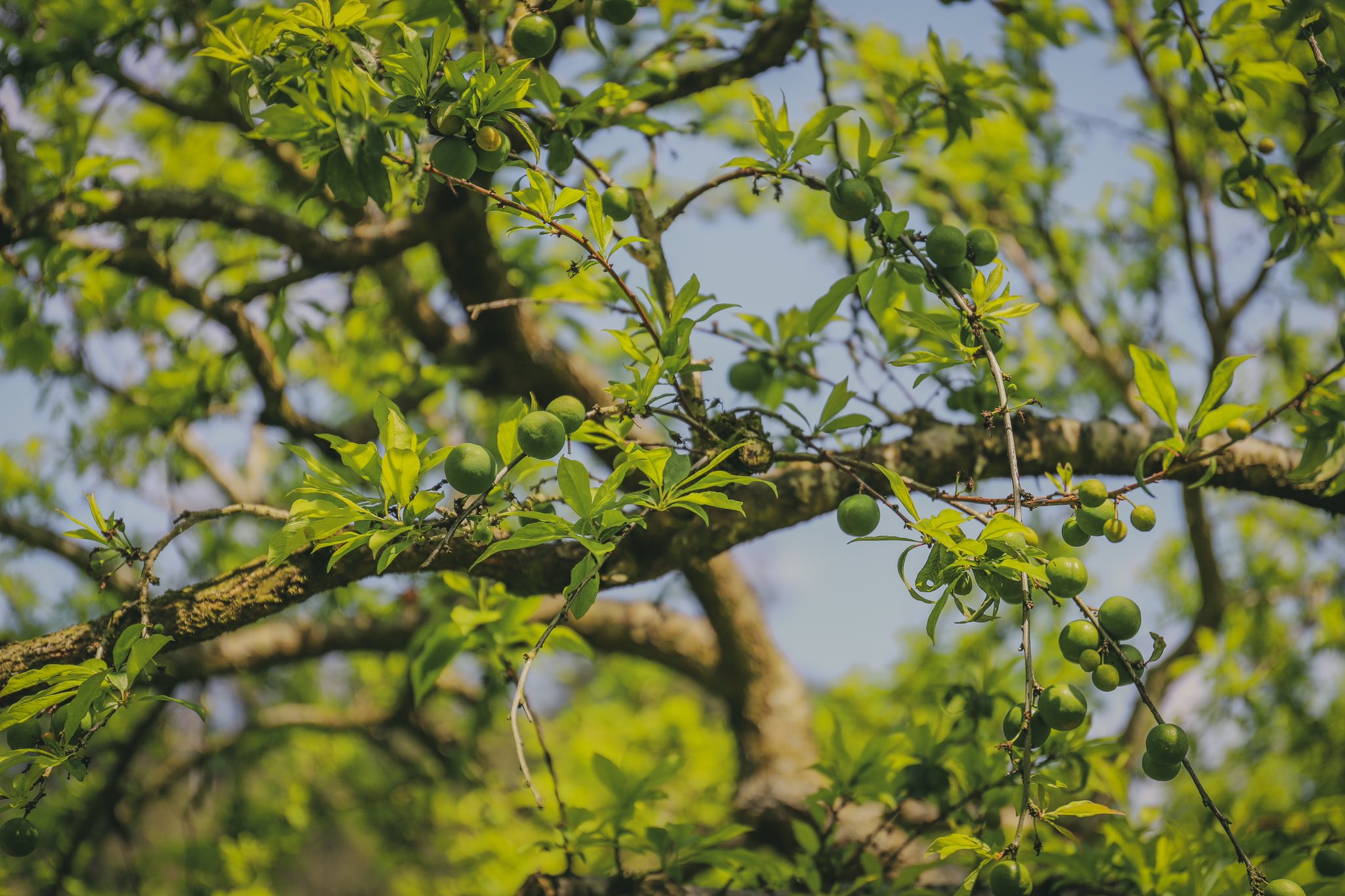
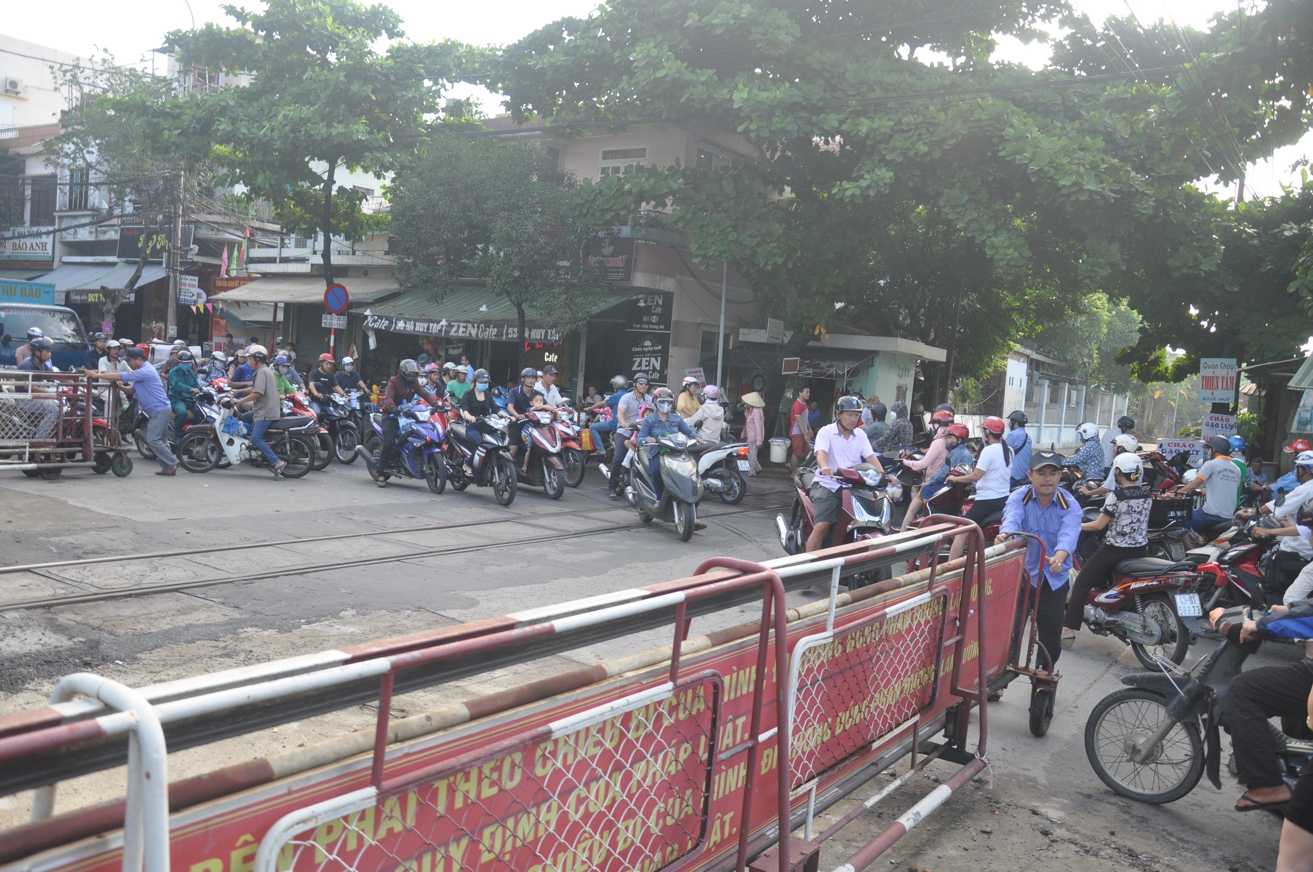
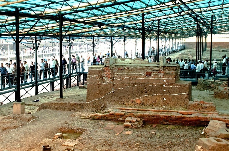
| The engraved copy of the Hung Sung Phat Phap stele (Lieu Quan Magazine) ( left photo) and the map in Quang Thuan Dao Su Tap recorded Cam Le ferry. Photo courtesy |
Based on the content of the two steles currently stored at the Institute of Han Nom Studies (Hanoi), we know that more than 300 years ago, in the area of Cam Le commune, there was a large pagoda. That was Linh Son pagoda, which left a stele erected in the 9th year of Duong Hoa, or 1603, and a stele "Hung Sung Phat Phap", erected in the 6th year of Khanh Duc, or 1654. In the stele of Hung Sung Phat Phap, it is clearly stated "Dai Viet country, Quang Nam province, Dien Ban prefecture, Hoa Vang district, Cam Le commune".
These two steles record the names of Buddhist devotees who donated large amounts of rice fields to the pagoda in the two communes of Hoa Khue and Cam Le. The content and form of carvings and decorations of the two steles show the scale and standard nature of Buddhist activities in the locality; unfortunately, today the ancient Linh Son pagoda of Cam Le no longer exists.
By the early 19th century, under the reigns of King Gia Long and King Minh Mang, the boundaries and scale of administrative units had many changes. Referring to the list and boundaries of communes in the Nguyen Dynasty's Land Register, it can be seen that during this period, Cam Le was a commune belonging to Thanh Quyt Trung Commune, Dien Khanh District, Dien Ban Prefecture. The area of Cam Le commune at that time was mainly located south of today's Cam Le River, with the general boundaries as follows: "East borders Lo Gian commune and the river. West borders Phong Le commune. South borders Mieu Bong commune. North borders the river". At the end of the 19th century, Cam Le commune people reclaimed and cultivated the hilly and sandy land north of Cam Le River; developed tobacco cultivation, established markets and turned the area on the north bank of Cam Le River into a residential area with many shops.
Although Cam Le commune was not large at that time, perhaps due to its riverside location and being a major ferry terminal on the north-south highway, Cam Le quickly developed into a trading and exchange point, and the name "Cam Le" soon became a prominent brand in the region. The geographical books of the Nguyen Dynasty all used the name Cam Le to refer to the river and the ferry terminal here, as an important positioning point at that time.
For example, the book Hoang Viet Nhat Thong Dia Du Chi (compiled by Le Quang Dinh under the reign of King Gia Long) described the geography of this area as follows: “From Thanh Chiem rest house, take the station road to the north, 9,667 fathoms, to the south bank of Cam Le river, here there is a branch road that turns west 8,444 fathoms to Canh Hoa post, source of Lo Dong... From the east of Cam Le post, there is a branch road that goes 3,381 fathoms to Hai Chau market... From the north of Cam Le post, follow the station road for 100 fathoms, to Hoa Khue commune...”. A map in the book Quang Thuan Dao Su Tap compiled by Nguyen Huy Quynh at the end of the 18th century, recorded “Cam Le ferry, commonly known as Ba Do”.
With its location as a crossroads, where the east-west river and the north-south road meet, the place name Cam Le is known to many people; and has become a common brand of tobacco products, which are produced not only in Cam Le but mostly in neighboring villages such as Dong Phuoc, Nghi An, Phong Le, Thanh Quyt; and are often gathered by traders in Cam Le before being distributed to markets.
Since the beginning of the 20th century, although the name Cam Le is no longer used for any administrative unit, it has become a typical name for the center of Hoa Vang district, a neighboring district surrounding Da Nang city. And following the brand name "Cam Le cigarettes", the product "sesame crackers", which is a common specialty of the entire Quang Nam region, is associated with the name Cam Le, today it has become a stable brand name "Cam Le Sesame Crackers".
Regarding the meaning of the name, considering the Chinese characters, most ancient books such as O Chau Can Luc, Phu Bien Tap Luc, Hoang Viet Nhat Thong Dia Du Chi, Dai Nam Nhat Thong Chi, Hoa Vang Huyen Chi all use the word form 錦茘. Cam (錦) means brocade, radiant; Le (茘) is the name of a plant, called the Lychee tree. We only came across a map in Quang Thuan Dao Su Tap, using the word form 錦麗, with Le (麗) meaning beautiful. Surveying the reality in Phong Bac residential area (Hoa Tho Dong ward, Cam Le district), we found that there were some ancient Lychee trees remaining in the gardens of people's houses. This could be a trace of a plant that was once common in this area and entered the place name Cam Le.
Through the ups and downs of history, the name Cam Le was revived and used to name a district of Da Nang city since 2005. Associated with the formation and development of the land over the past 500 years, it is hoped that the name "Cam Le" will continue to be present in the names of administrative units in the new era.
VO VAN THANG
Source: https://baodanang.vn/channel/5433/202504/bong-dang-lich-su-qua-danh-xung-cam-le-4003221/
![[Photo] Prime Minister Pham Minh Chinh commends forces supporting Myanmar in overcoming earthquake consequences](https://vstatic.vietnam.vn/vietnam/resource/IMAGE/2025/4/10/e844656d18bd433f913182fbc2f35ec2)

![[Photo] April Festival in Can Tho City](https://vstatic.vietnam.vn/vietnam/resource/IMAGE/2025/4/10/bf5ae82870e648fabfbcc93a25b481ea)

![[Photo] Opening of the 11th Conference of the 13th Party Central Committee](https://vstatic.vietnam.vn/vietnam/resource/IMAGE/2025/4/10/f9e717b67de343d7b687cb419c0829a2)


![[Photo] Reliving the heroic memories of the nation in the program "Hanoi - Will and belief in victory"](https://vstatic.vietnam.vn/vietnam/resource/IMAGE/2025/4/10/19ce7bfadf0a4a9d8e892f36f288e221)


Comment (0)