
(NLDO) - The majestic landscape of the area around the Iran-Iraq border has been shaped by the activities of an ancient piece of the Earth's crust.
Our Earth's crust is not continuous like Mars and many other alien worlds, but consists of about 20 large and small pieces called tectonic plates, which are constantly moving and shaping the landscape above, as well as providing important driving forces for life.
A study recently published in the scientific journal Solid Earth shows that such a tectonic plate is still contributing to slowly changing the terrain of the West Asian region.
More interestingly, it is the piece of Earth's crust that once carried the Neotethys superocean.

Mountains and valleys of the Zagros Mountains - Photo: NASA EARTH OBSERVATORY
According to Science Alert, Neotethys formed when the supercontinent Pangaea split into the northern continent Laurasia and the southern continent Gondwana about 195 million years ago, at the beginning of the Jurassic period.
Although Neotethys completely collapsed more than 20 million years ago, the oceanic crust that once supported it is still influencing the Zagros Mountains, the largest mountain range on the Iran-Iraq border.
"This tectonic plate is pulling this area down from below," said geologist Renas Koshnaw from the University of Göttingen (Germany), lead author of the study.
As Neotethys closed, the piece of Earth's crust that once carried it on its back almost completely sank below the tectonic plate that carries today's Eurasian continent.
Meanwhile, the Arabian plate, which forms the basis of present-day Iraq and Saudi Arabia, was pulled backward, resulting in a collision with Eurasia.
This collision created mountain ranges, pushing down the crust around them. As a result, these mountains eroded into this basin over millions of years, their sediments forming the Mesopotamian plain, through which the Tigris and Euphrates rivers flow.
Dr. Koshnaw and his colleagues found that in the southeast of this area there is an unusually thick layer of sediment, 3-4 km deep.
They mapped the area and used a computer model to show that the weight of the mountains alone could not account for such a deep crater.
Instead, the region is being pulled down by the remains of the Neotethys oceanic plate, which is still sinking into the mantle. But this plate is also being torn apart as it sinks.
On the Turkish side, the sediment-filled depression becomes much shallower, suggesting that the massive slab broke off in this area, reducing the downward pull.
Understanding these dynamics could help inform the mining of minerals, such as iron, phosphate and copper, which form in sedimentary rocks, the team says.
In addition, faults formed during the collision between the Arabian and Eurasian plates can also create large, deadly earthquakes that the relevant regions need to take precautions against in the future.
Source: https://nld.com.vn/ben-duoi-iran-va-iraq-vo-trai-dat-dang-tach-doi-196250206091845075.htm
![[Photo] Hanoi people warmly welcome Chinese General Secretary and President Xi Jinping on his State visit to Vietnam](https://vstatic.vietnam.vn/vietnam/resource/IMAGE/2025/4/14/d6ac6588b9324603b1c48a9df14d620c)


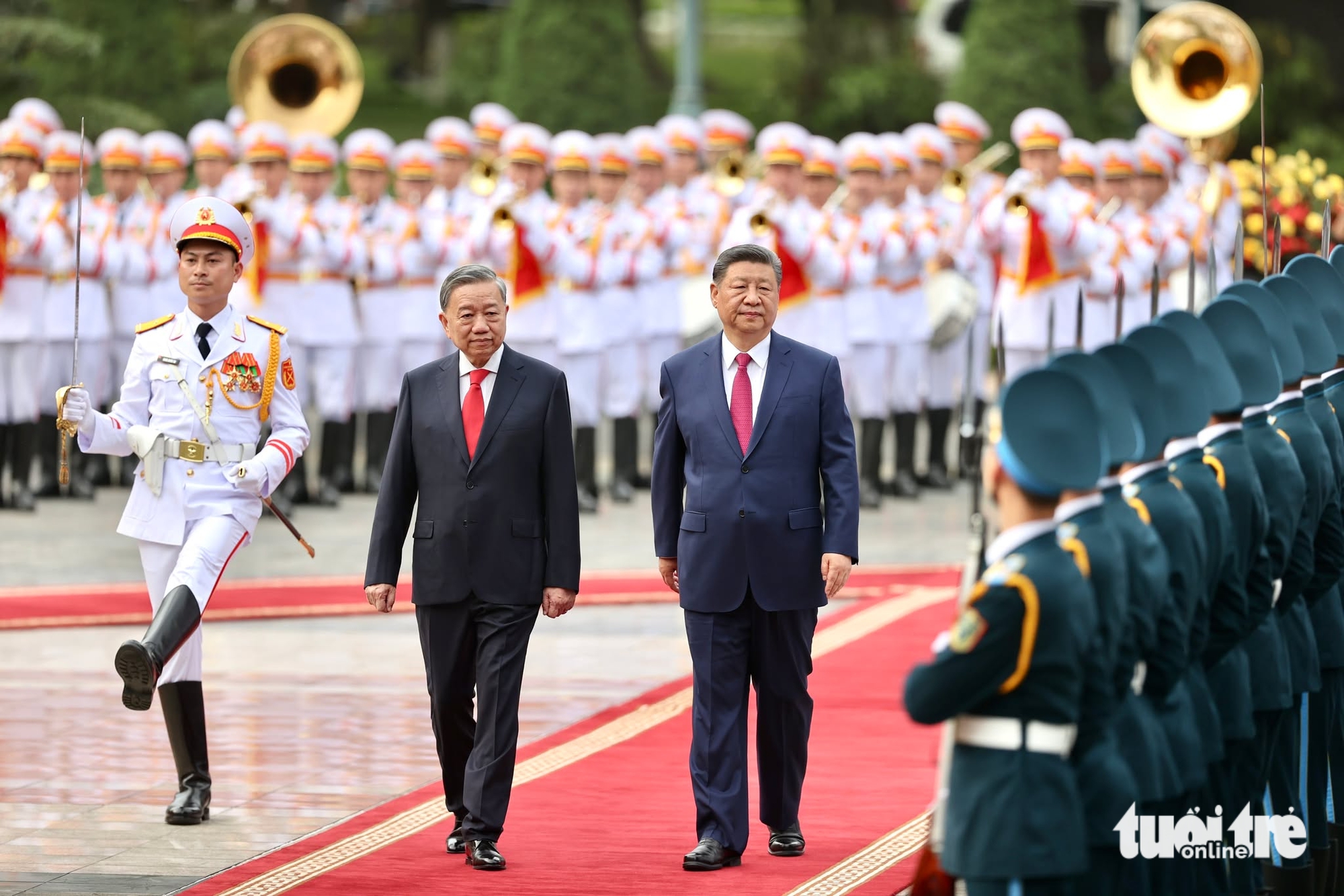
![[Photo] Ceremony to welcome General Secretary and President of China Xi Jinping on State visit to Vietnam](https://vstatic.vietnam.vn/vietnam/resource/IMAGE/2025/4/14/5318f8c5aa8540d28a5a65b0a1f70959)

![[Photo] Prime Minister Pham Minh Chinh chairs conference to review the implementation of Resolution No. 18-NQ/TW](https://vstatic.vietnam.vn/vietnam/resource/IMAGE/2025/4/14/dcdb99e706e9448fb3fe81fec9cde410)


Comment (0)