
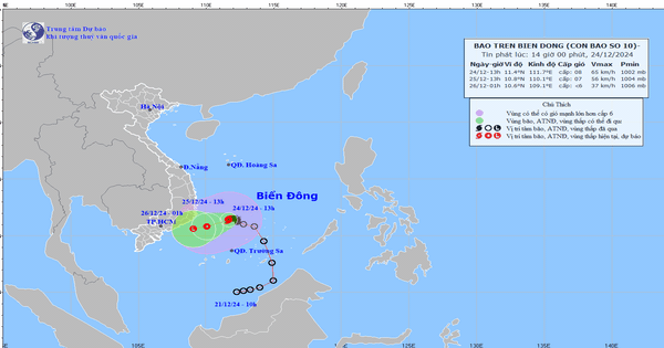
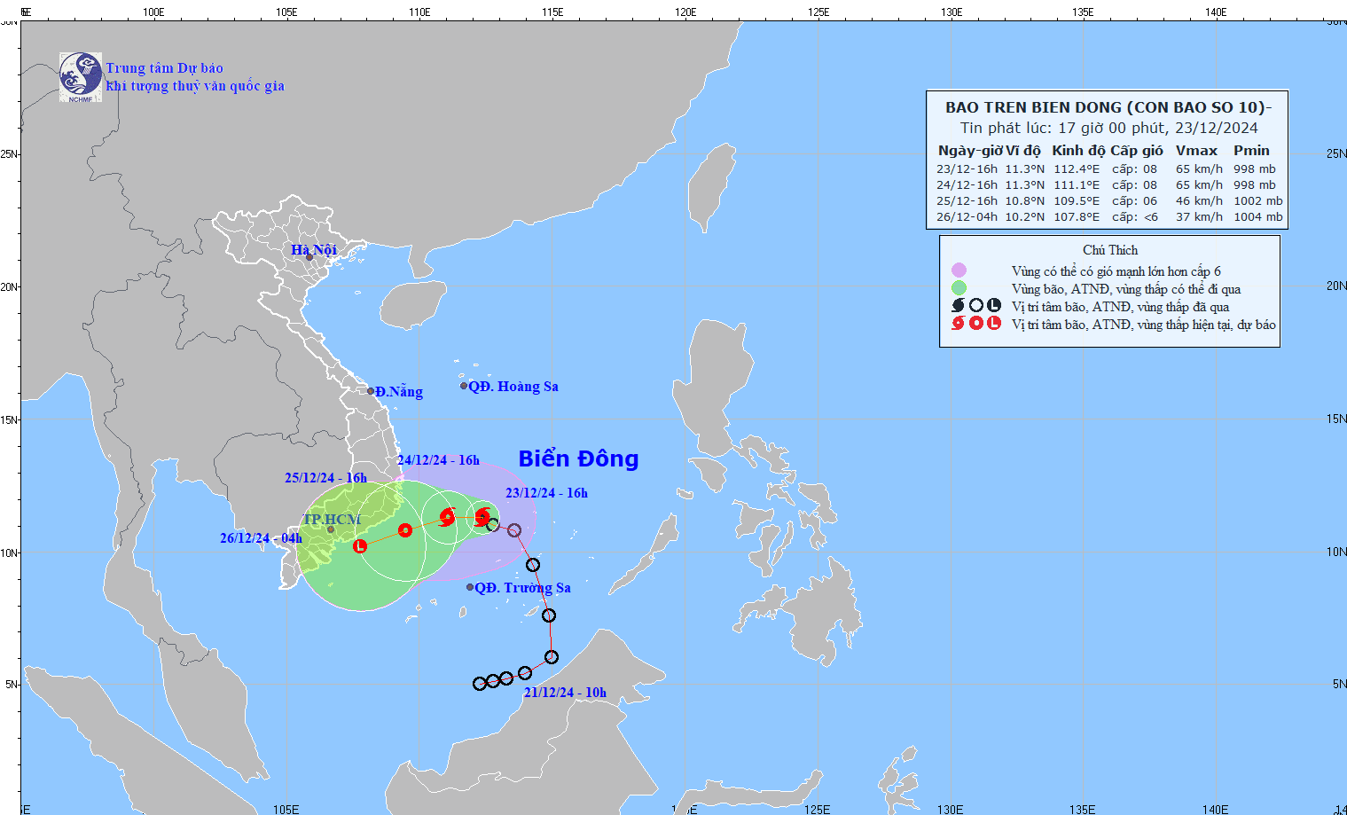
Forecast of location and direction of storm No. 10 at 4:00 a.m. on December 24 – Photo: NCHMF
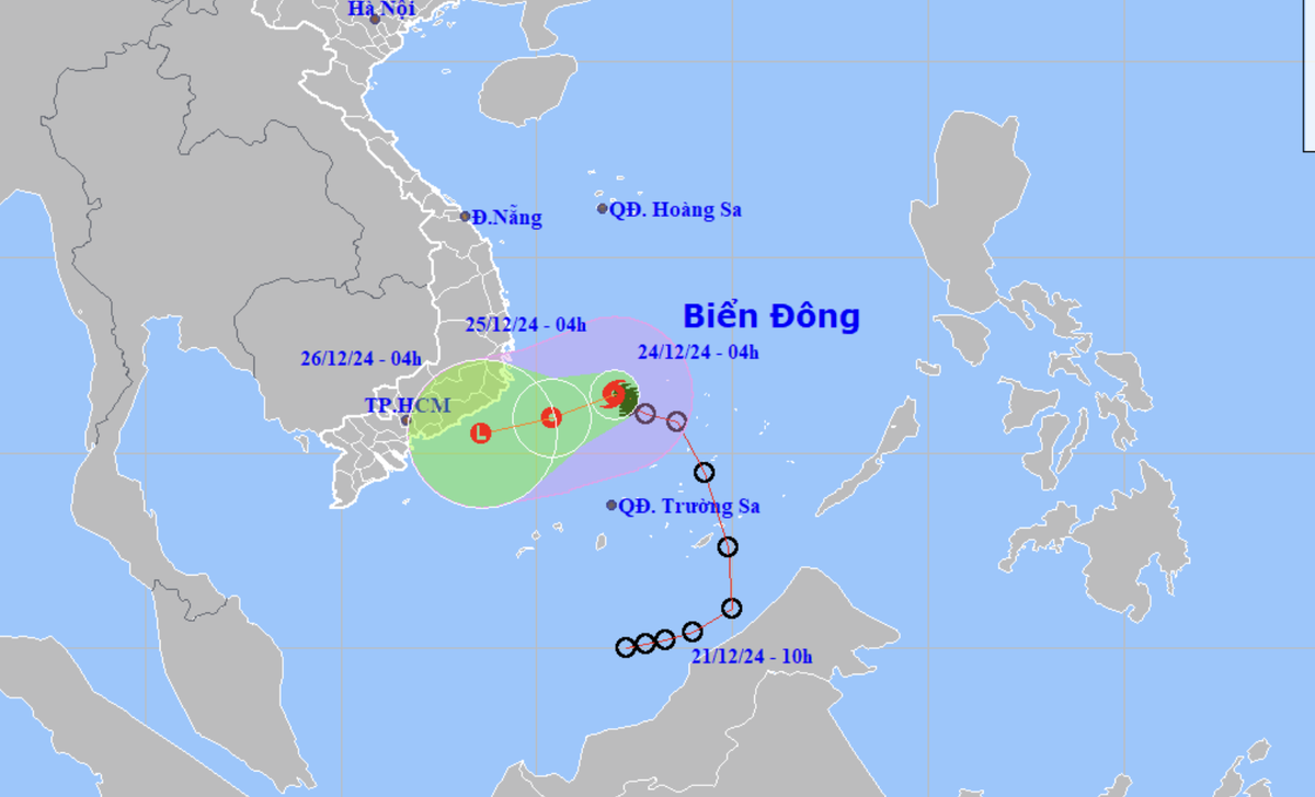
According to the National Center for Hydro-Meteorological Forecasting at 4:00 a.m. this morning (December 24), the center of storm No. 10 is in the southwest sea area of the central East Sea. The strongest wind near the center of the storm is level 8 (62-74 km/h), gusting to level 10.
Forecast today and tonight, storm No. 10 will move west-southwest at a speed of about 5-10km/h and gradually weaken into a tropical depression.
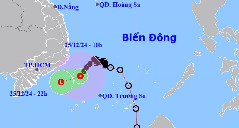
At 4am tomorrow morning, the center of the tropical depression will be over the sea of provinces from Khanh Hoa to Binh Thuan, the strongest wind near the center of the tropical depression will be level 6-7, gusting to level 9.
During tomorrow day and night, the tropical depression will maintain its west-southwest direction and continue to weaken into a low pressure area over the sea from Ninh Thuan to Ba Ria Vung Tau provinces.
Mr. Hoang Phuc Lam, deputy director of the National Center for Hydro-Meteorological Forecasting, said that storm No. 10 is unlikely to directly affect the mainland of our country.
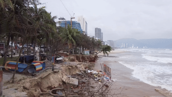
“Although the mainland coast of our country (Phu Yen to Ba Ria Vung Tau) is not directly affected by strong winds of level 6-7, due to the combination with the northeast monsoon, from tonight to the night of December 25, in the area from Da Nang to Khanh Hoa, there will be moderate to heavy rain. The rainfall is forecast to be from 60-150mm, with some places over 250mm,” Mr. Lam noted.
Due to the influence of storm No. 10, the northwest sea area of the southern East Sea (including the northwest sea area of Truong Sa archipelago) and the southwest sea area of the central East Sea have strong winds of level 6-7, the area near the storm's center has strong winds of level 8, gusts of level 10, waves 4-6m high, rough seas.
The sea area from Phu Yen to Ba Ria-Vung Tau (including Phu Quy island) has strong winds of level 6, sometimes level 7, gusts of level 8-9, waves 3-6m high, rough seas.
The meteorological agency also forecasts that from early this morning until the night of December 25, in the area from Da Nang to Khanh Hoa, there will be moderate rain, heavy rain, locally very heavy rain and thunderstorms with common rainfall from 70-170mm, locally over 300mm.
In the evening and night of December 24, Ninh Thuan, Binh Thuan and the eastern part of the Central Highlands will have rain, moderate rain and scattered thunderstorms, locally heavy rain, with common rainfall from 15-40mm, locally over 70mm.
Southern region is likely to have thunderstorms in the coming days.
Heavy rain can cause flooding in low-lying areas, urban areas and flash floods on small rivers and streams, landslides on steep slopes.
Tuoitre.vn
Source: https://tuoitre.vn/bao-so-10-tac-dong-the-nao-den-nuoc-ta-20241224061436682.htm
![[Photo] Prime Minister Pham Minh Chinh commends forces supporting Myanmar in overcoming earthquake consequences](https://vstatic.vietnam.vn/vietnam/resource/IMAGE/2025/4/10/e844656d18bd433f913182fbc2f35ec2)
![[Photo] April Festival in Can Tho City](https://vstatic.vietnam.vn/vietnam/resource/IMAGE/2025/4/10/bf5ae82870e648fabfbcc93a25b481ea)


![[Photo] Opening of the 11th Conference of the 13th Party Central Committee](https://vstatic.vietnam.vn/vietnam/resource/IMAGE/2025/4/10/f9e717b67de343d7b687cb419c0829a2)


![[Photo] Reliving the heroic memories of the nation in the program "Hanoi - Will and belief in victory"](https://vstatic.vietnam.vn/vietnam/resource/IMAGE/2025/4/10/19ce7bfadf0a4a9d8e892f36f288e221)


Comment (0)